Wednesday, March 31, 2010

The Central Coast is Awesome

Warning: actual nature and running in this post.

UCSD spring break came and went all too fast, but at least I got to spend some time on the Central Coast. The draw to the north wasn't as strong as before since the furthest I got was the very corner of Monterey County (i.e. not to San Francisco), but look at these pictures and I bet you'll agree that it was a fine choice.

One day I went to Ventana Wilderness in Los Padres National Forest. I went for an awesome run in the southern section up toward Ventana Cone (not all the way) but next time I go think I'll have myself a little jaunt from Kirk Creek Camp up San Vicente Trail to the Cone. That should be a fun one. I wrote about the shrinking range of the redwoods in Western North America during the Holocene before, often resulting from fires. Consequently it's nice to see that the redwoods are recovering - post-fire, needles sprout everywhere, even on the main trunks, so they look fuzzy:

From Central Coast Spring Break 2010

I brought some cones back to my buddy's place in Santa Barbara and sprinkled them in his yard. He just bought the place and he knows better than to plant a redwood next to his house so I told him if any of them come up to let me know and I'll move them. (So far none of mine have.)

The greenest green I have ever seen was the thousands of vertical feet of spring-grass covered ocean-facing slope descending toward the ocean. My poor iPhone couldn't capture the full sublime radiance of chlorophyll.

From Central Coast Spring Break 2010


On the same trip I visited two old missions that I'd always wanted to see, San Antonio and San Miguel. The Spanish built missions a day's ride apart and most of them grew into decent-sized or even huge towns (I'm sitting in one of them now, San Diego). Somehow, it never happened for San Miguel and San Antonio de Padua. San Miguel is a town of about 1,500 on I-5 north of Paso Robles; the church is still used and still has its original interior, despite damage from the 2003 Central Coast quake. San Antonio de Padua has noxxx town around it; it was part of the land that Hearst used for their private hunting reserve, and the old presidio was the "lodge" on the eastern side of the Santa Lucias that he took guests to. When William Randolph was broke and in tax-arrears in the 30s, he made a tax forgiveness deal with the Feds, and today the area around the mission is the Hunter Liggett military base. If you visit, make sure you have government-issued photo ID, and car insurance and registration, or they won't let you on the base.

San Antonio de Padua:

From Central Coast Spring Break 2010


This is what a 160-year-old grape vine looks like.

From Central Coast Spring Break 2010


San Miguel:

From Central Coast Spring Break 2010


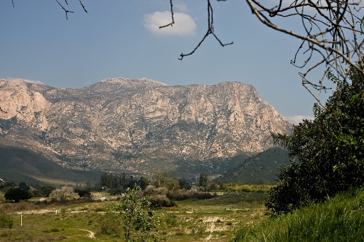
I also got a nice long run in back in the Santa Ynez Valley in Los Padres above Santa Barbara, where I stayed during my little visit. I'm thankful that all this land is preserved, so close to population centers. The water you see is actually the crossing (there's a concrete slab so it's not too deep to drive across).

From Central Coast Spring Break 2010


Last word: I saw what looked like a single Scotch broom plant as I was leaving Ventana, although a local naturalist tells me it was probably French broom. Either one is bad news. They're non-native plants that take over everything, destroying the local plant life. In the space of ten years, despite constant eradication efforts, I watched them take over large parts of Redwood Preserve in the East Bay Hills - so I was scared to see even one growing along Ferguson-Nacimiento Road a mile east of Highway 1, a few miles from literally the southernmost stand of redwoods on the coast that just barely made it through the Big Sur fires. I reported it by email to Los Padres online, and the naturalist I mentioned strongly encouraged me to just stop and pull the stuff out. Seriously, they're like triffids. So you can spot it and pull it out, here are pictures.

Tuesday, March 30, 2010

Thursday, March 18, 2010

Finish Chelsea's Run

You have to be living under a rock if you're a runner and you haven't heard about the effort to honor Chelsea King's memory. If you can make it, be there. In the meantime, read up on safety advice for women runners.

Wednesday, March 17, 2010

More Open Space Protected in Bay Area

Good news. Notice that this is in Walnut Creek, which is kind of the Orange County of the Bay Area; no communes there, but plenty of attorneys and business owners. The city (and its neighbors) want property values to stay high and they know which side their bread is buttered on, so they spend the money to preserve the space. The John Muir Land Trust contributed as well.

One of the valuable things this does is preserve a large stretch of contiguous space. You can see this better in the East Bay Ridge below, which stretches (almost) uninterrupted from Richmond to Fremont. Around here we have unintentional preserves in the form of the parks and canyons abutting Miramar MCAS (like Mission Trails); military bases are often accidental wildlife refuges.

Monday, March 15, 2010

Another Reason to Keep San Diego's Beaches Clean

I really didn't start this blog as an environmental blog. It's really an outdoors blog, which means I write about running, cool places I visit, and beer, in roughly that order. But it seems that the conservation-posts have been growing, and in retrospect the impetus is an easy one to guess: no conservation = no cool places to run or do anything else in. It really wasn't a planned development. I just wanted to use the space I take up on the web yammering about what I love to make a positive difference.

In that spirit: we live along the Pacific Coast. Have you heard of the Pacific Garbage Patch? If not, go watch this video (or if you're somewhere you can't watch videos, see this article about a group from the Scripps Institute that has been exploring the Patch.)


I had heard of it but images have a way of motivating you that dry text does not.
Take a look at these pictures of birds from the mid-Pacific with stomachs full of plastic. Here's just the first:


More photos here. This single set of photos has done more in the past year to make me self conscious of my consumption and recycling habits. Without doing something there's no reason to think that this Patch won't keep expanding, and soon we'll be looking at dead birds like these on San Diego's beaches. More information here.

Saturday, March 13, 2010

Government Penalizes Family For Using Native Plants

"...city officials told the Has they were violating several city laws that require that 40% of residential yards to be landscaped predominantly with live plants." This was up in the City of Orange.

Here's a news flash to the government of the City of Orange: we live in a desert.


See all that orange? Along the coast we get less than 10 inches a year (maybe this year we'll beat that). The inland areas before you hit the mountains in earnest gets up to 15. Simplistically, 10" of rain a year was the traditional definition, but now we take into account evaporation driven by sun, which we have a lot of. But no need for quibbling. You know how when you drive up I-5 to Orange County and you go through Camp Pendleton? That's what your neighborhood looked like before huge numbers of people showed up (actually, it's wetter than coastal San Diego). We might like the way our neighborhood looks, but if you consider the growth Southern California is expected to have in the next few decades, you have to ask seriously where the water for all those rosebushes is going to come from.

So why don't people xeriscape more? Cultural inertia. The U.S. was settled from its east coast, a largely temperate part of the world with plenty of rainfall, similiar to the places that European immigrants were leaving. So, having a lawn is a status symbol, and it's what your grandparents were used to anyway. But familiarity can make us accept strange things. Think about it this way: if people in Maine started planting palm trees and putting heaters around them to help them survive the winter, wouldn't that seem a little strange? Now look again at those green grass lawns all over Southern California.

Granted, xeriscaping won't be everybody's thing, but we at least shouldn't have local governments forbidding us from doing it. And anyway, don't you ever wonder how much your water bill at home goes up because of all the lush green landscaping around shopping centers and corporations? Check out the Theodore Payne Foundation, a Southern California group with information about using native flowers and plants.

Wednesday, March 10, 2010

I Looked Over Jordan and What Do I See

One of many reasons I enjoy distance running is that I imagine it's an activity that humans are made for, that's all tied into culture and intelligence and that helped separate us from other primates. There's a bit of romance to the hunter-gatherer ideal, and I often ponder this while running, though I have yet to eat a deer while on trail (although I did once catch a rabbit with my bare hands; I didn't hurt it, and surprisingly I didn't catch hantavirus). Hence, my impassioned polemics against the "distance running is bad for you because it runs afoul of our evolution" school of fitness might not be so surprising.

It's poignant that East Africans - the people who never left the cradle of the species, the evolutionary Holy Land in which I will soon fulfill my dreams of going for a run - are notoriously over-represented among elite distance runners. Given the small sample size and the movement of human beings around Africa for the past hundred thousand years or so, to suggest a meaningful association would be profoundly unscientific. Still - take a look at this picture from a New York Times article about how culture has helped direct evolution - yes, it's from a Kenyan highland pasture:

I've never wanted to go running in a photograph so much. No wonder this countryside produces great endurance athletes.

Tuesday, March 9, 2010

Plumas National Forest

Plumas is a remote, beautiful and fascinating forest in the transition zone between the Sierras and the Cascades.


Image credit Charles Soper.


Image credit MGW Biological Surveys.

In 2007 there was a big forest fire, and they need our help to reforest it. Looking for ways to offset your carbon footprint? This is a great way to do it, and now you have a special connection to a fantastic part of California.

Monday, March 8, 2010

San Diego Preservation Resources

Interested in preservation? There's a great article at the San Diego Hiker blog with links to a lot of the local foundations working hard to protect parks and open space. They can always use our help.

Just in the last few weeks I've seen an uptick in conservation discussions in the online San Diego community, which is great (here's a current article from the San Diego Outdoor examiner). One of the best ways to get individual people interested in conservation, whether they're outdoor enthusiasts or not, is to emphasize the connection between enhancement of private land and home ownership and preserving open space. Hopefully that means now is not the time for SDG&E to succeed with their shenanigans.

SDGE Begins Eminent Domain Proceedings

Think your property rights mean diddly squat to the power company? Think again. SDG&E has started eminent domain proceedings to force existing land holders to sell their land so SDG&E can build powerlines. Message - if you don't sell, we'll make you sell anyway. This has been on for a while; for more details, read this great article. Property owners and open-space advocates need to stick together to keep these actions from succeeding, and to keep courts from allowing them to.

Preservation of open space around San Diego enhances property values and property rights.

Friday, March 5, 2010

The Last Mountain Lion

...in Pennsylvania, at least - was killed in my home county of Berks in 1874, right off what is now the Appalachian Trail, maybe 10 miles east of where the picture shown in this post were taken in November of last year.

It would be interesting to see how this barely-preserved animal compares genetically to the closest remnant populations in the Black Hills and the Ozarks, if we could get any decent sized DNA fragments out of the tissue (anything but a done deal).

Tuesday, March 2, 2010

Safety Tips for Women Runners

There's not much to be said after the sad news from Lake Hodges today, except for the community to continue supporting Chelsea King's family, which by all appearances has already been happening. Meanwhile, we can do our best to keep this from happening again and read up on safety tips for women runners.

Friday, February 26, 2010

Missing Runner in San Diego Area, Spread the Word

http://findchelsea.com/


TEEN GIRL GOES MISSING WHILE JOGGING IN RANCHO BERNARDO: Massive search launched

February 26, 2010 (4:15 a.m.) - Sheriff Bill Gore has activated more than 100 Search and Rescue volunteers and deputies to locate missing Poway teen Chelsea King. King was reported missing by her family late Thursday after she did not return home from a run in the north Rancho Bernardo area.


She is an avid long-distance runner and routinely takes long runs in rural areas. She parked her car after school at the Rancho Bernardo Community Center on West Bernardo Drive and did not return to her locked car

Chelsea is a white female, Height: 5' 5", 115 pounds
with blond hair and blue eyes.


Anyone with information is requested to contact:
San Diego Sheriff's Department: 565-5200
Crime Stoppers: (619) 531-1500 or (619)531-1547

Wednesday, February 24, 2010

Saturday, February 20, 2010

Pacific Crest Trail Southern Terminus


Image credit: Paul Magnanti's PCT Thru-Hike


[Added later: Endurance Guy Toby Guillette ran this section the day after I did, but the border guys apparently didn't try to scare him. I posted at the article to ask Toby what was different; maybe the one I talked to hates runners?]


Today I ran, ih, 14 miles sorta kinda on the PCT, at the southern terminus right south of Campo. Note #1: don't just roll into Campo without looking up how to get to the official start of the trail. While people in Campo were certainly nice enough, they had no idea how to get to the trailhead (with the exception of the nice docent at the museum - thanks for your help!)

Note #2: when planning a run here, do your homework and take into account illegal border activity. As I plugged up the wet-sand road from Route 94 to the border where the official marker is, a Border Patrol officer in a truck stopped me. (I've never seen so much border activity in my life as I did today in Campo). He strongly advised me not to run on the PCT near the border because of drug and gun smugglers. It was raining off and on, and he said that activity increased during rain because the visibility is worse and some the trails and roads become impassable. Apparently he didn't think I was suitably spooked because he rolled down the back window to show me the M-16 he was carrying. "Don't run this section of the trail. Especially not today."

So I decided to stay on 94 and Buckman Springs Road for most of it, hence the sorta-kinda. It rained fairly hard while I was out but I tried to enjoy the un-San Diego-ness of cold rain at 3,000' since I know I'll be complaining about the heat inside two months. I also did a stretch on the actual trail just north of I-8 from Boulder Oaks campground up toward Laguna Mountain. That'll be the part I do next time I'm up there. On coming home, I did a search for any bad news happening on the trail and couldn't find much; maybe I should've done that ahead of time to avoid being put off by the Border guy.

(Image credit Craig Stanton.)

Two political thoughts (skip to last paragraph to avoid). First, it's extremely unfortunate that at the PCT's southern terminus access to open space meets safety considerations as a result of criminal activity; public safety is a core service of functional government and this problem is usually associated with the developing world. I found Central America frustrating for exactly this reason; lots of awesome volcanoes and forests and trails criss-crossing between villages, and lots of people in the woods who will rob and hurt you if you use those trails. In San Salvador, there are trails all over the volcano immediately next to town, and I was strenuously warned off running any of them - although you can pay guides who used those trails as guerillas in the recently-ended Salvadorean Civil War to take you up. (And here I used to think American Civil War re-enactments were a little strange. At least none of the guys on the field are the ones who were really killing each other during the war. By the way, here's a picture of my extremely handsome great great grandfather Jacob Caton prior to his capture at Moorefield West Virginia in 1864 in the Civil War's only sword fight.*)


The second thought is that the economic equation driving the smuggling part of the illegal activity up there is: drugs go north, guns go south. If we decriminalize, guess who goes out of business? And civilization doesn't end when countries do this - in 2001, Portugal decriminalized everything, and by all sorts of measures, they're better off than before. (Seriously, click on the link. Why this isn't discussed more in the U.S. is a mystery to me. Decriminalization is the worst nightmare of those smugglers sneaking across the border in Campo because it would put them out of business overnight.)

Am I planning to run the whole thing in pieces? Probably not, but who knows; that's one of the projects I'll do if we reach actuarial escape velocity while I can still run. (Prediction: will not happen.) Might as well knock off as many SoCal chunks as I can now because come 2013 I'll be heading back up north.

*My great great grandfather Jacob really was captured by the Confederates during a sword battle in West Virginia but he wasn't nearly this good-looking, or humble for that matter.

Mitochondria-Related Gene Variant Associated with Endurance Running

The gene is associated with producing new mitochondria as well as reducing oxidation damage and inflammation. Original article here, digests here and here.

Next, I'd be interested to see what the tissue expression profile is, particularly with respect to slow- and fast-twitch muscle fibers; a glance at the mouse transcriptome shows high expression in cardiac myocytes and smooth muscle, and a peak in thyroid, but not so much in skeletal muscle. It would also be interested to look into the geographic patterning among humans (if any); this is likely to be a fairly homogeneous sample in the context of overall human genetic diversity since it's an Israeli study that used Ashkenazi and non-Ashkenazi Jews. In particular, if such a pattern emerges, does it show any overlap with the pattern of alpha-actinin-3 deletion, another gene I wrote about before, a muscle component that is more likely than even odds to be deleted in female distance runners (and non-Africans) but less likely than even odds to be deleted in sprinters and weight-lifters.

Preserving Open Space the Right Way

I'm all for more preserved wilderness and open space; I'm also all for resepecting private property. These two priorities do not conflict. In fact, preserved open space increases property values and makes cities and states more enjoyable places to live. It's invariably suburban property developers who try to imply that there's some kind of political conflict between private property owners and preserving open space. Of course, it's in their interest to free up as much land as possible and sub-divide it as finely as possible. But is it in your interest? To put a fine point on it, are you a property developer? I'm not.

That's exactly why it's unfortunate when this growing but still-fragile public understanding of the relationship between private property and open space is damaged when government bungles an open space expansion, as they seem to be doing now in several places in the intermontane West. (One of these places is the San Rafael Swell. Q. How awesome would it be if this opened up to the public? A: very awesome. Think of the trails back there.) Unfortunately Utah residents are still feeling blindsided by the way that Grand Staircase National Monument was created, and anecdotally, I know that southwest Coloradans are none too thrilled with the way that Hovenweep National Monument was brought into being. They don't seem to mind that literally hundreds of Puebloan ruins are now open to public exploration - it was the ham-handed way the Monument was created that was the problem.

This is no screed against eminent domain. It's a reminder that there is a whole spectrum of private-property-respecting open space solutions, and they all begin with involving the stake-holders non-adversarially. In Ireland you can hike across farms and ranches as long as you're sure to close gates behind you (I've taken advantage of this system to explore the megaliths that are part of Ireland's prehistoric heritage and which would be off-limits behind ranch boundaries if they were in the U.S. In the Bay Area's East Bay Park System, in my wholly unbiased opinion the best urban park system in the United States, ranchers share space with the parks. These solutions work if they're handled well, and I think for the most part, ranchers and farmers selling their land would rather, all things being equal, see it preserved as is for future generations. In this case, as Utah Representative Rob Bishop says, "If [various agencies] do things in an open and transparent way and involve everyone, then there's no need for yelling and screaming...Do it the right way, and we can work it out."

Monday, February 15, 2010

Return of the Pony Express Route

That Pony Express route just won't leave me alone. I ran across a set of outstanding photos by some offroad folks who did a piece of the Pony Express in Utah. I posted on the thread to let them know that people have been inspired to similar feats (at least on foot and I would wager on bikes as well) and it might be good fun to join up for a cross-country offroading/biking/running triathlon to do the whole Pony Express route, maybe for a good cause. It would be a blast. Hood-to-Coast would seem passé!

El Cap and San Jacinto Down

I'm glad to be getting some time on trails around SoCal. El Capitan was a fun little slog Saturday; from the top of you can look back and see the San Diego skyline but yesterday you could also see three separate snow-capped sets of mountains and all the hills and knobs and ridges in between. El Cap is inexplicably little-known among San Diegans so I include a picture below - it's at one side of El Monte Valley (now endangered by power lines), and you may know it as that big red mother you see as you're heading out I-8 eastbound before you start climbing in earnest:


(Credit to the nice person at Picasaweb who took this)

Yesterday San Jacinto was too snowy to get to the summit (or even to Suicide Rock) but it was real purty-like and I'll be back. Once they all melt out, I might spend a long weekend summit-running. San Jacinto, San Gorgonio, and whatever the highest is in San Gabriel Natl Forest. Immediately after I post this I'm off to knock out Iron Mountain.

It's funny how much it bugs me to look out over the mountains and knobs and ridges inland, and not know all their names or how to get to them. But that makes it interesting too. A whole new territory to consume - not like the mountains care for the infinitesimal moment in their lives that we're scrambling along their flanks. But for that nanosecond, we're there, and I can't explain why, but it counts.

Oakland Cleverly Re-Starts Its Marathon

I lived in the East Bay for 11 years, and less than a year after I leave, Oakland cleverly re-starts its marathon. Hey Oakland Marathon, did you think I wouldn't notice the timing? But hey. I'm a trooper. I can take the rejection.

Oakland marathon runners, when you're running from Rockridge BART up to Route 13, there's one thing you should keep in mind: you poor bastards have twenty miles left.

This is what's called "sending out positive energy". It's what's great about America.

Friday, February 12, 2010

Saturday, February 6, 2010

Paleo Running

A distance runner and evolutionary biologist decided to look at barefoot runners. Only question: do you go to the physical environment that our earliest modern-human ancestors lived in, or do you go to a part of the world known for great distance runners who also run without shoes? Turns out it's the same answer for both: the Rift Valley in Kenya. And it turns out that biomechanically, barefoot runners land on the balls of their feet, which lessens the strike impact. It makes sense that this would mean less abuse to the joints and a longer running career - which you need if you're going to be chasing after game herds until you're old - but the real test would be to look at these folks when they're older and compare to a control group. Finding that control group would be tough.

As for me, I would love to "paleo run" and switch over to barefoot, but unfortunately our ancestors (and apparently the people of the Rift Valley) didn't have nails and glass. Next question: the Tarahumara usually run in home-made sandals, but what is their form like?

Friday, February 5, 2010

So Much for the Bay Area's Well-Behaved Mountain Lions

Here's a scary encounter between two families: two human brothers and a mountain lion mom and her adolescent son. Given how many outdoor-oriented people there are in the Bay Area, and how many pusses there probably are out there, it's amazing that there aren't more problems. There has only ever been one (unconfirmed) attack. Compare that to San Diego County (Cuyamaca Ranch in the 90s - yikes) or Orange County, or Vancouver Island up north. The lions in the Bay Area are so well-behaved I sometimes joke that even the mountain lions are polite in NorCal.

Pescadero Creek
is huge and empty heavily wooded, and amazingly close to Palo Alto. It adjoins to Big Basin too, so it's no surprise there are lions in there. Who knows, maybe it's the economy and lions are out of work.

Saturday, January 30, 2010

Nutcase Again Trying to Rename Mt. Diablo

Someone is trying to re-name the Bay Area's fantastic Mt. Diablo to Mt. Reagan. Why? Apparently he thinks Mt. Diablo is an evil name. This is ridiculous. And I even like Ronald Reagan. I was just at the Reagan Library two weeks ago.

(BTW, don't believe me about how awesome Diablo is? Here's just one picture from a random corner of the park.)

Other articles list a different name than Mt. Reagan, but it's all stupid. As a Bay Area expat I won't stand for this landmark being abused for one man's ego. If memory serves, this same schmendrick tried to re-name Mt. Diablo a couple years ago, that time to Mt. Nisenan. If you think this is goofy, there's a Facebook group you can join, "People AGAINST Naming Mt. Diablo to Mt. Reagan!!".

The Greatest News Story Ever Told

is this.

Let him who hath understanding reckon the number of the Beast, for it is 26.2.

Saturday, January 16, 2010

Another Pro Sports Team Demands a Free Stadium

The Vikings are telling Minneapolis to build them a stadium or they'll leave (not the main focus of this article on football economics but it's in there). Of course, this has happened before, and sometimes, when the city has a tourist economy outside of sporting events, they can tell the NFL team not to let the door hit them in the ass on the way out, as happened in San Francisco a few years ago. (I still love how stunned the Niners owner was.) Same reason the NFL won't give LA a new team, because LA won't spring for a stadium. On the other hand the Steelers were successful in their bid, in a post-industrial Pittsburgh that has better things to spend money on than a new stadium. Sometimes when they don't get their way teams will just plain-old sue their cities, as in Oakland. Thanks Al Davis.

It turns out my anecdotal instincts are correct. Economists have looked at these questions and it turns out that building new stadiums isn't much benefit to anybody except the sports teams in question. In an article titled "Too Big to Fail", we hear about the Chargers' stadium plans:

...[a new Chargers stadium] is definitely a questionable use of redevelopment resources. If you look at the state redevelopment law, there's two purposes for which the state has authorized cities to use tax increment financing. One is fighting blight and the other is providing affordable housing. Nowhere in the state community redevelopment law does it say you can use these resources because you don't want your football team to go to another city. None of the rationale we have heard from the Chargers or the mayor links the construction of a football stadium to either affordable housing or economic development. It's hard to argue that the Chargers' stadium would have any of these benefits because the team has said the plot of land is so small the only way they can finance it is with the city, because they can't build anything else there. Well, if you can't build anything but the football stadium it's hard to see how you will have any measurable impact on blight, affordable housing or economic development

From a redevelopment standpoint, a football stadium is not a very good investment of your redevelopment dollars. If your goal is redevelopment, which it's supposed to be, you can buy a lot more redevelopment taking that $800 million meant for the stadium and investing it in other things downtown.

Sports rarely report on the business aspect of pro teams (which is the real reason these people are all doing what they do); the only time you'll read dollar figures is when a player signs a huge contract, everyone clucks their tongues that this quarterback is making so much, then they go right on buying tickets and merchandise to pay that quarterback's salary. That's why stadium stories are certainly not going to be reported nationally by the sports media, so putting these stories together is up to those of us who read local papers or who travel around the country a fair bit and hear these stories in bars.

You might be a Chargers fan offended by my lack of sports patriotism (about which I wax eloquent here). Fair enough - but you have to recognize that professional sports organizations are really interested first, always and only, in money. If winning gets them there, that's what they'll do, and somehow if losing gets them there, that's what they'll do. And that's completely appropriate, because that's what private companies are for; you don't expect the owner of a McDonald's franchise in one town to make decisions that lower his profits just because he's loyal to that town. If he can move to a new town, and make more money, he will, and too bad for the customers from the first town that didn't come in! Same goes for the NFL, and yet somehow, people think differently about it. What we see over and over again is that if screwing the fans or city will get them there, that's what they'll do (exactly as we should expect with a private franchise). It's why your jerseys cost $200. Now, if the McDonald's franchise owners group in your city were exerting such influence on local politics, you might call it special interest pressure. Granted, other corporations do it too when they threaten to move their offices unless they get a tax break, but that has far more economic impact than an NFL team moving. (By the way, LA's economy doesn't seem to miss their teams.) So what enables the NFL to treat cities the way they do, when McDonald's can't? You the fan, that's what, taking the team's side and then voting out the politicians that took a stand against them when they got greedy. That's how they get mayors over a barrel.

The NFL is not a government agency. They're not entitled to public funds any more than your or my companies are, but they know they can stay at the trough by exploiting their fans' easily abused loyalty. Bottom line: NFL teams, you want a stadium? Move to one, or build it on your own goddamn dime. Maybe Minneapolis would lose tourist dollars without a team, but San Diego sure as hell won't.

Wednesday, January 13, 2010

Coast of San Diego County: Done

I've completed my little projecty of running the coast of San Diego County from Oceanside to the border with Mexico. (I used the same rules as my Around the Bay run last year.) This was the route:


You will notice that I didn't draw the route all the way up through Camp Pendleton to Trestles just for the sake of the map shape, and also that there is a break from Point Loma to Coronado. I wasn't going to swim or kayak a heavily trafficked and in any case secured strait, and I don't want to run through the industrial areas of National City or Chula Vista. So the rule is, since I was running the coast, I had to be even, on a north-south basis, with the next leg. Which I was, between Point Loma and Coronado. (Only time this rule needed to be used.)

North County Highlights: You can run through the southern part of Camp Pendleton (from the Oceanside Marina to Las Pulgas Canyon) if you go through the gate and show your drivers license. From Las Pulgas Canyon it's just along the coast past San Onofre to Trestles, right on the border with OC, and you don't need ID there. Carlsbad is more interesting than Oceanside, at least along the coast. There are nice coastal paths for running in both Carlsbad and Encinitas. In a sign of actually growing up, I can muster zero interest for a visit to Legoland, but at least now I know what the big smokestack up there is and one day I also had occasion to check out Oak Riparian Park. I think the camping area along the coast in Encinitas is closed, but people seem to keep using it. Encinitas has a neat little "downtown", but what the hell is that Eastern Orthodox-looking dome along the road? I also saw a fast runner going the other way who had an artificial leg; at first you feel all happy that someone is empowered, etc. etc., but all those feelings of warm benevolence evaporate when you start to worry that the guy would actually beat you in a race. Not much to say about Solana Beach.

La Jolla, San Diego City, and points south: Torrey Pines Preserve is so far the only place I have seen a rattlesnake in 4.5 months of running trails around San Diego, although the park is not that big, despite what surfing MD/PhDs named Anup may tell you. I really wish the lighting was better in northern coastal La Jolla; this was odd for me because I was running my usual afternoon run from 1998, when I still lived in Pennsylvania and was frequently in San Diego on business (never ran it at night until now). Pacific Beach and Mission Beach are nice if you want to try for a fast mile split and I keep swearing that I'm going to stop in for beer, pizza and an arcade game in M.B. sometime. There are sketchy types on the north side of O.B. The neighborhood in Point Loma reminds me a lot of the East Coast and Alameda in the Bay Area, maybe because both seem to be heavily influenced by relocated Navy families. Silver Strand is nice now and then but gets boring quickly. You can run on a levee to get into Imperial Beach, which has more character (and characters) than it knows what to do with (lots of Native American stores here - what's the deal with that?) The wooded areas at Border Field are cooler than anyone gives them credit for, at least when they're not under internationally-polluted flood water. It's nerve-wracking running at night there when you know border control guys with night vision goggles watching from mountaintops are saying to each other, "Hey Chuck, get a load of the jerk on the access road, he's running south." I wasn't deported, so that's a plus.

Thanks are in order to: the good people of San Diego County's coastal communities who recognize the importance of clean beaches, parks, and pedestrian trails and vote accordingly; and of course, also to the people at the border who were working as hard as ever on Christmas Eve (when I was there) to keep the country's frontiers secure.

So that was the first, easiest, and most boring project of the ones mentioned here. The next two will probably be running from the coast to the Salton Sea, or running a piece of the PCT.

Monday, January 11, 2010

Update on Paleolithic Sorghum

Follow-up: professional paleolith Loren Cordain MD was asked to comment on the paleolithic sorghum paper I wrote about before. Of course he's going to say this isn't good evidence of grain consumption at that time, though that doesn't mean he's wrong.

More importantly: it's good that we're having these debates and there's still a lot that evolution can teach us about health, but because we're at the beginning of these kinds of discussions, the bottom line should always be the empirical health endpoints that we observe from people right now consuming these diets. (Hence the little experiment that I'm currently beginning, with nutrition advice from Tom C.) The reason I emphasize endpoints is that we need to remember the only reason we care about CRP, cholesterol, etc. is because we believe they're linked to quantity and quality of life through heart disease and other conditions; the blood values are all proxy indicators for real endpoints that we should be constantly poking to make sure they're meaningful. As it turns out, even CRP might not be the gold standard of inflammation we've assumed it to be, as has been recently shown by the eminent Michael Gurven et al working with (guess what) hunter-gatherers in the Bolivian Amazon.

Sunday, January 10, 2010

Local Earthquake Triggering

Astute Californians will have noticed (and in many cases felt first-hand) this pattern:

30 December - 5.8 earthquake under Mexicali (about a hundred miles inland from San Diego)

7 and 8 January - 4.1 and 3.8 in San Francisco Bay Area

9 January - 6.5 off the coast of Ferndale, CA (Humboldt County, way up there in Northern California). Apparently this one was right at the Mendocino Triple Junction where the North American, Pacific, and the subducting Juan de Fuca plates come together. It's also deeper than the average strike-slip quake.

9 January
- 4.1, again under Mexicali (6 hours after Ferndale quake)

[Added later] 12 January - Here's the big one on the other side of the North American Plate, a 7.0 in Haiti.

See the trend? The trend is that property values in Portland and Seattle will be depressed for the next few weeks. You can get real-time earthquake information here, though they drop off after a week.

Years ago I'd noticed, like many people, that when there's a destructive quake in one part of the world, there's often another one (or more) within a few days. Interestingly, they're frequently at opposite ends of the same tectonic plate. It turns out that earthquake triggering is known to geologists but we don't yet know enough to predict where the next one might happen. But usually these triggerings are far from each other; and usually they're triggered by bigger quakes than these. My question is whether mid-size quakes are associated with quakes closer to them, rather than across the ocean?

In my last post about redwood habitat I mentioned how nature's real modus operandi, when you look closely, is to move with jerky, inelegant jumps instead of the inexorable beauty that we seem to read in the distant fossil and mineral record. When you live through something, you necessarily look closely.

For example: the Pinnacles are the best National Monument you've never been to, near the northern Central Coast, and they're the other half of an extinct volcano that died about 20 million years ago when the Pacific Plate started slipping northward as it is today, instead of subducting under North America. (The other half is near Lancaster, CA but it's not much to look at.) Today the two halves have drifted 300 miles apart. So you can If you work out the rate at which they move, does that mean that every year, the fault moves exactly an inch? No - but if you take measurements once every century, you're more likely to get an answer closer to that rate (8.25 feet). And what do you know! In the twentieth century, the San Andreas in the Bay Area moved 9 feet. Except it was almost all at one time, in 1906:

Talk about inelegant. This weekend the people in Humboldt County sure are. I should add that in some places the fault does creep noticeably, but this doesn't stop the jerks from occurring. Go here to see street curbs that have been separated over the years by fault motion.

Because I'm a nice guy I once tried to stop all this plate motion by standing on the fault at the Carrizo Plain and pushing south on the Pacific Plate but I guess this means it didn't work. My attempts to make Mount Shasta erupt by jumping up and down on the summit met with similar results.

For fellow wanna-be geo-nerds: I've been interested in the Mendocino Triple Junction and West Coast plate-boundary geology for a while; here's a post I did in May about that.

Saturday, January 9, 2010

The Invasion of Bay Area Flora Begins

Phase 1 is complete. Five minutes ago I planted a bunch of redwood cones today in front of my house in San Diego. Don't you understand? This is only the beginning.

Forgive the blurriness of my bad cell phone camera; you still have all the information you're likely to be interested in:

I collected a bunch of these bad boys from the Oakland Hills in Redwood Preserve just after a winter rain. I'll have to give them extra water down here in the Venus-like sun-blasted wastes at the very southern edge of the Mediterranean climate zone, but we'll see. Yes, I know there are various rules about when you harvest the cones, don't let them dry, only 5% germinate, etc. etc. but this is just a little experiment and I planted enough to take advantage of statistics. If any of them do germinate, when I move I'll dig them out and re-plant them; redwood trees wouldn't do any favors to future residents. They're not easy to maintain and one horticulturist described the area under/around a redwood as a war zone.

I'm patriotic and even protective about Bay Area flora. That's why I'm so acutely aware that since the start of the Holocene, western North America has become progressively warmer and drier, and commensurate with that, climate zones have marched inexorably north, redwood forests included. When you're looking at geologically significant periods long after they've passed, the world seems to change gradually. But when you're up close or in one of them, you understand that the universe is not elegant at all scales, and usually there are noticeably, unpleasantly uneven kicks and jumps. For redwoods, the most recent of these uneven jumps are the fires a couple years ago around Big Sur, the current southernmost extent of redwood forests. Barring further human aggravation of the trend, in a thousand years they may well have disappeared from Ventana Wilderness, and Big Basin will house the southernmost stands. This trend has in fact also run almost to completion elsewhere an another of Laurasia's daughter continents, across the Pacific in China; the range of the only redwood outside North America, the dawn redwood, had dwindled to a single forest by the 1940s when it became known to the global biologist community. In the meantime I'm throwing in my lot with the redwoods and giving them a little boost.

Every passing day I am more amazed that this cone contains a solar-powered chemical program to make a redwood tree out of air and dirt. We'll see if it can run on SanDiego OS.

[Added later: fewer foggy days in the summer is another way that redwoods' ideal habitat is shrinking.]

Tuesday, January 5, 2010

Another Powerline Land Grab: El Monte Valley

If you drive east on I-8 toward El Cajon, you'll notice an impressive red mountain to the northeast of the freeway. That's El Capitan, and the valley at the base of it is absolutely gorgeous. El Capitan Reservoir is right next to it and besides being a popular fishing spot, it's one of San Diego's main water sources.

SDGE is trying to put power lines across El Monte Valley. They're doing so surrepetitiously too because they know the reaction this decision will provoke. To learn more visit Save El Monte Valley. It's in the interests of big developers and government agencies to get us ("us" meaning land- and property-owners plus outdoorsy types) to think our interests are opposed, but they're not. They played this same game with Anza-Borrego.

The problem of course is that we do need electricity. This certainly isn't a near-term solution, but we would have fewer problems like this if we had more nuclear power. Electricity has to come from somewhere, right now those wind turbines supply less than 2% of California, and as oil becomes more expensive we'll start turning to coal, which is filthy and a far worse greenhouse fuel. The fact that this is an outdoors blog and I just said that should count for something.

Property Rights Advocate Supports More Open Space

Great article in the San Francisco Chronicle about a real estate agent in the East Bay who actively helps broker land use deals for the various park districts in the area. There's no conflict between lots of preserves and private land holding its value; in fact keeping open space increases land and home values. If I already owned property adjacent to a San Diego County canyon, I would be the first to complain if someone wanted to put in a power line or an overpass or a new subdivision.

The private property rights advocate in the article addresses the concern that's in the back of most land- and home-owners' minds: "[Park districts do] not have the power to condemn property," he said Wednesday while tromping around the Briones Valley property. "But what it does is bring another buyer on the market, and that's a good thing." When open space is freed up for development, there's one winner - the developer, and next thing you know, San Diego is completely losangelized. Adjacent landowners lose property value and open space lovers lose enjoyment. There's a lot of money to be had for the developer, which is why they try to scare people out of supporting their parks and preserves.

Trying Out Paleo-Lite(tm) for a Month

I will be able to bash paleo more effectively if I actually do it. My friend Tom isn't hardcore Paleo, but he is hardcore CrossFit.* He's going to give me a diet recommendation and physique performance goals for the month of February and we'll see what happens. It'll probably be some combination of weight, measurements and blood chemistry. Then in April I'll go back to a high-carb endurance-only regimen for a month and see how that looks. Once the metrics and diet are established I'll post it on here with regular updates. The worst that can happen is I'll actually learn something.

Monday, January 4, 2010

A Word About Point Reyes

The vegetation along the trails was so brilliantly green this weekend that after an hour on trail my eyes were color-fatigued and the exposed soil along the single-track started to look purple. There were deer prints all over the beach. Poor chlorophyll-challenged SoCal types don't know what they're missing.

SoCal types: clearly this is just the whining of a NorCal snob (who like all of them is really an uptight East Coast transplant anyway) and should be regarded as such. There is no reason to visit or move to the Bay Area. Plus, it was cloudy, and it actually rained several times while I was there.

Monday, December 28, 2009

San Dieguito Half Marathon, 14 February 2010

You should sign up; it benefits San Diego County parks. Never did an event like this before but want to support the parks? This should be a great one to try. Fast half-marathon time? Try a few rolling hills to see what you're made of. Should be a blast.

Wednesday, December 23, 2009

The Athletic Schism, and the Evolution of Endurance in Humans

A central controversy in current exercise science essentially boils down to endurance vs strength. What do you get out of (for example) sprinting vs. distance running? Is one or the other not only not as good, but actively bad for us? Perhaps even more importantly, why do each of us who sprint or lift weights or ride bikes a hundred miles do it - is it entirely for life extension? Or mostly for meditation?

I've waded into this a few times before, most recently here. Normally I don't care, except that a subset of the high-impact sprinter/lifter types have taken it on themselves to purge the exercise world of endurance-sport apostates. Evolutionary approaches have a great deal to offer this debate, and both sides have employed evolutionary arguments. And of course there are myriad other vitally important questions impacted by investigations into recent human evolution, in fields ranging from medicine to literature to philosophy.

One of the central questions in human evolution is whether human culture has "fed back" to impact our evolution. For the curious and/or scientifically-minded, U of Wisconsin Anthropologist John Hawks has hands-down the best blog focusing on recent human evolution and on feedback cycle of impact of our own culture. Actually, the question is becoming less central because the near inevitable consensus is yes.

Examples? 1) East Africans and Arabians have more efficient versions than the rest of us of a drug detoxification enzyme that operates best on alkaloids found in East African and Middle Eastern food. 2) Human skeletons have become more gracile (delicate) over the past hundred thousand years, paralleling the physical changes that follow domestication in other species of mammals. 3) Europeans and West Africans have much higher rates of lactose tolerance because they started using milk as a diet staple earliest. These are all genetic changes resulting from the impact of cultural behaviors transmitted down the generations. Almost seems like common sense, in retrospect. If you're still not convinced, you better check your doctors' credentials because they're teaching us this at UCSD medical school too.

So what does any of this have to do with the endurance/strength debate? Everything. While the vast majority of genes in humans are the same across the whole species, a few of them do differ. This is why we're not all clones of each other. Some of those differing genes have a geographic patterning (for example, skin and hair coloration); some don't. For some differences we've figured out an obvious adaptive value (anemias as malaria-resistance in tropical regions); for some we haven't.

One recently discovered difference is in alpha-actinin, a protein critical for muscle function. Muscles are fascinating molecular machines (actinin is in the Z-line in that animation), and as you might expect, changing the parts in machines usually isn't a good idea. There are different sub-types of alpha-actinin, and most mutations in most sub-types are just plain bad. That is, they cause a disease. There is one curious one, however: sub-type #3 is disappearing from humans, at least in some parts of the world. Some people are lacking it entirely. If you're African, there's about a 10% chance that you're missing it. But if you're European or Asian, odds are 50% (presumably similar odds for everybody else not African). Fortunately there's no disease if you're missing it because sub-type #2 takes over. The thing is, when you see a difference like that between different populations, that's a big red flag. It often means something is going on, in terms of natural selection.

Here's Where It Starts to Get Cool

Looking at where we find people missing this gene today, as well as taking information from surrounding DNA, it looks like about starting in Asia around 33,000 years ago, this gene was selected for. Why is that a big deal? Because it means that not only was it not harmful, but there was some reason that people missing this gene did better. (About this time is when people are starting to jump up and down and shout Well what does the goddamn thing do but don't worry, we're getting there.) Based on these same methods, it looks like the gene made its way into Europe about 16,000 years ago. The timing is interesting because humans began leaving Africa en masse about 40,000 years ago, right when the famous language gene FoxP2 started spreading - that's important because it correlated with a paleolithic industrial revolution, in the sense that suddenly tools became more specialized and refined. Because we also know a) the ancestors of modern Indo-European speakers dispersed from the Eurasian steppes starting no later than 6,000 years ago, and b) there was still a big ice sheet over much of Europe and the Eurasian steppes 33,000 years ago, preventing people from moving into Europe until it retreated. Consequently I would bet that what we're seeing is the selection of some muscle-related trait post-Africa FoxP2 positive ancestors of steppe-dwellers, including the ancestors of today's Indo-Europeans (and probably at least Altaic speakers).

It Gets Really Cool Here

So what does the alpha-actinin-3 deletion do? What has been found is that in competitive sprinters and weight-lifters, very few people are entirely deleted. In fact it seems that the higher up you go in the competitive world, the less likely it is you could carry the deletion. So there is some phenotypic effect, at least at the margins of human activity. But it's still hard to imagine why not being able to lift heavy weights or run fast would actually be selected for, unless...

This Is the Coolest Part

...unless there's another effect. It turns out that a) mice who have alpha-actinin-3 knocked out show a greater endurance capacity, judging by metabolic markers, and b) the effect is seen in female endurance athletes, who are more likely to have the deletion than the general population. It hasn't been seen in males, not yet anyway (one of many things I'd love to do my med school research project on). [Added later: I have now had my genome screened for a host of functional polymorphisms, by 23andMe. It turns out I am an alpha-actinin-3 knock-out homozygote. I don't have any functional copies. So it's no surprise I'm a much better endurance runner than sprinter.]

Long story short: deletion of this protein correlates with better aerobic performance at the cost of extreme feats of strength. Why would that have been selected for starting 33,000 years ago? Because suddenly our ancestors found ourselves on some enormous plains, with less fruit but better tools and herds of game. Ambush hunting (or running away from large African predators) would have been less useful than chasing down game over miles and miles, a practice that can only evolve in predators smart enough to develop persistence - like humans. What we're seeing in our genes is selection for high-endurance long-term physical activity. As I've pointed out before, there are groups of people in the world who still do this, or did until the recent past (Khoi-San, i.e. Bushmen, and Navajos being two examples).

So why am I happy? The core of the paleo diet and/or high impact sprint/lift people seems to be that greater health is to be had from those types of exercises because they more closely match the behavior of our pre-agricultural ancestors. This view seems increasingly wrong, unless they want to discount the evolution that's taken place since the spread of FoxP2 turned us into cognitively modern humans - and we started doing things that fed back to impact our own evolution. After all, there must be some reason that the deletion was selected for. And anyway, I'll trade in the ability to work up to an 800 lb. clean-and-jerk for being able to run 15 miles easily enough that it's meditative. Because the most important point in all this is that distance running is a hell of a lot more fun.

This post was inspired by an entry at PZ Myers's blog.

REFERENCES

[1] MacArthur et al. Loss of ACTN3 gene function alters mouse muscle metabolism and shows evidence of positive selection in humans. Nature Genetics 39, 1261 - 1265 (2007)

[2] Lek et al. The evolution of skeletal muscle performance: gene duplication and divergence of human sarcomeric alpha-actinins. Bioessays 32(1):17-25. (2009)

[3] Yang et al. ACTN3 genotype is associated with human elite athletic performance. American Journal of Human Genetics 73(3):627-31. (2003)

Sunday, December 20, 2009

Hey Paleo Dieters, Let's Go Out for Pasta

New find in Mozambique shows that some humans were already relying on grains 100,000 years ago, way the hell back in the paleolithic (if that's gated for you, here's the boiled down version). To see a longer rant against Devany'ite jihadists (and indirectly against paleolithic diet and other bad evolutionary arguments) go here.

Thursday, December 17, 2009

Random Update

1) If you live in SoCal you're already way ahead of me on this, but in case you're not: check out the wine selection at Henry's Markets. Imagine a local chain with the quality of a Whole Foods, the prices of a Trader Joes (or even better) and a wine selection with good picks from Argentina, Chile, Spain and California Central Coast, and you have Henry's. Here is my excuse for posting this on an outdoor blog.

2) Somebody cut a hole in the Susquehanna River by accident once. You can see the whirlpool around 5:10 here.

3) I have two more pieces to go before I've run the whole coast of San Diego County. Still trying to figure out if there's a way they'll let you run through Camp Pendleton, other than on I-5.

Saturday, December 5, 2009

Tijuana River Valley is Cooler Than You Think

As part of my little run-the-whole-coast project I was back there today - very green and woodsy, which I miss. Highlight: I saw three of the following gorgeous (and talkative) birds:


They were black-throated magpie jays, principally found in northwest Mexico. Since I was only about a mile from the border at the time and I couldn't make out the color at first, my first thought was that the U.S. was getting colonized by quetzales. But these guys are just as cool. Always neat when you see a critter that you've never seen before (even in photographs) and weren't expecting bio-novelty. Credit to LoveYourDog on Flickr not only for the picture but posting it with the species name so I could figure out what I'd seen.

Monday, November 30, 2009

Obstructing Access to Horseshoe Trail Near French Creek

Yes, the Horseshoe Trail and French Creek in Berks County, Pennsylvania, where I was back for the holidays. I had read about the Horseshoe Trail and was all fired up to run a good section of it early afternoon on Thanksgiving. So I start in French Creek, come out the western side and cross Geigertown Road, where the yellow blazes clearly show that it continues up the driveway of the South Birdsboro Archery, Rod and Gun Club.

There were active shooters using the range, 2 men and a boy. Wanting to be safe and polite, I approached them between volleys to make sure that was the trail. "No, the trail goes into the park." "I know, I just came from the park. The trail is blazed and crosses Geigertown Road here." "No, those yellow blazes are for archery practice," he insisted (repeatedly). "Well then why are they exactly the same as the ones marking Horseshoe Trail in French Creek?" "I don't know what to tell you. We've had problems with people thinking they can hike here. Don't be one of them." Not one to argue with people with guns, I decided to cut my run short.

Needless to say, I was disappointed, not only for myself (I'd been looking forward to running this trail literally for months) but for the people who maintain and support the trail, which I know is a lot of work. I emailed the trail commission but it's difficult to give the benefit of the doubt to these guys when the trail is so clearly blazed, which means by extension that they were clearly lying to keep me from using the trail.

Fortunately, there were no such problems on the Appalachian Trail near Port Clinton, where the Schuylkill River emerges from the "front range" of the Appalachians:


It was interesting that even from one end of Berks County to the other (Port Clinton to Morgantown) there was a difference in small-vegetation greenery surviving this late in the season. The turnpike still has a fair number of green leafy bushes which were nowhere to be seen up in Hamburg.

Friday, November 6, 2009

Good SoCal Hiking Guides

In doing my homework for my upcoming weekend hikes in San Bernardino Natl Forest and Mt. San Jacinto State Wilderness, I was fortunate to run across the extremely knowledgeable and helpful Allen Riedel, whose books 100 Classic Hikes in Southern California and Best Hikes with Dogs in Southern California are indispensable. Also check out this great hiking site.

With so many friendly people giving advice, I'm finding it hard to maintain my snobby Northern California stereotype of Southern Californians. Come on guys, start talking about your tan or something! Anyway, here's looking forward to hiking 'mongst actual trees.

Wednesday, November 4, 2009

Bears vs. Al Qaeda?

Yes. Bear 2, Al Qaeda 0.

For added fun: imagine reporting that one to your local Al Qaeda commander, or explaining how Allah let this creature triumph over his "warriors". NICE, and by that I mean TOTALLY NICE!

Monday, October 12, 2009

Anza-Borrego, and Encroaching Power Lines


I made my first real trip out to Anza-Borrego today, saw me some rams and some oasis and some petroglyphs, but what I really noticed was the signs and bumper-stickers about the power line project. People's Power Link has information about a project to cut through the middle of Anza-Borrego with power lines.

It may not seem like there's a lack of open space when you travel east of the city, but what's not part of Anza-Borrego or Cleveland is ranchland, and when it becomes economical for the ranchers to sell it to developers, they will. That's why we have to protect what we do have. One thing I've noticed San Diegans pride themselves on is being Southern California, but not being LA. A good way to keep not being LA, in fact to get even more unlike LA, is to preserve that open space.

Open space erodes easily. It's nice to have Miriam Bear Canyon, but the 52 freeway forms the northern boundary, and frankly the Regents Road parking area is ridiculous - it has to take up a quarter of the canyon, and I've never seen it even a tenth full. It's almost as if city planners were nervous about letting there be too much contiguous land surface without some kind of road on it, and they couldn't help themselves. And current property owners - nature preserves will drive up the value of your property. Even wonder why the Bay Area is so expensive? Parks everywhere, and people want to live there, that's one reason.

Meanwhile, do we still need to keep our lights on? Yes - and what's not helping is our antiquated power grid. What do we need? More nuclear. Yes, I really said that in a pro-nature blog post. (Don't agree? The co-founder of Greenpeace does.) It's the greenest option we have at the moment.

Monday, October 5, 2009

Great Time in Marin Yesterday

Thanks to a certain unnamed physical therapist and her very lucky groom for a very fun time. Great to see everyone. It was a typical gorgeous Bay Area autumn day in China Camp, and just before the end of the trail there was a superb four-bridge view and I had to sit down on a log and look upon't well. I was trying to fill up on Bay Area experiences - you know, trails through redwoods and scrub oak, the smell of the autumn dust and chapparal in the sun, the cold wind coming off the North Pacific. Terrible! I'm thinking of the desert 2 miles from my house and crying on my keyboard. It seems that my visit had the opposite of its intended effect.

Looking forward to pictures.

Wednesday, September 30, 2009

Preserve Rose Canyon

Tonight I was running through Rose Canyon when I had the good fortune to run into Debby Knight from Friends of Rose Canyon. Having just moved to the area, naturally I want to help preserve the open spaces that San Diego enjoys, and I would think everyone else does - not only is it nice to have somewhere quiet to get away, but nature preserves increase property values.

This makes it all the more astonishing that, per Debby, the City of San Diego has twice tried to build a major road right over top of the canyon, perpendicular to it. Never mind for the moment the huge number of people who enjoy the canyon - what did the people who live along the canyon have to say about this? Whatever it was, I bet it wasn't printable. Fortunately, the first time and the most recent time the city tried to do this, Friends of Rose Canyon prevailed.

So what can we do to ensure the canyon's future? For one thing, get involved with Friends of Rose Canyon by going here. Or just go down to the canyon one evening for a little walk along the south edge. Easiest access is from Genesee south of Decoro and north of Governor, or from the end of Regents Road north of Governor. It's already one of my favorite places in San Diego; helps that I live right next to it.

One idea I've been kicking around in the short time I've lived here: I've noticed a dearth of trail races in San Diego County relative to NorCal. Maybe it's because I'm just not integrated with the community yet, or maybe it's the dearth of online resources listing races. (By all means, point me to resources!) Or, maybe there just aren't any - which is all the more reason to start a new one. So maybe it's time to start, if only informally, the Tri-Canyon Challenge? Including the full lengths of Rose, San Clemente and Tecolote adds up very roughly to 14 miles. The bonus would be a whole new group of people interested in preserving these canyons. Other (very cool) races have been started specifically inspired by the need for preservation and ended becoming local favorites.

Sunday, September 27, 2009

Watch an Avalanche From Inside

This video is incredible, and scary as hell. Definitely a keeper if you've a) been on a 38 degree slope and wondered how set the layers were and/or b) in movies, you hold your breath while the protagonist is underwater. A back-country skier in Alaska triggers an avalanche seconds after starting his run, and fortunately his mates dig him out (all videoed from his helmet cam, complete with sounds of him gasping for air) less than 5 minutes after he goes in. Can you watch the whole thing until they get to him? I couldn't, and it wasn't out of boredom that I stopped it.

Sunday, September 13, 2009

What is the Greatest Gift of All?

In this holiday season,* it is important to remember the greatest gift we can give to our fellow humans. You may be tempted to say: "It's nothing that has monetary value; it's nothing tangible; in fact, it's love." But you would be wrong. Because it's Yuengling. I have been presented with not one, but two cases of this nectar of the gods by one Garron, a truly stand-up individual. I am eternally indebted. I'll try not to drink it all at once.

*The Feast of St. John Chrysostom, according to Wikipedia.

Saturday, September 12, 2009

Run and Swim

For all my kvetching about "I miss the Bay", I do have to admit it's nice going for a swim in reasonably warm ocean water at the end of the run. Today I lapped Mission Bay and took a little swim next to the PB pier after I was done.

Below is an image tracking where I've run in the last couple weeks (in red) and which will be updated as I explore more routes and trails.

Friday, September 11, 2009

Goddammit, Now I Have to Run This Trail Too

I refer to San Diego's Trans-County Sea to Sea (Salton to Pacific). Not finished yet, but neither was the Bay Rim Trail (or whatever it's called, I already forget).

In fact, I think for my next little projecty (in the spirit of my around-the-Bay run) I'm going to let my many thousands of readers vote. Should I:

a) Run around the seldom-referred-to San Diego Bay
b) Run some chunk of the Pacific Crest Trail
c) Run the bad boy referred to at the start of this post
d) Run the whole San Diego Coast (about 57 miles; IMHO, the most boring project mentioned here)
e) Some other program of devious intent to be suggested by readers

Thoughts?

Sunday, July 26, 2009

Northern California Summer


Gray blankets damp earth
Spiderwebs sagging with fog
While moss and ferns drink.


Quick hilly run on Matt Davis Trail, Mt. Tam. Started in the heat about 1,000' and descended into one of the densest marine layers I'd ever been in. The contrast was rapid. I stopped at the fog boundary to look at the sunlight slanting down through the forest canopy. The mist droplets were big enough that I held out my hand to watch them trace the air currents around my hand and eddy at the back. I got cold - couldn't have been more than 60 F down there - then climbed back up above the marine layer and was soon dying from the heat as I slogged back up the mountain. At the pullout where I'd parked a German tourist family was enjoying the view of the white washed-out world below and the hidden rushing ocean, with no idea how cold it was just a mile beyond the trailhead.

Saturday, July 25, 2009

What's With the Trail Signage in CA State Parks

Disclaimer: I greatly enjoy California's state park system and I realize that it faces under-appreciated challenges, like for example that 50 parks will be closed as a result of the most recent state budget deal. That said - has anyone noticed that sometimes the signage and in particular the mileage is a little off? There are some markers at junctions around Castle Rock and the northern part of Big Basin that seem way off. If anyone has run back there with a GPS, I'd appreciate a yay or nay as to whether I'm right that the mileages are often way off.

Monday, July 13, 2009

China Wall Rock Formations at Mt. Diablo Foothills

Right on the border between the state park and the Mt. Diablo Foothills regional park is this awesome formation:


(credit to ParsecTraveller, whose photos are almost too good.)

I stumbled across it during the East Bay Hash's 30th anniversary, where I showed up two hours late (surprise) and running it all by my lonesome, got badly lost (surprise again). But I found this place, so it was worth it.

What's With The New Contra Costa Images on Google Maps

New Contra Costa County images. Go look. They appear 1) to have been taken during the winter, when the grass is green, thus decreasing contrast between grassland and forest, as well as decreasing visibility of topography, and 2) they appear somehow smoother or more artificial than the previous satellite photos.

I don't consider the new images an improvement. Go look - see what I mean? Am I alone in thinking these are worse?

What Do I Miss About Summer on the East Coast?

Real summer days at the beach. 89, humid, and you can't wait to jump into 78 degree water where there's surf (but no Maverick's waves), and no great whites.

Every other day: the pool. Laying on grass, listening to the same soft rock station play the same songs every day, and it's okay. Because a summer day where you don't swim is a day wasted.

Crab houses. Places where everybody is just fine with relaxing and being middle class and not worrying about the rest of the people in the restaurant, because frankly no one is even thinking about all that.

Yuengling.

Real food. Pizza, Italian sandwiches, and cheesesteaks. And funnel cakes. And Turkey Hill iced tea. And Tastykakes.

Real boardwalks, with well-behaved families and kids busting their asses selling french fries and pinball machines that look like they were there when your grandfather was chasing your grandmother (and guess what, they probably were).

Thunderstorms; the smell of the earth five minutes before the rain comes, and the sound of the first sheet of it approaching through woods so green they stain your retinas.

At night: frogs and katydids and lightning bugs.

And the strangely joyous urgency of having to get all this in within 14 short weeks, until the return of football and school and falling leaves.

Saturday, July 11, 2009

Websites for Trail Races in Southern California?

I'm looking for trail events this fall in San Diego and SoCal in general, and not finding any nice centralized lists - TheSchedule.com seems to focus on NorCal events. Is this just because there are more NorCal events? Anyone know of any trail event resources for SoCal?

Thursday, July 9, 2009

Fire Photos

I'm putting together my fall race schedule and I'm populating it for the first time with races in the southern half of CA, since I'll be moving to San Diego in a couple months. I had met the person that used to organize the 9 trails race in Santa Barbara and it seemed like a cool race, so I'd wanted to do it. Want to see a scary picture? Go here and you'll see why yhis year's run will be in Montana de Oro instead.

Needless to say, I'll be disappointed not to be running in the Santa Barbara coast range (as I'm sure many people will) but it's more important to let the vegetation recover.

Sunday, July 5, 2009

The Bermuda Triangle? No, The San Leandro Square

What? This:


View Larger Map
A while ago I noticed this formation on satellite maps. Not only are they straight lines a mile on a side, they're oriented exactly with the cardinal directions. The lines are pretty clearly vegetation, but there's no mention of what it might be on the EBMUD trail map. So I ran back in there with the annotated trail map and a GPS. Those lines are rows eucalyptus trees - tall old ones - planted exactly aligned with the cardinal directions, which is not easy considering the rather robust relief of the land back there. Ramage Peak Trail goes right through it - from inside, if you weren't looking for it, you might not notice the straight lines of trees since it's pretty big. There is evidence of cattle terracing inside on both sides of the summer-dry creek bed running up the middle.

So what is this? It wouldn't keep cattle in because at their bases the trees aren't close enough together, and yes I know that often eucalyptus is planted as windbreaks, but then it would be one stand, right next to a house or field with fragile soil or crops. Any theories? Yes, I know I could just call EBMUD and they'd probably tell me but that would spoil the fun.