I went on a fantastical voyage of discovery, with wonder - and danger. Read on if you dare!
I wore an N95 in the plane, airport, rental car shuttle, and most of the time to stores and in the casino. Hardly anyone else was. Most people have resumed normal life, whether or not they decided that explicitly. I still feel guilty when I get on a plane or go to a restaurant, as if I'm taking an unnecessary risk for mere entertainment. The risk is still not zero and I really don't want long COVID.
Here's where we went:
You will notice it's a static image, because Google continues to fuck up and make their service less useful by not allowing the waypoints in the embedded map.
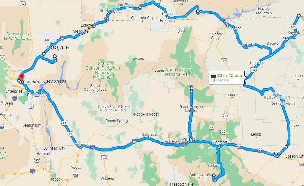
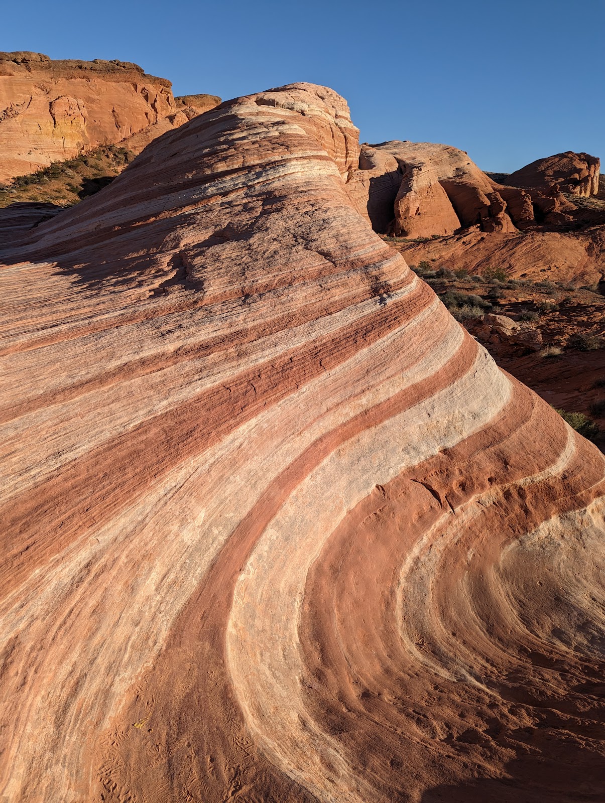
VALLEY OF FIRE
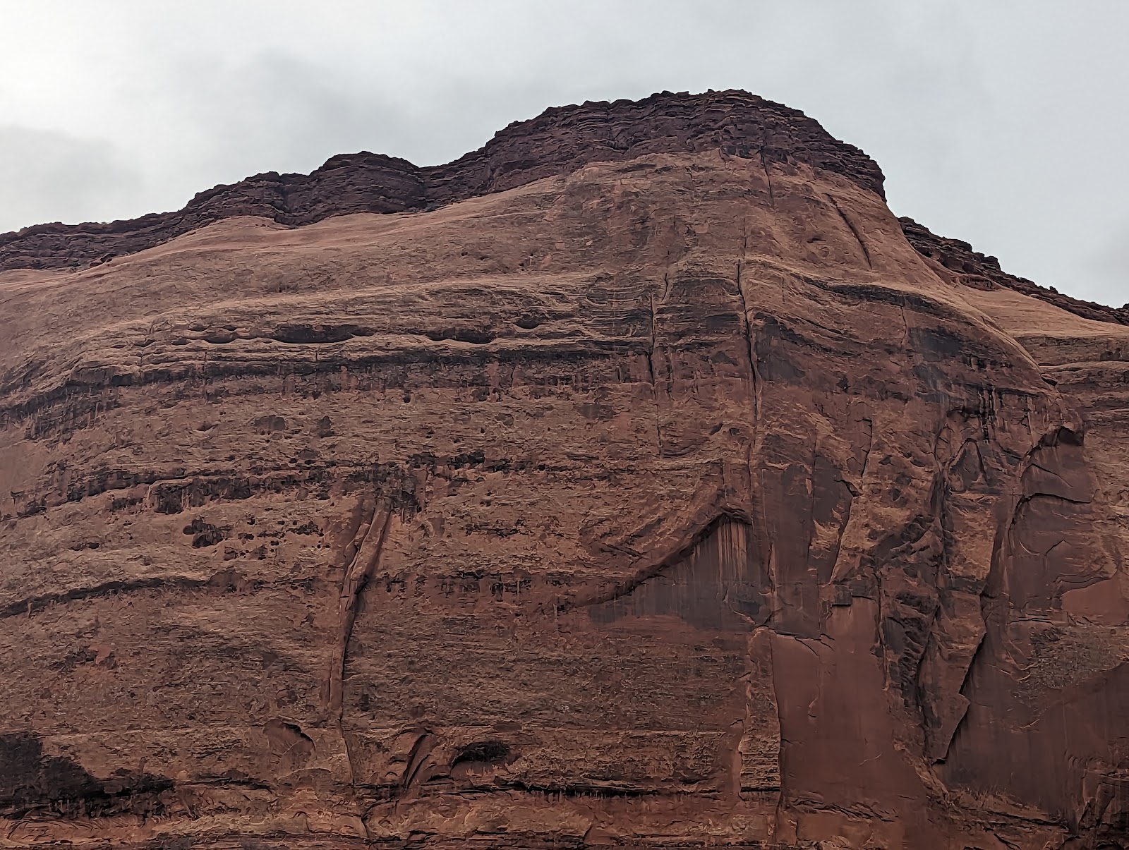
Years ago I used to travel frequently to St. George UT for work, always flying into Vegas and driving. Somehow I never stopped to check out Valley of Fire State Park, which has the Fire Wave, which is much better than the stupid old regular Wave in northern AZ. The sudden transitions in the rock between white and red had to do with whether it was being laid down in a reducing or oxidizing environment (swamp vs not at the time.) These are Jurassic but there are also Cretaceous red rock layers in the Southwest.
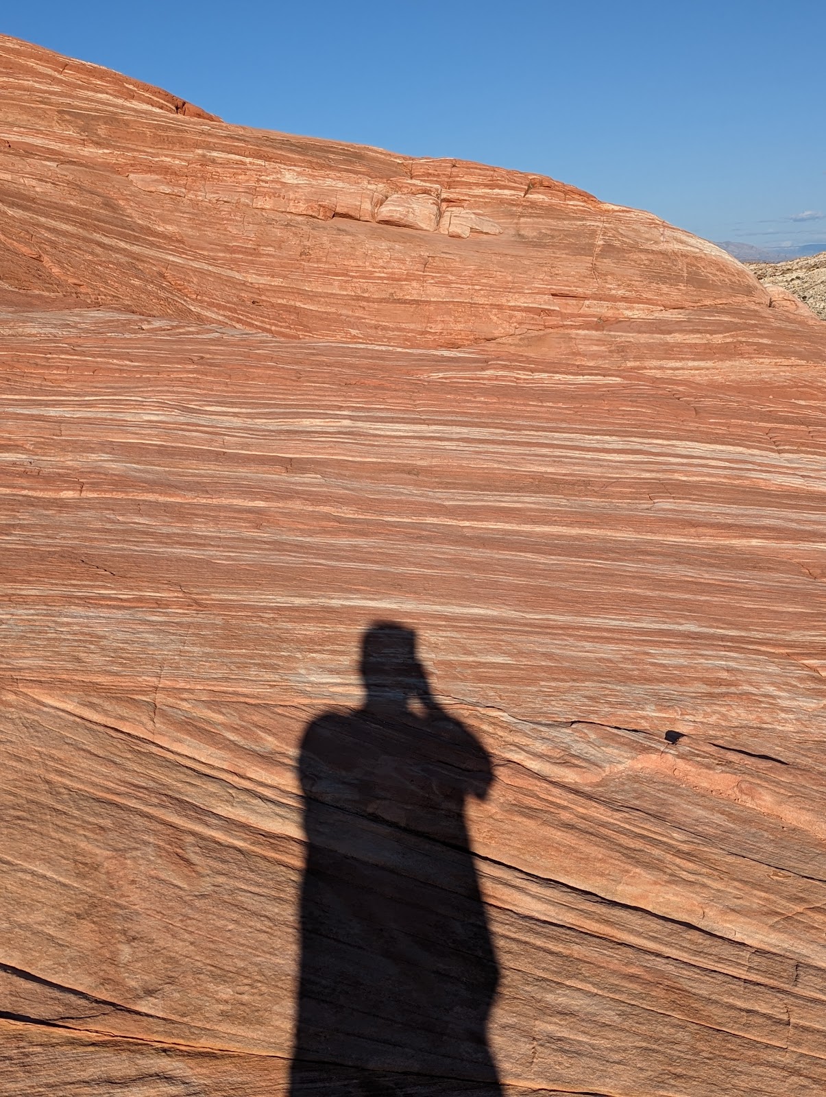
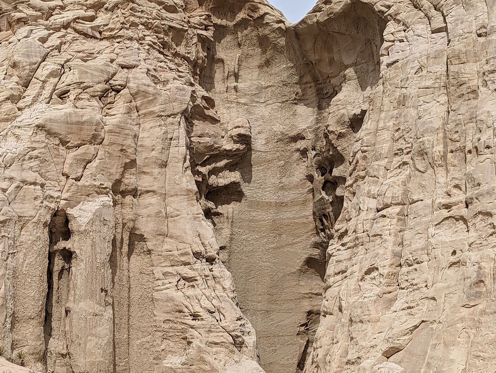
Above: a fellow hiker chased down and cornered Salacious Crumb in a rock formation.
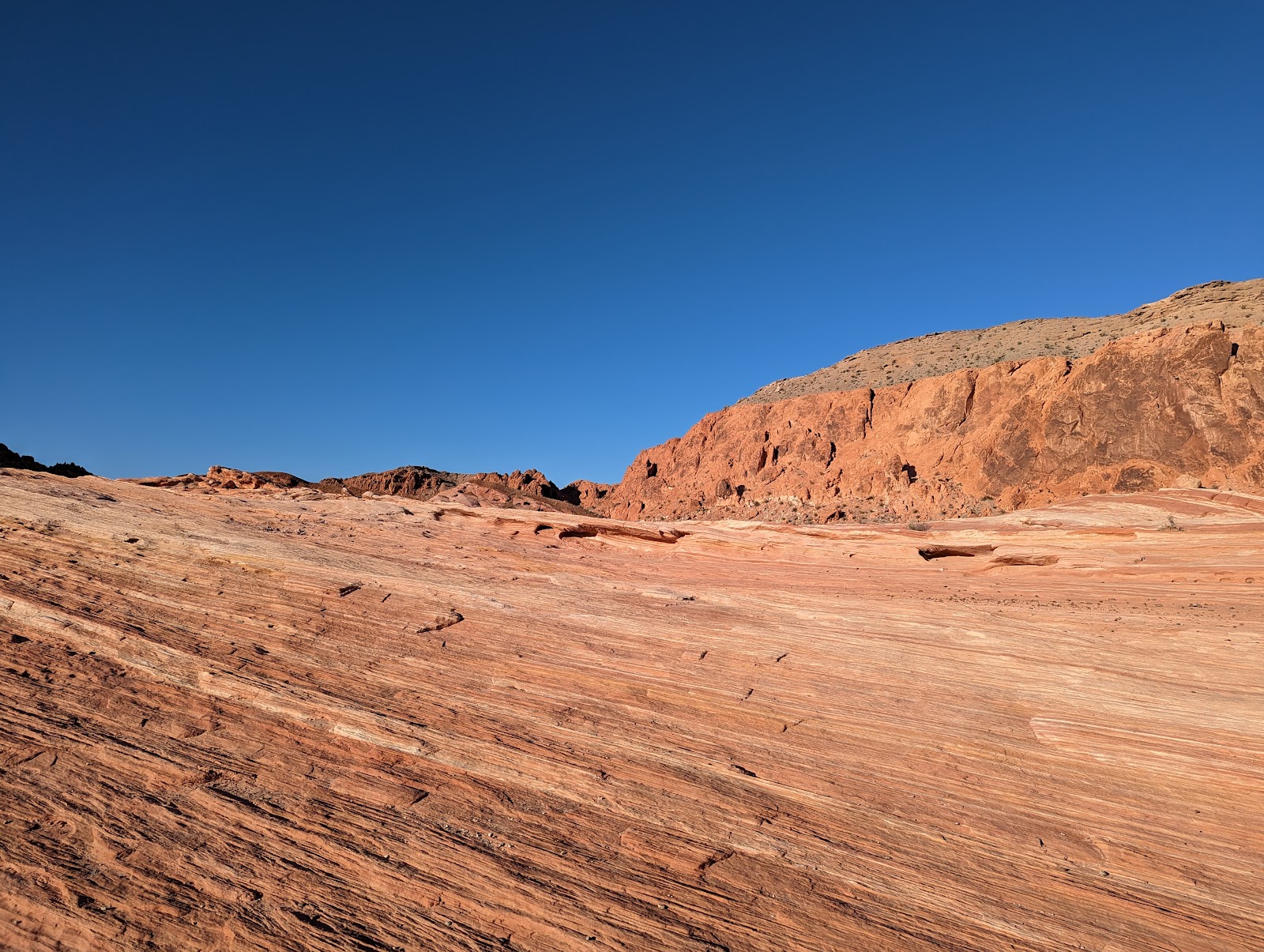
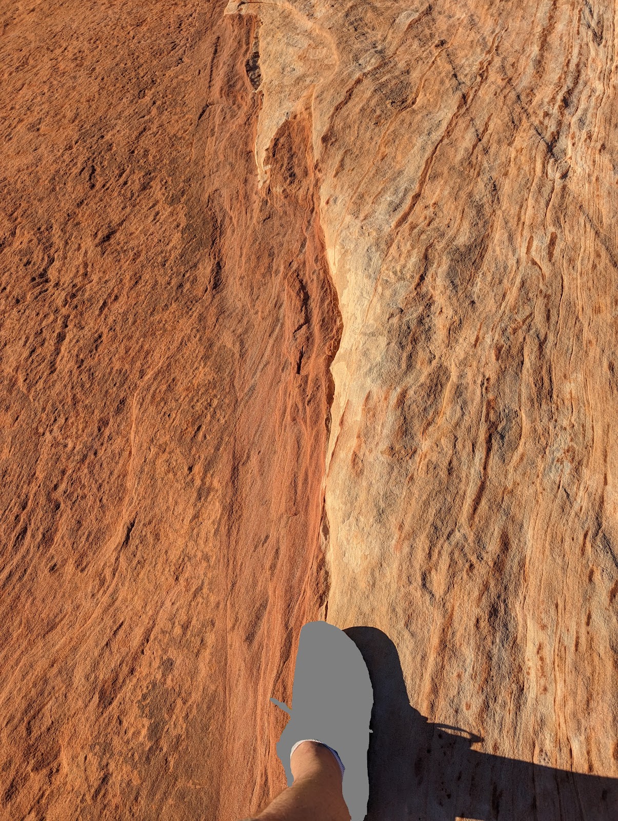
Above: you can see how clean and rapid the transition is between red and white rock, reflecting a change in local water conditions at the time, possibly because of a change in a river flowing over the sand at the time. Sneaker for scale, and as you can see the effect of the rock is powerful, immediately turning shoes a featureless gray.
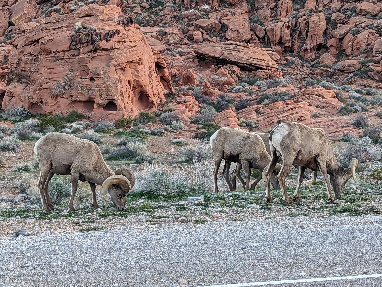
Above: sunset in the Valley of Fire. Below: very mellow bighorns. (Very little zoom used here, they were just hanging out and very cooperative when people wanted to stop for pictures.)
SOUTH UTAH AND ZION NATIONAL PARK
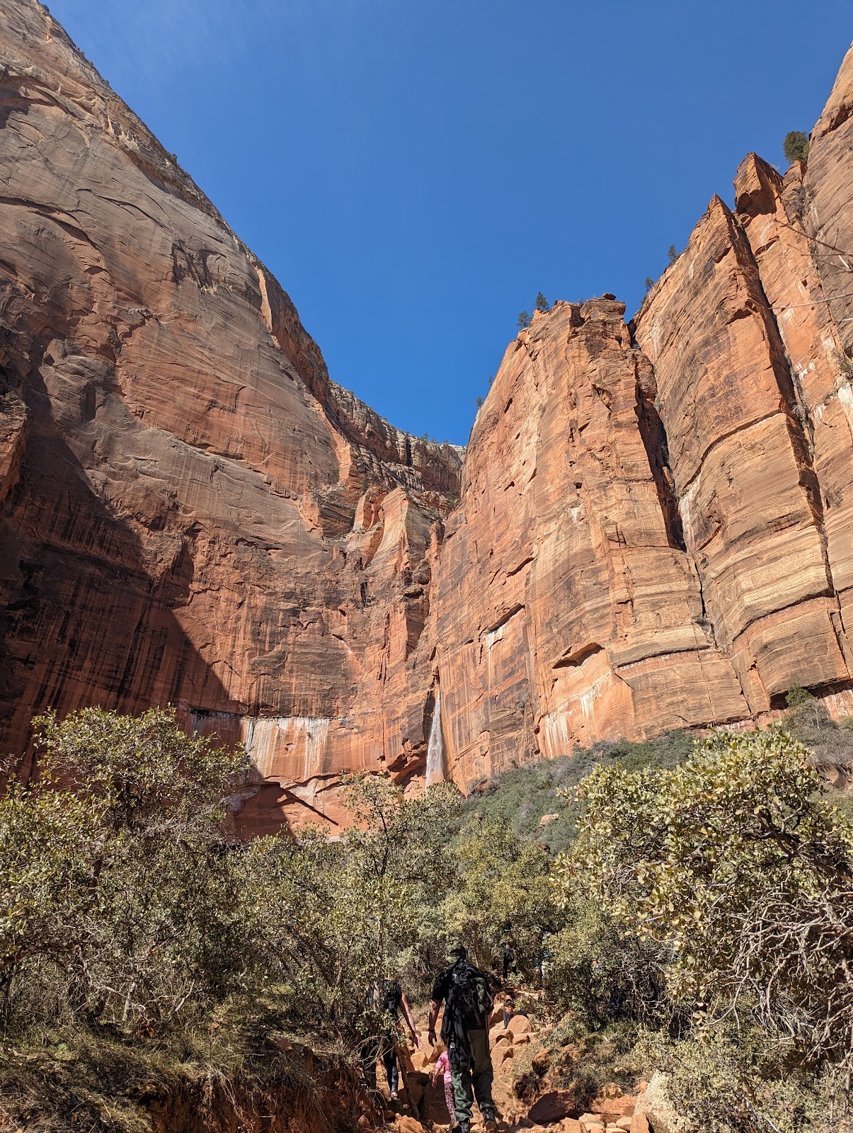
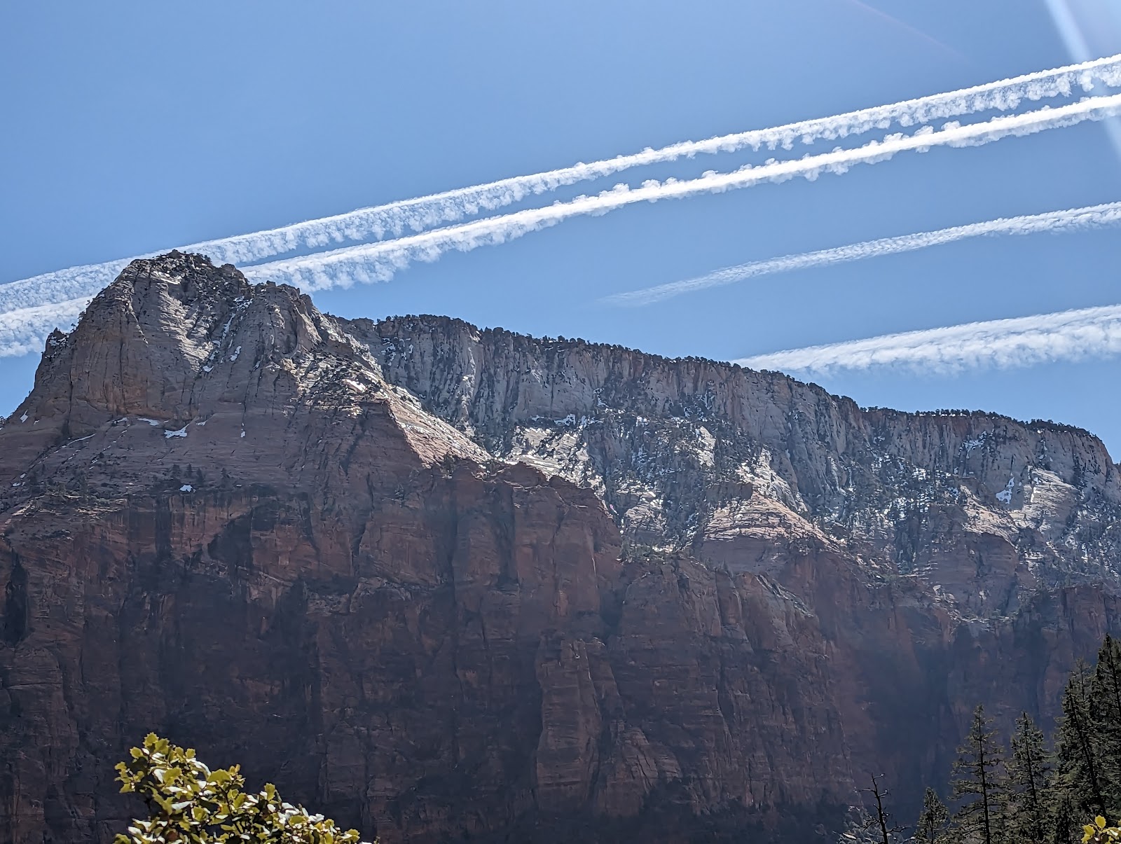
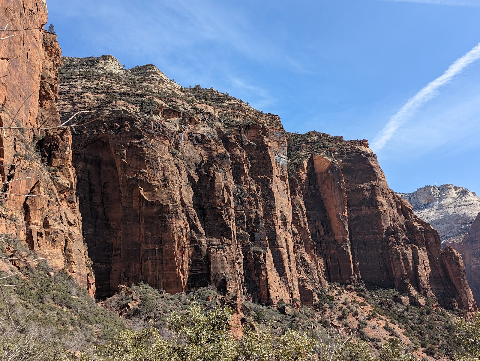
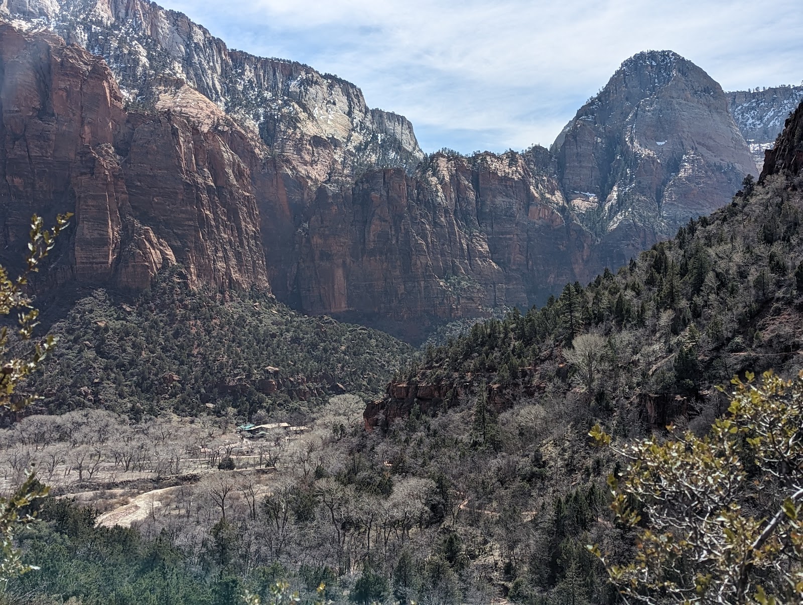
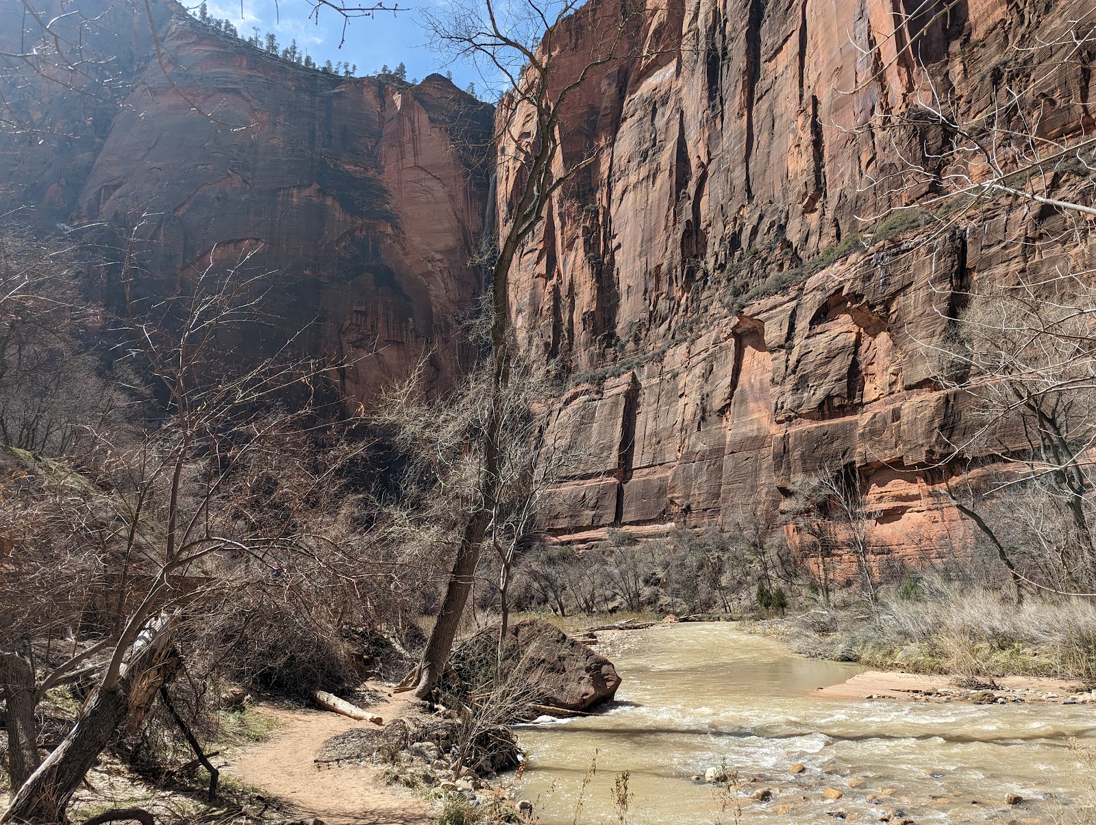
On the way to Zion you get off the 15 in St. George, and boy has St. George grown in the last 20 years, doubling in population! (I recommend Frostop Burgers, whose imitation fry sauce is indistinguishable from Arctic Circle's at least for this gentile.) The home prices in Springdale at the entrance to Zion in terms of price per unit area are comparable to some decent places in Sonoma County, a finding that I repeated at several other trendy growing outdoorsy towns on this trip. Zion was beautiful as always. We did Emerald Pools which was surprisingly crowded but people were nice. At this point in the trip we were still thrilled by the novelty of snow (visible in patches on the upper reaches of the canyon walls.) Flagstaff would cure us of this.
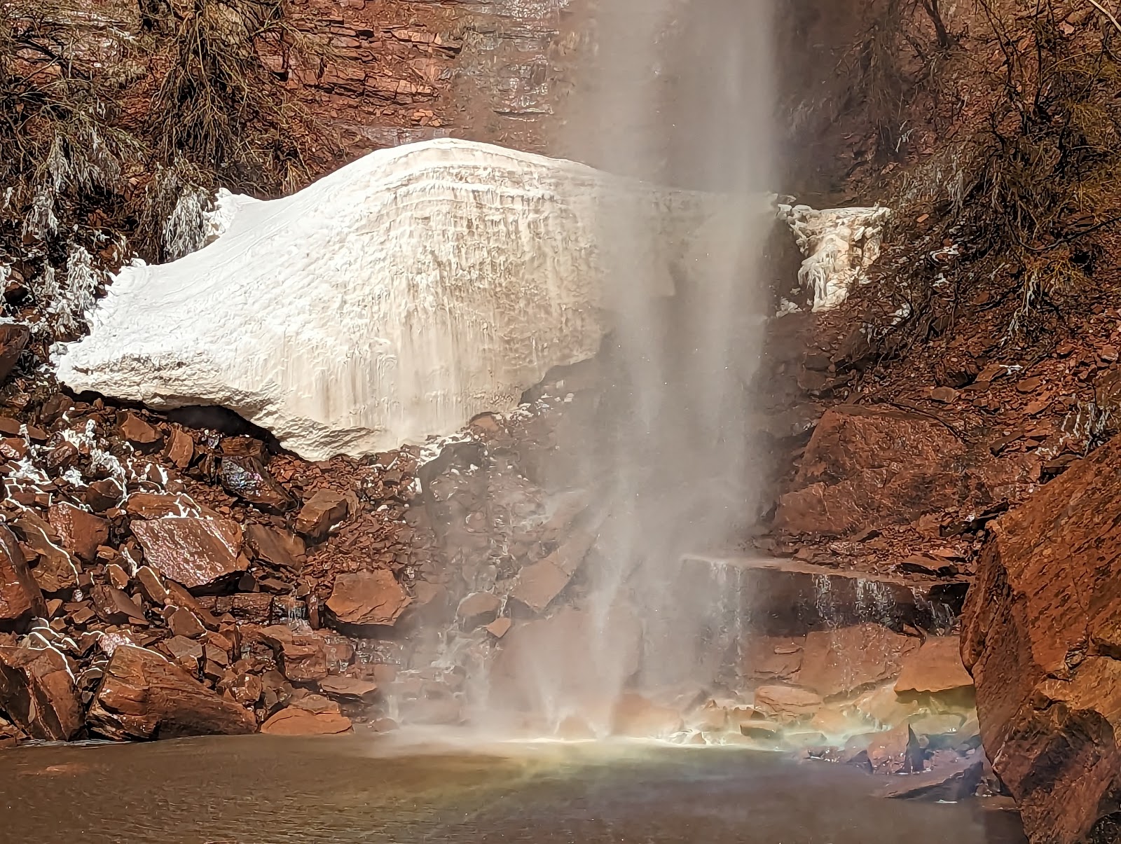
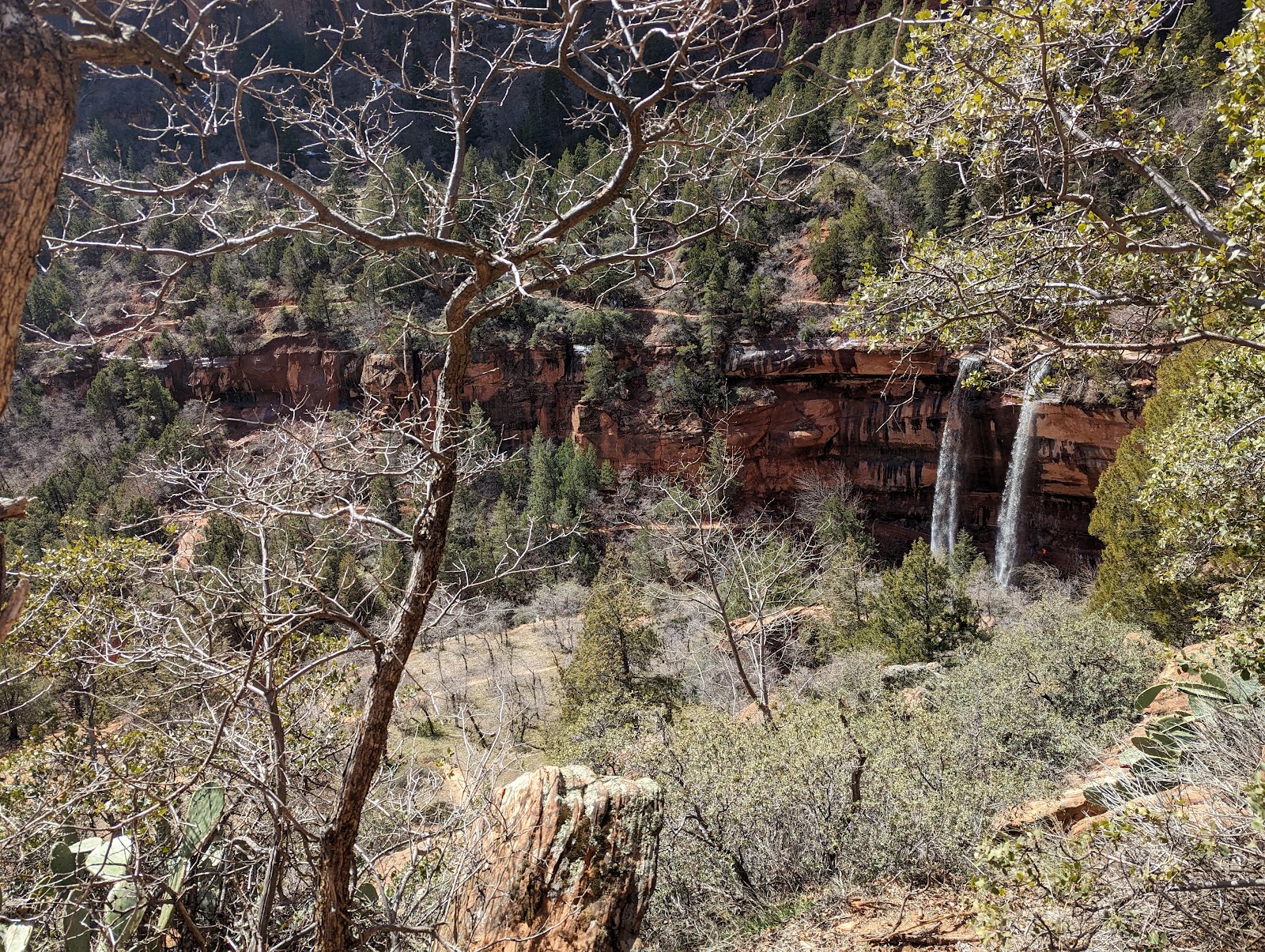
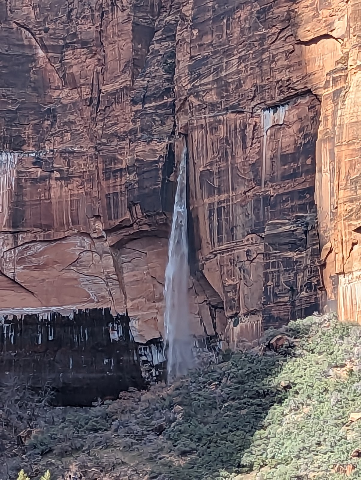
Above: I heard another hiker theorize that these smooth piles of snow near the misty bottoms of the several falls around Zion were the result of "natural snow maker" effects of the falls at sub zero temperatures. I think this is right because most high falls had one of these.
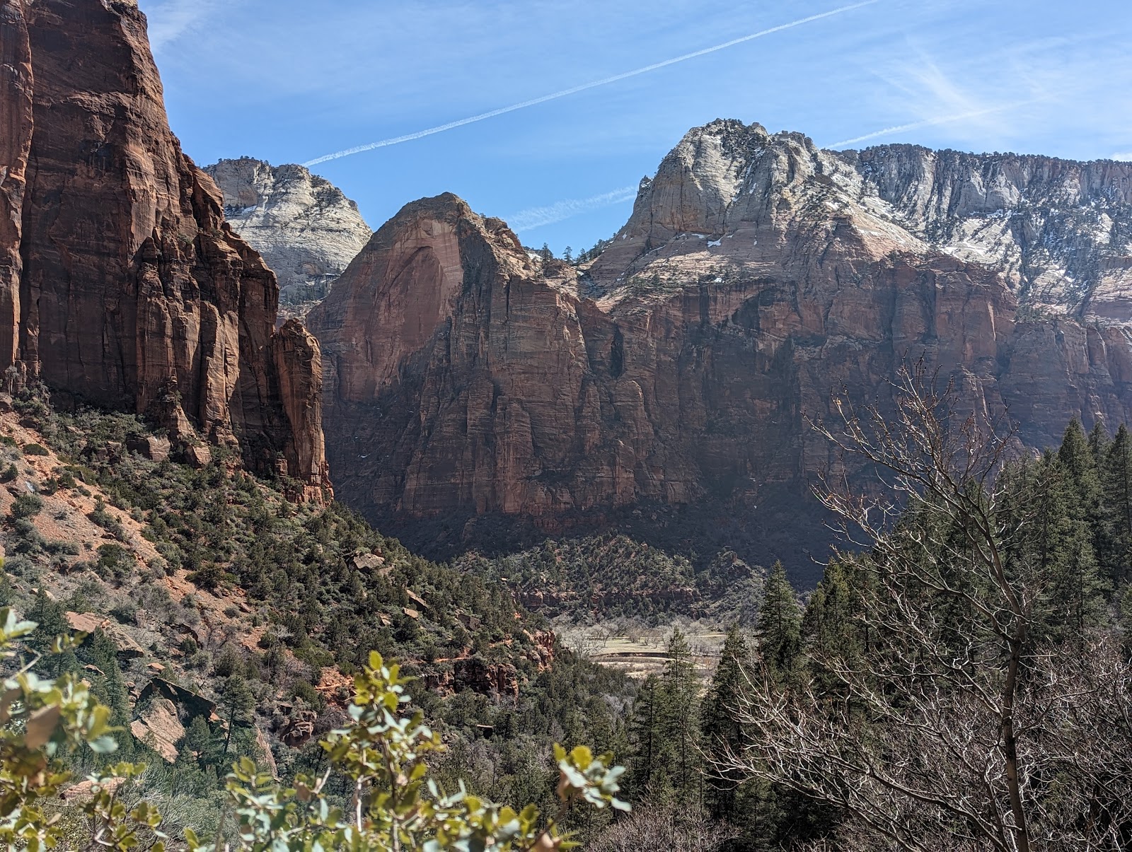
Compare above and below. The east end of Zion Canyon was used as the entrance to the hideout in Butch Cassidy and the Sundance Kid.
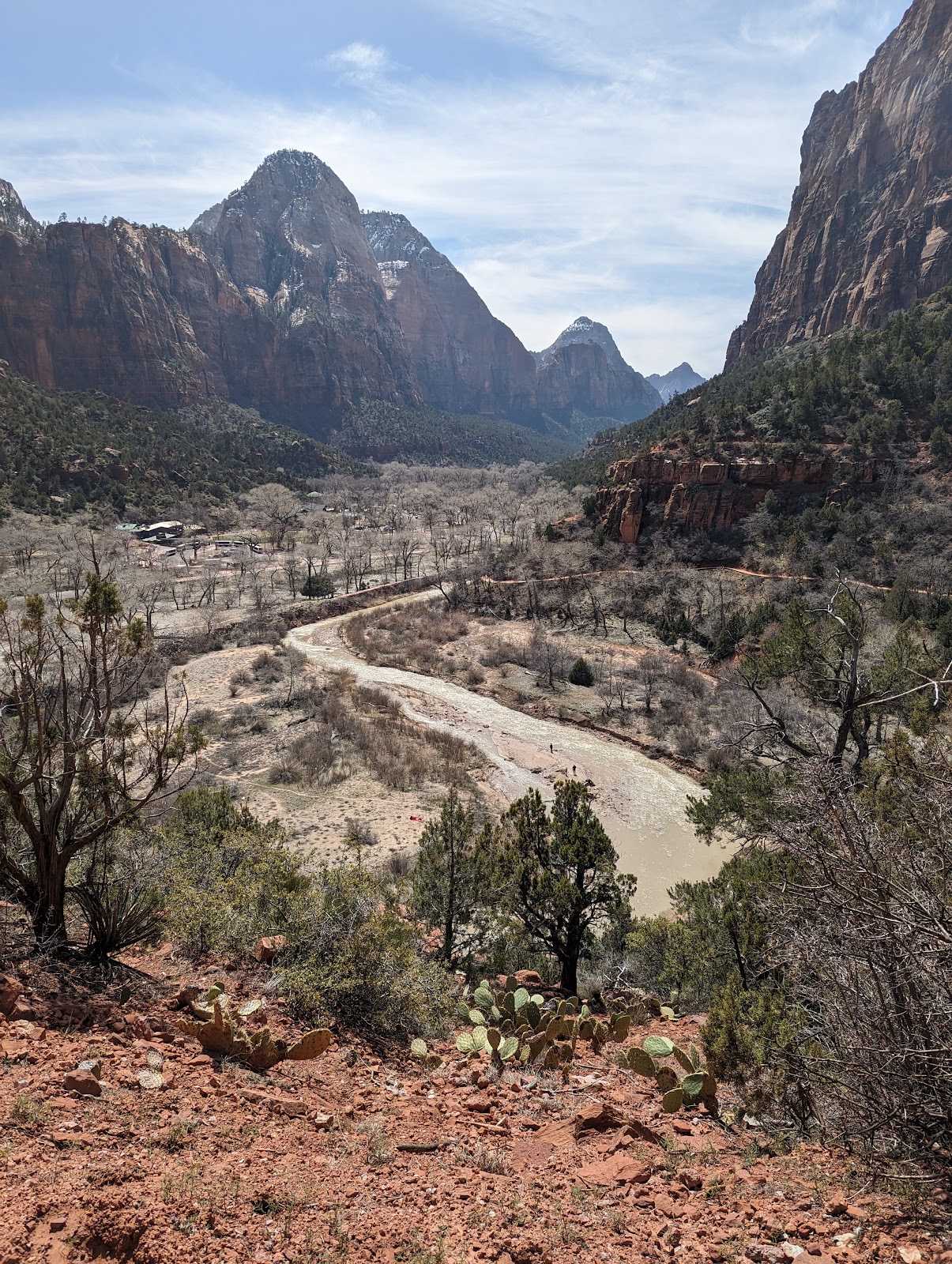
Also pictured, Riverside Trail to the Narrows. Unsurprisingly this winter, the Virgin River was roaring, so no hiking up the Narrows (though honestly I've never done it and don't understand the appeal of hiking in water or rock hopping for ten miles.) Very proud of my daughter who kicked butt on both of these hikes. Although she was unsure of hiking to a place called the Temple of Sinawava became she said it sounded like a bad guy. In Springdale outside Zion, for dinner I highly recommend the Bit and Spur. Try the local gin (Madame Pattirini, named after Brigham Young's drag performer son - yes really, and yes he really performed for LDS elders with their full knowledge.)
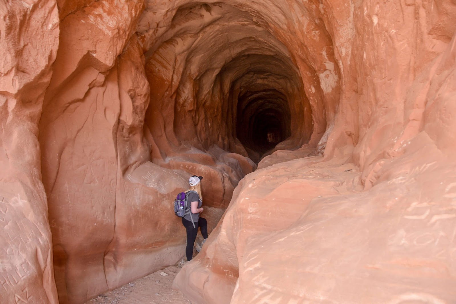
When we left Zion we passed through the windowed tunnels, then went into the Belly of the Dragon cave (pictured below, credit visitsouthernutah.com
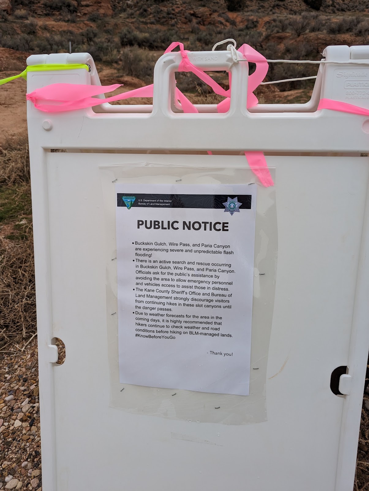
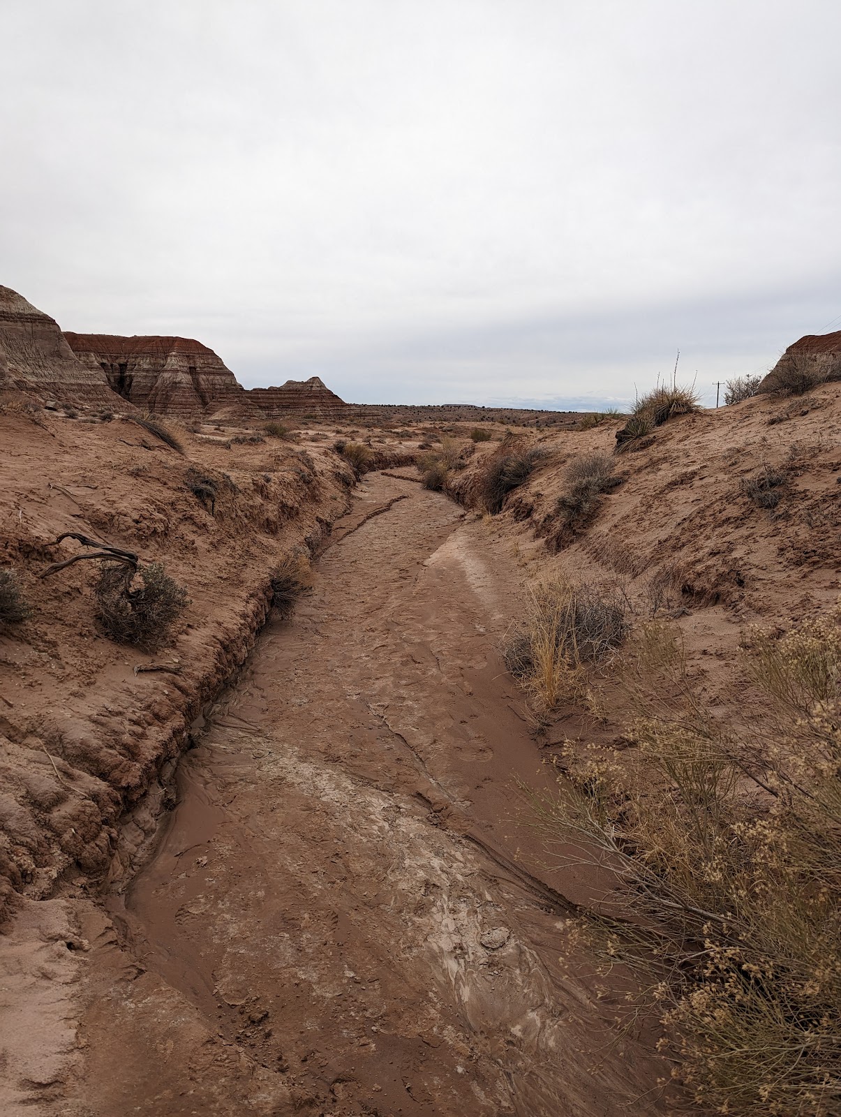
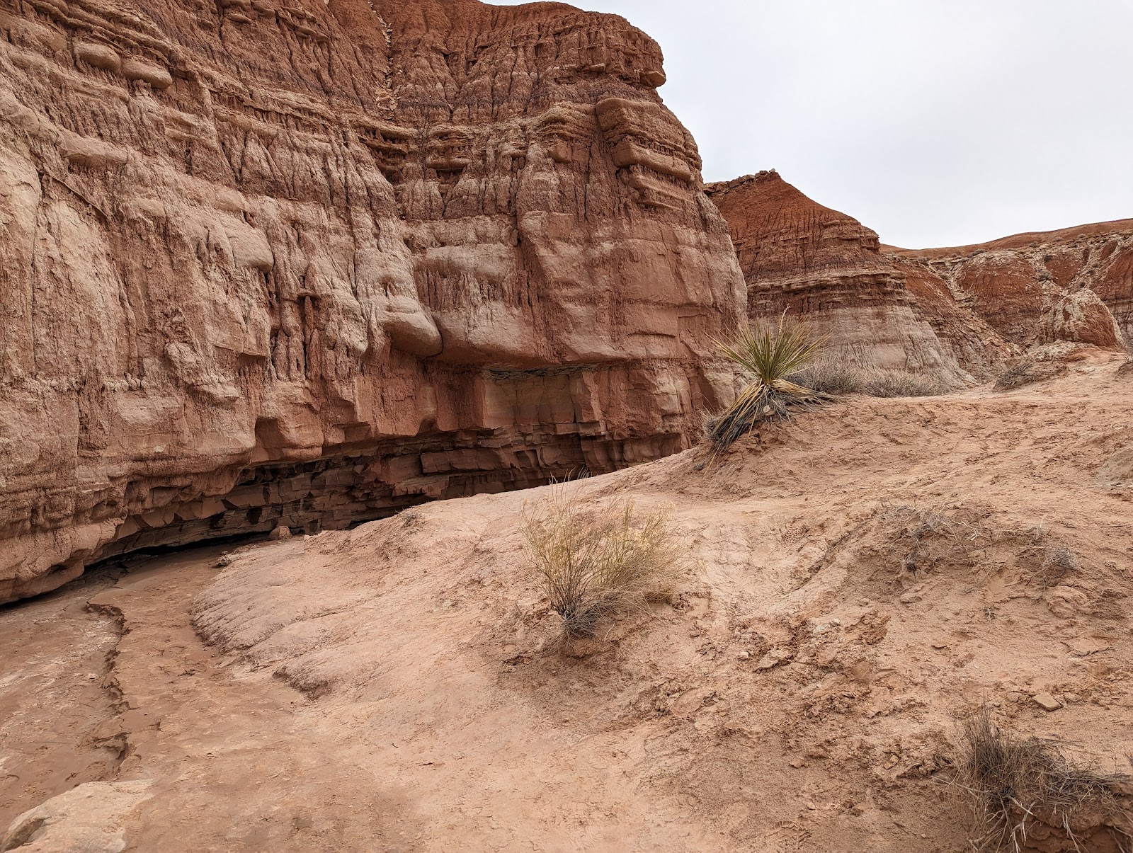
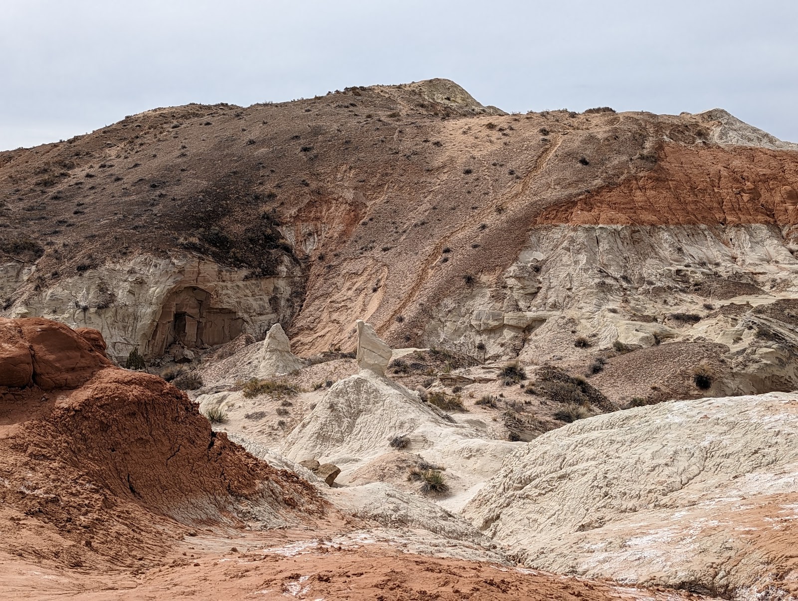
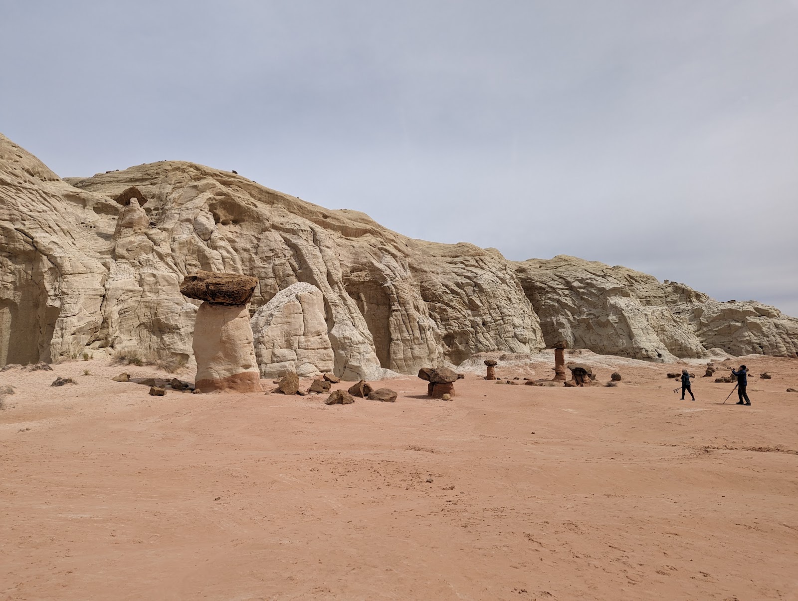
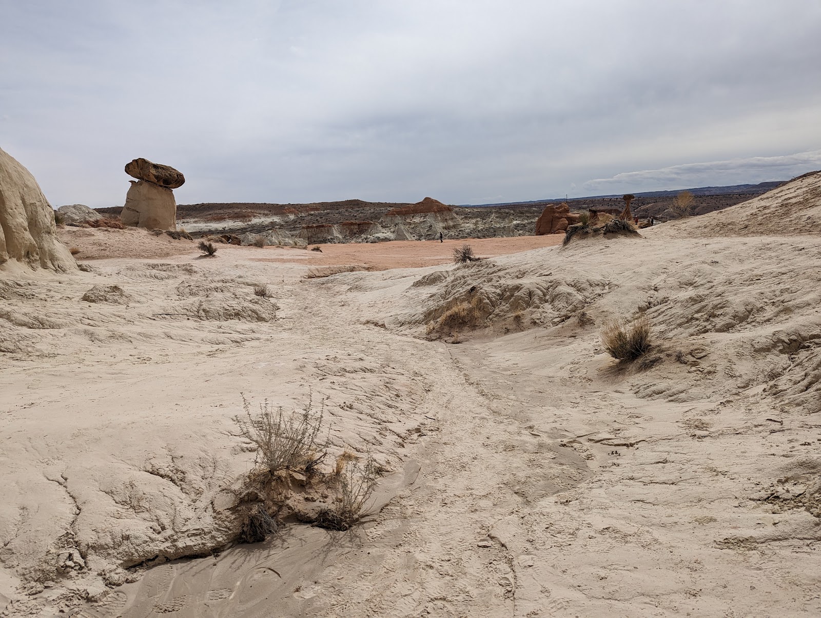
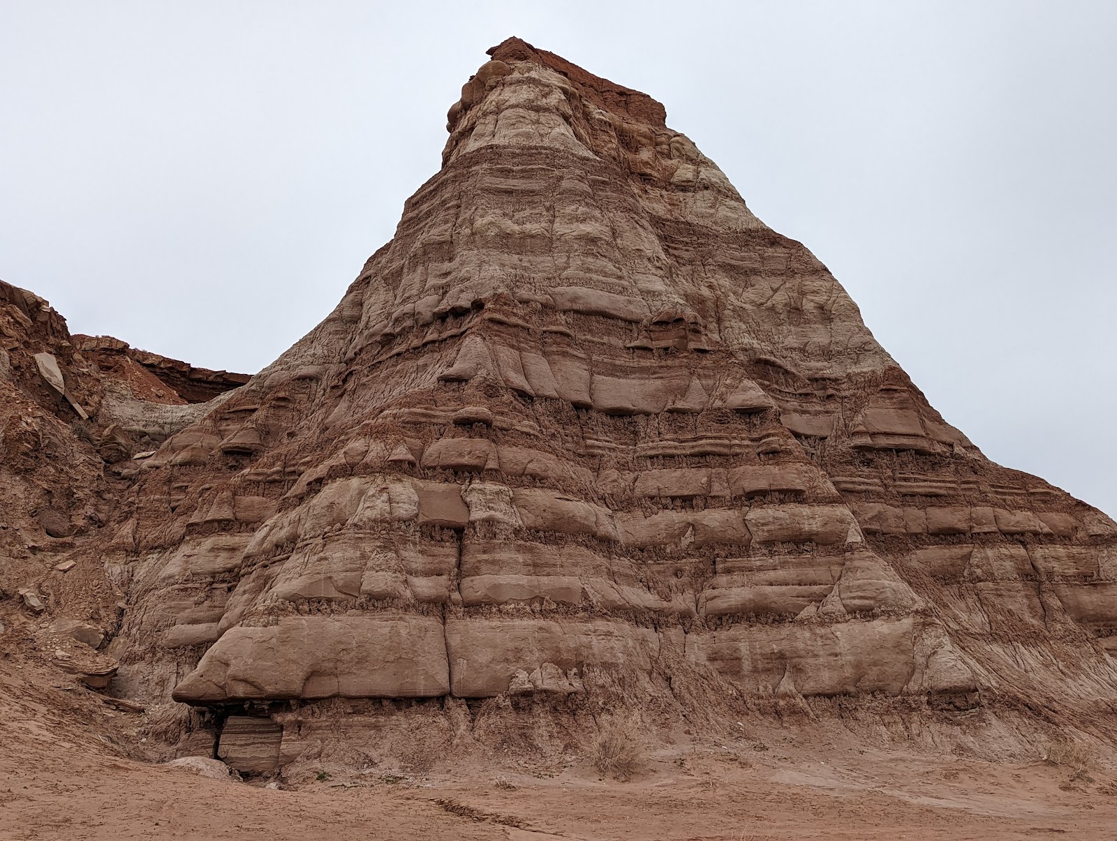
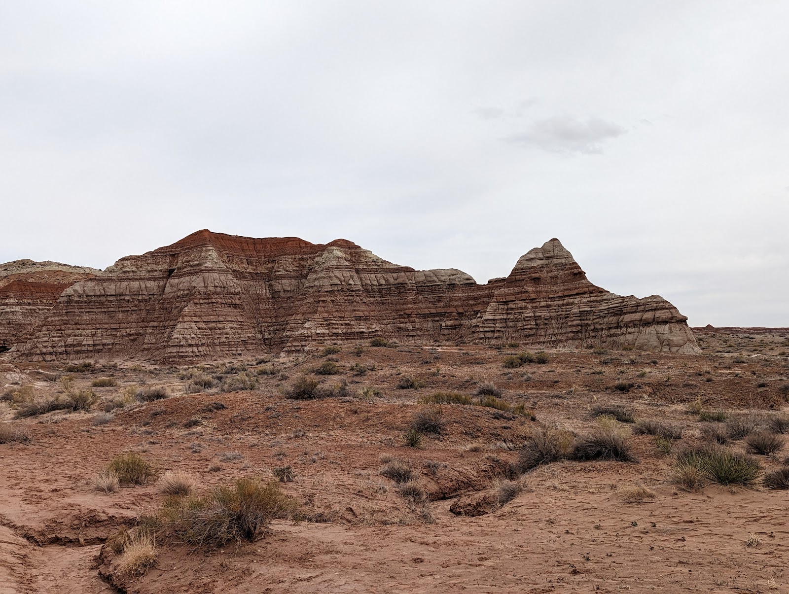
Sadly Moqui Cave was closed. Our original plan was to hike Buckskin Gulch but there were at least two deaths in the previous week and the people who didn't die, didn't have fun. We made it down the fairly washed out 7-mile BLM road but, as I consider among my strengths as a father and husband that I don't kill my family, I decided we wouldn't risk hiking into it. And it worked out - because if we hiked Buckskin, we probably wouldn't have stopped at the understated trailhead for Toadstools SP, which I had never been to before.
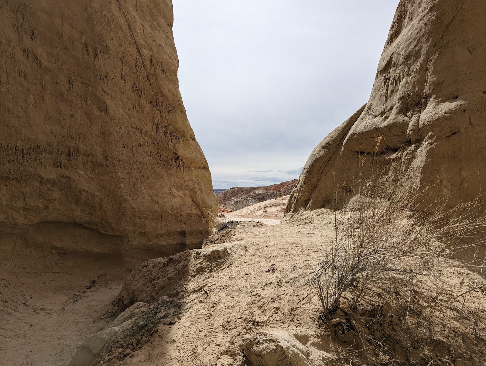
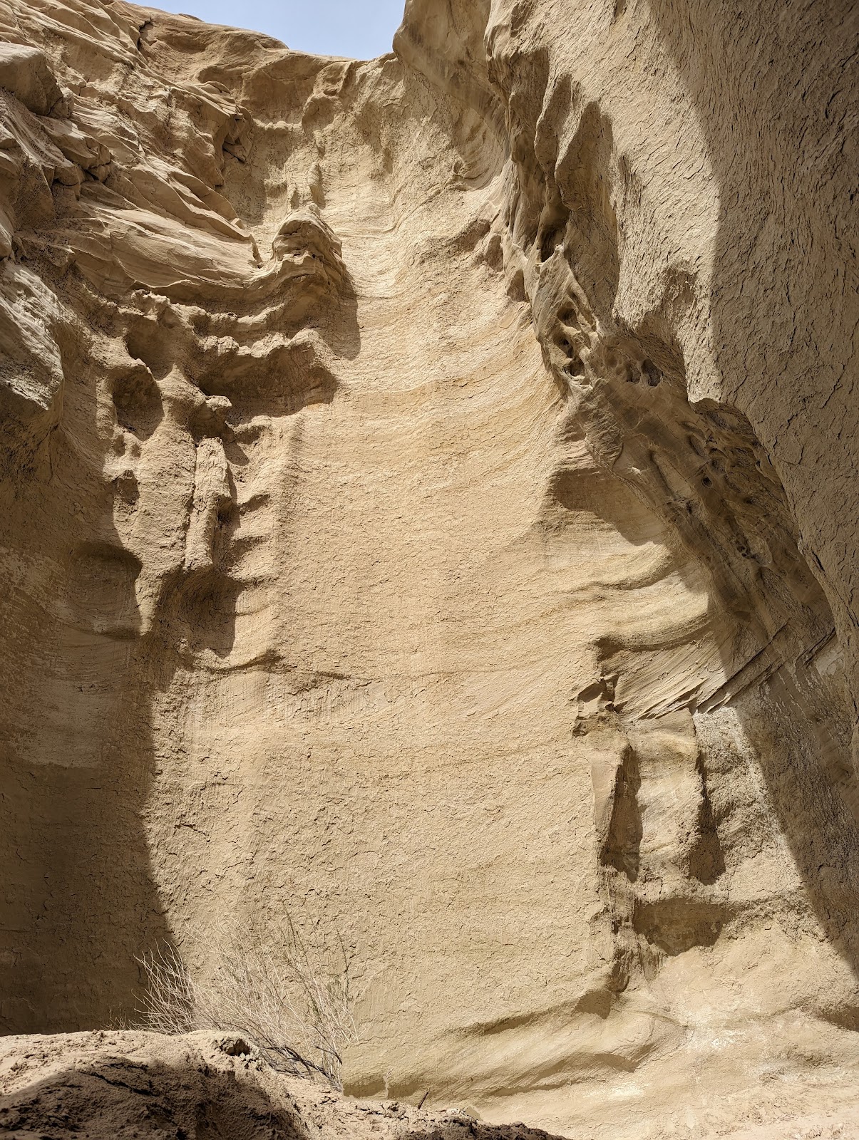
Above: inside an amphitheater. Three pictures down you can see it from a distance.
This was one of the big surprises of the trip (and if you're not surprised by something new at some point on a trip - why did you go?) In the parking area we also had our first encounter with a native person, who sold us some jewelry (nice lady; we later saw her in Safeway at Page.)
Afterward we crossed the Glen Canyon Dam (holding back Lake Powell - Hoover Dam's younger brother.) I know someone who did their honeymoon on a houseboat exploring the side canyons of Lake Powell which sounds like a blast. Page is smaller than I thought; also more native, although I'm not sure why this surprised me given the proximity to Dineta (Navajo Nation.) The street of little motels in Page would be a fun place to stay for a little bit, but I'm not sure I'd want to live in hastily built cinder block proto-Googie architecture indefinitely (as some people do because some have been converted into homes). Navajo Mountain stuck out as always but I learned it's off-limits as a sacred mountain to Navajos (clearly doesn't stop people though.) Navajo Peak is an igneous intrusion in the Colorado Plateau (itself a block of crust pushed up during the Laramide orogeny.) We skipped Goosenecks because it was out of the way and Antelope Canyon because you have to schedule a guide and it's expensive.
THE NAVAJO NATION
From Page it was a long haul across the Dineta (not sure people realize it's big - bigger than West Virginia, more than 200 miles by 100 miles.) There were signs offering compensation for radiation exposure - there was uranium mining in the Dineta, which you can learn about in this brief video. One person working at the Monument Valley visitor center (which has its own exhibit on the history) told me she'd just watched it herself and this was a known problem during her grandparents' generation. (See also, the uranium mine at Joachimstahl in the Czech Republic in this post, where political prisoners in Warsaw Pact countries were sent during the Cold War.)
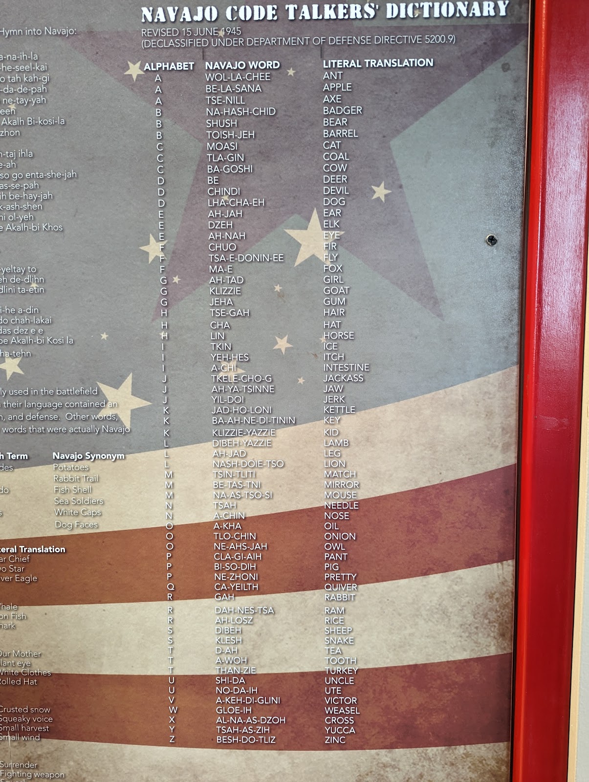
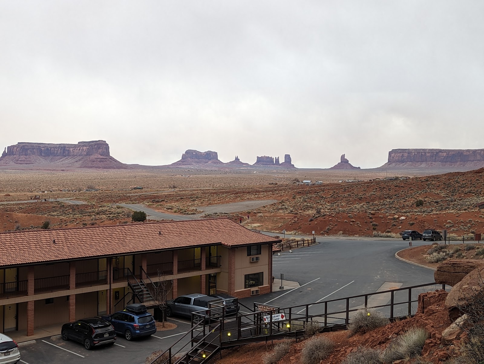
Why is this list posted in the Burger King in Kayenta, AZ? It's part of a WWII museum, which also includes captured Japanese guns and flagsThe Navajo Nation is justifiably proud of their role as code talkers. (Note, the Japanese actor Tadanobu Asano, who is famous for his role as Genghis Khan in Mongol among others, is actually a quarter Navajo - has grandfather was a code talker who spent time in the Japanese home islands.) We stayed in Goulding, which had just as great a view of Monument Valley and unbelievably cheap dinners (great steak! Super cheap!) I noticed that the room TV was tuned to the Sirius XM metal channel when we got in, and later noticed one of the house staff wearing a Behemoth T-shirt. (She admitted yes, she listens to metal while cleaning.) Keep on spreading the metal gospel sister! I have more/better pictures of Monument Valley and the materials at the Kayenta BK here (although the code talker display is updated now.)
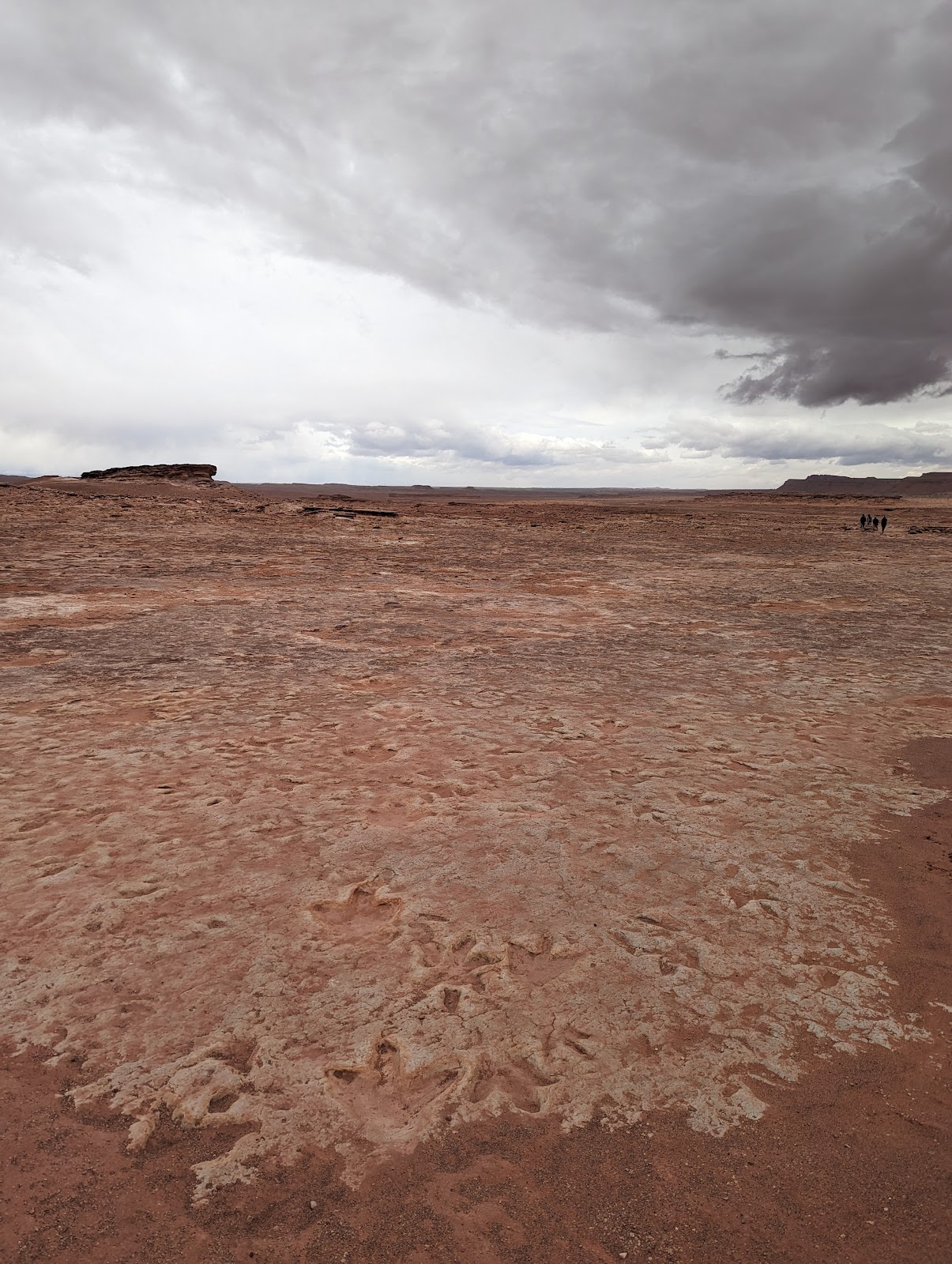
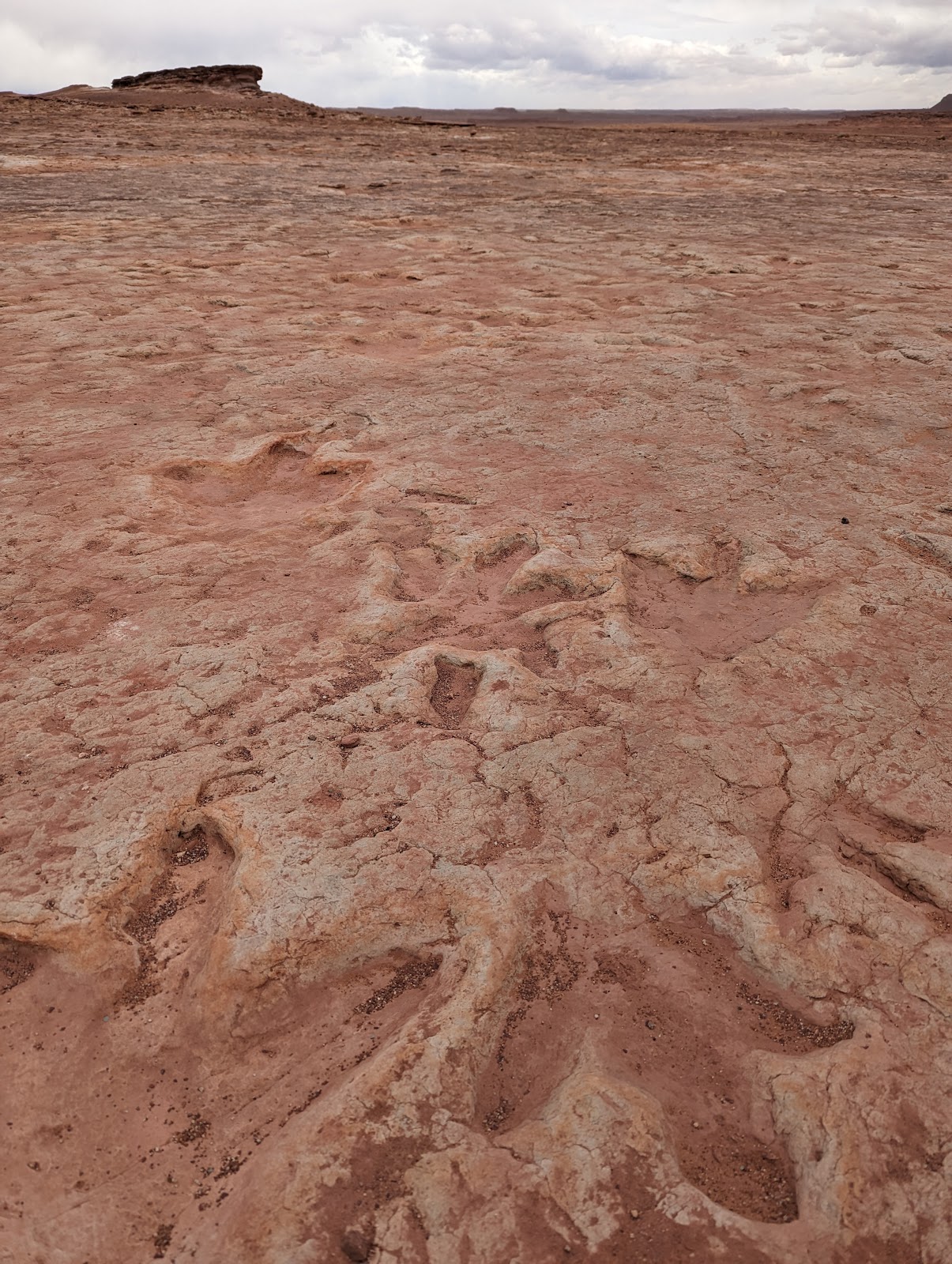
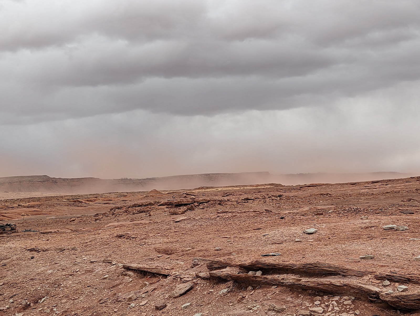
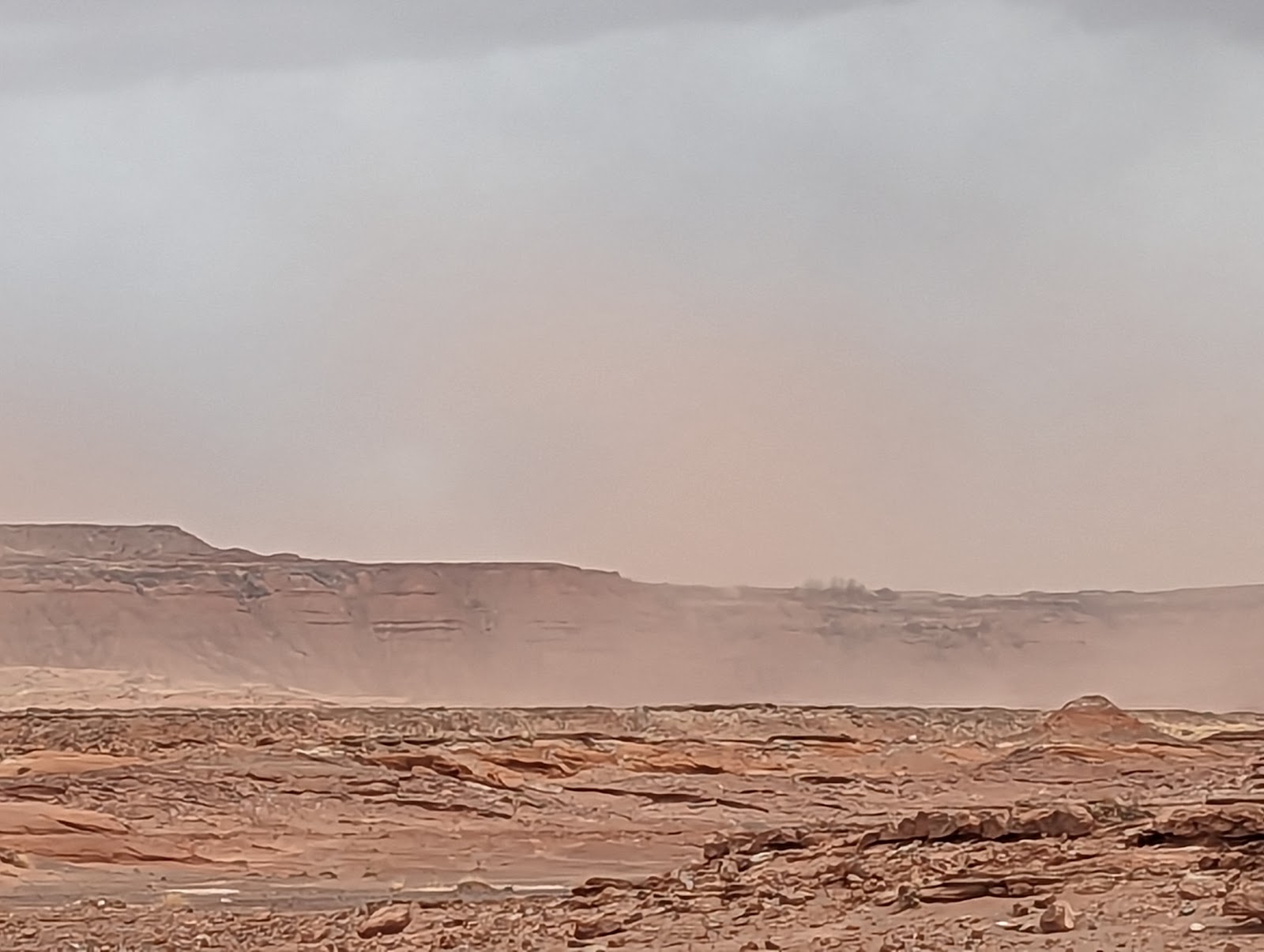
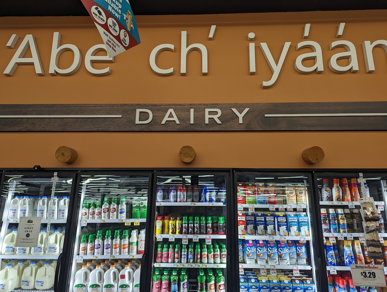
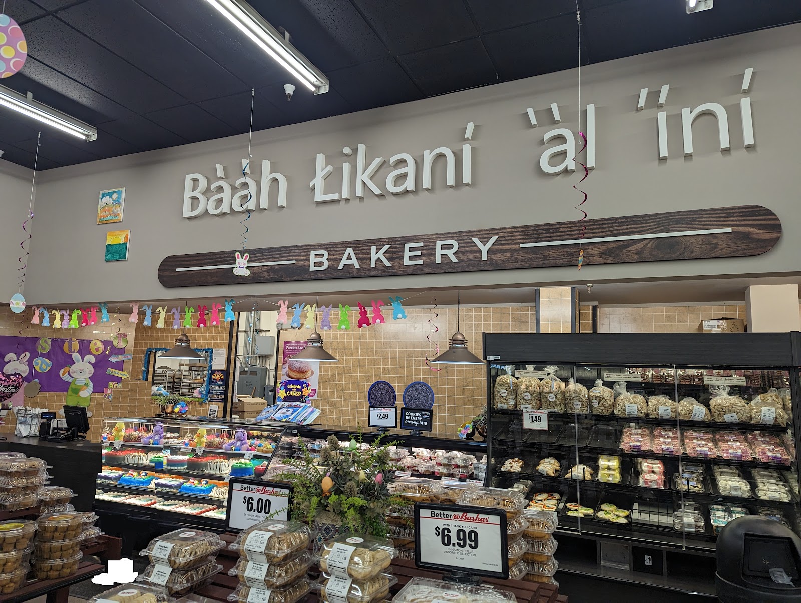
Next day, it was back across the Dineta to Moenkopi (Tuba City) to see some dinosaur tracks and buy some turquoise. Yes, they're real tracks, made during the early Jurassic. While we were there the wind blew harder and harder, until finally we could see a red cloud rolling toward us from the flat land to the south, and a sandstorm blew in (no these photos were not taken on Mars.) The woman we bought from told us March is usually bad and she advises against trying to drive in that area (one benefit, now I didn't feel so bad about taking my family the long way to Flagstaff instead of over Olympus Mons.) To get the sand out of our eyes and mouths we went into Basha's, an AZ grocery store chain which has a specialized chain in the Dineta. The main difference in products available inside the rez was that they had a LOT of lamb.
Yes those are all real tracks. I don't know how the Perseverance rover is missing all of this.
I'm going to submit this to the "cozy places" subreddit.
As noted before, the Dineta is big. In fact it's so big that it has other nations inside of it - namely, the Hopi, who live on the effectively named First, Second, and Third Mesas. The simplified history of the Southwest is that around AD 1000-1100, it was drying out and resources were getting scarcer because the population had grown (in some areas on the Colorado Plateau like SW Colorado, the population today is still substantially lower than it was at this time.) That's when the common ancestor of the Navajo and Apache arrived from the north where their relatives still live in pockets up the West Coast, and on much larger territories in western Canada and Alaska. This couldn't have helped things, and the appearance of easily-defended cliff-dwellings at that time suggest things weren't going great (and the fact that the people living in these abandoned dwellings are referred to today by the Navajo as Anasazi, meaning ancient enemies.) This is also consistent with the typical pattern in history, where more aggressive newcomers push the previous residents up into the highlands - it happened with Basques in the Pyrenees, the Polynesian-speakers in Madagascar when Bantu-speakers arrived, the Marquesan-descended menehune of Hawaii when the new Tahitian settlers arrived - and of course, to Native Americans as a whole when Europeans arrived. (See also: the region of Zomia in James Scott's The Art of Not Being Governed.)
The Hopi were part of one of the few even partly-successful native revolts against the Spanish, and in the early twentieth century after American influence was penetrating the area in a way the Spanish never had, part of the Hopi chose to withdraw completely, Amish-style, and remain so today (in the village of Oraibi.) I had no desire to force myself into the village, but even in the theoretically modern towns nearby like Kykotsmovi, it's anything but clear that outsiders are welcome (hand-written signs warn against photography.) At one point I got off the main road and drove into Kykotsmovi proper, which was clearly much poorer than the towns was saw in the Dineta. For unclear reasons, they were also much more committed to wearing facemasks than the Dine. We went to the Hopi Cultural Center and got Hopi tacos with sliced beef; we would have gone to the Burping Coyote store just because of the name but sadly it was closed, possibly due to GI problems. I have to say the stretch from Second Mesa to Winslow seemed like the most desolate.
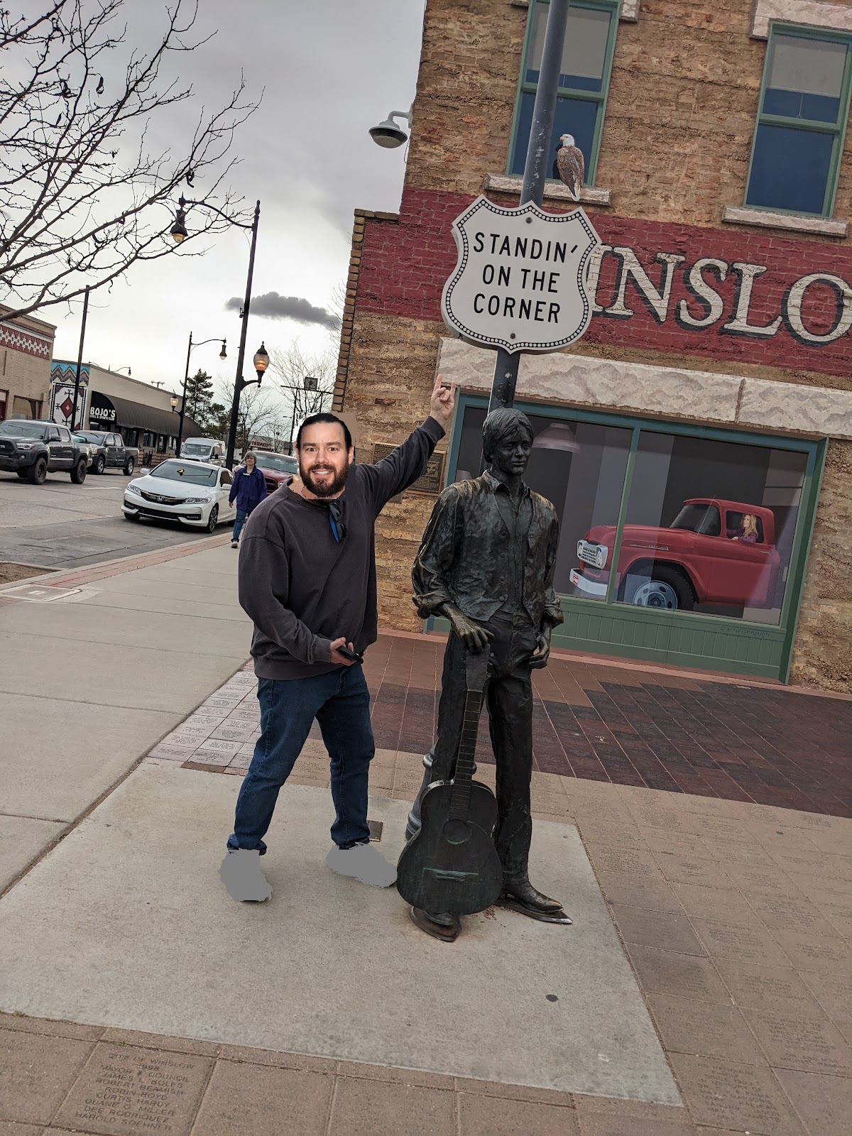
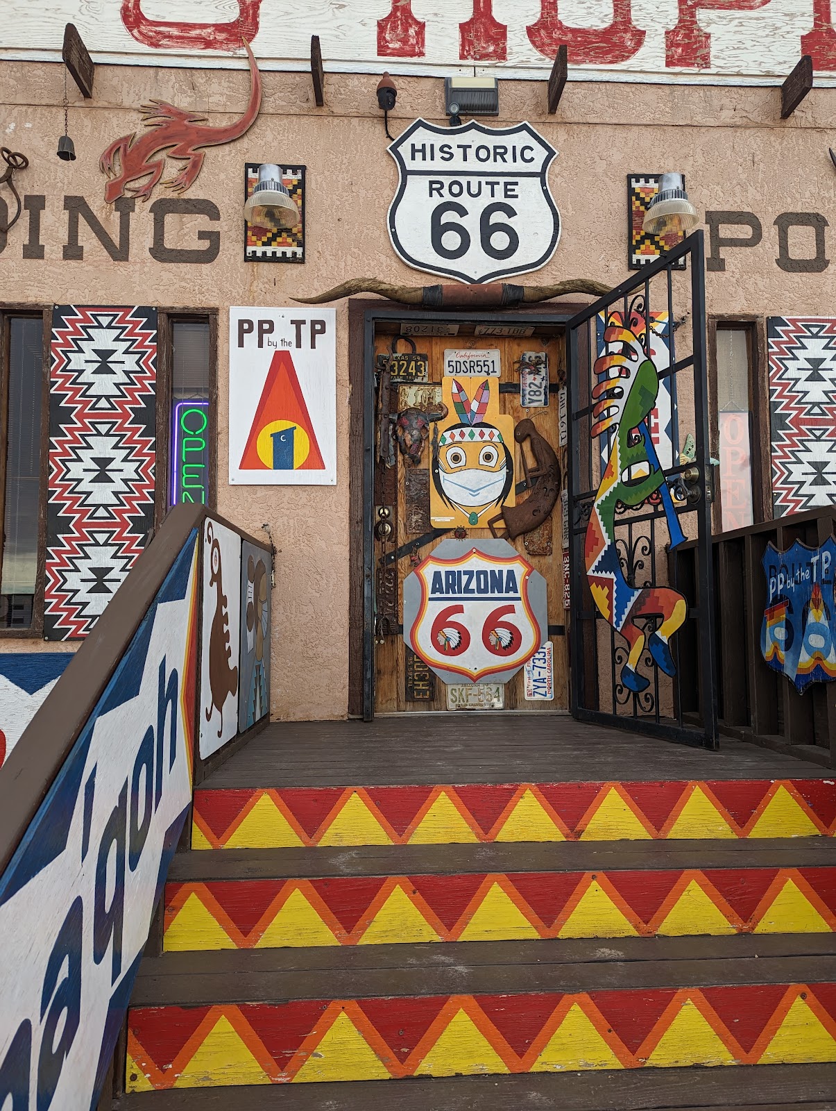
Below: yes, I'm standing on a corner in Winslow, Arizona. This is not a growing town but they capitalize on what they have, and it's interesting to see that for the first time they have a native mayor. Below that is the entrance to a typical Route 66 trading post. One of the take-homes from this trip: kachinas have gotten popular and expensive. I mean, good for them, but they're cool and I want one, just not at the $500 level. Maybe time to make a Sonoma County style kachina.
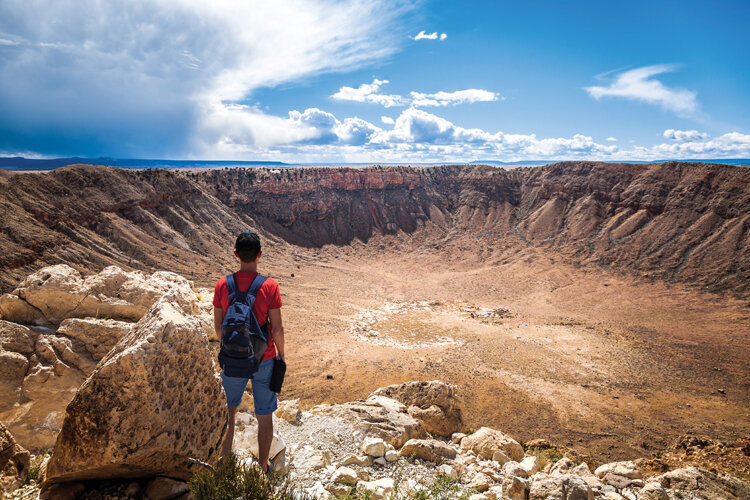
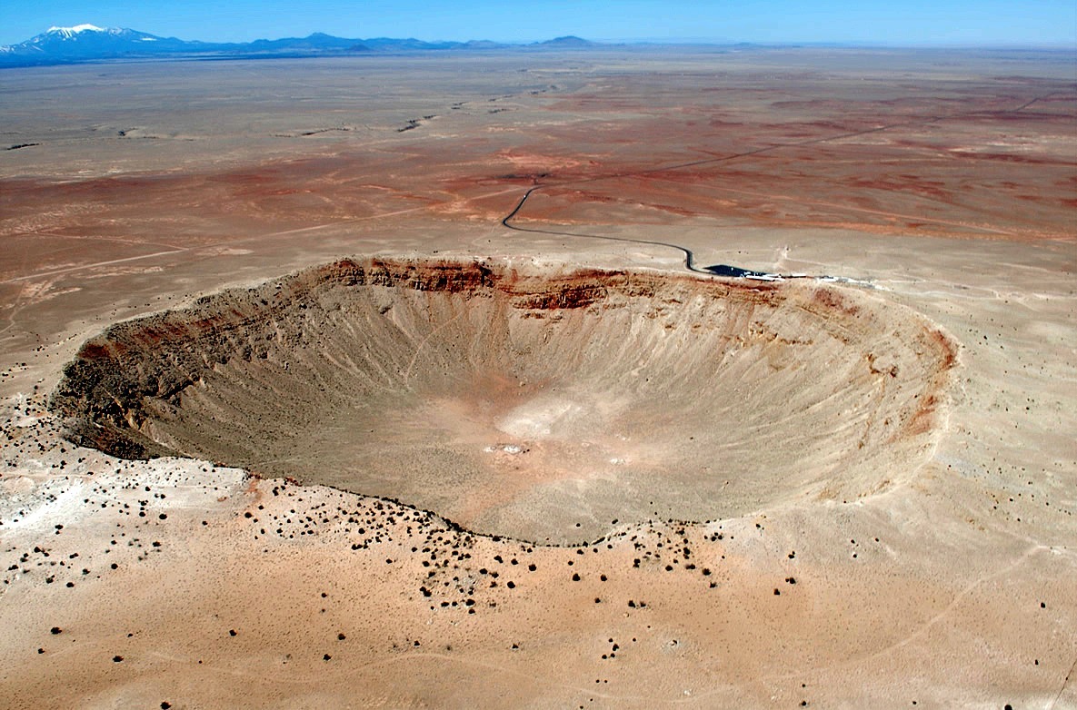
Just west of Winslow is Meteor Crater National Landmark. Incredibly windy that day (continuing the theme that I'm the only idiot who takes his family to Arizona to be cold.) The site is updated since I was last there 15 or so years ago, with information about the Chelyabinsk meteor from 2013. Image credit Planetary Society and Barringer Crater Landmark.
FLAGSTAFF
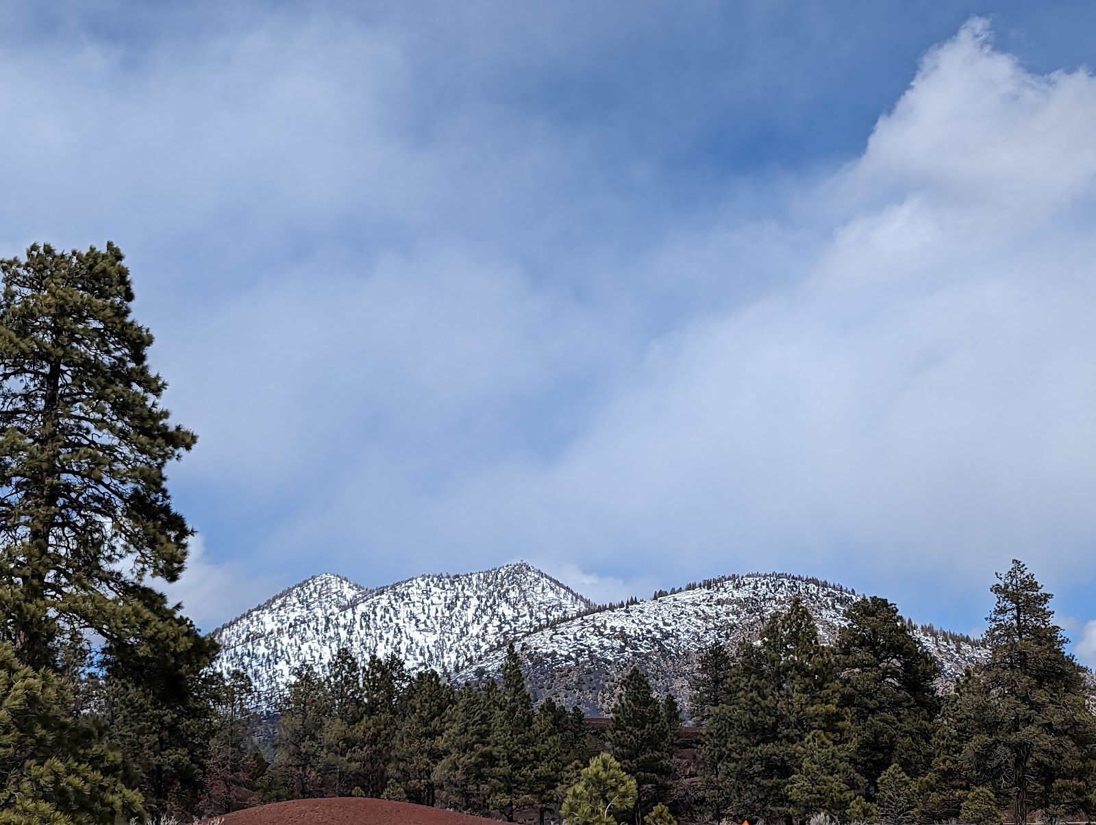
It was sleeting that night, and then the next morning I was awakened by the unbounded enthusiasm that can only be shown by a child waking up to snow. This was the last time any of us would be charmed by snow. Even the child. I should add: I grew up in the Northeast where it snows, every winter, at sea level. I have traveled quite a bit in the mountains of the Western US, including the Sierras and Cascades. Of the three scariest snow driving experiences in my life, two were in Flagstaff, one of which was during this trip. It snowed literally every day while we were there, regardless what the forecast said. One day we kind of escaped by driving east into the rain shadow of Mt. Humphreys (on which much of Flagstaff's inclement weather can be blamed). Possibly due to the weather, Flagstaff and Northern Arizona University reminded me quite a bit of State College, PA during this visit. It wasn't all bad - we had a couple days in which we were forced to relax (something many Americans are no longer good at, even on vacation) - bumming around the Airbnb as a family, playing board games, walking to dinner (in short, it was awesome). Two experiences that stuck with me: when grocery shopping I dropped something on the massive stack I was balancing to take to my car, and someone rushed to help me (wouldn't happen everywhere); and as I went for a walk, a Native guy was running around the street in the snow trying to be helpful and show people where to step to avoid getting soaked. He was pretty clearly intoxicated and noticing me doing my best to diplomatically refuse his attention, he turned and shuffled off, saying "We're not all bad people you know." I do know, but man that was a bummer.
The first two below: like the rest of the American west, Flagstaff has had a bad winter - with difficulty delivering mail and goods, and it showed on the produce shelves the night we arrived.
Above: see, I told you it was like State College. Below: a clever system at NiMarco's pizzeria, which I consider the analog business to the now-defunct Gumby's.
Flagstaff looks like it has some cool urban trails and the system connects to the Arizona Trail. The problem was, the trail was either under several inches of snow, or several feet of water. You can see the creeks which are dry for much of the year could barely handle the weather.
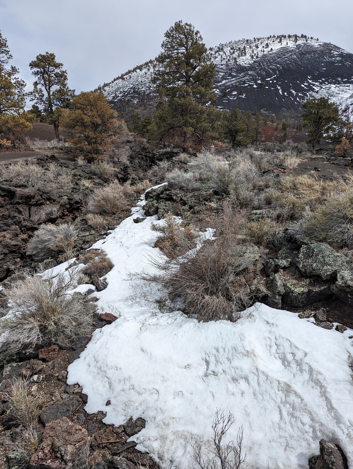
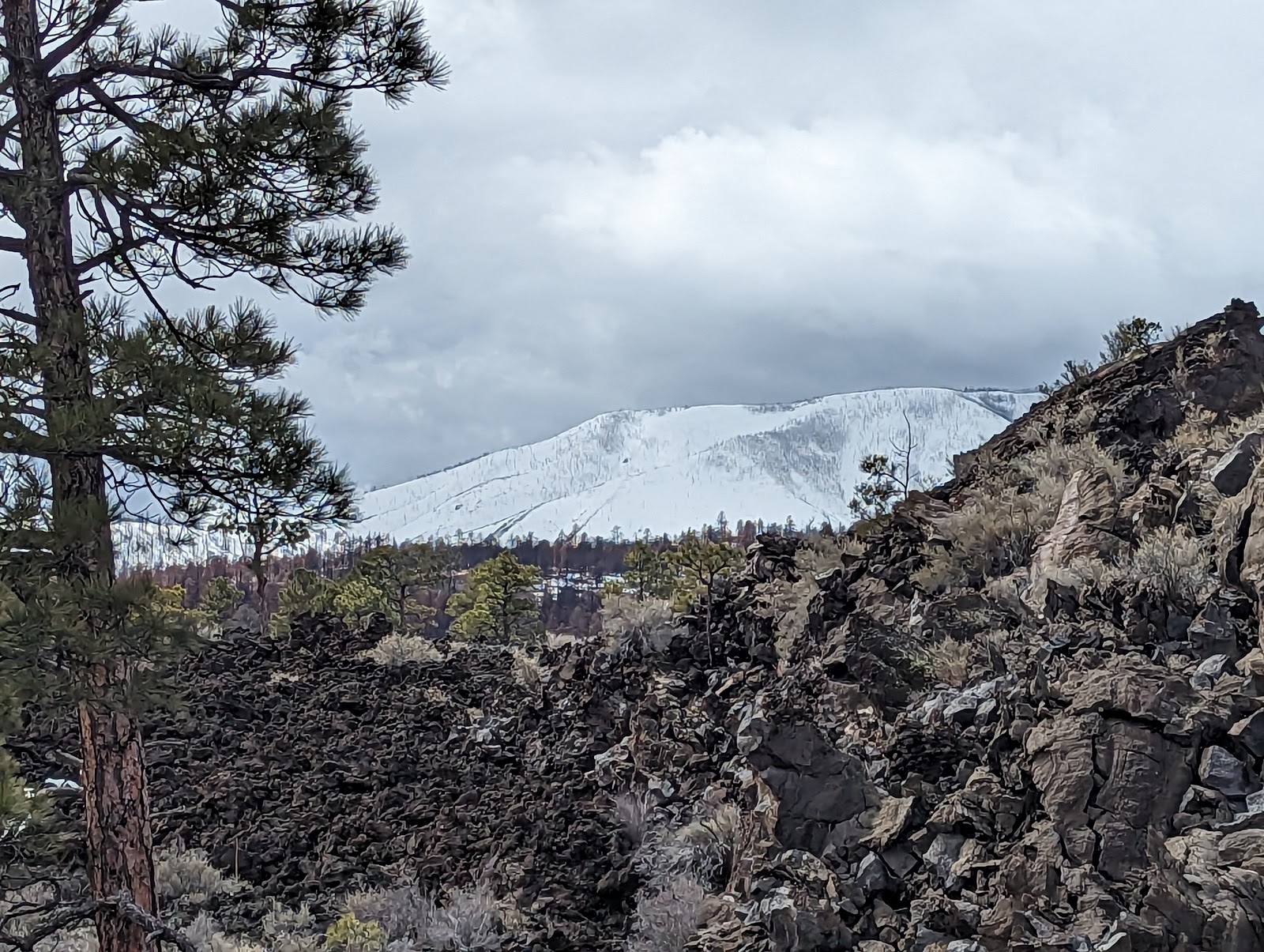
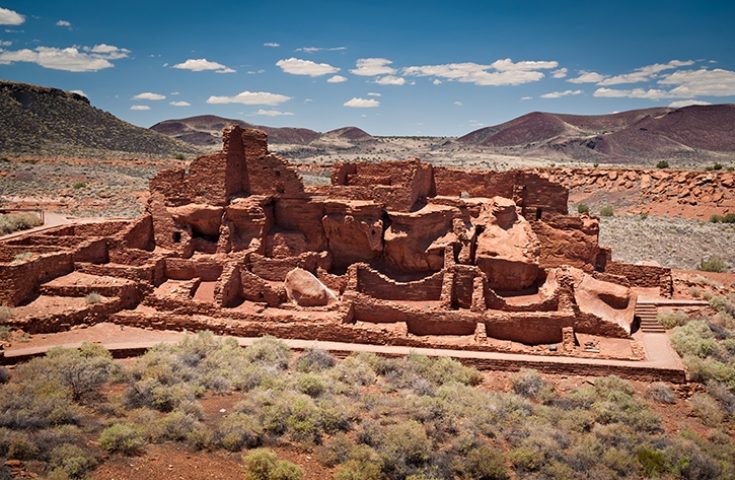
Then we headed off to Wupatki to see volcanic craters and ruins. Built by the Sinagua people (an exonym for the likely ancestors of the Hopi who abandoned the area around Flagstaff and went to the mesas shortly after the arrival of the Dene speaking Navajo). I always forget how volcanic the area north of Flagstaff is and I don't quite understand why there would be so much activity there but not as much in Nevada which has some of the thinnest crust on the planet. We got to the ruins but the family had clearly lost their patience with windy ancient things.
The ruins at Wupatki, built by Sinagua people about a thousand years ago. From Visit Arizona.
Other notes on Flagstaff: try La Fonda Mexican (which, for Berks people, is really the Mexican Victor Emmanuel's of Flagstaff). Ponderosa Trading House is cool but had genuine kachinas, which were of course expensive. I also wondered why the BNSF rail line runs right along US 40, and it basically goes back to the initial surveyor Beale who was charged with making a wagon road roughly following the 35th paralell to enable the settlement of California. The route he found through rough terrain was used not only by pioneers in wagons but later by trains, then Route 66 and finally US-40. Hence the rail line that runs right through Flagstaff along the old 66. On San Francisco Street: Flagstaff Climbing is cool and has a good staff. There's a fish and chips place (Evans) that's not bad for being far from saltwater, and a Korean place we liked, Kokiyo (note that all this stuff is on or within 1-2 blocks of San Francisco Street.) Hankerin' is a good late night stop for burgers, tacos and beer and is clearly an establishment by, for, and of stoned people. And, I got my first straight razor shave at a barbershop at Ray's. Actually much more relaxing than I expected.
SEDONA
Sedona is one of those outdoorsy tourist magnets that I somehow have missed despite my travels, though this one hasn't become a pretentious uppity place like Moab or Banff (not sure what I mean? Read this) possibly by appealing to a broad range of tourists. (If you want a fun experience and to taste rattlesnake sausage, have lunch at the Cowboy Club.) I should add: I noticed a high frequency, throughout this trip, at any themed eatery (of the sort that might have hired a consultant at one point), of ambient 80s hard rock. Obviously these establishments were targeting the demographic of middle-aged white men which (sadly, also obviously) I am in. But it's so pervasive that it's what I would expect if there were a middle aged white man exhibit at the zoo and they want to keep us comfortable in a facsimile of our native habitat. (No joke, I started typing this on my phone as I waited for my BBQ order at B66 in Flagstaff, when I realized "Love Bites" by Def Leppard was playing in the background.)
I wanted to show the fam an arch so we hiked up to Fay Arch, which hides on the side of a canyon. Needless to say it blizzarded on us on the way back down to the canyon floor, then cleared up and was nice by the time we got back to the car. Sunny Arizona. In all seriousness, originally I had rented a bike to give the kid her first experience riding on slick rock, but due to the uncertain weather I'd canceled it, and the hike to the arch ended up being one of the highlights of the trip. Hiking down a canyon during blizzard conditions is tricky! Especially if you're a little kid! Uttered during the descent: "You know how Daddy likes to tell you stories about his adventures? We'll you're in one now."
Above, Montezuma's Castle, so named due to the overactive imagination of the whites who first saw it rather than an actual association with the Aztec monarch - this was built by Sinagua people like the people up around Flagstaff. It wasn't actually that far out of our way because 89 was closed due to Oak Creek flooding, so we had to take the 17 anyway. And this is relevant because driving back up the 17 was the most harrowing snow-driving I have ever done. First black clouds moved in which dumped rain as we climbed back up onto the Colorado Plateau and covered the highway with more than hydroplane-depth water. Of course, this turned into snow soon enough - not just snow, but seemingly fist-sized flakes that covered the road within a few hundred yards of making the transition from rain, and created white-out conditions. And of course once you're on that stretch of 17 there's no other way to get to Flagstaff and not many exits.
THE GRAND CANYON
The North Rim would still be effectively closed at this time of year in a normal year, a thousand feet higher as it is, and this year, it is especially closed. Despite my obsessive checking of the weather to find a clear day (and it did say the day would be clear), we got about 20 miles from Grand Canyon Village before our morning blizzard for the day started. But we fought our way through and made it to the rim for the grandest views that the human eye can behold!!!!
Oh YOU feel let down? Imagine the mood in the car. After my wife (not literally) talked me off the ledge, we had some lunch, saw some elk randomly walking through the parking lot, and came back, and it was much better.)
The kid made a snowman at the rim (collaborating with a visitor from India) which I think not every kid can say. We were just barely able to make out a mule team coming up Bright Angel Trail, but they were so small and far away you can't really see them in the picture.
Above: we nervously watched the snow fall on the North Rim 20+ miles away and hoped it wouldn't cross the canyon.
(Note: Red Mountain on the way from Flagstaff to the Grand Canyon is, I'm told, a good place to find gypsum crystals if you don't have the time to make the detour to Glitter Mountain. But we didn't go because it was too snowy to find a DAMN thing. And Lava River Cave road was invisible under the snow and closed, even if we had wanted to go.)
THE HOOVER DAM AND LAS VEGAS
Above and below: Las Vegas in the modern era. Despite this, it really is more family-oriented than it used to be.
I hadn't been to Vegas for about 15 years, and it's changed. More construction to be sure (rumors of its demise from the 2008 recession were greatly exaggerated) but really a lot more to do there these days besides drink, gamble, and otherwise sin, especially if you have kids. On one hand, this was kind of a forced move. Millennials just don't gamble that much, at least not in person. But more importantly, besides all the neat stuff for kids (detailed below) people were just NICE. The customer service people, the tourists, everyone. Literally the worst thing I saw the whole time was two guys sliding down a banister. The second-worst was a guy and his daughter walking up the down escalator (come to think of it they looked really familiar, move along, no need to discuss that further.) The biggest negative is that the monorail really is pretty out of the way for most things and you might as well just walk the strip or, for about the same price, take a rideshare.
We start below with the Hoover Dam. Though it's still low, it's way downstream from the water that typically fills it and they seem optimistic. Despite jumping up and down on it, we did not wake up Megatron. The I-11 bridge was not there last time I was there. Who says Americans can no longer build big things? There's a new big thing right there, next to an old big thing!
Above: the view of the dam from the new freeway bridge. Below: the people in the image are thrilled they've found a support group for people with reverse lockjaw and tooth whitener addiction.
Below: the flower arch at the Bellagio. Even a dead-eyed philistine like myself has to admit the Bellagio is quite beautiful.
Above: the Hershey store (one of the aforementioned family-friendly activities) which adjoins New York New York. Sadly the chocolate bar did not seem to specialize in any sort of girly candy drink, otherwise I would've totally been right there dude.
Two photos above: what it's like in a room at the Luxor, and the interior space of the building. Below: you didn't think I was leaving Vegas without my steak and eggs breakfast did you?
The view from the canal in Venice. Insert essay by Umberto Eco about hyper-realism. (Was he wrong? Is this bad?)
Aboard the High Roller ferris wheel, with the Bellagio fountain display ("where the water dances" as the kid describes it) far below.
Above, you can just barely make out the parallel zip lines, running over the alley next the the Flamingo. The black dome is an entertainment arena the Venetian is finishing that should be open by September 2023.
Above, a ceiling at the Venetian.
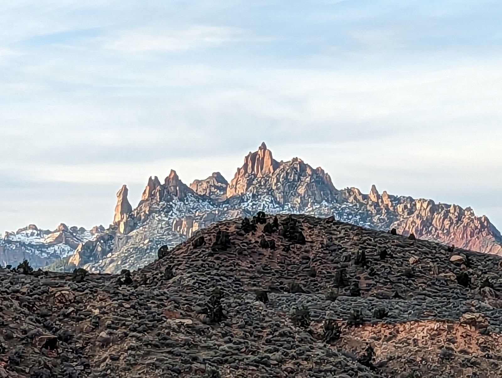
One day I went out to the recently-protected Sloan Canyon to get a desert run in and see some petroglyphs. When I found that there were steeper and steeper scrambles to get up to the next level of the creekbed/canyon bottom, I turned around since I was by myself. I had also wanted to go to Picture Canyon in Flagstaff but elected not to due to the aforementioned local Ice age. This means that, in this part of the country where you have to move petroglyphs to get to the toilet, my family and I failed to see a single one during the entire trip. There are obvious igneous intrusions in the sides of the valley. In the distance Charleston looked remarkably white.
Other things we did in Vegas: saw the mermaids at the Silverton, virtual reality ride in Excalibur, Circus Circus, the Bellagio fountains from close up, the Mirage volcano* (it's on borrowed time, go see it now, won't be here anymore at the end of 2023!), the flamingo habitat at the eponymous casino, and of course Rainforest Cafe.
Things we didn't do because of the cost, i.e. either the kid wasn't interested enough to justify the cost or we have same/better at home: aquarium at Mandalay Bay, the Marvel suits exhibit at Treasure Island, and the human anatomy exhibits at either the Luxor or Horseshoe. For some folks those would be worth it (although you knew you can dissect your own cadaver now if you want, right?)
Things we will do next time: see the indoor rain at Miracle Mile, that thing at Excalibur where you eat like a queen or king, shoot a machine gun in the desert, four-wheeling, the roller coaster at New York New York, the stratosphere, the Coke Museum.
Things we will not do next time: virtual reality rides, because vomit.
Things we may do on future trips to the Southwest: SEE SOME PETROGLYPHS, Acoma Pueblo, Mesa Verde, Glitter Mountain, hike up on the "plateau" above Zion and see some condors, go NORTH and see Bryce, Capitol Reef, Canyonlands, and Arches, do the Grand Canyon crossing, and if in Flagstaff - Walnut Canyon, Picture Canyon, and NOT get snowed on.
On returning home we watched Ocean's 11 which I hadn't seen in over 20 years, and I was surprised to see that they fictionally robbed a real casino (turns out the producer knew the Bellagio's owner.) The kid correctly noted that the protagonists were the bad guys, since they were robbing a casino owned by someone who was just minding his business. And, as unique and spectacular as that part of the country is, it's always nice to get home, and the weekend after our return the clouds finally parted on a weekend to reveal the lush green spring this wet winter had prepared in Sonoma County (in Annadel State Park.) Time to start looking for turkey feathers for Sonoma kachinas.
FIN
*There was a goose tutting around in the Mirage volcano lagoon who looked increasingly apprehensive as the eruption time grew closer, gradually moving toward the back of the lagoon. We'd all but forgotten about him until a minute into the eruption sequence proper when, to the delight of all, this same distressed looking fellow passed overhead honking in terror and hauling ass to anywhere but here like the metaphorical bat.
Solvitur ambulando! Note the thick brow-ridge and the death-grip on the beverage. You can email this handsome devil at mdcblogs@gmail.com. "[If you are depressed] go for a long walk...and if still depressed, then walk again." -Hippocrates ca. 410 BCE
SUPPORT YOUR BLOGGER
Donate? If you enjoy and find useful what you read here, any little bit helps and is appreciated!
Rattlesnake Encounter Map
Have you run across one of our scaly friends on a trail in California? Take 5 seconds and add it to this map so we can see where interactions are more likely to take place, and make life safer for trail users.