Monday, June 21, 2010

Ecozone Prediction From First Principles

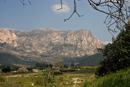
We've all had that experience of running or hiking somewhere and saying, "You know, right here in this valley/mountain/prairie, you could trick me into thinking that I was in x." You might be thinking of another spot on the West Coast of North America, or you could be thinking of somewhere else entirely. As a recent transplant from NorCal to SoCal, I'm always noticing when somewhere in SoCal reminds me of NorCal. In the winter, in Miriam Bear if you squint, you can almost pretend you're in some parts of Marin County, and some of the parks in the hills behind Malibu similarly remind me of some of the more rugged East Bay parks.

I also find myself guessing more specifically at the impact to San Diego of various hypothetical climactic changes; instead of alternative history, it's alternative climatology. What if that wet winter San Diego had extended into June? What if this happened every year from now on? Unfortunate though it may be, we wouldn't look like British Columbia overnight; there aren't any Douglas fir cones around, for one thing, and the ferns would have to spread out of the very few canyons where we can now find them around here.* It would take awhile; after all, after the glaciers melted off of Europe 12,000 years ago, the preboreal period in Russia lasted a good seven centuries.

Of course such geeky speculation led me to further wonder whether you could take climate and geographic data and inductively fit an equation that would predict resulting vegetation with any useful kind of accuracy. For the ecozone values you could try to match your outputs to you could use the Köppen system. The most useful inputs would be:

Latitude - the further south you go, the more desert like it is. Pretty obvious, but it doesn't explain why there are redwoods in SLO County and deserts in British Columbia. The transition is often abrupt. Once in inland Washington State, I came out of the evergreens into the glaring July sun of a Western desert in the space of less than five miles - it was that abrupt (on Route 97 at the southern edge of Wenatchee National Forest.)

Distance from coast - again obviously, the further inland you are, the drier it is. Taking only the first two factors, a simplifed North America, e.g. completely flat, would look like the more gay-friendly map on the left, but in fact it looks like the map on the right:


Right about now you're wondering not without justification whether I've completely lost my mind. But do notice that I used humor just right up there. Because humans have been demonstrated to react positively to it. Also note that the no-mountains map isn't completely insane relative to the real-world map.

Of course the complication to the gay-friendly map is the terrain - elevation, drainages, plus angle and consistent gain of ranges. This is the tricky part of the equation, and it makes all the difference. A 30 degree slope for 100' of elevation gain? Who cares. For 3,000' of gain? If it's west-facing, it'll be greener. Look at the map of rainfall in San Diego County and you'll see what I mean. You can clearly see in the state map above the Cascades, plus the coast ranges and the Sierras. If you're in the lee of a real slope, you'll be drier and have less moderating benefit from the ocean. This is why Santiago, Chile has more extreme weather than Sacramento or even Bakersfield- Chile's coast ranges (as opposed to the next range inland, the Andes) attain 10,000'+, as opposed to California's which top out at ~6,000' with a ridgeline usually closer to 3,000'.

If you want to get really fancy you could use some measure of "evenness" of rainfall, i.e. what's the standard deviation on monthly precipitation? In Mediterranean climates this is high. San Francisco gets the same rainfall as Dodge City Kansas, except it pretty much all falls in a five month period from November through March. In Dodge City it falls pretty evenly across the whole 12 months.

But am I going to do this? No! The real proof in the pudding would be in comparing the real Köppen zones at some decent level of resolution (pixels of 100 sq mi?) and including the elevation information would require programming skills and time that I don't have. Also the end result of all this would be merely an exercise in predicting ecological regions from first principles. On the other hand, if there's an Earth-like planet among the 700 new exoplanet candidates that Kepler just unloaded, and you want to know where to buy real estate that's most like Santa Barbara, then give me a call and we can work something out.

*In other news the redwood cones I planted in January in case of massive climate shift haven't sprouted yet.

Sunday, June 20, 2010

Monday, June 14, 2010

"The Best Post-Race Food, Ever, No Question"

Agreed. Why can't we have sauerkraut after races in California?

San Diego County Coast - Done, Finally

Friggin' hooray. Only 14 more counties to go. You think I can count the parts of San Mateo and San Francisco and Marin I did for my around-the-Bay thing?


Note: it is possible to run on one specific route through Camp Pendleton (or bike as most people do - south of Las Pulgas and north of Oceanside.) Just make sure you carry your drivers license, or your run ends at the entrance (North of Las Pulgas you don't need it.) It was very, very difficult for me to find this out - I ended up just driving to the guard box one day and asking them, since no one answers their public information line.

Thursday, June 10, 2010

Abused Child Rescued in Indian Ocean

[Added 21 June 2010: turns out I'm not the only person to have such doubts. The whole article is worth reading but what jumped out to me was that Child Protective Services interviewed Abby Sunderland before she left for the trip. No word on whether it was a proactive family volunteering this to clear the air or a CPS representative who saw the press and wanted to be sure.]

Yes, I'm talking about SoCal 16-year-old Abby Sunderland, who was sailing around the world solo. A few days ago she put out a distress call when her mast snapped in the Indian Ocean; thank goodness she's now safe. Of course, this is on the heels of another SoCal kid (13 years old) who became the youngest ever to summit Mt. Everest. Both of these activities have non-zero chances of death. And at the end of the day, neither of them delivers more than bragging rights.

Why "abused child"? Because there's nothing inspiring or heroic in these stories at all, that's why. These are kids either being allowed to attempt, or being put up to, a stunt, by parents who are at best incredibly irresponsible and at worst willing to endanger their own children's lives to live vicariously through them. Abby Sunderland is a minor, and her safety is her parents' number one responsibility. Imagine those French fishermen hadn't found her; would people be so tolerant of her parents' permissiveness (or vicarious ambition) then? Or, imagine you have a 16-year-old kid, and she comes to you and says "I want to sail around the world solo." If you're a good parent, you'll say, "No. End of discussion." In fact you'll say that if you're a halfway mediocre parent. Frankly even Homer Simpson would say that. What do you think her chance of death was on this trip? Let's conservatively say 1%. Imagine your kid came to you and said, "I want to do X, but I'll have a 1% chance of dying." (For the record, attempting Everest has about a 5% chance of death.) What would the pay-off have to be for you to allow that to go forward? A hundred million dollars? Guaranteed entrance to Harvard? Most parents would be unable to even think about such a thing. If you have children, I certainly hope that there's no amount of money that would make you consider endangering their lives. Okay - so instead of money, what if the payoff was a few newspaper articles and an entry in the Guiness Book of World Records? Even more ridiculous, if that's possible. But she was really prepared! you (and she) might object. In case you haven't noticed, every teenager is immortal and knows everything. For that matter, everyone who's ever attempted Everest has thought s/he wouldn't be one of the statistics. But these are decisions each of us is free to make, for ourselves, once we've reached the age of majority.

If you think my tone is a little strident, please consider: do you find it distasteful, even borderline abuse, when children are allowed or pushed into the Hollywood acting scene by their parents? Then isn't it even worse that kids are allowed to (or encouraged to!) endanger their own lives with these kinds of stunts? The worst thing that happens to those Hollywood kids is a tabloid scandal and a stint in rehab ten years from now, and that's bad enough. But these kids could've died. Abby almost did.

Monday, June 7, 2010

Tourists in Guatemala is Some Goofy Bastids

Pacaya Volcano has been in the news recently for erupting. Really, it's erupting more now. I was there two years ago and it wasn't fully "off" then (volcanoes are not quantized). The mountain is less than an hour west of Guatemala City. I was in the country for a friend's wedding; he was kind enough to give me his camera to get some footage, and his father-in-law told me how to get to the highest village. Memorably, one kid in the village who was hustling people to try to get paid for giving tours was albino.

I took some video but only scrambled up most of the way. This is by far the most active volcano I've ever been on and if Hood or Rainier started acting like that, I would glissade down that minute, and then drive back to San Diego to boot. But this mountain was booming and shaking. And, there was lava coming out - as I soon realized, underneath the rocks I was standing on. Listen for the hiss when the water lands on the rocks:


In a rare moment of common sense, I turned around. That's actually how I ended up getting back down, by throwing water every couple steps so I could figure out which rocks weren't hot enough to fry eggs, and by extension where the lava was not. As you can imagine, it's a little concerning that tourists are flocking to this place now because, as the article says, "hundreds of people live in the nearby village so they must be safe". Nice heuristic! I bet Spirit Lake, Washington and Pompeii and Joya del Ceren probably felt safe too. Lightning is also a problem around volcanoes, even in Iceland, let alone in tropical Guatemala during rainy season.

Monday, May 31, 2010

Patronize Businesses That Give Back to the Outdoors

Eagle Creek, Ocean Minded and STM Bags volunteered for trail maintenance work at Elfin Forest. Thanks guys! I'll be sure to shop there!

The Ethics of Letting Your 13-Year Old Climb Everest

This post pretty much states my own misgivings about public admiration for this feat. If I told you I let my 13 year old kid do something that had a 10% death rate, what kind of father would I be? His parents will no doubt reply that their kid was special, and the 10% chance of death didn't apply to him. No doubt that's exactly what everybody in that 10% since 1954 has thought, and the fact that he happened to have made it up and down in one piece doesn't change the morality of the decision.

Time to Xeriscape Your Property?

It's cheaper, it's easier, and makes your home more San Diegish. Other reasons here. Theodore Payne is a native plants specialist and here's an article with pictures of the natives.

Saturday, May 29, 2010

Only in Humboldt County

I really, really love Northern California and wouldn't mind living in Humboldt County specifically. But if stereotypes ever have a basis in fact, they certainly do up there: "Police in [Arcata] are warning LSD users to beware after responding to a rash of incidents apparently connected to bad acid trips." Imagine police crashing Woodstock with megaphones: "Attention hippies: there's some bad weed going around. Watch out. That is all."

Write-up About Rose Canyon in the Union-Tribune

Article here.

Friday, May 21, 2010

High-Volume Trolley to Be Put in Rose Canyon

I just learned about this only because it was in the minutes of my development's owner's organization. Just incredible. Fortunately, there's still time to do something - but not much.

Before I even get into how this would ruin the canyon - if you live anywhere near Rose Canyon, imagine trains going through every 4-5 minutes, instead of only periodically as the Coasters do now. Imagine the construction noise and dust for (how many) years. Imagine most of all what it will do to your property's value.

There's a lot more information at Friends of Rose Canyon's website, including the next (and last!) meeting here citizens can voice our concerns, coming up this Tuesday, and email addresses (which I also include below). I will be going to this meeting, and I've already sent my email. Yes, we're all busy, and yes it's a little intimidating going to one of these functions - but I've done it before and it's amazing how much impact you can have by going. But you have to show up.

Besides the damage to property values and quality of life (think about that! trains every 4 minutes!) another set of tracks will ruin the canyon, not only for our own esthetic enjoyment but for a lot of the plants and animals that live there now. There's precious little open space in San Diego set aside for our kids and their kids as it is. And the best part is, saying NO to more trains in Rose Canyon doesn't stop the line, it just moves it. The colored lines on the map below are possible lines. The yellow one goes through Rose Canyon. The others don't. This is good, because we need more public transporation - and stopping the SANDAG trolley in Rose Canyon doesn't stop us from building it; we just build it on one of the other routes.

[Update: A story in the La Jolla Light says that the MTA has endorsed the red line on the map below. This is great news - a real win-win. We get public transportation, and homeowners and and outdoors folks get to keep Rose Canyon. I don't know if endorsement constitutes the official end of the story so I'm still going to the meeting.]


Did I mention the effect on Rose Canyon property values?

If you can't make it to the meeting, please email the following people RIGHT NOW (time is running out!) and tell them you don't want more noise and trains and dirt ruining Rose Canyon:

To: midcoast@sandag.org

cc: sherrilightner@sandiego.gov

bcc: rosecanyon@san.rr.com


If you go to this meeting, I'll see you there (please come up and say hi):

Caltrans District 11 Office
Garcia Conference Room
4050 Taylor Street, San Diego, CA 92110
4-7pm
Tuesday May 25 2010
Bus stop/Transit station located at Taylor St./Juan St. & Old Town Transit Center

Monday, May 17, 2010

Statewide Earthquake Drill to be Held 21 October

More information here. I'll go out on a limb and say it might actually be fun, plus then people can't keep muttering "Sure they can do public earthquake drills in Japan but that would never work in the U.S."

Sunday, May 16, 2010

Public Comment for Powerlines Cutting Through National Forest

A judge has said that there has to be a period for public comment on the proposed SDG&E powerlink. Here are some news sources and the organizations trying to protect these lands (news here and here, organizations here and here). I couldn't find the link to leave public comment; might not be up yet, I'll post it when it is.

Saturday, May 15, 2010

Pony Express Re-Ride This June

Turns out that they already "re-ride" it. Info here; info on our run of the last leg from Martinez to Oakland here.

Saturday, May 8, 2010

Rose Canyon From the North Side

Cross-posted at my blog The Late Enlightenment.

Looking toward the south side from the Genesee Highlands area. Acrylic on canvas.


When you're running, you perceive massive amounts of information just for a moment (that rock on the trail, that lizard skittering in front of you, a patch of mustard flowers hanging out on the trail) and literally after a second all that experience is gone, and you're left with an impression of a ridge and a valley with yellow grass and mint-green sage. That's okay; you can't take the sense-experience with you.

I'm not the first runner or outdoor enthusiast who's wanted to pay tribute to the lands I know and love by reproducing them in my own hand, by writing or painting, so I thought I'd try filtering Rose Canyon through a planist perspective. "Planism" is an umbrella term I use to catch many styles of art, including some named 20th century schools (including cubism) but also van Gogh and in particular Cezanne. I think given my lack of training it's clear that the idea is more interesting than the execution, but it at least prompted me to think about where my interest in this style comes from:

1) Planism is how humans actually see. We break the world into surfaces. This has been investigated scientifically and I've also had a number of personal experiences reinforcing and highlighting this aspect of visual perception. By this I mean the kinds of experiences that nature forces on you, if you're paying attention. Climbing a steep trail in mountainous country, endless parallel ridges backing up to the horizon reveal themselves this way and in so doing lift one corner of the veil off the inner workings of how our consciousness quietly knits itself together moment-to-moment. Even staring through a tree long enough can make the branches seem to suddenly stratify into planes of non-continuous depth. "Line" in representative art seems often (usually?) to really just be a way to emphasize the break between planes, a discontinuity in depth, and that's what inspired my amateurish effort here. Apparently in Europe a century or two ago the fashionable debate was between followers of Ruben or Poussin, who debated whether line or color should demarcate surfaces. Evidently none of these people were ever in the outdoors in California, because here, line clearly does exist in nature.

2) The recent history of line in Western art is a history of planism. Cubism and some of the other 20th-century -isms were descended from or influenced by Cezanne and van Gogh, who broke scenes into planes favoring certain angles (right or slightly acute in the case of cubism). Cezanne's paintings in particular (especially later in his career) flattened scenes into non-contiguous planes, often using dark lines.


Mont-Sainte Victoire, 1885, image from Wikipedia

Also moving toward a more planar style was van Gogh, influenced by Asian and in particular Japanese art which hadn't yet assimilated three-dimensional perspective or realism. (This is no indictment of perspective or realism as aberrations of European art - it's under-appreciated that realism was independently developed in sculpture at least one other time by the Maya.) In the end, if I'm trying imitate anybody, it's Cezanne, but true imitation would require talent and technique which as you may have noticed are absent in the work which begins this post.

3) The Pacific Northwest. A form of planism that absolutely fascinates me is the style traditionally referred to as Haida, but it really spans the Pacific Northwest culture region. (By planism I also mean art which appears to intentionally overemphasize the surfaces in a scene by dramatically decomposing them into planes. I'm not referring to all art which lacks perspective, in which case planism would be a useless term since it would mean, for starters, every drawing ever beginning with Lascaux and extending through 15th century Europe.) I might be trying to imitate Pacific NW style even more than Cezanne (except in full color, on canvas):


From Alcheringa Gallery.


This technique breaks up the subject in stylized ways, emphasizing through relative-size-exaggeration functionally important parts of the animal; teeth, claws, head and eyes; on birds, the wings and their anticipated movements are prominent. Most interesting is that Pacific NW representations are essentially the same in both two and three dimensions - that is, the style in drawings is essentially the same as the style in wood-carving. Think about that: they have more wood than they know what to do with up there, and yet when the style was developing they ended up imposing planes on three dimensions rather than imposing depth on two.

Boy, that's a whole lot of talkin' for one painting. If you made it this far I hope it was interesting to you.

I haven't decided whether the next one will be another planist attempt (on San Clemente Canyon, i.e. Marian Bear) or I'll do a Pacific Northwest mountain lion.

Thursday, May 6, 2010

Penn State Beats California School at Volleyball

Looks like Cal State Northridge didn't have what it takes. Them thar East Coast types can play some volleyball, huh?

Wednesday, May 5, 2010

Berks County Needs More Trail Volunteers

Berks County, PA needs folks to help by being on trail 3 hours a week and helping or answering questions from other trail users. More info here. This is a great way to help Berks County's ever-improving trail system.

Monday, May 3, 2010

Bashoo Didn't Like Deserts

Yellow summer grass;
All that remains past warm spring
From green winter rains.


Warrior dreams and poppies in Rose Canyon:


Image credit to Moonjazz.

Saturday, May 1, 2010

Running the Coast: Mapping Language Boundaries

I finished running the civilian part of the San Diego County coast some months ago but if I want to do the whole county including Pendleton, I still have one more piece (from the southern border of Pendleton to Las Pulgas). Turns out that my most recent piece of it, from Las Pulgas to the O.C. border, was the southern half of the Juaneño (Acjachemen) territory. Next time if I run from the OC border to just south of Laguna Beach I'll have covered the rest of the Acjachemen Nation. Maybe I should start marking my runs in terms of languages or language families:

(That's a WikiMapi)

On second thought scratch that - everything along the coast in this picture is Uto-Aztecan, and it'll be awhile until I'm in Chumash territory up in Santa Monica. I have to say it's curious that the Kumeyaay were omitted from this map. I like Kumeyaay because it's the only coastal San Diego County group from a language family that also has members in the Bay Area or NorCal (Hokan, which contains Pomo, ancestral tongue of the Sonoma Coast and of thrash metal vocalist extraordinaire Chuck Billy). Which is why the only casino I go to is Sycuan.

Wow, that's a lot of digressions even for me.

Friday, April 30, 2010

Oakland's Urban Paths

There's now a Facebook group for Oakland's Urban Paths. Berkeley has a great path system too. I lived there for a decade and by the time I left I was still discovering new ones; don't know whether that's neat or sad. (Hat tip Thurston, aka Gregor. No Thurston, you won't get that. Yet. Heh.)

A Little History About Rose Canyon

Named after settler, postmaster and entrepreneur Louis Rose. I'd heard of him before because there's a small monument to him on UCSD campus not far from the Sun God. More at Wikipedia here.

Thursday, April 29, 2010

UCSD Free Clinic Founder Recognized by Irvine Foundation and the State of California

This isn't exactly about outdoors stuff but it certainly is about San Diego.

Today Dr. Ellen Beck received a James Irvine Foundation Leadership Award and was recognized by the state legislature for her work with the UCSD Student-Run Free Clinic. I'm currently taking the free clinic class and many of my colleagues (as well as Dr. Beck) are featured in the video. We're all very lucky to have people like Dr. Beck.

Dr. Ellen Beck, UCSD Student-Run Free Clinic Project, San Diego from The James Irvine Foundation on Vimeo.

Monday, April 26, 2010

Canucks!

I don't really follow pro sports, but since a) I like Vancouver and b) I like pissing off people from LA, I will do my best to remind people that the Canucks just knocked the Kings out of the playoffs. Let's have a pity party - 1, 2, 3, awwwww.

Sunday, April 25, 2010

The 8km Stairclimb

....up Huangshan (Yellow Mountain) in Anhui Province, China. These pictures are straight out of a Sung landscape painting; seriously, click through on this couple's photos. On my already-long to-do list for the Middle Kingdom.

Heads-Up: There's a Creepy Guy in Balboa Park

He's flashing joggers. That in itself might seem funny but there are further safety considerations when someone is behaving like this.

Cleaning Up the Death Zone

People always seem surprised that people who die on Everest are left there. Look: at that altitude, it's all you can do to carry your own gear and put one foot in front of the other. Carrying 160 lbs. of literal dead weight through the Khumbu Icefall is not an option, and the county coroners won't go up there for you. That's not all that's up there. Never having been to the snow-line in the Himalayas, I have heard repeatedly that the upper elevations are a litter field of freeze-dried bodies, discarded oxygen bottles, and excrement. Apparently the Nepali government is bothered enough by it that they're sending Sherpas up for a clean-up. Yes, you want to keep the mountain as pristine as possible and it's a huge revenue source for the government (~$20,000 per summit pass. Per individual, not per group.) But the point of all this stewardship of the environment is the point of all behavior, which is to preserve life and quality of life. So do you really want to risk still-living people for a) no-longer-able-to-suffer people, and b) the esthetic sense of people climbing the mountain?

Join the Earthquake Sensor Network

(Cross-posting this from my more sciencey blog).

If your computer has an accelerometer, you can join the early warning network. With the ongoing seismic activity inland from San Diego recently I would hope folks in San Diego and Imperial Counties would be motivated. NPR has an article about it here. Among laptops, Lenovos and Apples both have accelerometers, maybe others too. Right now only 1,000 people around the world have this installed but the goal is to get at least 10,000 just in California. This is better than the post-quake "Did you feel it?" maps because it has the potential to give us a few extra seconds and save lives. Come on! It's more useful than SETI! Here's a link straight to the program itself.

Plus I bet it's way better than toads.

Saturday, April 24, 2010

So Now It's Frogs That Predict Earthquakes?

Given the recent SoCal earthquakes, this may be interesting: a researcher watching toads in Italy noticed that they left their breeding area, then 3 days later, an earthquake struck.

(Cue X-files music)

There are many, many stories of animals mysteriously sensing impending earthquakes. There was even a guy in San Francisco who said he kept track of the number of dog run-aways and a few years ago when he saw a spike, announced that the Big One was coming. Guess what? No Big One. I imagine that anomalous animal migrations happen all the time, and when they're near an earthquake, we humans with our confirmation bias notice. As much as it would be nice to believe we've found a reliable way to predict quakes, the jury is still out on this until someone figures out an experiment that can distinguish between actual causation, vs. fooling ourselves with wishful thinking.

Great Boston Marathon Moments

Warning: it's from The Onion.

Friday, April 23, 2010

Warm-Up Bleg

I just came back from a run in Rancho Penasquitos which was a perfect example of a problem I've been having for a year or so, which is that it takes me forever to warm up. Pardon the bitching, but if you run across this post I'd be glad to hear from you.

I haven't been able to find much online about my "syndrome". What happened tonight is typical: I start, I feel bad. I run a mile, I feel worse. I run two miles, I feel really bad; it's all I can do to keep from walking, even on the flat. I basically give up on having a decent run. After an hour and 7 or so miles of this I get back at the car, at which point I realize I'm effectively sprinting and feel great. So I've had an hour of miserable running only to open up to feeling like Superman for the last five minutes, at which point of course I'm done. I know from experience it's not in my head, i.e. that if I turn around and run for another hour, the Superman feeling stays. Unfortunately I usually don't have time to run for more than an hour, and if my one-hour runs continue to be this un-fun I don't know what I'll do. What's wrong? How can I fix this?

I have several theories, none of which are mutually exclusive, and none of which seem to explain the problem (or suggest a solution):


Over-adaptation to long distance. That is, have I after 20 years of distance running effectively converted all my muscle fiber into slow-twitch? This is probably the most flattering and least likely of the three alternatives.

Bad condition, worse workout schedule. I'm not putting in the mileage I could before med school. My workout schedule is awful and may actually cause more damage than good. Typically: 12-15 miles Saturday, 12-15 miles Sunday, both hilly if I can help it. After this I'm sore, cranky, unfocused and peeing orange for 48 hours (and needless to say not running). Maybe Tuesday or Wednesday I'll finally got around to doing 4, which will as mentioned above be awful. Maybe Friday I'll do 5 and push really hard to punish myself for being weak. And then another huge weekend, and I'm back to being worthless. But if it's just injury that's the problem, why is a 2 hour run better than a 1 hour run?

Old age. I'm no longer 25, which when I could get away with my self-flagellation workouts. If this is it, same paradox as above - why is the second hour better than the first?

Wednesday, April 21, 2010

Cool Stuff Happening in Berks County

The Schuylkill River Heritage Area received funding to expand the trail and connect towns along the river. I'll be hitting this next time I'm home and I'm jealous that this wasn't there when I lived in Berks! Time for a Volksmarch (with beer at the end)? If you can't wait for a Volksmarch but want to drink beer outside with good folks, try the Reading Hash House Harriers.

Also volunteers are getting out and working on the trails in Berks. If you enjoy the outdoors you've probably benefited from the work of volunteers already and it feels great to give back.

Local Boy Makes Good

David Western, adjunct biology professor at UCSD and founder of the African Conservation Centre in Kenya, has won the 2010 World Ecology Award. Congratulations!

One Finch Flies, One Finch Disappears

The finches survived Monday night okay, although it gave all of us caring neighbors a start when I saw they weren't in the their artificial nest anymore - until I heard baby-cheeping and saw Ma and Pa finch hovering over the bush right next door, and sure enough, there they were. Because the cold rain was already starting, a neighbor and I were about to bring them inside for the night, so I caught them and put them in a big box first so their parents could see they were still present and alive. But before I knew what happened, the better-developed one flew right out of the box and landed in the tree across the street! Dad followed on his/her tail. The younger one stayed in the box.

Quite surprised, I changed my mind and left the younger one in the artificial nest for the evening. This morning he was gone again, and I haven't looked for him/her, but maybe s/he flew away too. Because I will likely have no proof of any outcome to this story, that's what I'll choose to believe.

Tuesday, April 20, 2010

Rescuing Baby Finches

Finches are interesting buggers. Zebra finches in Australia have been studied because they have regional accents; yes, you really can tell which part of their range they're from by listening to the song. You can measure it. Turns out they listen to their dads and imitate his song, and because no copying process is perfect, geographic distance correlates with dissimilarity, exactly as it does with human language, or exactly as time correlates with genetic distance. What's really interesting is that if these birds have a mutation in a gene that is also important to humans for learning to speak grammatically (yes, really) they also have trouble producing a coherent song. They even have rules for "grammar" themselves - that is, song structure that are apparently biologically built-in a la Noam Chomsky and Derek Bickerton, which all zebra finches obey. House finches in North America (those little red-headed grey-bodied guys) follow similar rules. Consequently they've been studied as a non-human model of language acquisition.

What's far more important than all this is that the babies are SO DARN CUTE.


Here's one where the little sister didn't blink:


Last night these two little dummies jumped out of their nest right by my bedroom window - prematurely, apparently, because only the larger one could sustain flight for even a few seconds. Mom and dad were flying around like maniacs looking for them and after a few tense moments, they finally found the shrub where one had landed and where I placed the other one. After this picture was taken a kind and skilled neighbor (good combination) made a little nest for them with cotton and cloth and a foil cover, anticipating a cold night, and I put in some seeds for them. They were doing okay as of this morning but I haven't seen mom and dad go in there to feed them yet. I'll post updates on the progress of these guys.

Sunday, April 18, 2010

Orange County's New Great Park; Plus Outdoors Education for Kids

1) Here's a new blog by folks hiking the Pacific Crest Trail this year with the intention of raising awareness for kids' outdoor education. It's not just your imagination: kids really do spend too much time inside watching TV and playing video games. Not only will they pay the price for it in terms of their health later in life, they lose interest in preserving the great outdoors when they grow up to vote. This is a great project and I'll definitely be following their blog. Have fun out there Melissa and Justin, and be safe!

2) And another PCT blog here. Good luck to you too Mark! Lucky bastards...

2) Also check out Volunteer San Diego, where you can search volunteer opportunities. Looking through the RSS feed for San Diego events this weekend I was thrilled how many clean-up and stewardship efforts were going on, and wish I didn't have an endocrinology exam tomorrow.

3) When I posted about the possibility of Miramar MCAS and Camp Pendleton becoming parks or preserves in the future, a reader was kind enough to comment based on her own experience. I just ran across an article about this open space, Orange County's in-development Great Park which is on the old El Toro base. Official website is here. New metropolitan parks in SoCal in 2010 aren't easy, but they're worth it. I can't wait for it to open.

Animated Map of the Iceland Ash Plume

This is cool.


I'm a geek so I also like watching animated satellite weather maps of the Eastern Pacific and looking up to see if approaching systems are visible on the horizon yet. But (fortunately!) they've never been as interesting as that.

And following up my earlier speculations about the variation in joules of global seismicity per year and triggered earthquakes - I wonder if volcanic output correlates as well?

Saturday, April 17, 2010

"Surfers Worried Trail Will Bring Non-Locals"

They're putting in a new trail up at Trestles, and regular surfers are unhappy about it.

You know those kids in school who got mad if you sat in "their" chair even though there were no assigned seats?

It's public land, guys. Anyone can use it. This reaction just reinforces many people's perception of serious surfers.

Monday, April 12, 2010

Seismic Activity in Joules, Watts and Standard Deviations

I used to think that all the interesting stuff was in Northern California, but I've been awakened twice by earthquakes in the last week (bringing the total to three in the 11 years I've lived in California). Until I wrote this post I didn't even remember that there was already unusual activity in Mexicali 3 months ago.

What I would like is some script that collected the little squares on the USGS maps over time so I could make an animation showing how they cluster and migrate and trend over a year or more (like a time lapse weather map), but to do that I'd have to know something about Java thingies. [Added later - turns out that USGS does have this; see it here.]Link to live USGS map here; below is a static screenshot of the CA-NV map as of 12 April 10. There's normally not even close to that much activity in extreme southern California.


I also wonder if over a period of a year's time, the total joules released by plate movements around the entire planet changes significantly. Living in the Western hemisphere (Haiti + Chile + Mexicali), it certainly seems like 2010 will be such a year. I bet these papers have been put together somewhere but what's the geology equivalent of Pubmed.gov? I'd also be curious what the standard deviation is for global seismic wattage (total joules released by all earthquakes per year), and what time period you have to drop down to before the standard deviation increases to, say, 10% of the average. If you run across this post a know where this data is, please point me in the right direction!

Sunday, April 11, 2010

Variable Climates

Here is my mother's balcony in Pennsylvania in summer and winter. See if you can guess which is which. Spot the difference!


Three Unlucky Hikers

Can you imagine going for a hike to see a waterfall, and getting arrested and imprisoned by a dictatorship? That's what happened to three Berkeley students hiking near the Iranian border when Iranian officials captured them - and they've been held for 250 days now. Visit freethehikers.org for more information and to show solidarity.

Saturday, April 10, 2010

Art Devany Redux

One of my favorite writers on human genetics, Razib Khan, runs across an Art Devany interview and gives his interesting two cents. In a nutshell, Devany considers endurance sports and running in particular to be a form of arch-villainy. More on Devany is here. Note that Khan makes the same point I did: let's see how it works within related individuals (Devany looks to be in good shape in those pictures. Did a lot of his relatives struggle with early-life obesity? I doubt it.)

Devany is an economics professor, which means he must know his statistics - so he should know that in statistics, you can't ask too many statistical questions with the same set of data. Why? Because if you ask enough times, eventually, there will be an equation that fits the scatterplot you're looking at, purely by accident. The converse applies as well. The further afield a theory is applied, the more likely it's not giving us real information, beyond the overconfidence of the theorist. The guy who created the Simpsons (Matt Groening) had a comic called Life In Hell, and I remember one of them was a list of types of college professors. One of them was called the One Theory Explains Everything Guy: "The nation that controls magnesium controls the world!"

On a podcast I heard from December 2009, paleo promoter Robb Wolf extended his claims for a paleo diet from weightlifting performance (I have no grounds on which to object) to "leaky gut" (a "syndrome" incoherent enough that it's not medically recognized) to claims that Huntingdon's disease (yes, really) could be treated by moving to a paleo diet. For the record: Huntingdon's is a well-understood genetic neurodegenerative disorder - you get it from your parents, not from grains.

Thursday, April 8, 2010

Bad News and Good News from CA Outdoors

Bad news: climber death was related to altitude sickness on Mt. Shasta. Most people think 14,000' is low for an actual death from altitude sickness but this is the second time I've heard of it. (Note: I haven't read the report, so there may be more to it than just AMS.)

Good news: despite the best efforts of jerks on the Central Coast, a condor egg hatched in the Pinnacles! Hooray!

Sunday, April 4, 2010

New Data Shows Open Space and Home Ownership Coexist

Story here. "Land preservation efforts in Silicon Valley and surrounding areas have had only a minor effect on housing construction, according to a new Stanford study that looks to end decades of squabbling between environmentalists and developers." If you read the blog periodically and I sound like a broken record, that means we agree! So help get the message out and prevent San Diego (or your own hometown) from turning into Los Angeles.

Friday, April 2, 2010

I Got Tom Stienstra's Back

For what it's worth, I love Tom Stienstra's columns, and he's been a great source of outdoors info as well as an outstanding advocate for hunters, fisherman, and hikers everywhere. He was recently arrested up in Northern California for growing marijuana. Clearly he's a productive member of the community, and he's far from the only person doing this in NorCal; the whole thing makes these laws seem even sillier. What a waste of law enforcement attention and taxpayer money.

Thursday, April 1, 2010

Do Open Space Groups Have Plans for the Future of Miramar and Camp Pendleton?

One of the main tricks special interests have to keep the public from acting in their own interest is to polarize an issue on the political spectrum - for example, to convince conservatives that maintaining open space is a communist plot and threatens private property (when in fact open space enhances property values; see here and here). Another possible alliance that I hope will one day will occur in reality would be between the NRA and the Sierra Club ever got together on open space issues so forests and mountains and deserts were preserved for hunters and hikers and everyone in between, they would be unstoppable. There would be nowhere on the political spectrum for mineral extraction and agricultural lobbies to turn.

Open space groups and the U.S. military seem another unlikely alliance - but think about where the open space is in San Diego County. Yes, it is almost entirely off-limits - today. In a more peaceful world, these bases can be decommissioned (yes, this is possible!), and huge tracts of preserved land will suddenly be with our reach, and then we have a choice to make: do we become southern Los Angeles, or do we set aside at least some of it to defend the land and the cultural character of San Diego? Runners, just imagine the trail runs in the wide-open Pendleton Unit of Cleveland National Forest (the official map will be better):


Worth thinking about next time you're driving up I-5 to O.C.

I bring this up now because, optimistically, Camp Pendleton will close eventually (optimistically not out of disrespect to the military, but expecting that we'll all build a safer world). When it does I hope that there have been organizations (private, non-profit or otherwise) that have already been talking to the military and local governments and have preservation plans ready to go.

Wednesday, March 31, 2010

The Central Coast is Awesome

Warning: actual nature and running in this post.

UCSD spring break came and went all too fast, but at least I got to spend some time on the Central Coast. The draw to the north wasn't as strong as before since the furthest I got was the very corner of Monterey County (i.e. not to San Francisco), but look at these pictures and I bet you'll agree that it was a fine choice.

One day I went to Ventana Wilderness in Los Padres National Forest. I went for an awesome run in the southern section up toward Ventana Cone (not all the way) but next time I go think I'll have myself a little jaunt from Kirk Creek Camp up San Vicente Trail to the Cone. That should be a fun one. I wrote about the shrinking range of the redwoods in Western North America during the Holocene before, often resulting from fires. Consequently it's nice to see that the redwoods are recovering - post-fire, needles sprout everywhere, even on the main trunks, so they look fuzzy:

From Central Coast Spring Break 2010

I brought some cones back to my buddy's place in Santa Barbara and sprinkled them in his yard. He just bought the place and he knows better than to plant a redwood next to his house so I told him if any of them come up to let me know and I'll move them. (So far none of mine have.)

The greenest green I have ever seen was the thousands of vertical feet of spring-grass covered ocean-facing slope descending toward the ocean. My poor iPhone couldn't capture the full sublime radiance of chlorophyll.

From Central Coast Spring Break 2010


On the same trip I visited two old missions that I'd always wanted to see, San Antonio and San Miguel. The Spanish built missions a day's ride apart and most of them grew into decent-sized or even huge towns (I'm sitting in one of them now, San Diego). Somehow, it never happened for San Miguel and San Antonio de Padua. San Miguel is a town of about 1,500 on I-5 north of Paso Robles; the church is still used and still has its original interior, despite damage from the 2003 Central Coast quake. San Antonio de Padua has noxxx town around it; it was part of the land that Hearst used for their private hunting reserve, and the old presidio was the "lodge" on the eastern side of the Santa Lucias that he took guests to. When William Randolph was broke and in tax-arrears in the 30s, he made a tax forgiveness deal with the Feds, and today the area around the mission is the Hunter Liggett military base. If you visit, make sure you have government-issued photo ID, and car insurance and registration, or they won't let you on the base.

San Antonio de Padua:

From Central Coast Spring Break 2010


This is what a 160-year-old grape vine looks like.

From Central Coast Spring Break 2010


San Miguel:

From Central Coast Spring Break 2010


I also got a nice long run in back in the Santa Ynez Valley in Los Padres above Santa Barbara, where I stayed during my little visit. I'm thankful that all this land is preserved, so close to population centers. The water you see is actually the crossing (there's a concrete slab so it's not too deep to drive across).

From Central Coast Spring Break 2010


Last word: I saw what looked like a single Scotch broom plant as I was leaving Ventana, although a local naturalist tells me it was probably French broom. Either one is bad news. They're non-native plants that take over everything, destroying the local plant life. In the space of ten years, despite constant eradication efforts, I watched them take over large parts of Redwood Preserve in the East Bay Hills - so I was scared to see even one growing along Ferguson-Nacimiento Road a mile east of Highway 1, a few miles from literally the southernmost stand of redwoods on the coast that just barely made it through the Big Sur fires. I reported it by email to Los Padres online, and the naturalist I mentioned strongly encouraged me to just stop and pull the stuff out. Seriously, they're like triffids. So you can spot it and pull it out, here are pictures.

Tuesday, March 30, 2010

Thursday, March 18, 2010

Finish Chelsea's Run

You have to be living under a rock if you're a runner and you haven't heard about the effort to honor Chelsea King's memory. If you can make it, be there. In the meantime, read up on safety advice for women runners.

Wednesday, March 17, 2010

More Open Space Protected in Bay Area

Good news. Notice that this is in Walnut Creek, which is kind of the Orange County of the Bay Area; no communes there, but plenty of attorneys and business owners. The city (and its neighbors) want property values to stay high and they know which side their bread is buttered on, so they spend the money to preserve the space. The John Muir Land Trust contributed as well.

One of the valuable things this does is preserve a large stretch of contiguous space. You can see this better in the East Bay Ridge below, which stretches (almost) uninterrupted from Richmond to Fremont. Around here we have unintentional preserves in the form of the parks and canyons abutting Miramar MCAS (like Mission Trails); military bases are often accidental wildlife refuges.

Monday, March 15, 2010

Another Reason to Keep San Diego's Beaches Clean

I really didn't start this blog as an environmental blog. It's really an outdoors blog, which means I write about running, cool places I visit, and beer, in roughly that order. But it seems that the conservation-posts have been growing, and in retrospect the impetus is an easy one to guess: no conservation = no cool places to run or do anything else in. It really wasn't a planned development. I just wanted to use the space I take up on the web yammering about what I love to make a positive difference.

In that spirit: we live along the Pacific Coast. Have you heard of the Pacific Garbage Patch? If not, go watch this video (or if you're somewhere you can't watch videos, see this article about a group from the Scripps Institute that has been exploring the Patch.)


I had heard of it but images have a way of motivating you that dry text does not.
Take a look at these pictures of birds from the mid-Pacific with stomachs full of plastic. Here's just the first:


More photos here. This single set of photos has done more in the past year to make me self conscious of my consumption and recycling habits. Without doing something there's no reason to think that this Patch won't keep expanding, and soon we'll be looking at dead birds like these on San Diego's beaches. More information here.

Saturday, March 13, 2010

Government Penalizes Family For Using Native Plants

"...city officials told the Has they were violating several city laws that require that 40% of residential yards to be landscaped predominantly with live plants." This was up in the City of Orange.

Here's a news flash to the government of the City of Orange: we live in a desert.


See all that orange? Along the coast we get less than 10 inches a year (maybe this year we'll beat that). The inland areas before you hit the mountains in earnest gets up to 15. Simplistically, 10" of rain a year was the traditional definition, but now we take into account evaporation driven by sun, which we have a lot of. But no need for quibbling. You know how when you drive up I-5 to Orange County and you go through Camp Pendleton? That's what your neighborhood looked like before huge numbers of people showed up (actually, it's wetter than coastal San Diego). We might like the way our neighborhood looks, but if you consider the growth Southern California is expected to have in the next few decades, you have to ask seriously where the water for all those rosebushes is going to come from.

So why don't people xeriscape more? Cultural inertia. The U.S. was settled from its east coast, a largely temperate part of the world with plenty of rainfall, similiar to the places that European immigrants were leaving. So, having a lawn is a status symbol, and it's what your grandparents were used to anyway. But familiarity can make us accept strange things. Think about it this way: if people in Maine started planting palm trees and putting heaters around them to help them survive the winter, wouldn't that seem a little strange? Now look again at those green grass lawns all over Southern California.

Granted, xeriscaping won't be everybody's thing, but we at least shouldn't have local governments forbidding us from doing it. And anyway, don't you ever wonder how much your water bill at home goes up because of all the lush green landscaping around shopping centers and corporations? Check out the Theodore Payne Foundation, a Southern California group with information about using native flowers and plants.

Wednesday, March 10, 2010

I Looked Over Jordan and What Do I See

One of many reasons I enjoy distance running is that I imagine it's an activity that humans are made for, that's all tied into culture and intelligence and that helped separate us from other primates. There's a bit of romance to the hunter-gatherer ideal, and I often ponder this while running, though I have yet to eat a deer while on trail (although I did once catch a rabbit with my bare hands; I didn't hurt it, and surprisingly I didn't catch hantavirus). Hence, my impassioned polemics against the "distance running is bad for you because it runs afoul of our evolution" school of fitness might not be so surprising.

It's poignant that East Africans - the people who never left the cradle of the species, the evolutionary Holy Land in which I will soon fulfill my dreams of going for a run - are notoriously over-represented among elite distance runners. Given the small sample size and the movement of human beings around Africa for the past hundred thousand years or so, to suggest a meaningful association would be profoundly unscientific. Still - take a look at this picture from a New York Times article about how culture has helped direct evolution - yes, it's from a Kenyan highland pasture:

I've never wanted to go running in a photograph so much. No wonder this countryside produces great endurance athletes.

Tuesday, March 9, 2010

Plumas National Forest

Plumas is a remote, beautiful and fascinating forest in the transition zone between the Sierras and the Cascades.


Image credit Charles Soper.


Image credit MGW Biological Surveys.

In 2007 there was a big forest fire, and they need our help to reforest it. Looking for ways to offset your carbon footprint? This is a great way to do it, and now you have a special connection to a fantastic part of California.

Monday, March 8, 2010

San Diego Preservation Resources

Interested in preservation? There's a great article at the San Diego Hiker blog with links to a lot of the local foundations working hard to protect parks and open space. They can always use our help.

Just in the last few weeks I've seen an uptick in conservation discussions in the online San Diego community, which is great (here's a current article from the San Diego Outdoor examiner). One of the best ways to get individual people interested in conservation, whether they're outdoor enthusiasts or not, is to emphasize the connection between enhancement of private land and home ownership and preserving open space. Hopefully that means now is not the time for SDG&E to succeed with their shenanigans.

SDGE Begins Eminent Domain Proceedings

Think your property rights mean diddly squat to the power company? Think again. SDG&E has started eminent domain proceedings to force existing land holders to sell their land so SDG&E can build powerlines. Message - if you don't sell, we'll make you sell anyway. This has been on for a while; for more details, read this great article. Property owners and open-space advocates need to stick together to keep these actions from succeeding, and to keep courts from allowing them to.

Preservation of open space around San Diego enhances property values and property rights.

Friday, March 5, 2010

The Last Mountain Lion

...in Pennsylvania, at least - was killed in my home county of Berks in 1874, right off what is now the Appalachian Trail, maybe 10 miles east of where the picture shown in this post were taken in November of last year.

It would be interesting to see how this barely-preserved animal compares genetically to the closest remnant populations in the Black Hills and the Ozarks, if we could get any decent sized DNA fragments out of the tissue (anything but a done deal).

Tuesday, March 2, 2010

Safety Tips for Women Runners

There's not much to be said after the sad news from Lake Hodges today, except for the community to continue supporting Chelsea King's family, which by all appearances has already been happening. Meanwhile, we can do our best to keep this from happening again and read up on safety tips for women runners.

Friday, February 26, 2010

Missing Runner in San Diego Area, Spread the Word

http://findchelsea.com/


TEEN GIRL GOES MISSING WHILE JOGGING IN RANCHO BERNARDO: Massive search launched

February 26, 2010 (4:15 a.m.) - Sheriff Bill Gore has activated more than 100 Search and Rescue volunteers and deputies to locate missing Poway teen Chelsea King. King was reported missing by her family late Thursday after she did not return home from a run in the north Rancho Bernardo area.


She is an avid long-distance runner and routinely takes long runs in rural areas. She parked her car after school at the Rancho Bernardo Community Center on West Bernardo Drive and did not return to her locked car

Chelsea is a white female, Height: 5' 5", 115 pounds
with blond hair and blue eyes.


Anyone with information is requested to contact:
San Diego Sheriff's Department: 565-5200
Crime Stoppers: (619) 531-1500 or (619)531-1547

Wednesday, February 24, 2010

Saturday, February 20, 2010

Pacific Crest Trail Southern Terminus


Image credit: Paul Magnanti's PCT Thru-Hike


[Added later: Endurance Guy Toby Guillette ran this section the day after I did, but the border guys apparently didn't try to scare him. I posted at the article to ask Toby what was different; maybe the one I talked to hates runners?]


Today I ran, ih, 14 miles sorta kinda on the PCT, at the southern terminus right south of Campo. Note #1: don't just roll into Campo without looking up how to get to the official start of the trail. While people in Campo were certainly nice enough, they had no idea how to get to the trailhead (with the exception of the nice docent at the museum - thanks for your help!)

Note #2: when planning a run here, do your homework and take into account illegal border activity. As I plugged up the wet-sand road from Route 94 to the border where the official marker is, a Border Patrol officer in a truck stopped me. (I've never seen so much border activity in my life as I did today in Campo). He strongly advised me not to run on the PCT near the border because of drug and gun smugglers. It was raining off and on, and he said that activity increased during rain because the visibility is worse and some the trails and roads become impassable. Apparently he didn't think I was suitably spooked because he rolled down the back window to show me the M-16 he was carrying. "Don't run this section of the trail. Especially not today."

So I decided to stay on 94 and Buckman Springs Road for most of it, hence the sorta-kinda. It rained fairly hard while I was out but I tried to enjoy the un-San Diego-ness of cold rain at 3,000' since I know I'll be complaining about the heat inside two months. I also did a stretch on the actual trail just north of I-8 from Boulder Oaks campground up toward Laguna Mountain. That'll be the part I do next time I'm up there. On coming home, I did a search for any bad news happening on the trail and couldn't find much; maybe I should've done that ahead of time to avoid being put off by the Border guy.

(Image credit Craig Stanton.)

Two political thoughts (skip to last paragraph to avoid). First, it's extremely unfortunate that at the PCT's southern terminus access to open space meets safety considerations as a result of criminal activity; public safety is a core service of functional government and this problem is usually associated with the developing world. I found Central America frustrating for exactly this reason; lots of awesome volcanoes and forests and trails criss-crossing between villages, and lots of people in the woods who will rob and hurt you if you use those trails. In San Salvador, there are trails all over the volcano immediately next to town, and I was strenuously warned off running any of them - although you can pay guides who used those trails as guerillas in the recently-ended Salvadorean Civil War to take you up. (And here I used to think American Civil War re-enactments were a little strange. At least none of the guys on the field are the ones who were really killing each other during the war. By the way, here's a picture of my extremely handsome great great grandfather Jacob Caton prior to his capture at Moorefield West Virginia in 1864 in the Civil War's only sword fight.*)


The second thought is that the economic equation driving the smuggling part of the illegal activity up there is: drugs go north, guns go south. If we decriminalize, guess who goes out of business? And civilization doesn't end when countries do this - in 2001, Portugal decriminalized everything, and by all sorts of measures, they're better off than before. (Seriously, click on the link. Why this isn't discussed more in the U.S. is a mystery to me. Decriminalization is the worst nightmare of those smugglers sneaking across the border in Campo because it would put them out of business overnight.)

Am I planning to run the whole thing in pieces? Probably not, but who knows; that's one of the projects I'll do if we reach actuarial escape velocity while I can still run. (Prediction: will not happen.) Might as well knock off as many SoCal chunks as I can now because come 2013 I'll be heading back up north.

*My great great grandfather Jacob really was captured by the Confederates during a sword battle in West Virginia but he wasn't nearly this good-looking, or humble for that matter.

Mitochondria-Related Gene Variant Associated with Endurance Running

The gene is associated with producing new mitochondria as well as reducing oxidation damage and inflammation. Original article here, digests here and here.

Next, I'd be interested to see what the tissue expression profile is, particularly with respect to slow- and fast-twitch muscle fibers; a glance at the mouse transcriptome shows high expression in cardiac myocytes and smooth muscle, and a peak in thyroid, but not so much in skeletal muscle. It would also be interested to look into the geographic patterning among humans (if any); this is likely to be a fairly homogeneous sample in the context of overall human genetic diversity since it's an Israeli study that used Ashkenazi and non-Ashkenazi Jews. In particular, if such a pattern emerges, does it show any overlap with the pattern of alpha-actinin-3 deletion, another gene I wrote about before, a muscle component that is more likely than even odds to be deleted in female distance runners (and non-Africans) but less likely than even odds to be deleted in sprinters and weight-lifters.

Preserving Open Space the Right Way

I'm all for more preserved wilderness and open space; I'm also all for resepecting private property. These two priorities do not conflict. In fact, preserved open space increases property values and makes cities and states more enjoyable places to live. It's invariably suburban property developers who try to imply that there's some kind of political conflict between private property owners and preserving open space. Of course, it's in their interest to free up as much land as possible and sub-divide it as finely as possible. But is it in your interest? To put a fine point on it, are you a property developer? I'm not.

That's exactly why it's unfortunate when this growing but still-fragile public understanding of the relationship between private property and open space is damaged when government bungles an open space expansion, as they seem to be doing now in several places in the intermontane West. (One of these places is the San Rafael Swell. Q. How awesome would it be if this opened up to the public? A: very awesome. Think of the trails back there.) Unfortunately Utah residents are still feeling blindsided by the way that Grand Staircase National Monument was created, and anecdotally, I know that southwest Coloradans are none too thrilled with the way that Hovenweep National Monument was brought into being. They don't seem to mind that literally hundreds of Puebloan ruins are now open to public exploration - it was the ham-handed way the Monument was created that was the problem.

This is no screed against eminent domain. It's a reminder that there is a whole spectrum of private-property-respecting open space solutions, and they all begin with involving the stake-holders non-adversarially. In Ireland you can hike across farms and ranches as long as you're sure to close gates behind you (I've taken advantage of this system to explore the megaliths that are part of Ireland's prehistoric heritage and which would be off-limits behind ranch boundaries if they were in the U.S. In the Bay Area's East Bay Park System, in my wholly unbiased opinion the best urban park system in the United States, ranchers share space with the parks. These solutions work if they're handled well, and I think for the most part, ranchers and farmers selling their land would rather, all things being equal, see it preserved as is for future generations. In this case, as Utah Representative Rob Bishop says, "If [various agencies] do things in an open and transparent way and involve everyone, then there's no need for yelling and screaming...Do it the right way, and we can work it out."

Monday, February 15, 2010

Return of the Pony Express Route

That Pony Express route just won't leave me alone. I ran across a set of outstanding photos by some offroad folks who did a piece of the Pony Express in Utah. I posted on the thread to let them know that people have been inspired to similar feats (at least on foot and I would wager on bikes as well) and it might be good fun to join up for a cross-country offroading/biking/running triathlon to do the whole Pony Express route, maybe for a good cause. It would be a blast. Hood-to-Coast would seem passé!

El Cap and San Jacinto Down

I'm glad to be getting some time on trails around SoCal. El Capitan was a fun little slog Saturday; from the top of you can look back and see the San Diego skyline but yesterday you could also see three separate snow-capped sets of mountains and all the hills and knobs and ridges in between. El Cap is inexplicably little-known among San Diegans so I include a picture below - it's at one side of El Monte Valley (now endangered by power lines), and you may know it as that big red mother you see as you're heading out I-8 eastbound before you start climbing in earnest:


(Credit to the nice person at Picasaweb who took this)

Yesterday San Jacinto was too snowy to get to the summit (or even to Suicide Rock) but it was real purty-like and I'll be back. Once they all melt out, I might spend a long weekend summit-running. San Jacinto, San Gorgonio, and whatever the highest is in San Gabriel Natl Forest. Immediately after I post this I'm off to knock out Iron Mountain.

It's funny how much it bugs me to look out over the mountains and knobs and ridges inland, and not know all their names or how to get to them. But that makes it interesting too. A whole new territory to consume - not like the mountains care for the infinitesimal moment in their lives that we're scrambling along their flanks. But for that nanosecond, we're there, and I can't explain why, but it counts.

Oakland Cleverly Re-Starts Its Marathon

I lived in the East Bay for 11 years, and less than a year after I leave, Oakland cleverly re-starts its marathon. Hey Oakland Marathon, did you think I wouldn't notice the timing? But hey. I'm a trooper. I can take the rejection.

Oakland marathon runners, when you're running from Rockridge BART up to Route 13, there's one thing you should keep in mind: you poor bastards have twenty miles left.

This is what's called "sending out positive energy". It's what's great about America.

Friday, February 12, 2010

Saturday, February 6, 2010

Paleo Running

A distance runner and evolutionary biologist decided to look at barefoot runners. Only question: do you go to the physical environment that our earliest modern-human ancestors lived in, or do you go to a part of the world known for great distance runners who also run without shoes? Turns out it's the same answer for both: the Rift Valley in Kenya. And it turns out that biomechanically, barefoot runners land on the balls of their feet, which lessens the strike impact. It makes sense that this would mean less abuse to the joints and a longer running career - which you need if you're going to be chasing after game herds until you're old - but the real test would be to look at these folks when they're older and compare to a control group. Finding that control group would be tough.

As for me, I would love to "paleo run" and switch over to barefoot, but unfortunately our ancestors (and apparently the people of the Rift Valley) didn't have nails and glass. Next question: the Tarahumara usually run in home-made sandals, but what is their form like?

Friday, February 5, 2010

So Much for the Bay Area's Well-Behaved Mountain Lions

Here's a scary encounter between two families: two human brothers and a mountain lion mom and her adolescent son. Given how many outdoor-oriented people there are in the Bay Area, and how many pusses there probably are out there, it's amazing that there aren't more problems. There has only ever been one (unconfirmed) attack. Compare that to San Diego County (Cuyamaca Ranch in the 90s - yikes) or Orange County, or Vancouver Island up north. The lions in the Bay Area are so well-behaved I sometimes joke that even the mountain lions are polite in NorCal.

Pescadero Creek
is huge and empty heavily wooded, and amazingly close to Palo Alto. It adjoins to Big Basin too, so it's no surprise there are lions in there. Who knows, maybe it's the economy and lions are out of work.

Saturday, January 30, 2010

Nutcase Again Trying to Rename Mt. Diablo

Someone is trying to re-name the Bay Area's fantastic Mt. Diablo to Mt. Reagan. Why? Apparently he thinks Mt. Diablo is an evil name. This is ridiculous. And I even like Ronald Reagan. I was just at the Reagan Library two weeks ago.

(BTW, don't believe me about how awesome Diablo is? Here's just one picture from a random corner of the park.)

Other articles list a different name than Mt. Reagan, but it's all stupid. As a Bay Area expat I won't stand for this landmark being abused for one man's ego. If memory serves, this same schmendrick tried to re-name Mt. Diablo a couple years ago, that time to Mt. Nisenan. If you think this is goofy, there's a Facebook group you can join, "People AGAINST Naming Mt. Diablo to Mt. Reagan!!".

The Greatest News Story Ever Told

is this.

Let him who hath understanding reckon the number of the Beast, for it is 26.2.