To make some small attempt to pay it forward from the people whose online information helped me complete this (here, here, here, and especially here), I will try to include useful information for others undertaking the difficult and little used Kaupo Gap Trail in the future.
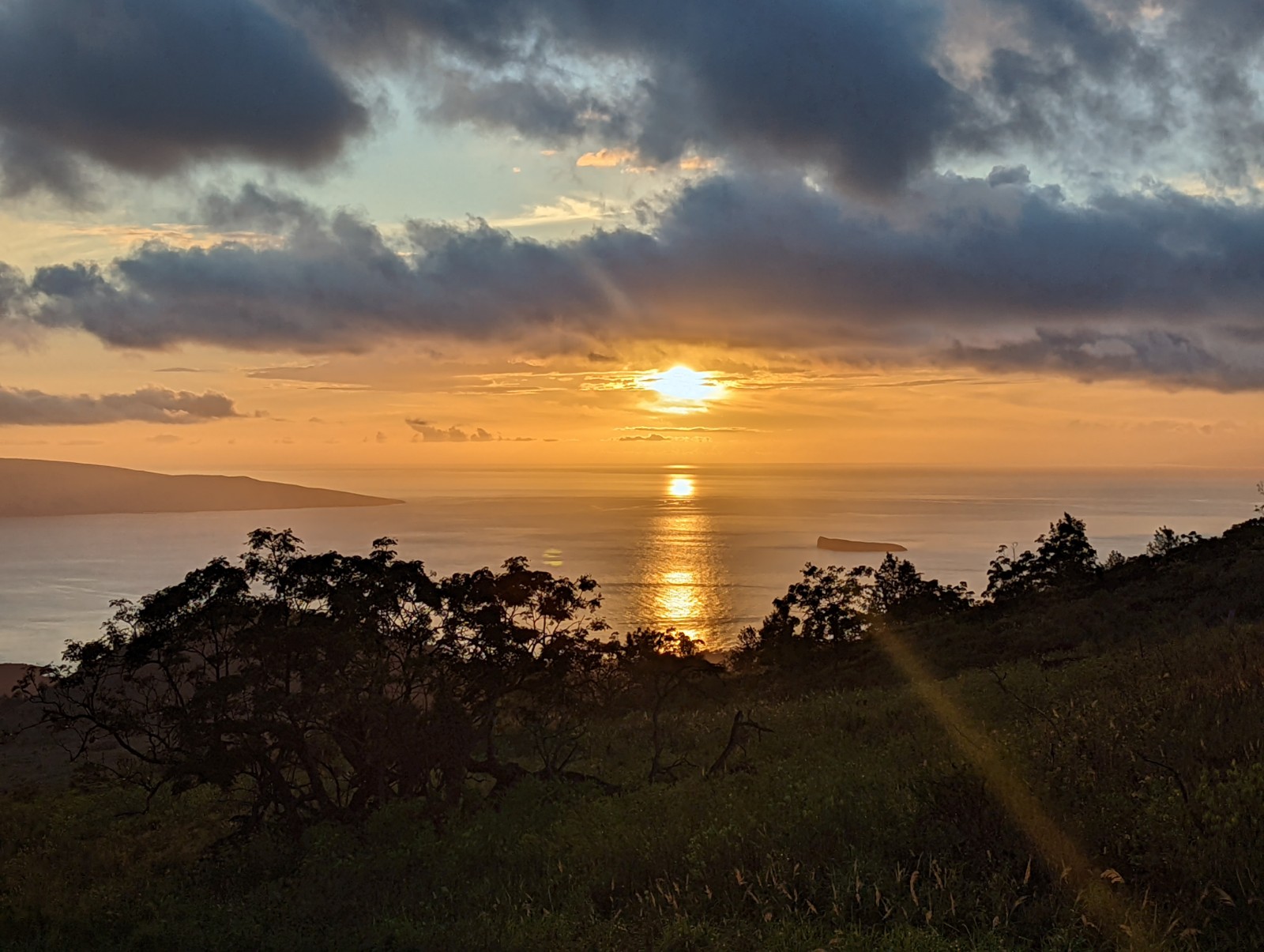
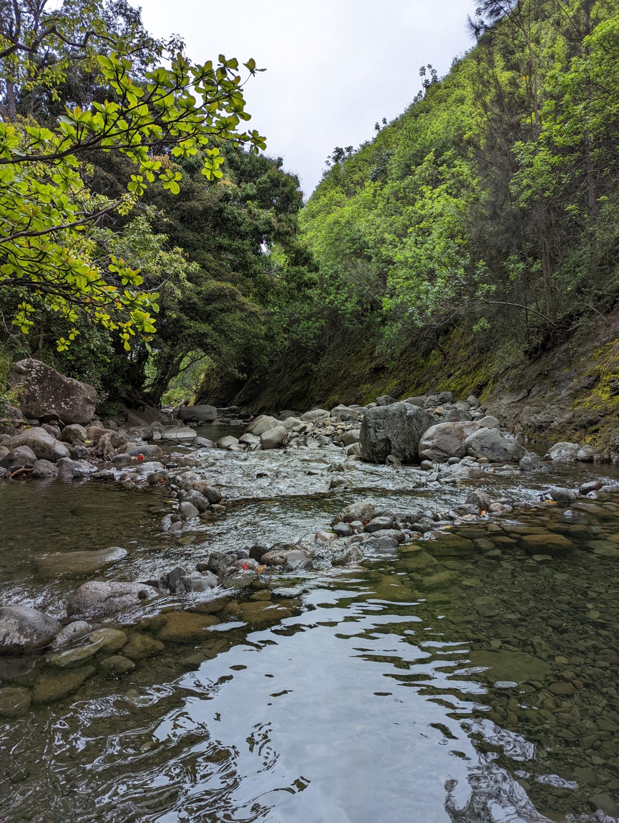
If you want pictures of Maui (stratovolcano or otherwise), just scroll down past the volcano stuff, but do stop for a minute on the native rainforest pictures toward the end of the volcano part, when I was descending to the ocean via Kaupo Gap. I had never seen a place like that before in my life, and unless you've hiked in a Hawaiian cloud forest, neither have you.
THE VOLCANO: HALEAKALA SUMMIT-TO-SEA VIA KAUPO GAP TRAIL
PRAGMATIC HIKE SUMMARY STATS
Date of hike: 03/21/2022
Duration: 8h30m (9:00am - 5:30pm)
Total elevation change: -10,023' (+10,023' to sea level) (my hike was motivated by not liking hard math) (yes occasional very minor uphills but I'm not counting them)
Conditions: at summit, high 40s, clear and windy at 9am. Warmed quickly into crater even with clouds rolling across intermittently. By Paliku around 7000' at 12:30pm, mid 60s, misty with solid clouds. Broke through clouds for good around 3:30pm 2000', 80 and sunny. Least favorite weather was when I first got past the clouds at 3000' - intense sun!
My condition, for your comparison: late 40s former marathoner (emphasis on former) who now needs 2h30m for a flat sea-level half-marathon, still active hiker; psychologically ready for long difficult slogs.
Mileage
| TOTAL | 18.5 miles |
| Inside crater - visitor center to Kaupo Gap Trail Junction | 10.0 |
| Back and forth from Kaupo Gap Trail Junction to Paliku | 0.4 |
| Kaupo Gap Trail | 5.7, about 3 of which was inside the park boundary |
| Road from Trailhead to Piilani Highway | 1.6 |
| Hui Aloha Church | 0.8 |
During the hike I consumed:
- 4 L of water (was thirsty at the end, and it was 60s and mostly cloudy during the hike)
- 2 power bars
- 1 wild guava in the Kaupo Ranch portion (could have had more)
- Beer and poke afterwards (so I'm told; consciousness was compromised)
Opportunities for food and water along the way:
- Paliku for water - NPS does not guarantee it will always have water, though it did; it tasted nasty enough even after filtering that I actually just kept it as an emergency reserve and didn't drink any more.
- Guava along the ranch portion of the trail
- Kaupo Store appears permanently closed
Clothing/protection:
- SPF 50 on face, neck and shoulders (but not my legs, which got pretty red - if wearing shorts, put sunblock on your legs)
- Long sleeve synthetic shirt
- 3.5 L Camelback
- 1 L handheld filter bottle
- Regular Android phone for photos and thin plastic bag to protect from moisture
- Standard running shorts
- Cotton-polyester blend standard socks
- Hoke One One shoes
- Also carried: light rain poncho (never put on, was soaked already and not cold), long hiking pants (should have put on, pushing through vegetation cut and irritated ankles and shins a bit, just too impatient to stop and do it), change of socks (would have been soaked in 5 minutes anyway, why bother)
Communication and logistics: Verizon texts worked at least by the time I entered Kaupo Ranch. Per a local at St. Joseph Church who was kind enough to pick up the phone and talk to a rando (me) who called with questions about the mountain, cell reception can vary with weather because the towers you connect to from Kaupo are actually over on the Big Island (wild!) For point to point projects like this, rather than worry about parking, I obtained an extremely patient and understanding spouse and I recommend you do the same.
General notes:
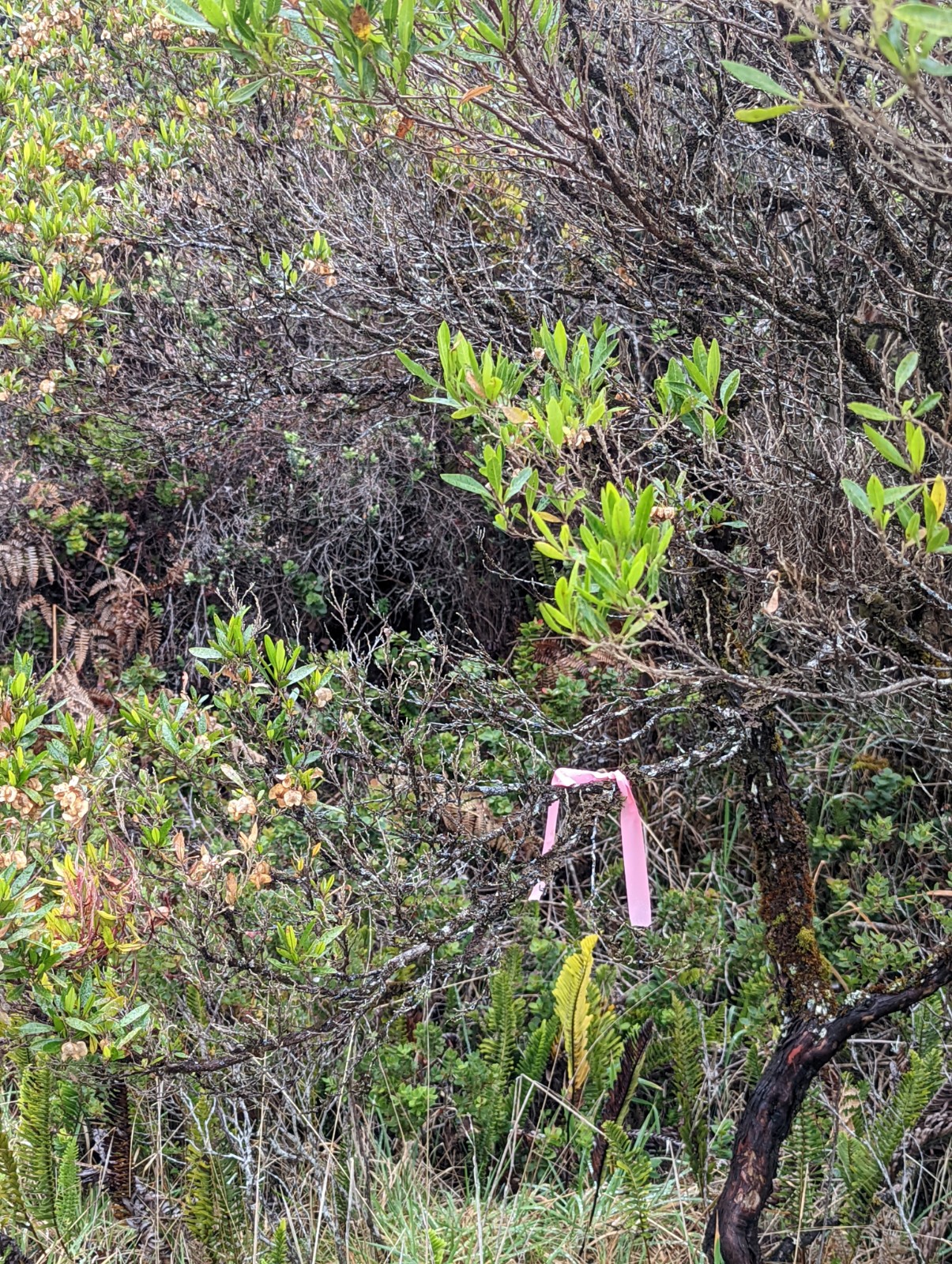
Follow the pink ribbons. I can't emphasize this enough. Ultimately all my map studying, GPS, even making maps with lat and long marked out manually, etc. didn't matter - it was staying focused on the pink ribbons.
The portion from the trailhead to Paliku was not hard. I was never cold, tired, frustrated by the ground surface, disoriented or lost. Only problem was I should have applied sunblock to my legs. I burn fairly easily (Fitzpatrick 2) and still only got mildly red and tight in my skin, but okay the next day.
Try to carry all the water you need. Paliku is quite open about being non-potable, but I'm used to drinking "non-potable" water with a filter and having no problems. Still, even with a filter the water at Paliku was nasty-tasting and tinted green, and I did refill my filter bottle but reserved it for an emergency.
Kaupo Gap Trail is psychologically very difficult. I imagine it would be worse going up, which is part of why I chose to go down (it's less demoralizing getting lost going down.) Three or four miles of plowing through jungle with branches in your face and scratching your legs and ankles, long grass wrapping around your ankles, not being able to see the trail below your waist and anticipate the grade, or the large rocks rolling around that you will step on every fifth time you put your foot down, all while the water in the air and on the branches is flowing down your body. Then you get into the more open environment of the ranch, but the coarse loose gravel is every bit as annoying to descend as the other reports claim, and then some. On the ranch road section I slipped about every fourth step but never actually fell. My quads were killing me for 2-3 days afterwards.
Did I get lost? Yes, once - see map below. Frustratingly, it was right at the end by the ranchhouse, 0.3 miles from the trailhead. Apparently people climbing the trail often have the same experience when they start at this same spot. I couldn't follow the trail at all, and ended up 50-100 yards east of where it says the trail is on other maps including Gmaps below, bushwacking through a creekbed submerged 10 foot high grass that you can't see out of in, climbing a very steep hill in that grass, trying to pull myself up with a tree which them cracked and fell over and whacked me on my head (no joke - the closer to the end I got, the harder it got, it was like Xeno's trail or something.) My apologies if the ranch workers heard me cursing because my frustration got the better of me at that point.
INTRODUCTION
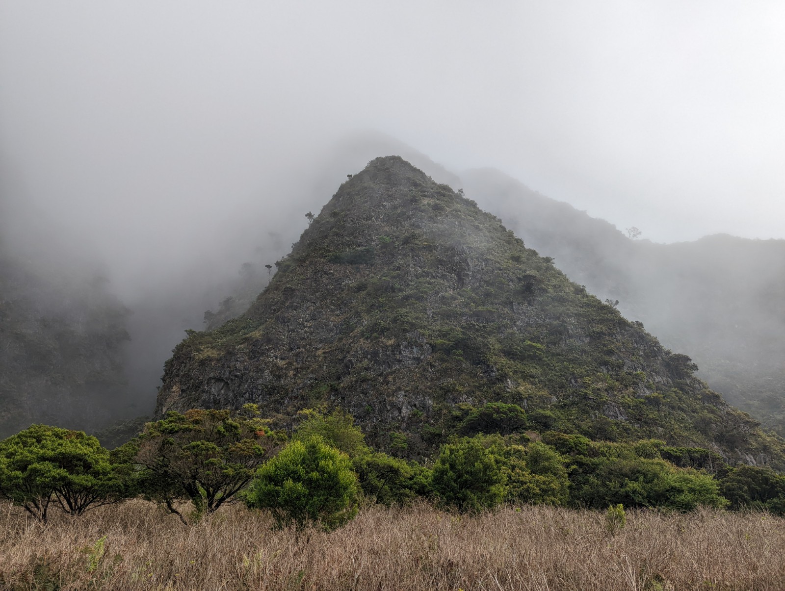
As a still-exciting single person, I admit Hawai'i (the so-called Canary Islands of the Pacific) always seemed kind of boring to me - a place for family vacations, not true adventure. And sure, you can choose to just stay by the ocean and go to the beach and eat poke (nothing wrong with that; more later.) But Hawai'i also has three volcanoes over ten thousand feet, the tallest mountains in Oceania, right next to the ocean. And it's a trivial exercise to conclude that, which such vertical relief, a reasonable person really has no choice but to set out to hike between the extremes in a single day. You understand of course. My original plan was to start at the ocean and go up. I modified this for two reasons: I don't think my physical condition would allow it anyway, but more importantly, psychologically, getting lost going UPhill is extremely demoralizing, and Kaupo Gap Trail is infamous for being poorly marked. In retrospect I am quite confident the choice to descend was the right one. And even so it was still one of the harder outdoor experiences I've undertaken. I'm really glad I did it. The rainforest once I started descending Kaupo Gap is easily the most unique ecosystem I've ever been in. Combine that with the fact that in pretty much every other rainforest there would be snakes and spiders that would make this kind of bushwhacking a lot more dangerous, amd the cliche becomes truer than ever - there really is nowhere else like Hawai'i.
If you'll indulge me a moment of nostalgia: at eleven years old I visited Maui with my family and drove to the top of Haleakala. The place is amazing for anyone, but for a kid from Pennsylvania it was overwhelming. And when I arrived at the summit it seemed like I had just been there the previous week. The way it took me back to childhood, and bidding farewell to my wife and daughter at the summit, and realizing in the first minute of my run that this week would be the anniversary of my father's death, unexpectedly turned it into an emotional experience. I was worried I'd have two red vertical streaks of sunburn on my face from tears washing away sunblock (I didn't.) Dad, this is dedicated to you.
The route breaks naturally into two pieces: the Sliding Sands Trail from the summit to Paliku Cabin, and Kaupo Gap Trail from Paliku Cabin to the bottom ((the trail plus a little bit of road to the ocean.)
The Volcano Part 1: Haleakala Summit to Paliku via Sliding Sands Trail

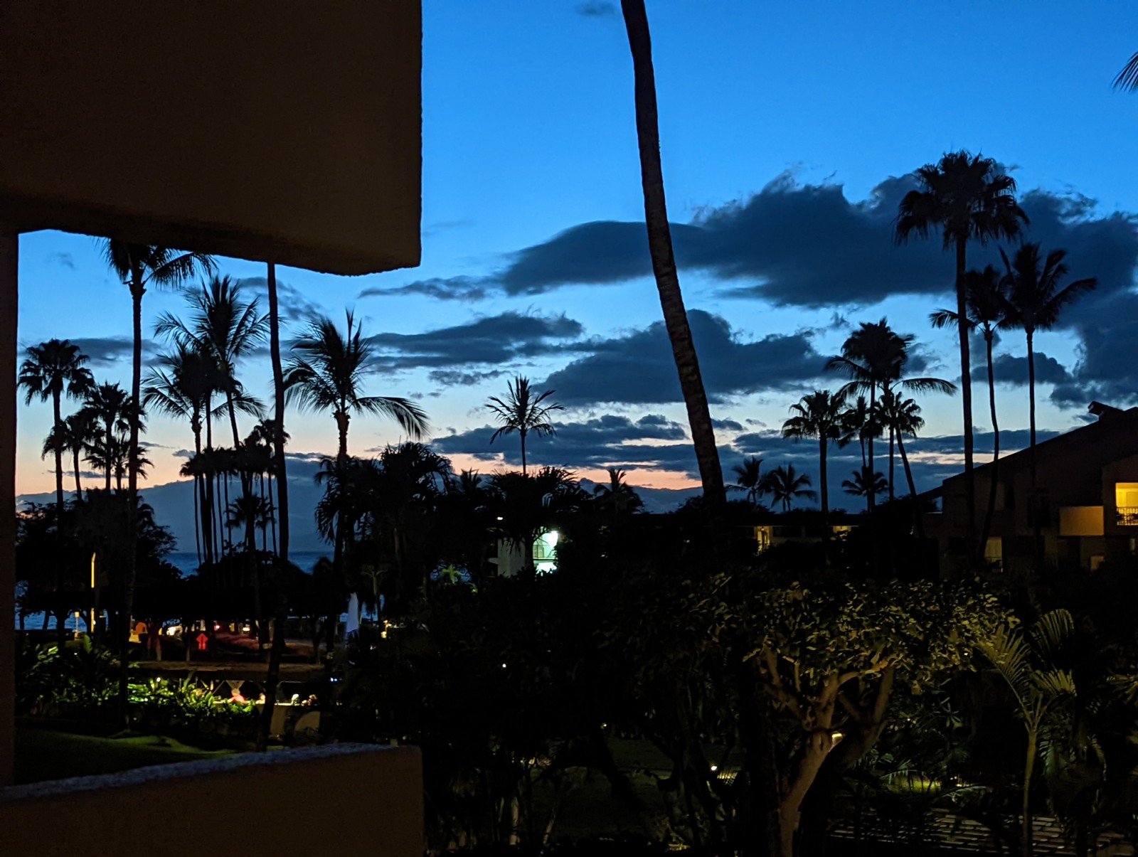
The first view from above the cloud deck as I drove up the volcano.
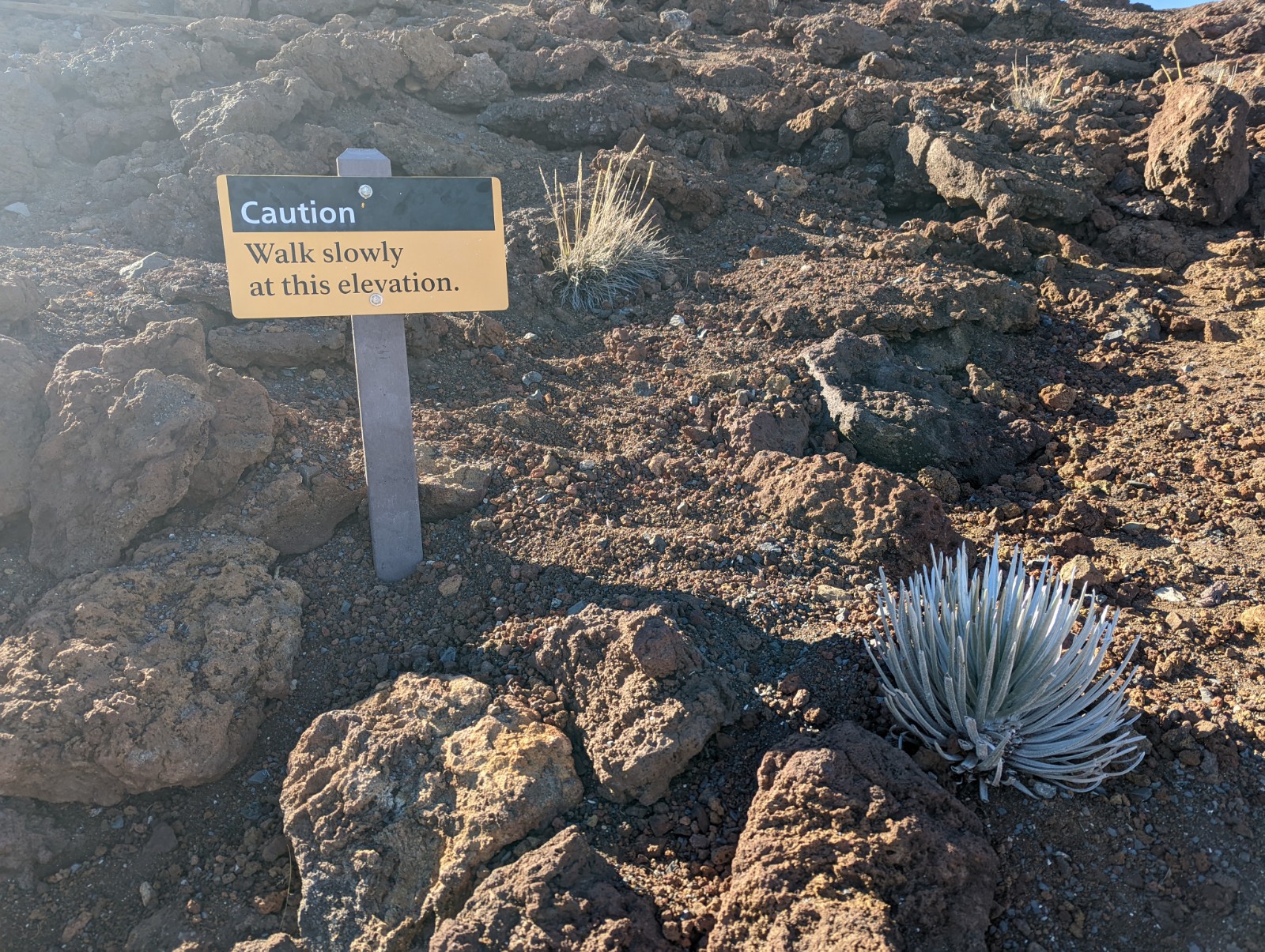
This sign obviously doesn't apply to seasoned adventurers like myself.
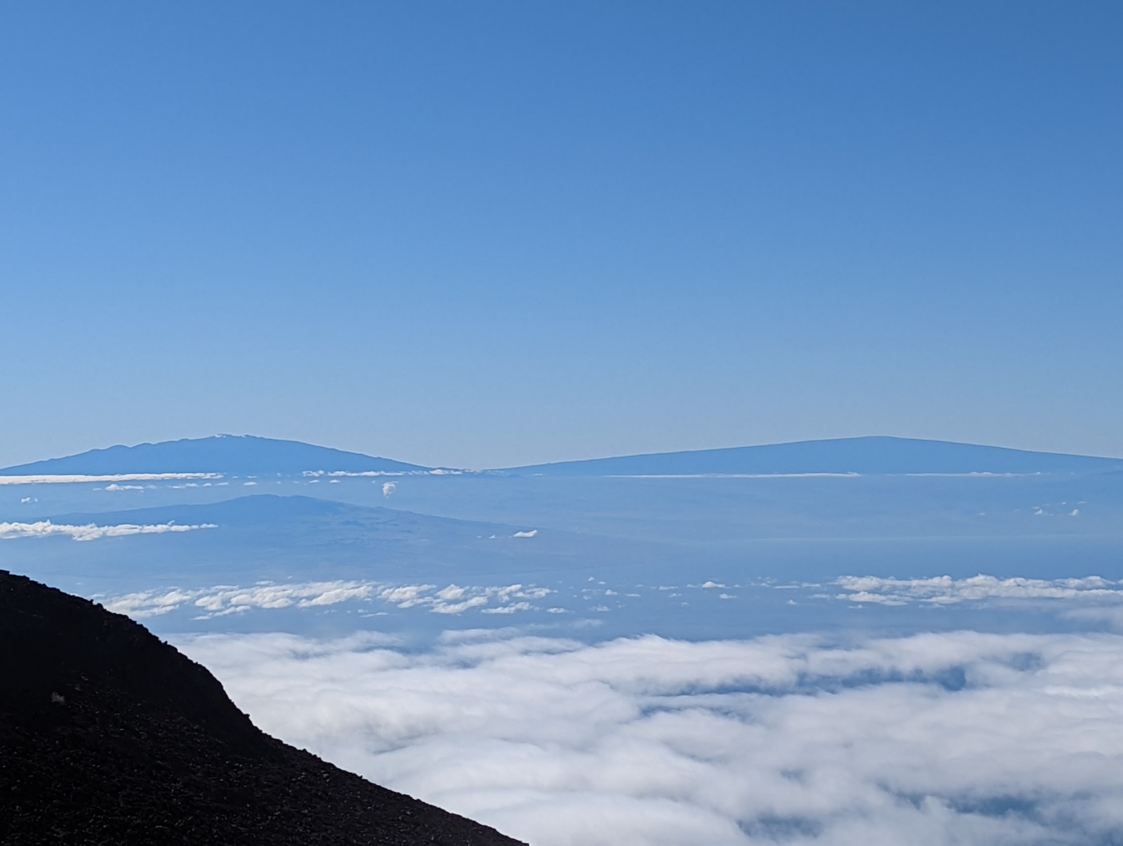
Mauna Loa and Mauna Kea over on the Big Island. To my right the other islands south of Maui (Kaho'olawe and Lanai) seemed very far below.
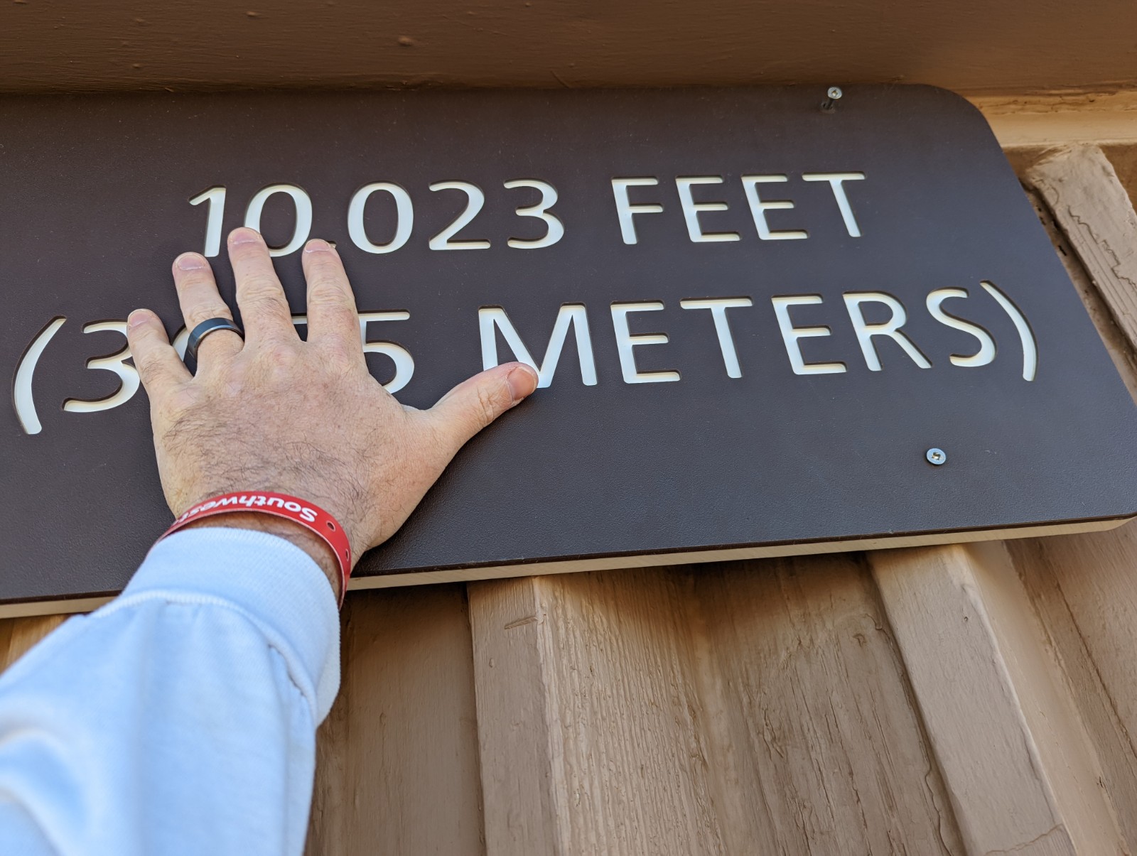
This whole thing is a scam, and I just had a sign made. This was actually taken on my back porch.

The observatory. This is where 'Oumuamua was discovered.
To get from the summit building to the trailhead, you walk down the road toward the lower parking area to pick up Slidings Sands. I kissed my family goodbye in the summit parking lot (it was cold and they wisely didn't want to spend much time outside the car) and began my descent. There was a sign and orange plastic post at the Sliding Sands Trailhead saying it was closed, but there was a group in the parking area that said they'd just asked a ranger who said it was fine. The poor marking begins immediately! Inauspicious! (Turns out that besides this, the marking was actually fine until the very bottom of Kaupo Gap Trail.) This is the view into the crater from the trailhead.
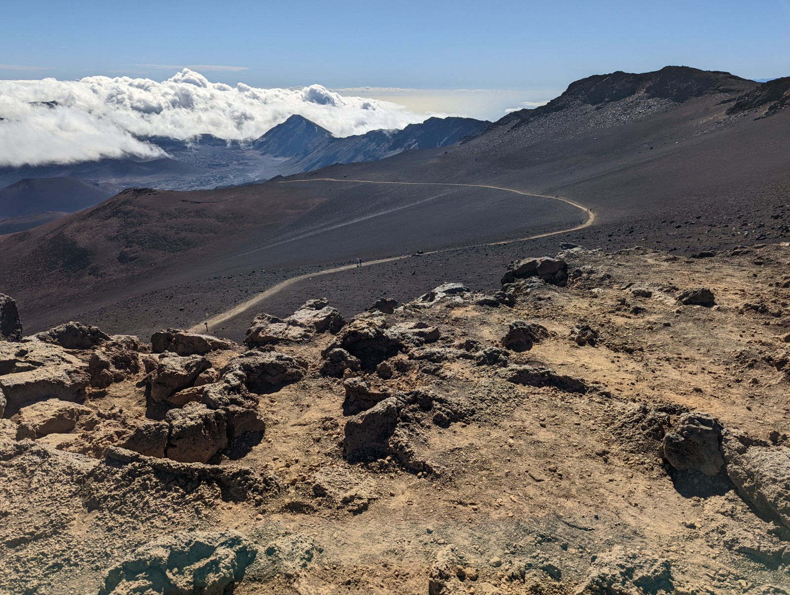
Looking back up as the trail descends into the crater. You lose the first 2000' in about the first 3 miles, then it's much flatter after that. In fact there's some mild uphill a couple miles before Paliku.

I don't know who this fellow was; doesn't look like a young nene to me.
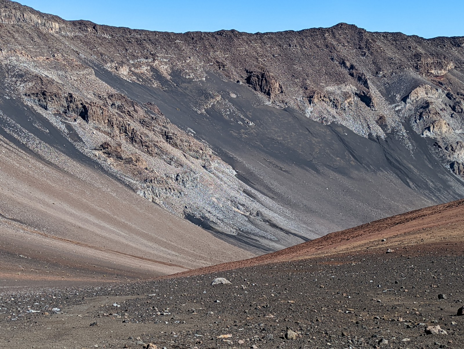
When you're somewhere like this, where you have little similar experience in the natural world to help you relate, you start thinking of metaphors in man-made abstractions. You start thinking things like "This area looks like if Rothko had a diagonal period."

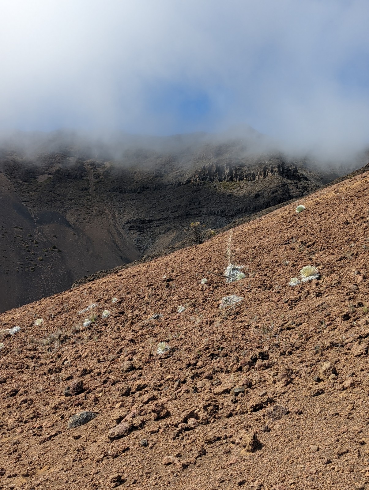
This is not a silversword, but it's still weird, as you'd expect the plants that survive on the summit plateau to be. In general, inside the crater it looks the set for a Star Trek landing scene (though I saw no Gorn.) In New Zealand I'd noticed that it always seemed at any given elevation that you're higher than you actually are; there's effectively an Alpine meadow near Queenstown around 3,000'. My theory is that New Zealand's flora is all evolved from wussy South Pacific plants that can't handle low temperatures, whereas Hawai'i is just barely close enough to North America that it has some plants from California's mountains and with some tweaks they're a bit more adaptable to cold and extremes - like silverswords.


Now those are silverswords. They're descended from California tarweeds (below, divergence time about five million years) and though that's recent by evolutionary standards, the two plants look nothing alike. In fact, they're used as an example of the limits of morphological difference per genetic change. That is, this is about as different as one organism can look from a related one, on a per-mutation basis. One of its tricks is that the curvature of the leaves focuses heat out toward the more exposed, vulnerable tips. I presume, but don't know for sure, that the silvery coloration is an adaptation to high UV.


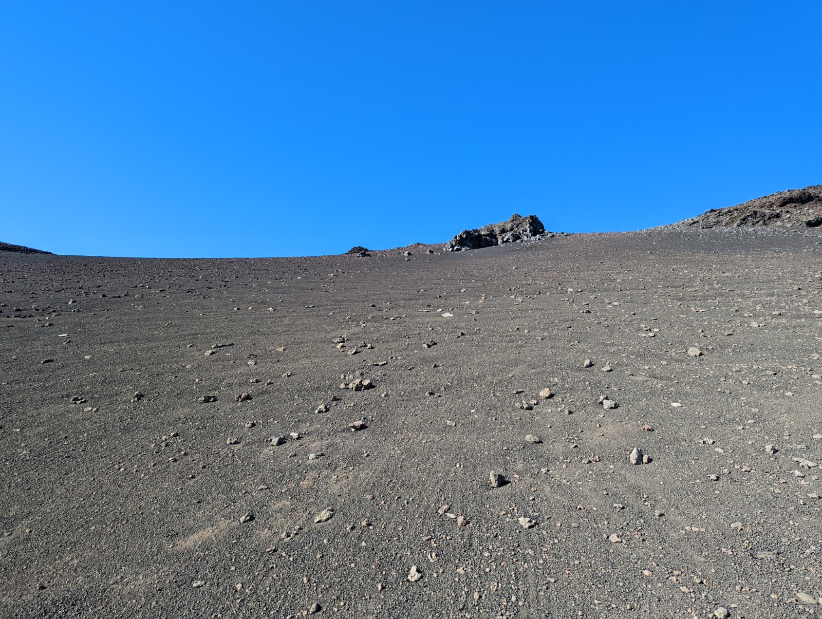
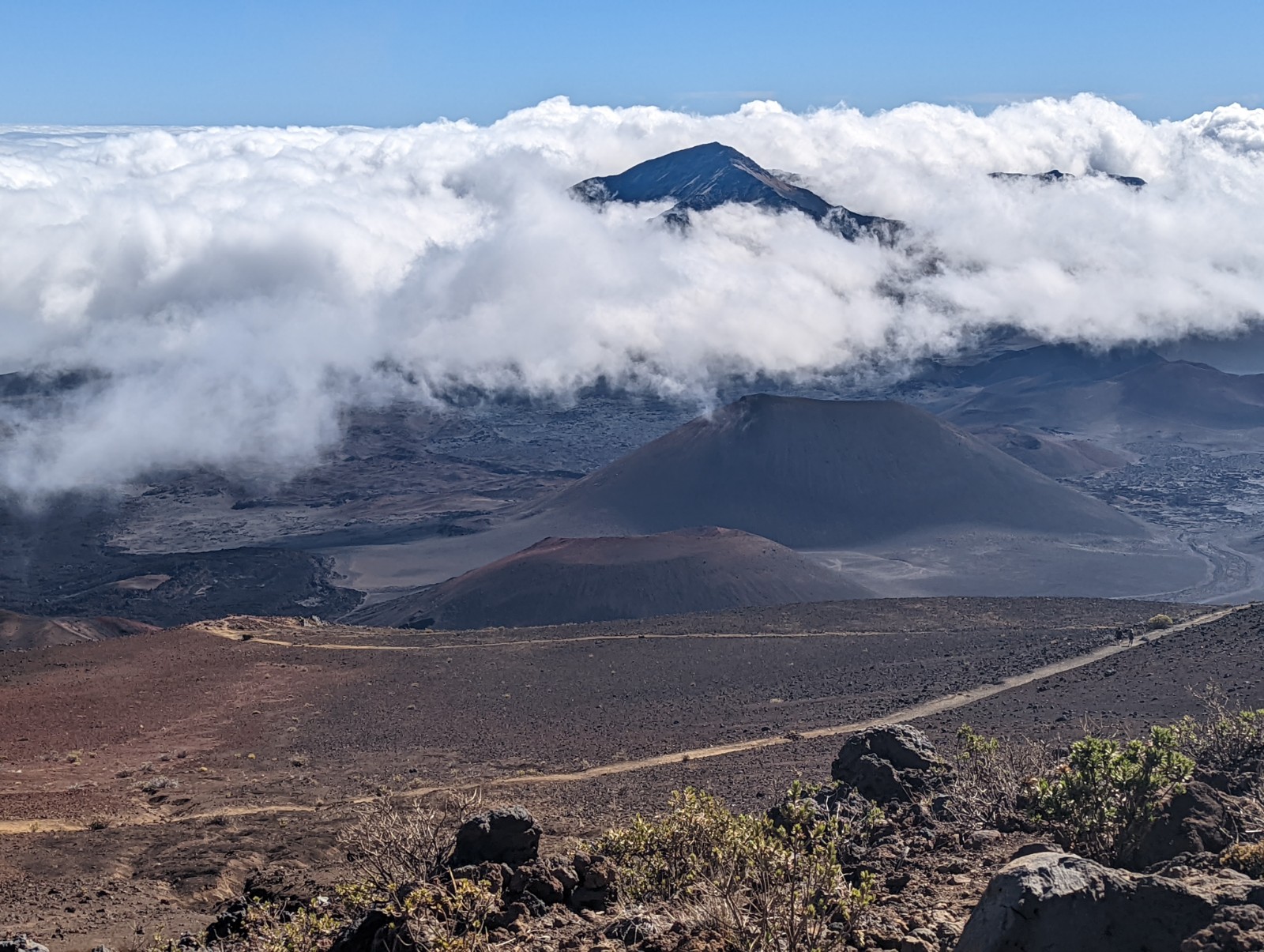
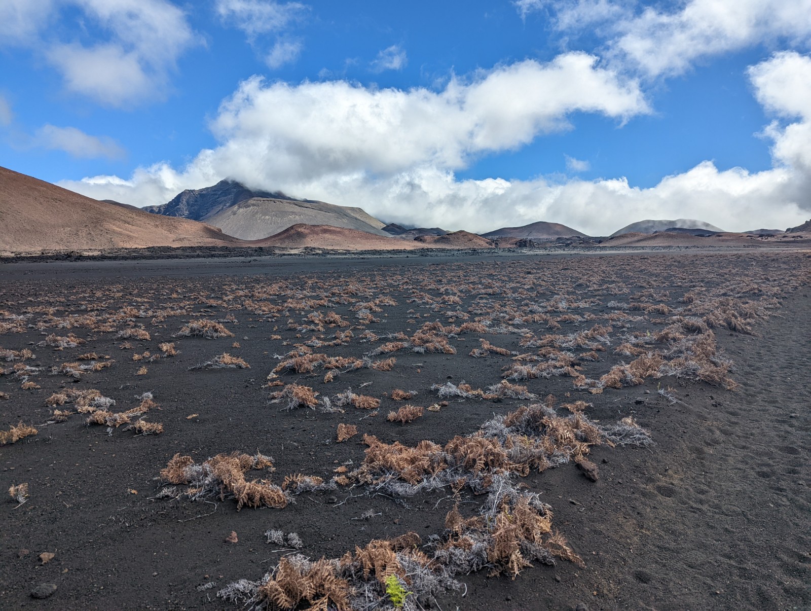
No, this is not a picture from Perseverance Rover. In fact in some of these you can see people on the trail if you zoom in. I saw less than 20 people in 8 hours, all of them in the barren part of the crater except one; one more coming the other way as I approached Paliku; and then none on Kaupo Gap.

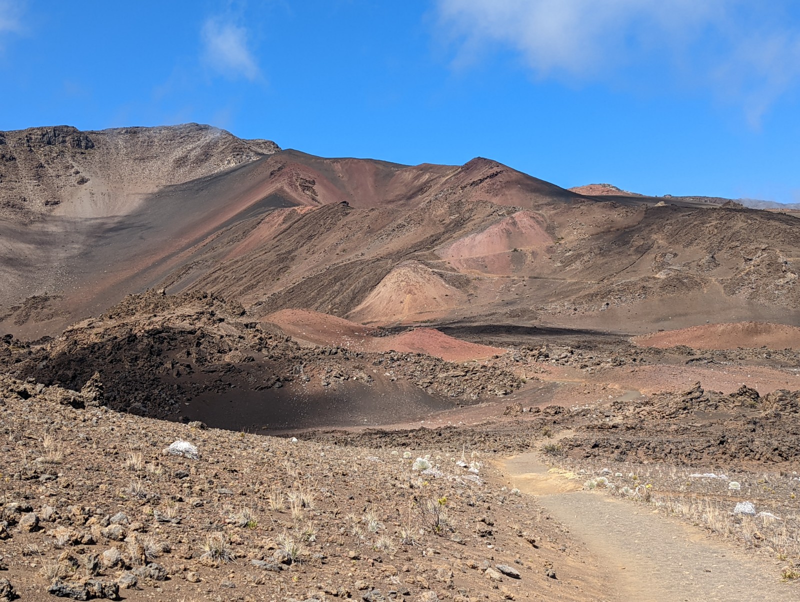
There are other trails throughout the crater approaching some of the cinder cones and lava tubes but I was focused on my route, to get to the other end of the crater and descend through the gap. If I get back to Haleakala I will be exploring those.


More silverswords.


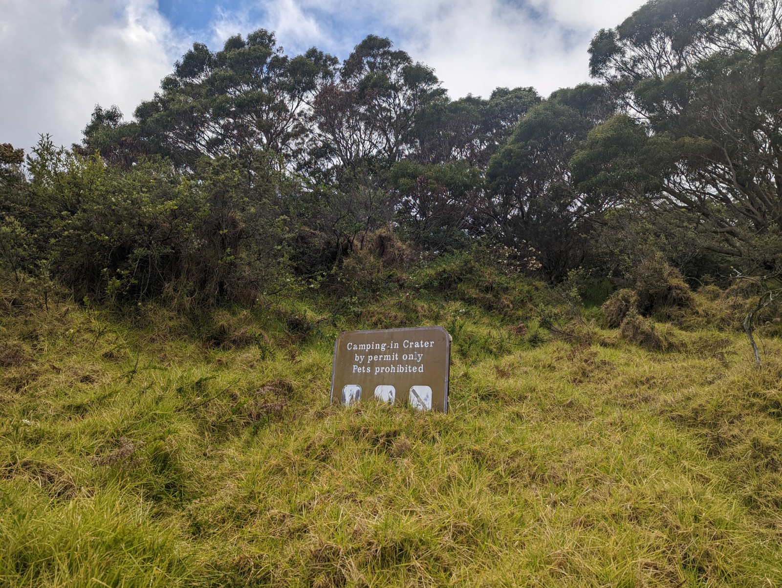
The signs seemed a bit absurd.

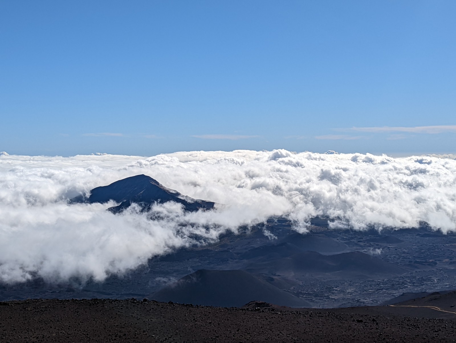
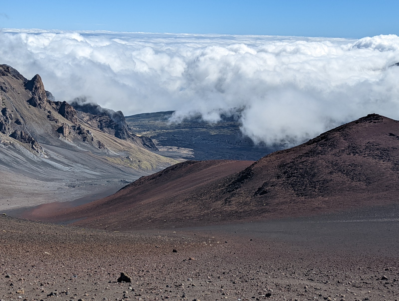
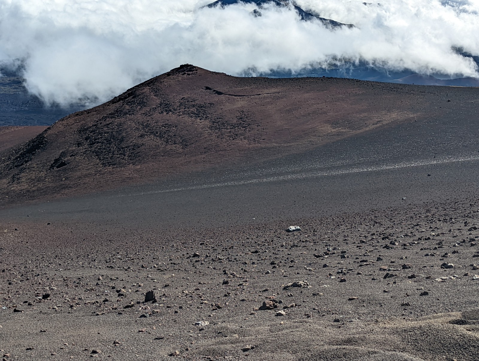
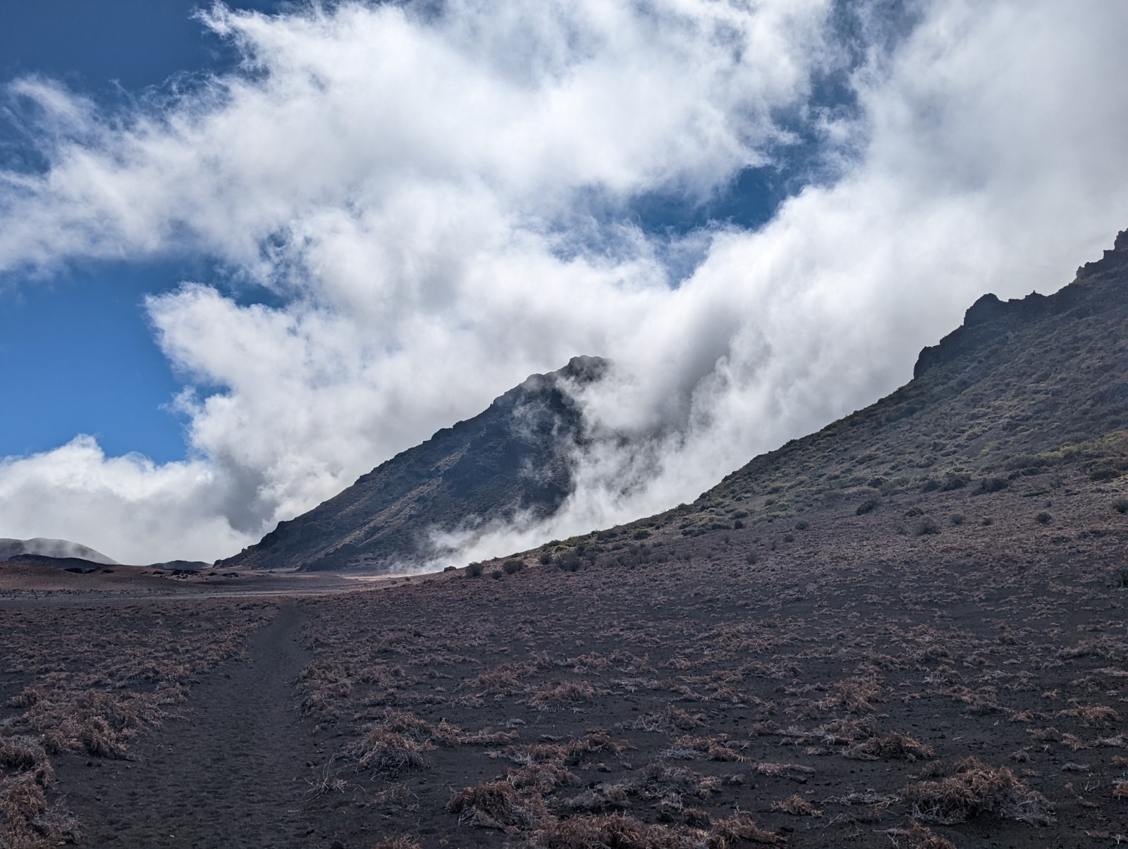
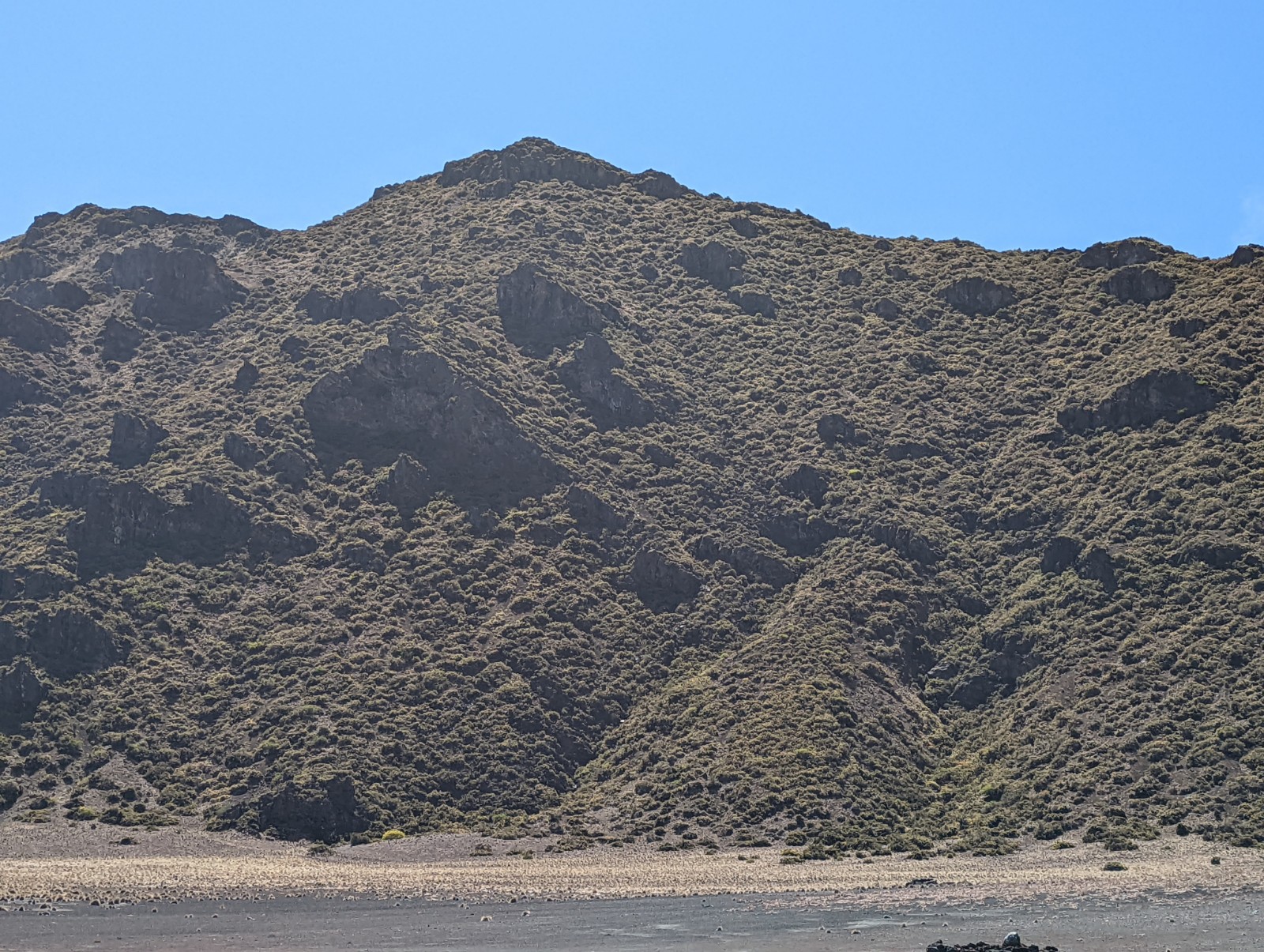
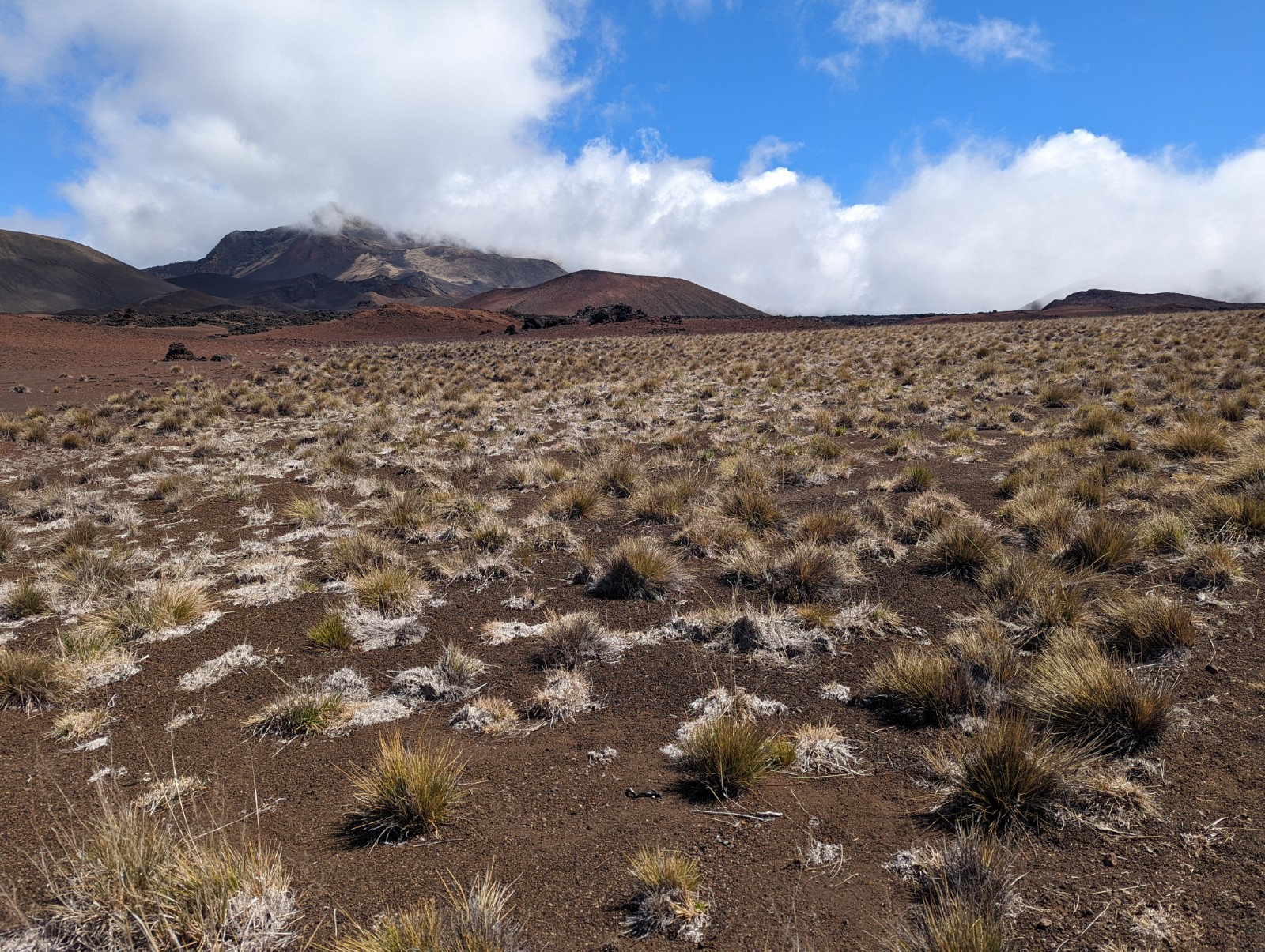
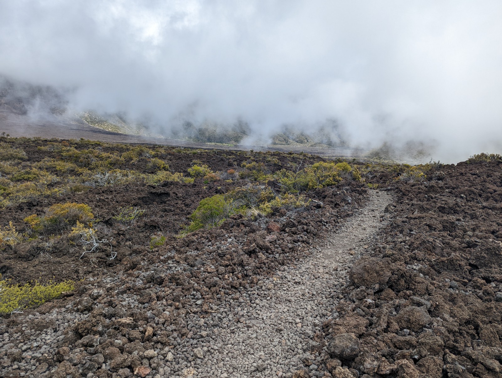
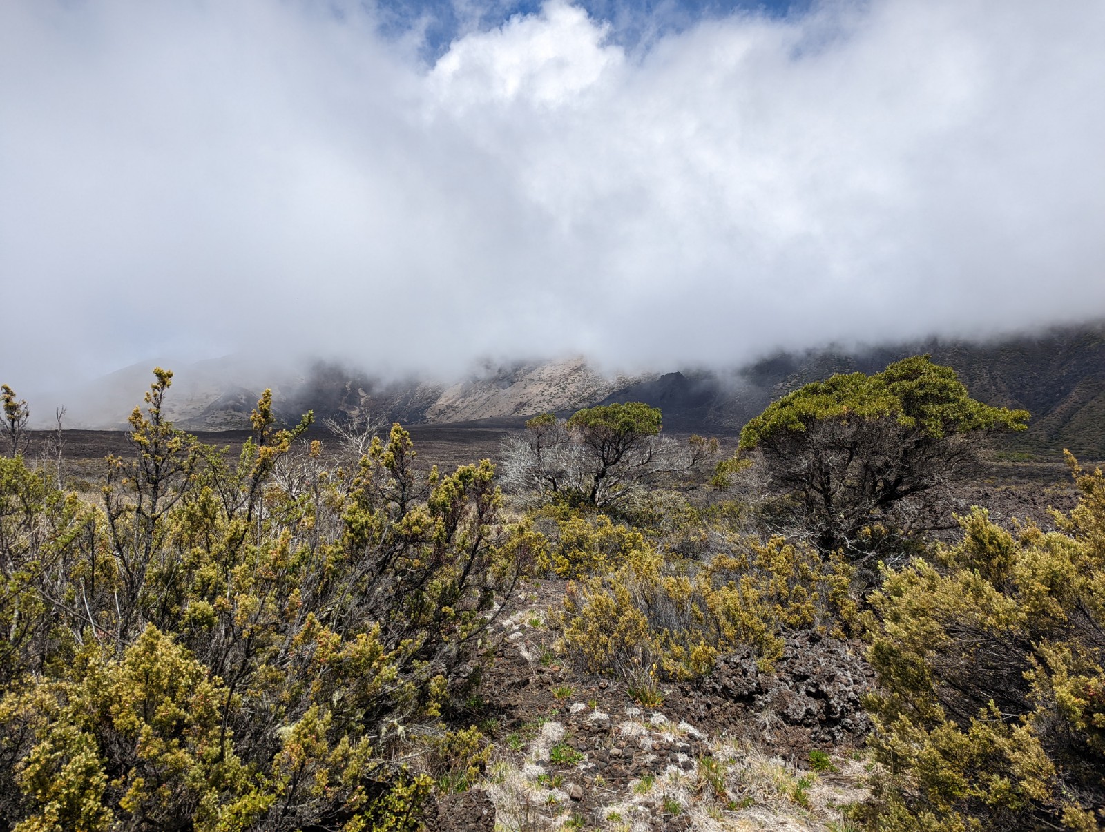
I'd lost enough elevation that you can see the vegetation is starting to increase, and the clouds (previously below me) were getting closer to the trail elevation. This was really where the flat sandy portion of the trail began. It wasn't as bad as some of the reports have said, and at no point did the elevation bother me. But then again, if I had already come UP Kaupo Gap and I had to get through a few miles of this at elevation in the second half of the hike, it might be more annoying.
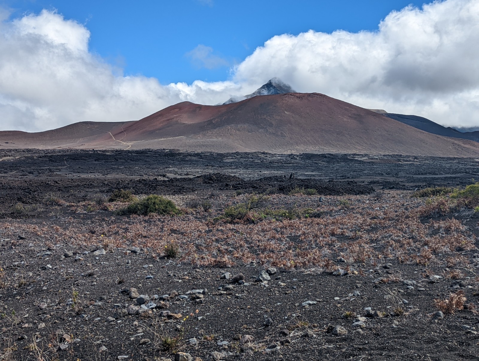
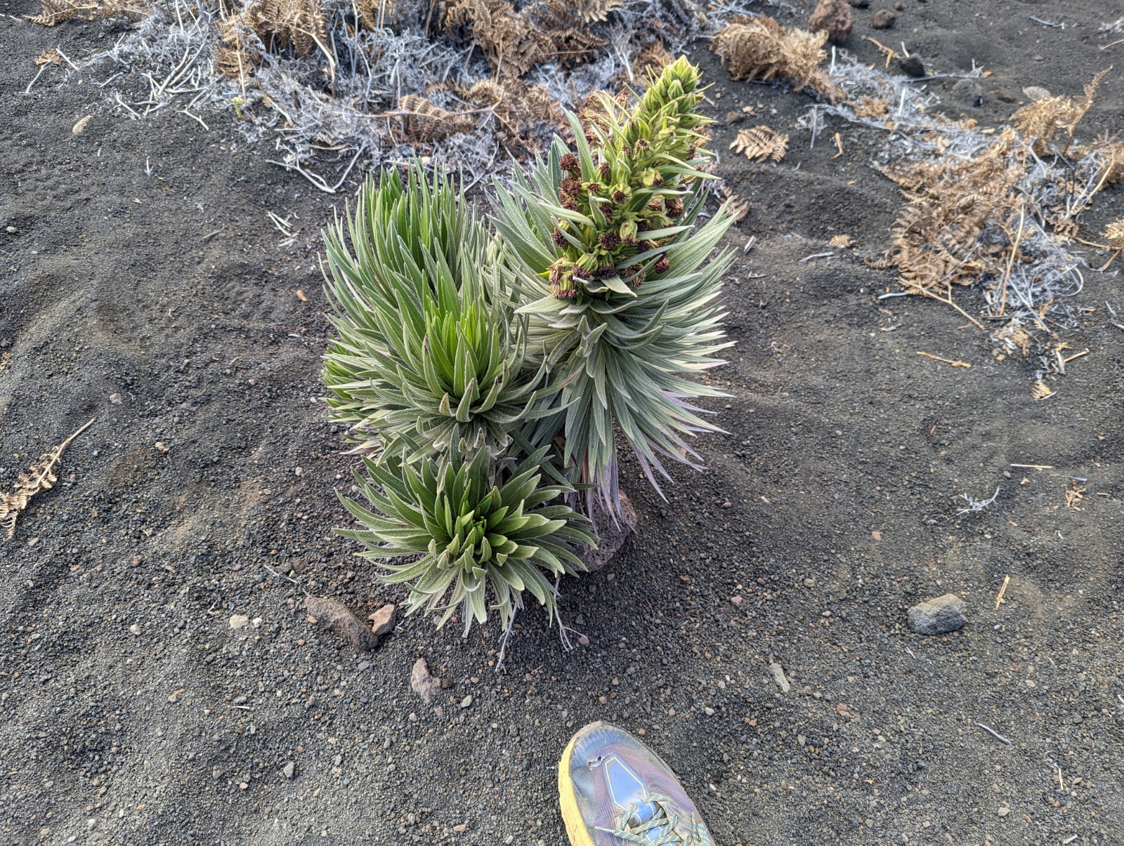
There are also related greenswords that grow at lower elevations. It seemed like the lower I got, the greener the silverswords were.
I know of two myths about Haleakala. One is that Maui's grandmother wanted to dry her laundry but the sun passed over too quickly - so Maui went up on top of Haleakala, threatened the sun that if he didn't slow down he would chop off all his legs, ie sunbeams (doing just that to one of two of them) and kept the sun tied to Haleakala to slow it in its passage. Hence the name of the mountain which means House of the Sun. The other is that the volcano goddess Pelee lived here, had a fight with another goddess, and lost, and had to move to the Big Island. This second one is an attempt to explain why Haleakala no longer erupts, while the first might explain why the sun is stronger at the summit; also how tidal drag has slowed the Earth's rotation over time, decreasing the length of the day from (for example during the Devonian) 20 hours. Oh you don't think so? You don't think the Hawaiian creation myths are real? Well guess what, ever since we stopped teaching in schools that the islands were formed by Maui pulling them up from the seafloor with his hook, kids are growing up with no moral compass and that's why we have mass shootings in this country now.
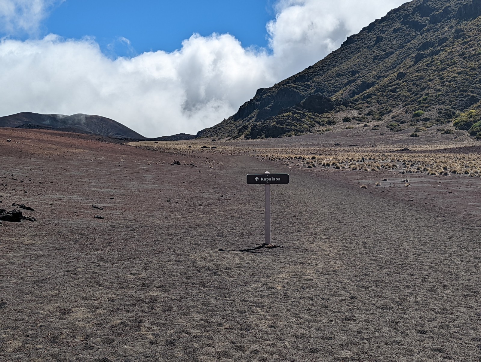
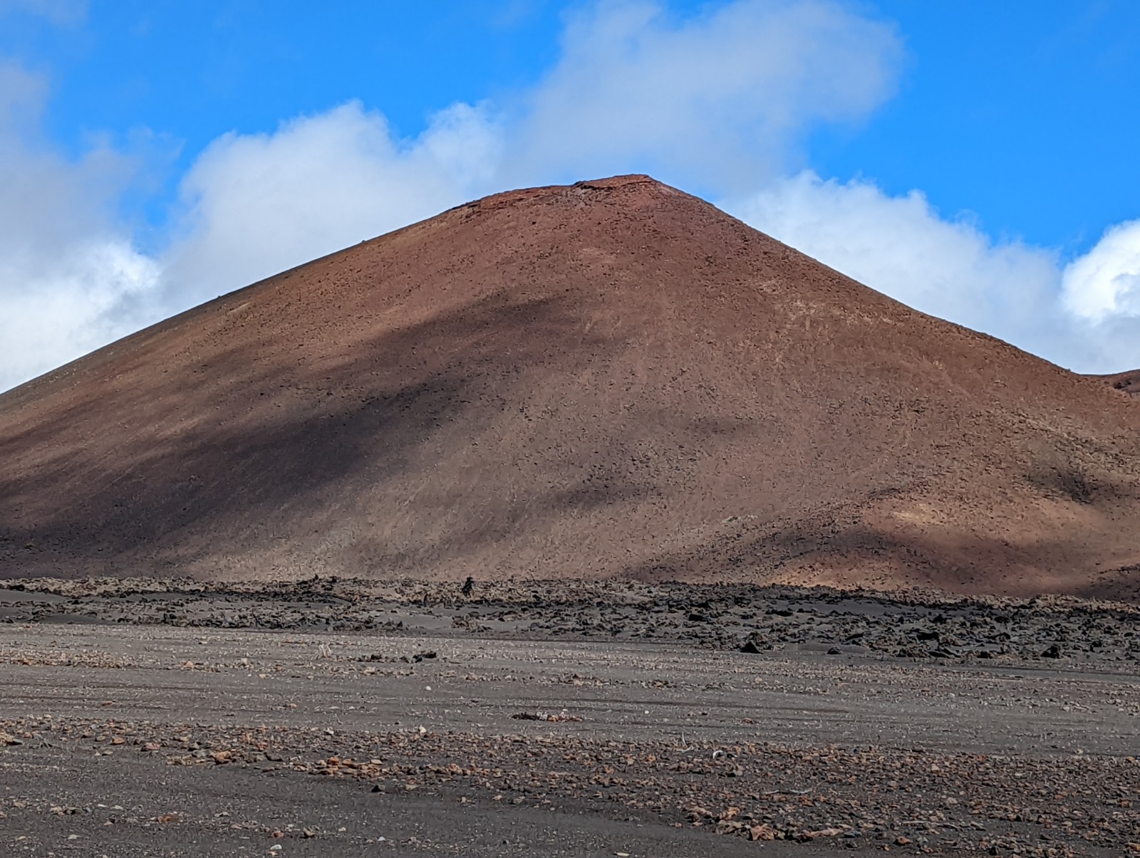
If you want to sleep overnight in the crater in the more Martian part, there's a cabin at Kapalaoa.
A question people often have is when Haleakala last erupted - latest was 1600, although I think that refers to the flow lower down by the ocean at Makena and Hoapili Trail. I don't know stats on when the last activity in the crater was. As per usual, when I was in there I jumped up and down a bunch to make it erupt. No dice. Didn't work on Shasta or Hood either. I might need to find a new method.
The trails and signage inside the crater were never a problem, except within half a mile of Paliku there was a ~200 yard side trail that joined back with the main one anyway.
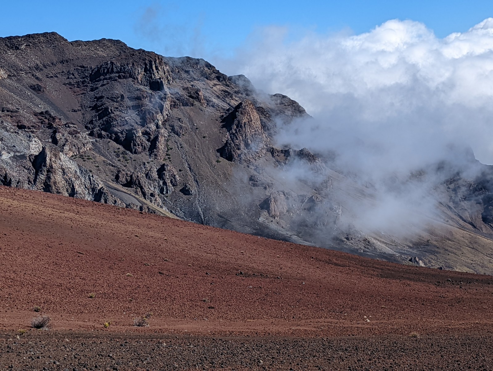
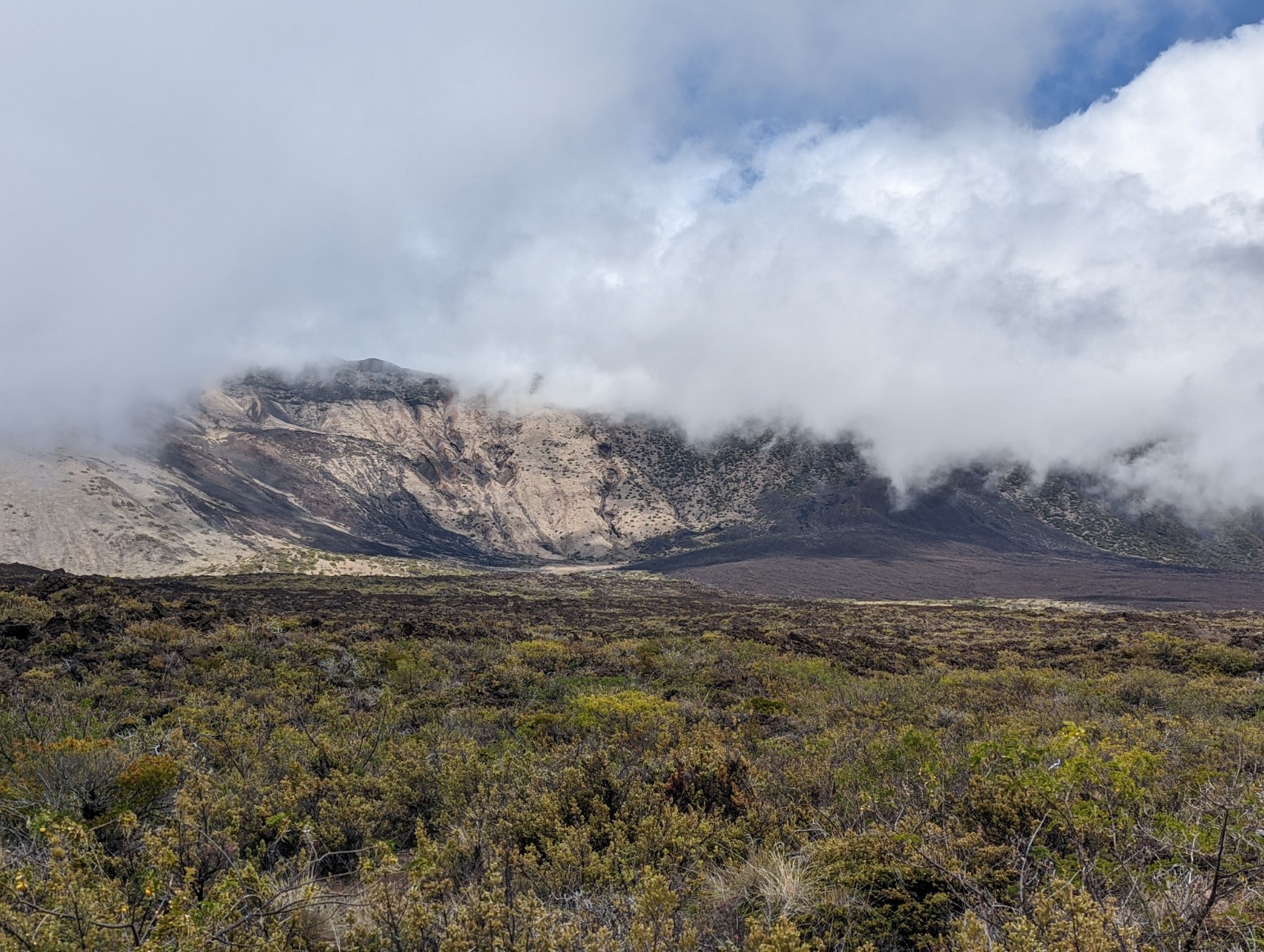
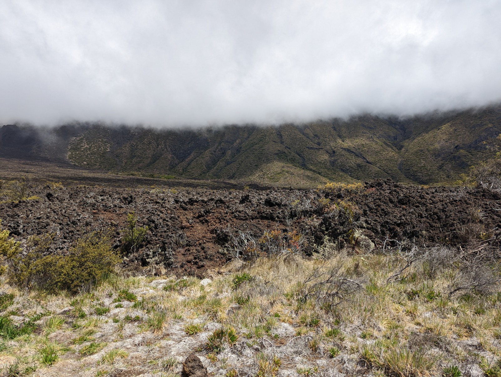
After Kapalaoa the vegetation picked up but the trail was never difficult to find. At this point the surface was less sand or gravel and more solid basalt - that is to say, the floor was lava. ZING

Around this point I started hearing nene flying around honking in the clouds fairly regularly (other than possibly that one guy right at the beginning, I didn't see any in the more barren part of the crater.) They sound like their Canada goose relatives (divergence time a little over a million years - see timetree.org) though with a honk that is more extreme - that is, starts on a lower pitch and jumps to a higher pitch than Canada geese.

Who would cross the Bridge of Death must answer me these questions three


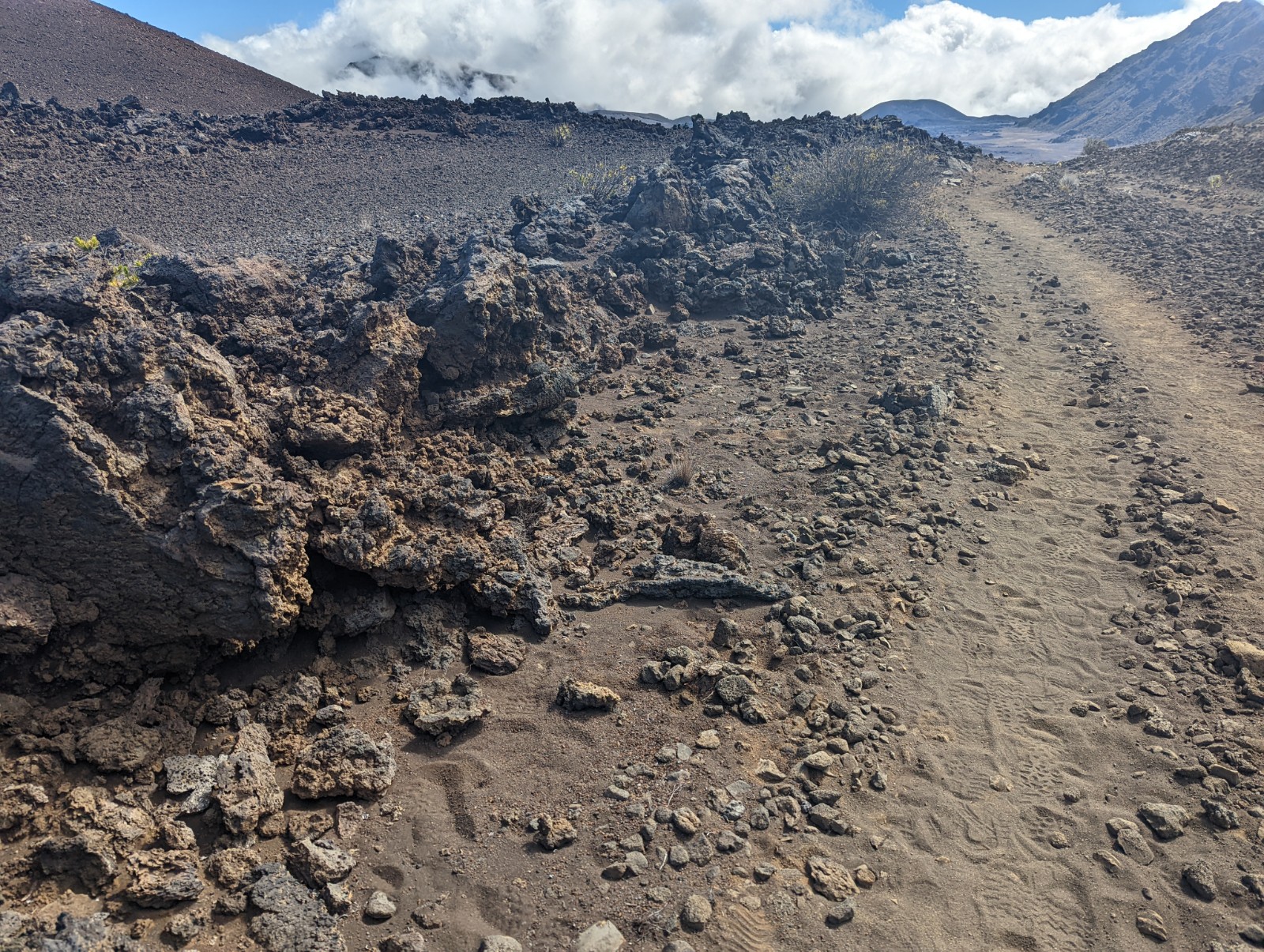
A small lava tube under the trail.

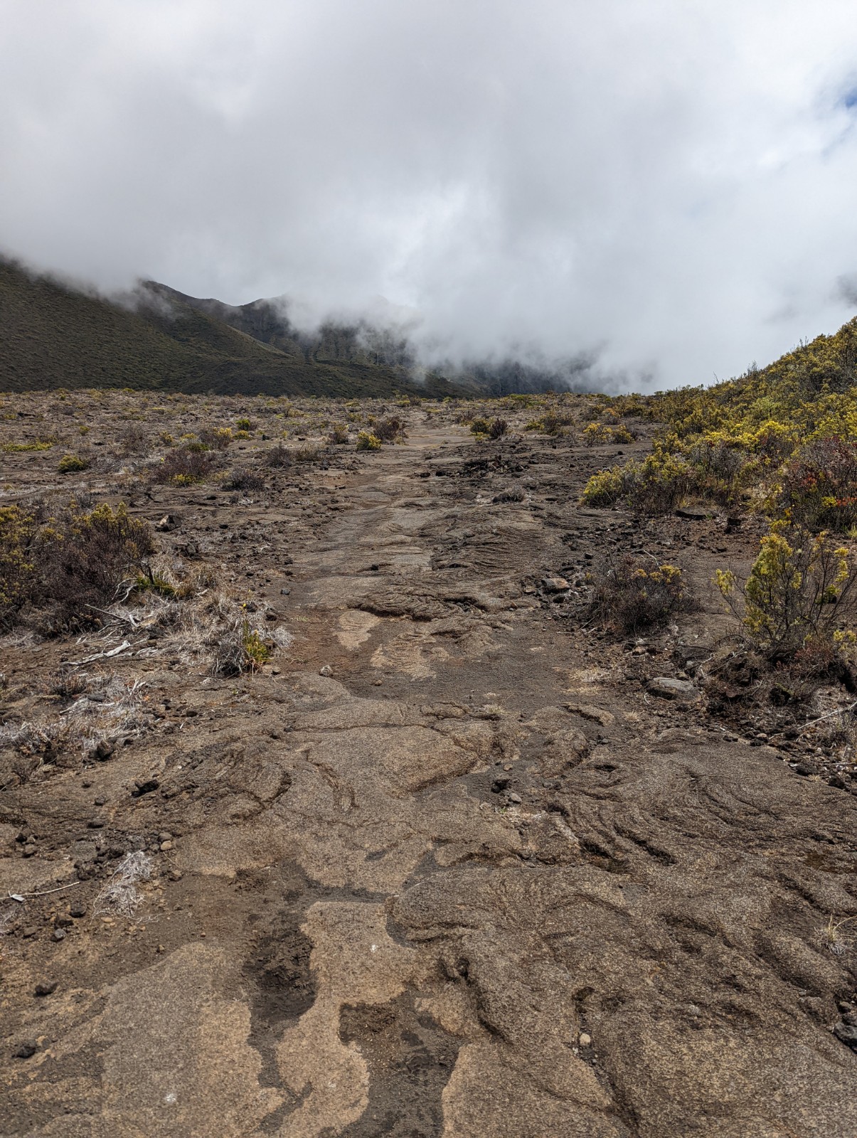
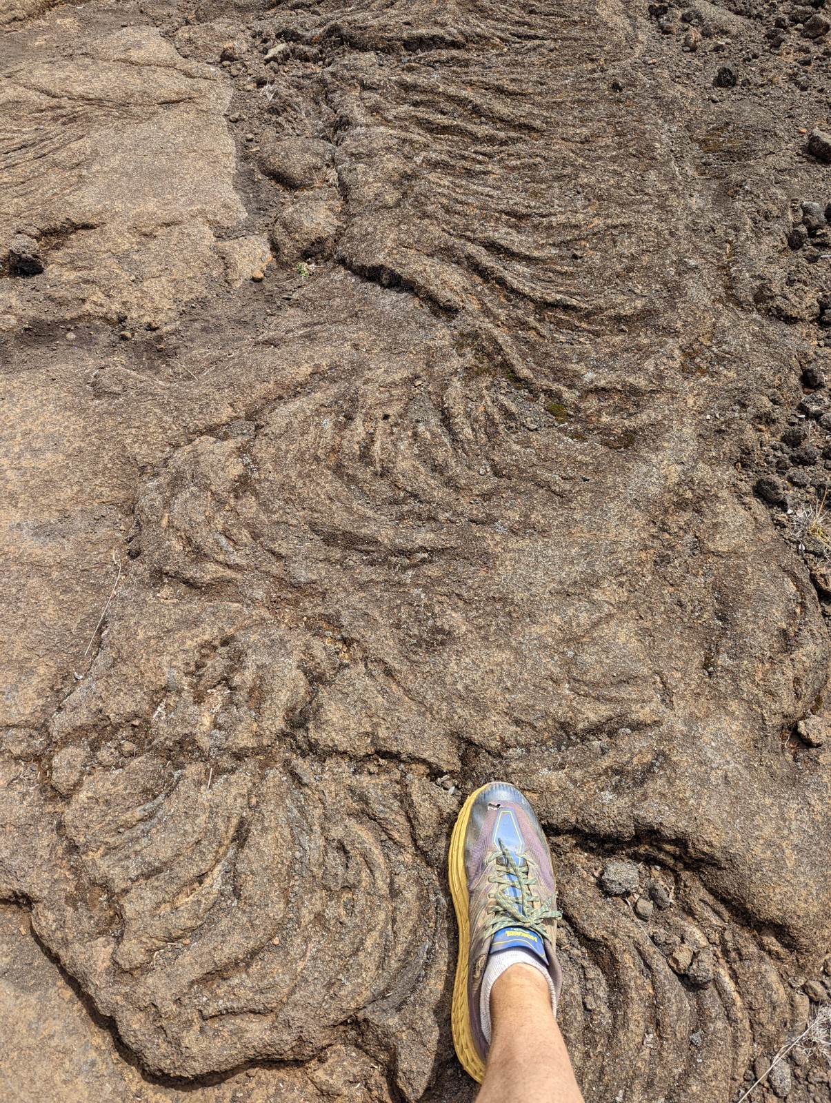
Yeah okay I get it. It's lava. I'm on a volcano. Relax.

Right around here I saw my last human of the day (until a guy on a 4-wheeler as I walked down the road from the ranch.) I hadn't seen anyone since before Kapalaoa at this point.


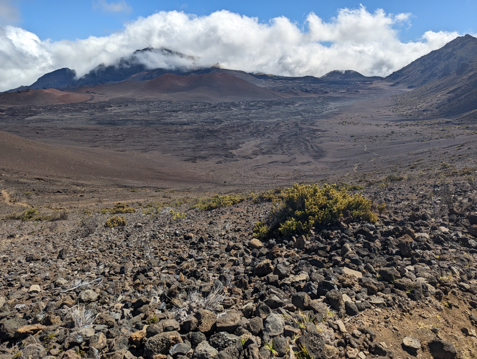
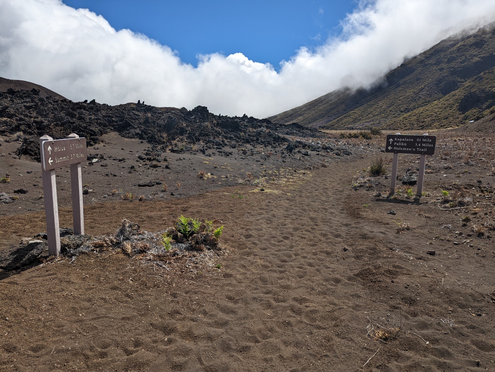
Sliding Sands ends at an intersection with a 0.2 mile spur to Paliku, and Kaupo Gap Trail. At this point you're at about 7000'. There is water at Paliku, but there are signs that it's non-potable - okay, I have a filter, fine - but even after I filtered it, it looked a bit greenish and tasted odd, so I kept it as an emergency reseve. I called the NPS ahead of my hike and they did not guarantee there would be water there, and they have no way of monitoring it.
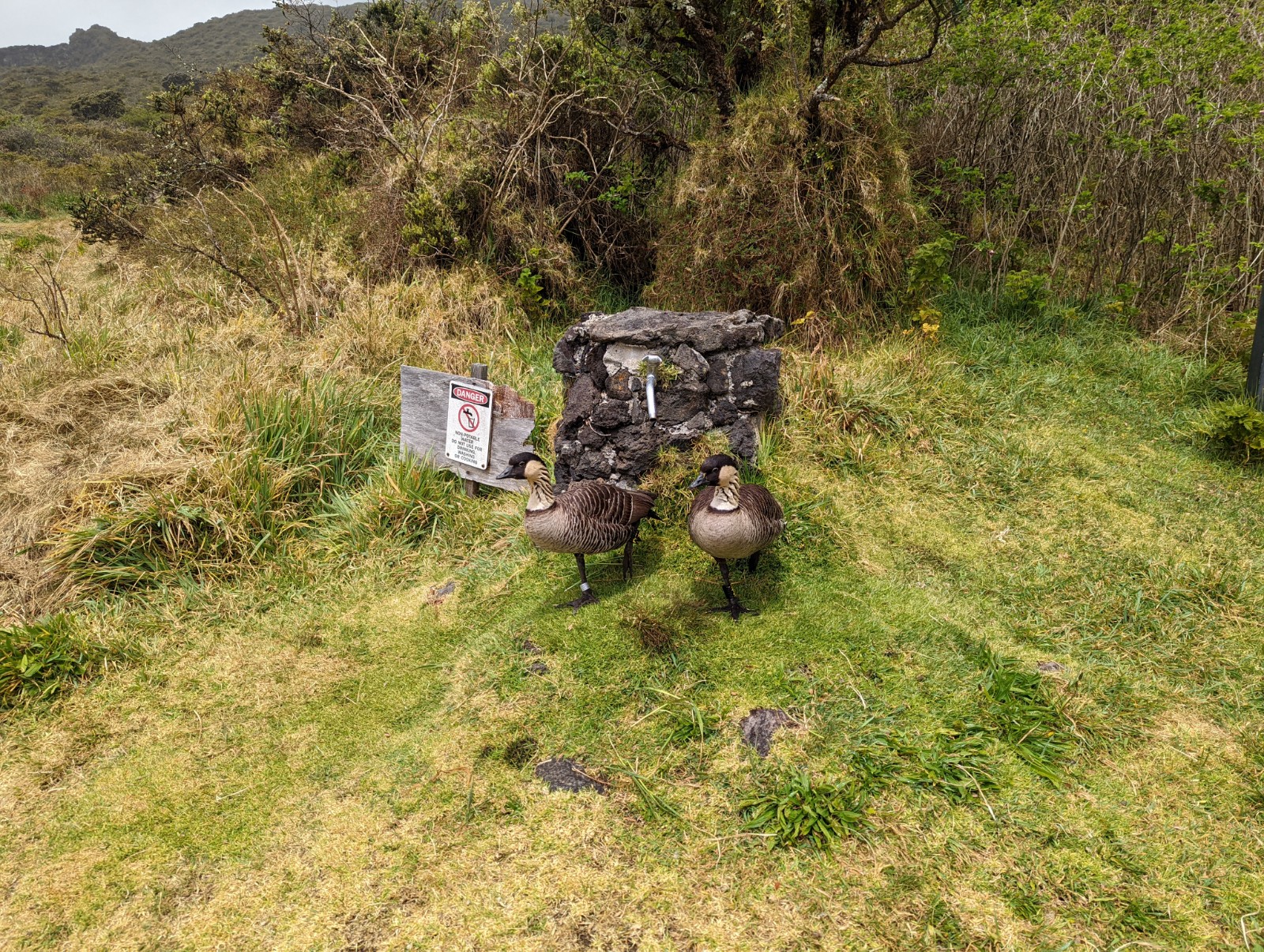
It was here that I had my only "negative" wildlife encounter. See that faucet behind those honking idiots? That's the water source at Paliku. This (what I presume to be) husband and wife pair were extremely comfortable standing right goddamn there and they were not at all interested in my explanation that I needed water, as you will see.
I don't know if the raised back foot is the bird version of giving the bird. But I now realize I misunderstood them: I thought they were guarding the water from me. I now realize they were warning me in vain not to go down Kaupo Gap Trail...
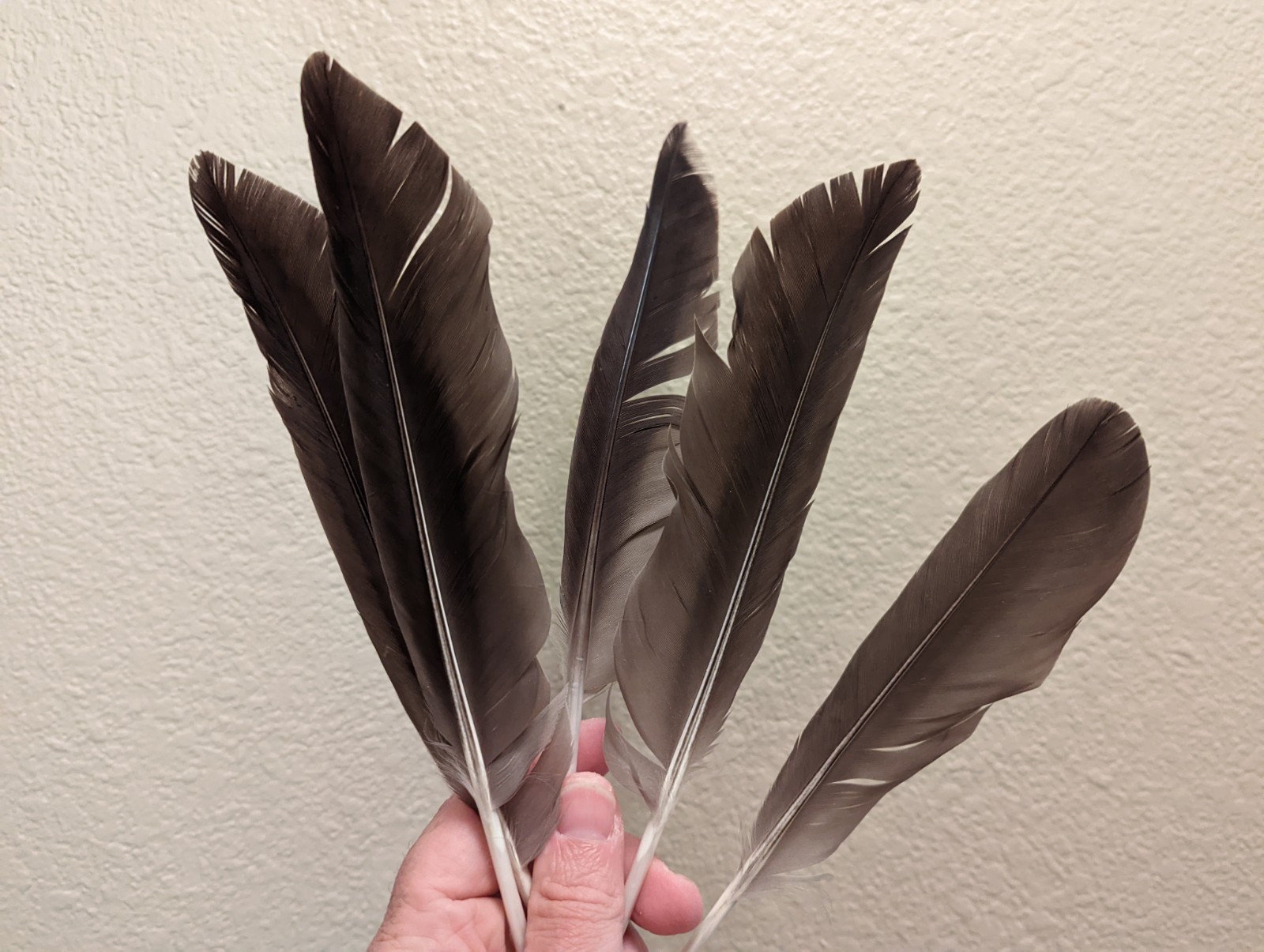
Since they wouldn't move I plucked those silly bastids to show em what's what. Kidding! The nenes were gone when I came back and there were nene feathers actually littering the ground around the Paliku shelter.
The Volcano Part 2: Paliku to the Ocean via Kaupo Gap Trail
Life-savers. Whowever did this, park rangers, local hikers, the demigod Maui, thank you.
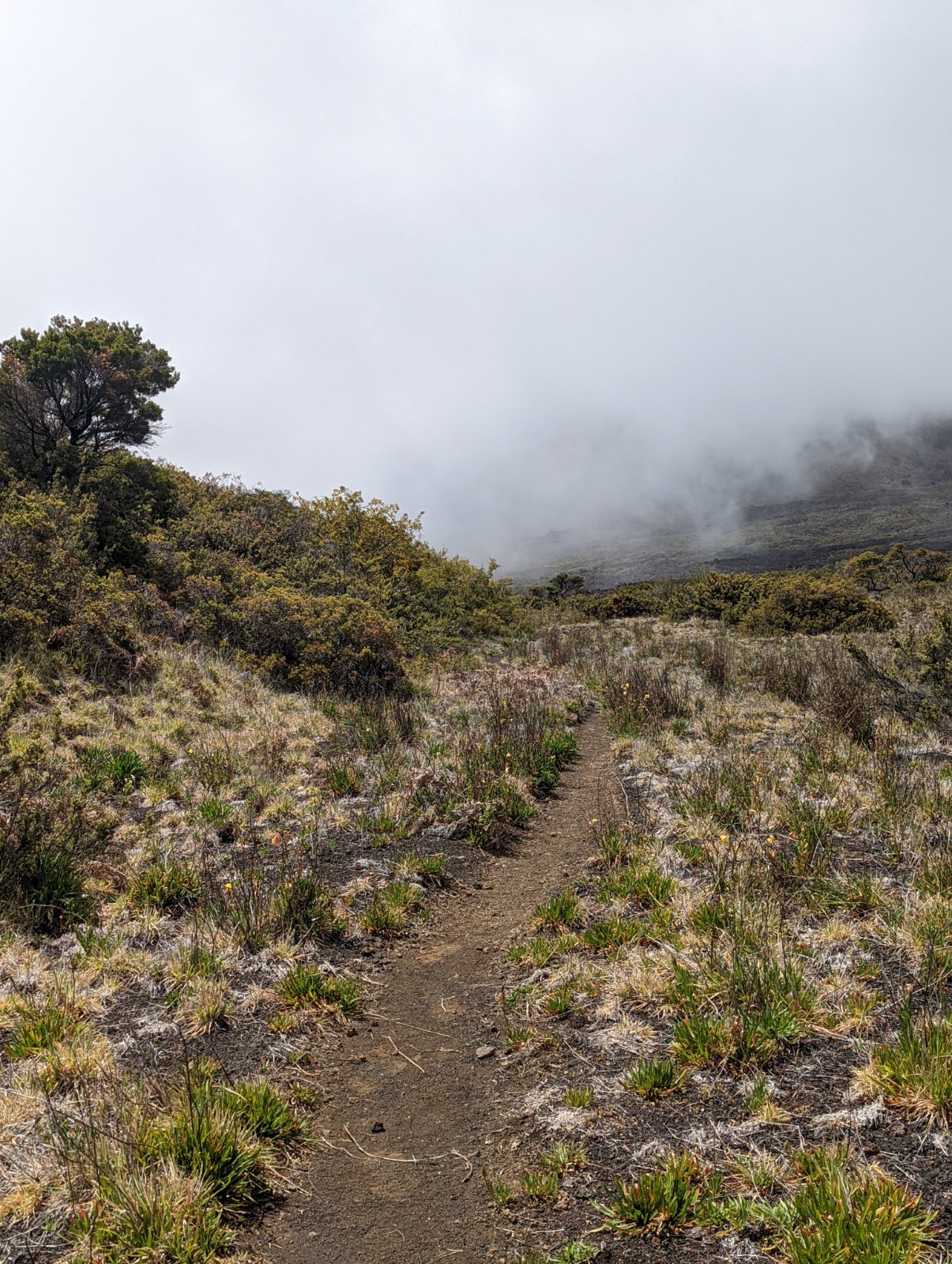
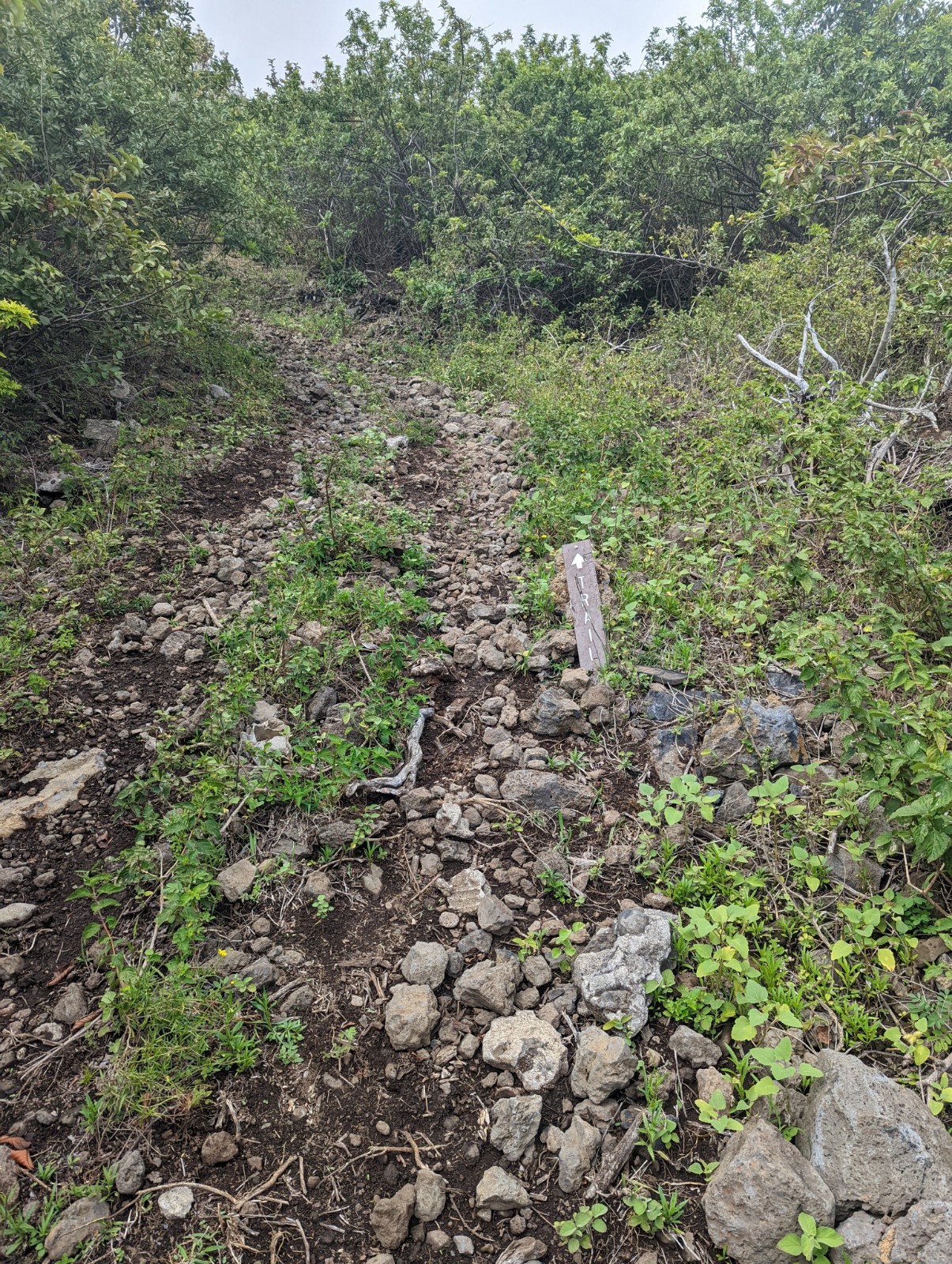
Notes on trail conditions on Kaupo Gap Trail as of 3/21/2022: Heading down, the pink ribbons begin literally exactly at the intersection with Sliding Sands and the Paliku Spur. FOLLOW THE PINK FLAGS. Without those, this trail would be completely un-navigable. I studied others' videos, text descriptions, satellite images, etc. Once I was on the actual trail, I referred to that only once - the pink flags were far and away the most useful navigation tool. I never counted more than 120 paces between flags, usually fewer than 100. There were occasionally flags of other colors too, moreso near the top, but I don't know what they mean and ignored them. The flags continue onto the Kaupo Ranch easement part of the trail and I only got lost once, at the very end (more below.)
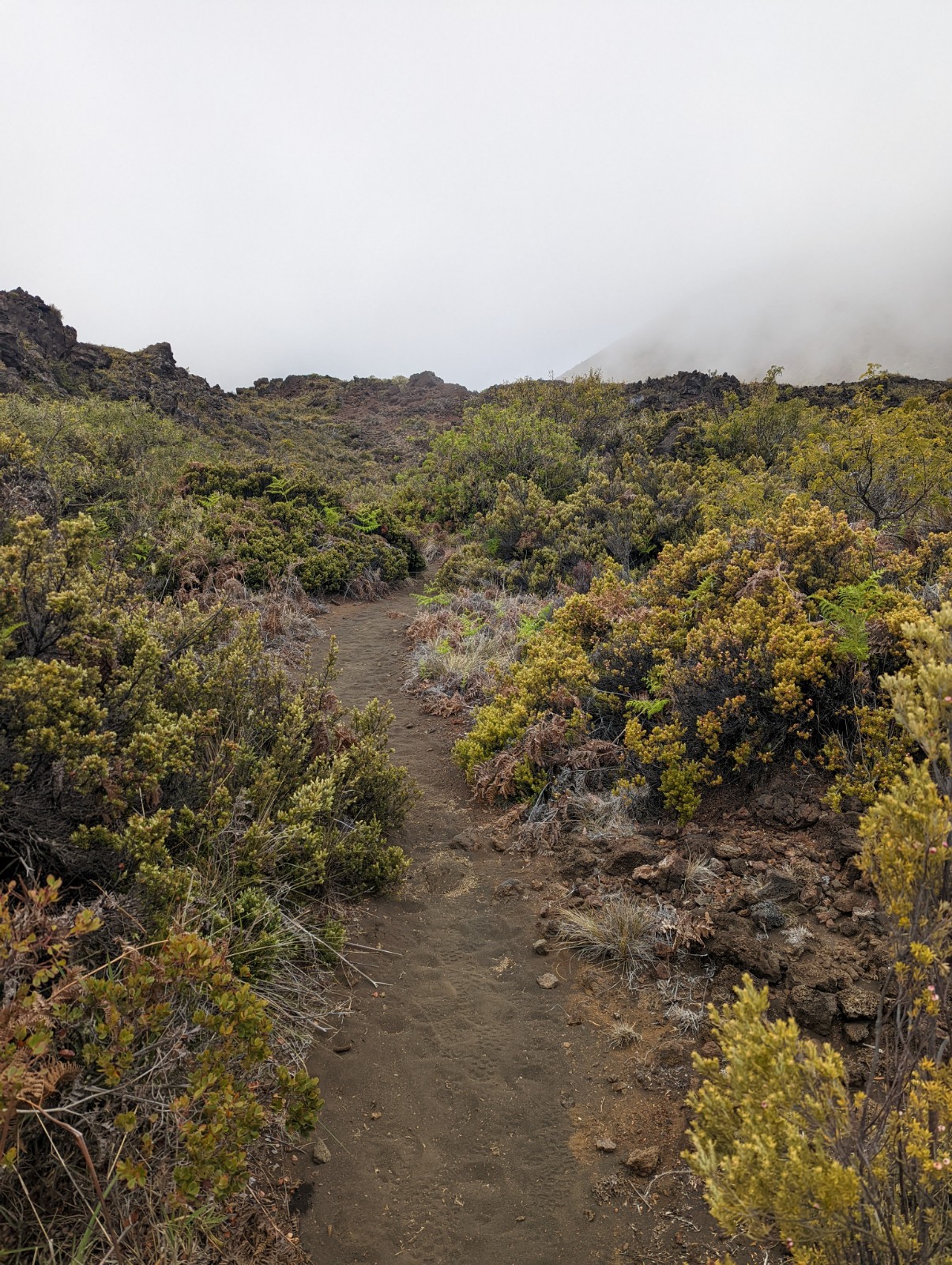
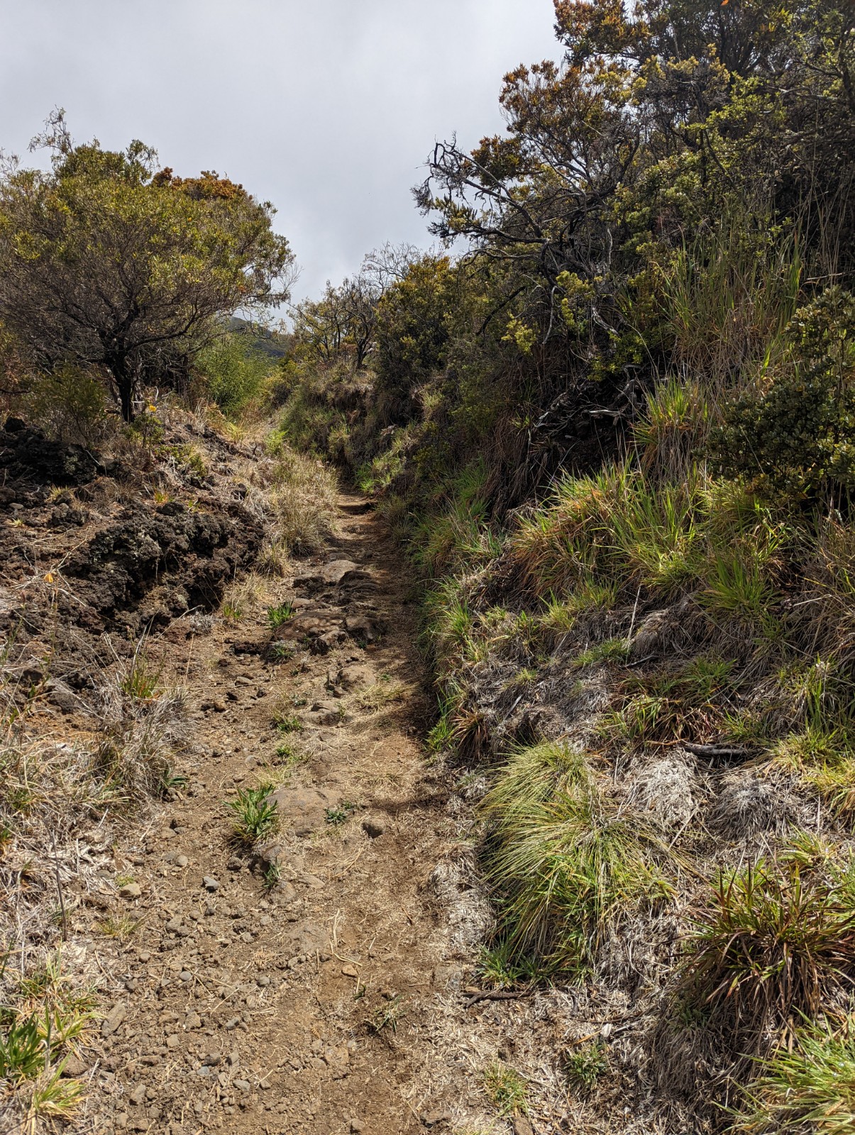
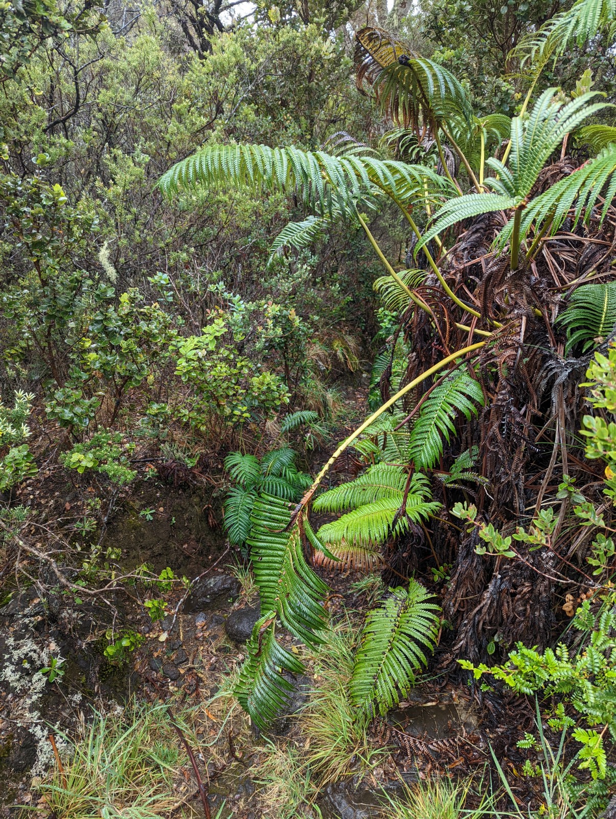
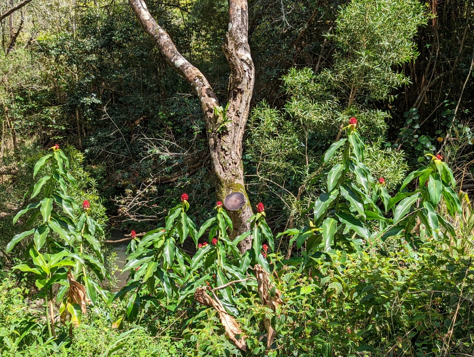
Trail conditions in the park section of the trail were as advertised- very overgrown, constantly pushing branches out of your face, grass wrapping around/sticks scratching at your ankles. Furthermore you usually can't see where you're stepping and the ground drops away quickly, the grass is slippery, and there are unseen lava rocks rolling around underneath all that vegetation. Plus I was in clouds pretty much the whole time so whether it was actively misting on me or not, I was soaking wet the whole time from water flowing onto me from the vegetation. It was warm enough that it was refreshing rather than chilling, but still - I made a point of trying to accept that these would be the conditions and I think that helped psychologically. I'm sympathetic with the NPS trying to mark the trail since they don't have many tropical parks and the usual system of trail marking is quickly overwhelmed (though I checked online discussions about Virgin Islands National Park in the Caribbean and they don't seem to have the same problem.
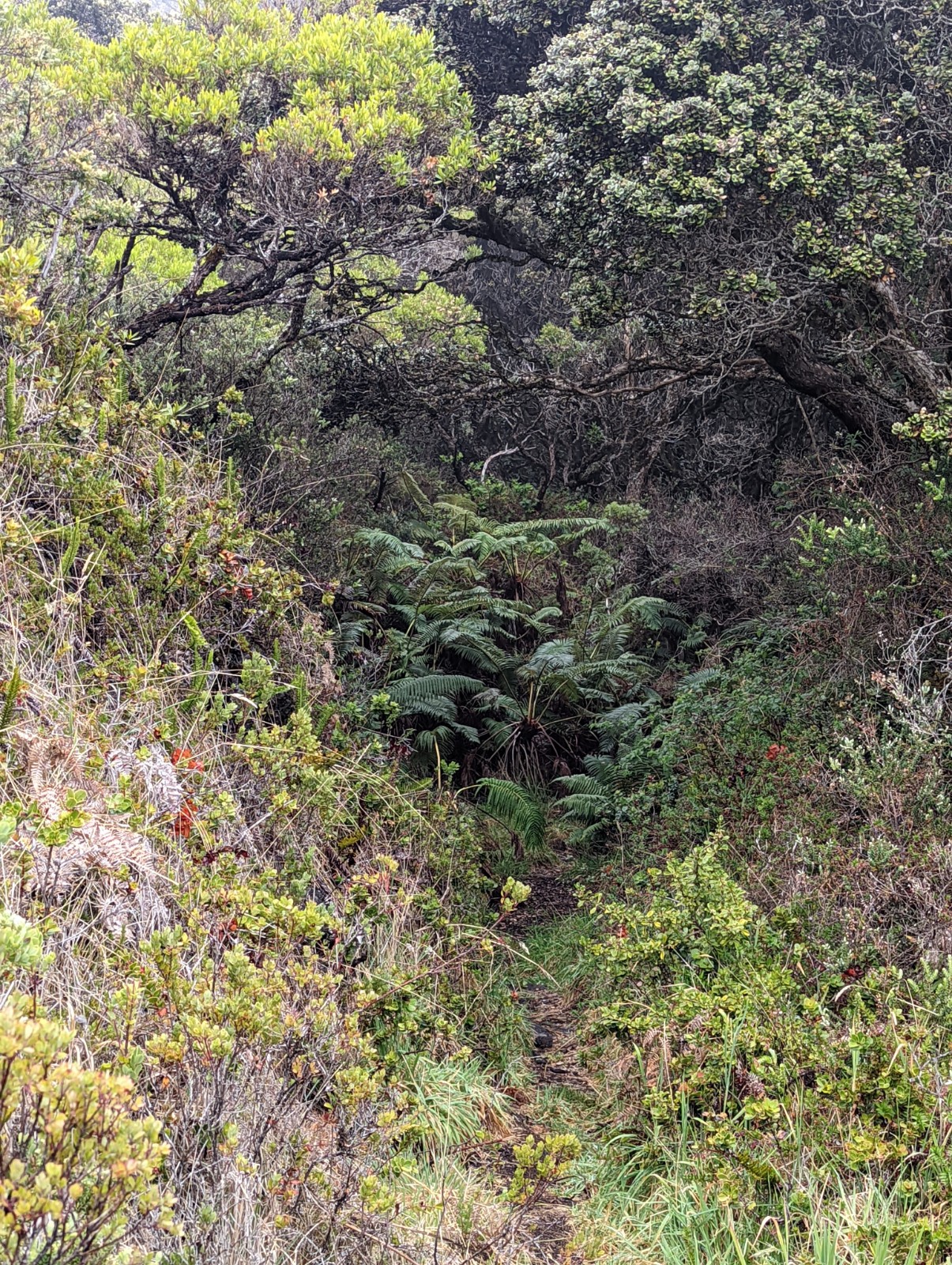
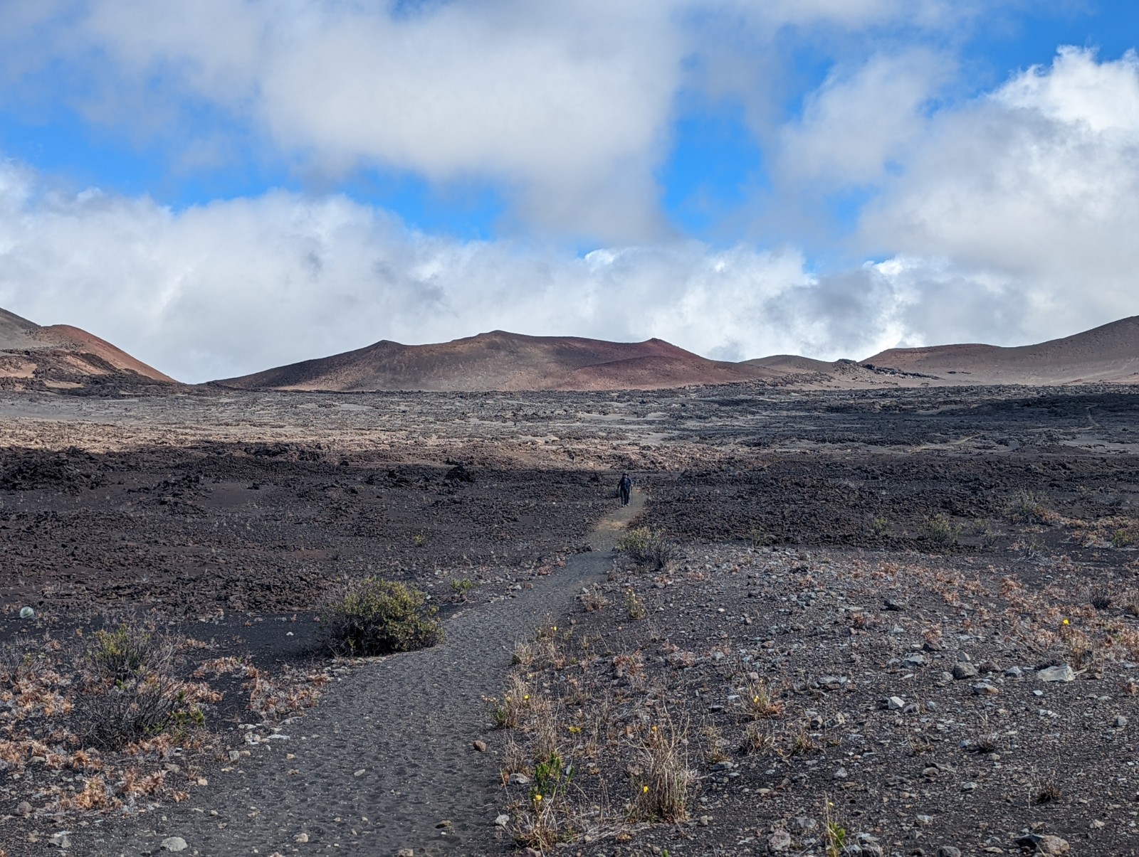
My apologies for not having more pictures of the rainforest. It was a combination of wanting to get through it, and my phone malfunctioning when I had it on battery-saver mode. You can get an idea because above, you are looking directly down the trail. See it? Me neither. And three miles of that. (Don't believe me? See here also.)

It was here that I accidentally walked into a Tang landscape painting. I kind of expected this in China (see Ermei-Shan section here) but not so much on Maui.


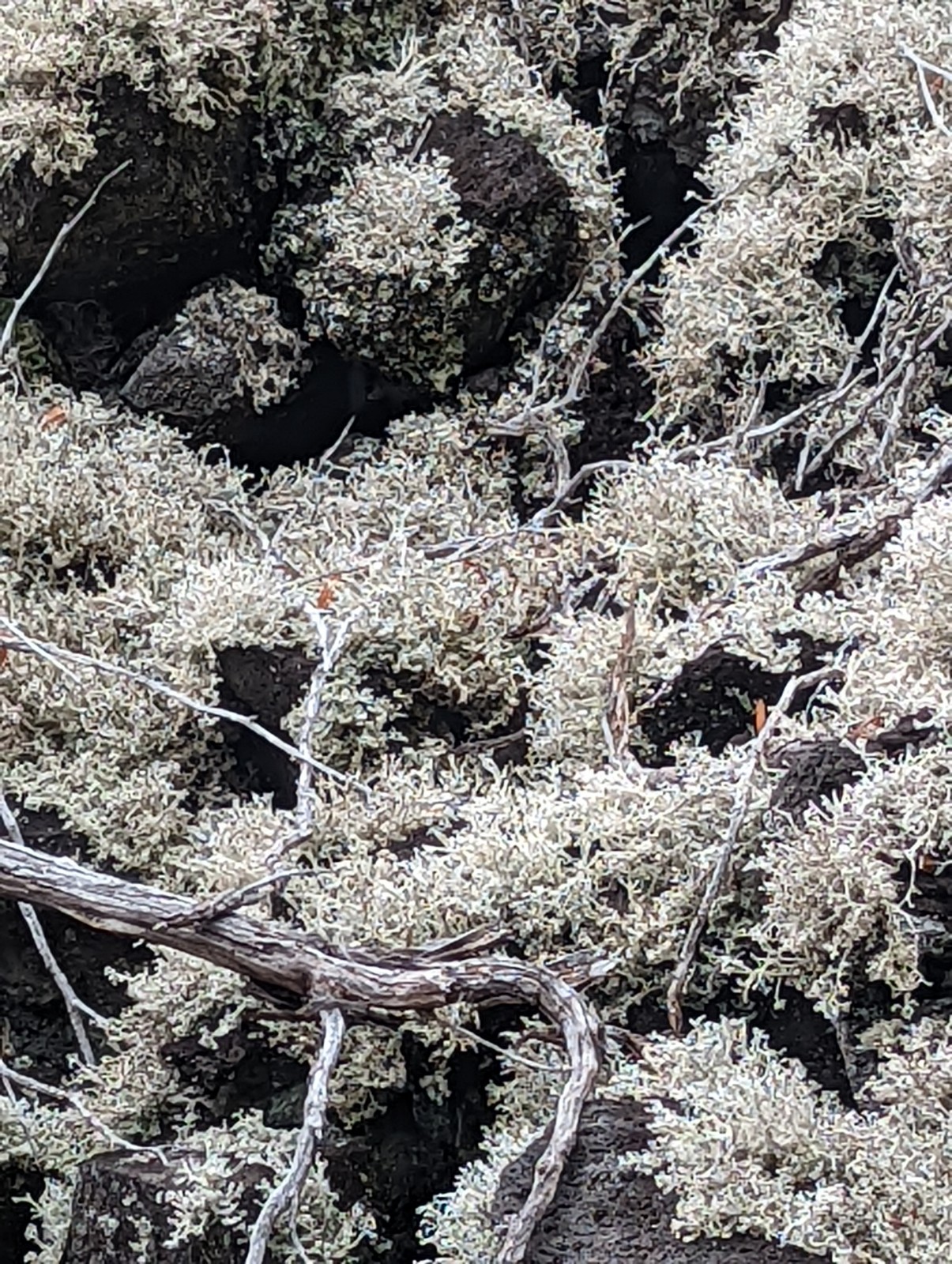
This is a very bushy fuzzy lichen I saw growing on jumbles of otherwise bare basalt in a number of places in the rainforest. Apparently common and a widespread genus, Stereocaulon vulcani is often found in Hawai'i as a pioneer species on bare lava rock. The image doesn't capture how white it was against the black and green of the volcanic rainforest.
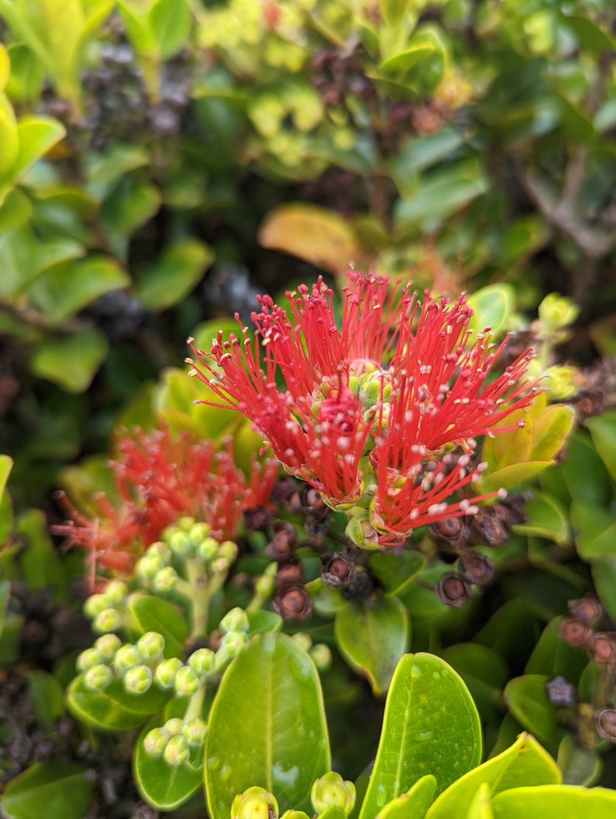
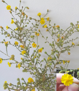
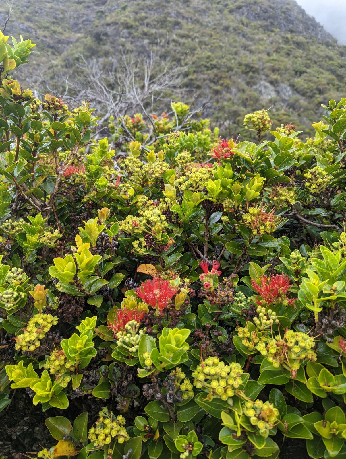
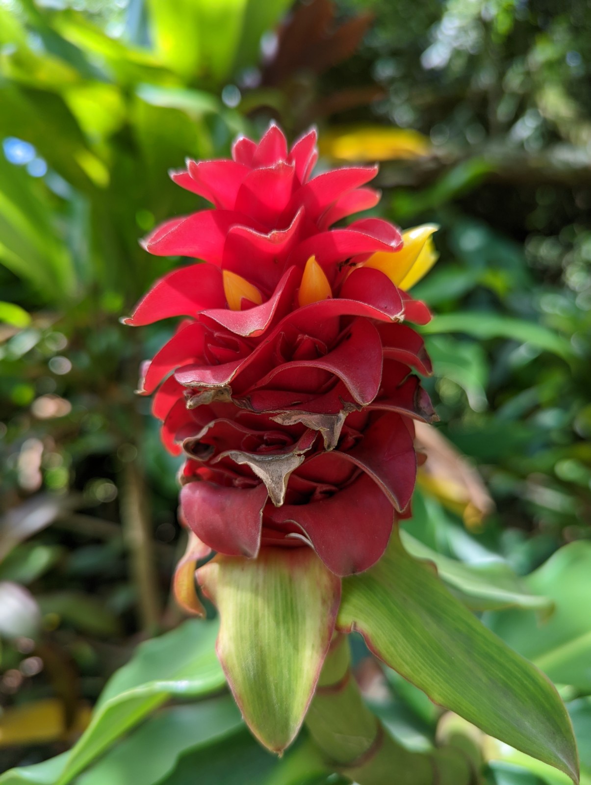
'Ohi'a flowers. I figured they'd be in the myrtle family from their weird "petals" (think of eucalyptus or callistemon flowers.) Nice Hawaiian myth explaining their origin about separated lovers and Pelee's jealousy.
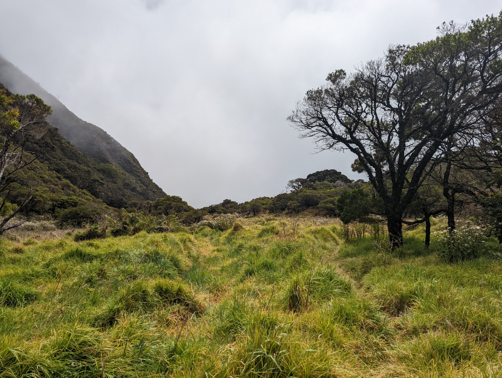
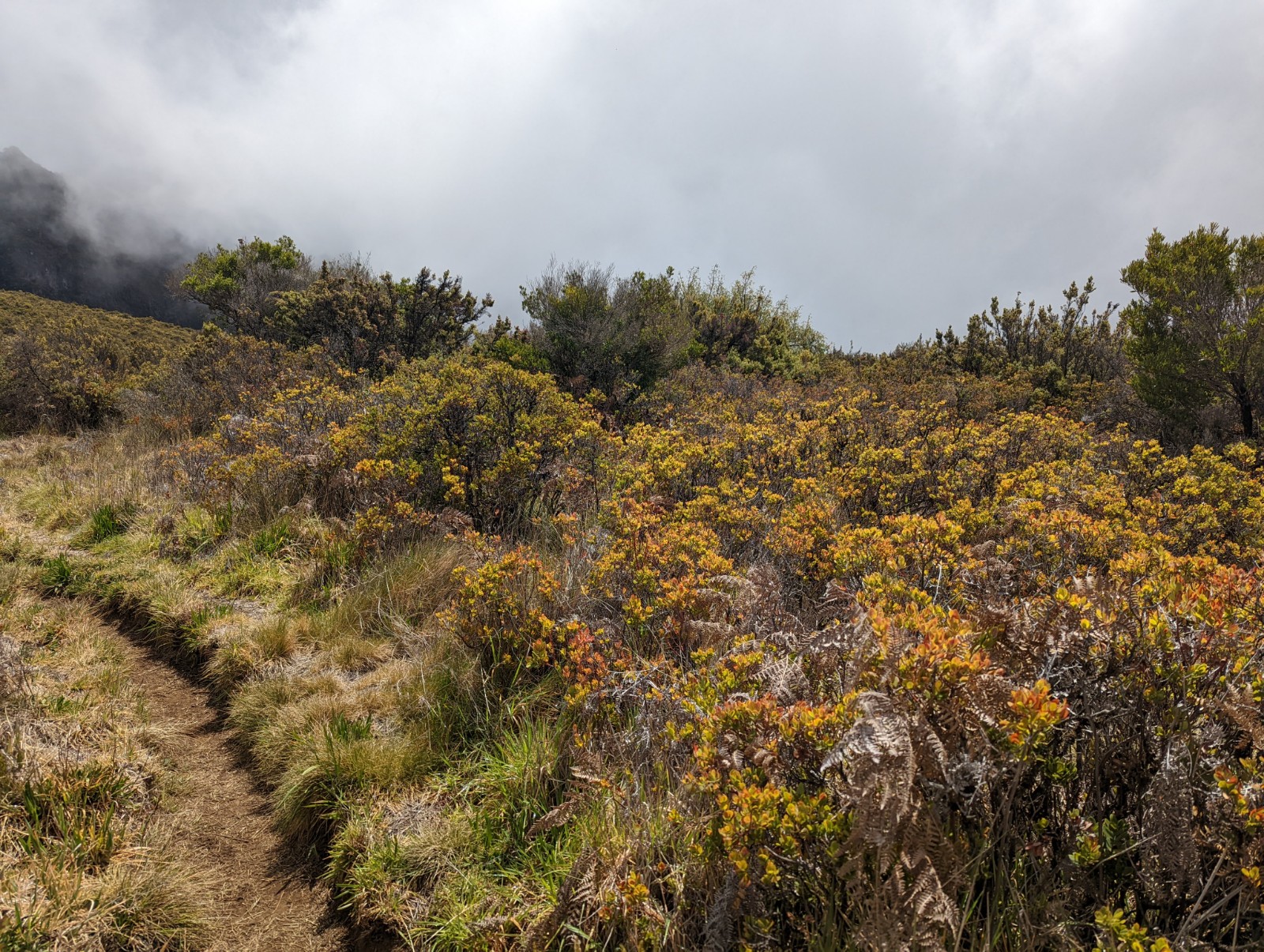
These open grassy areas would have been impossible to navigate without the pink ribbons. Hashers would call these "natural checks".
Above: once again, you're looking directly down the trail.
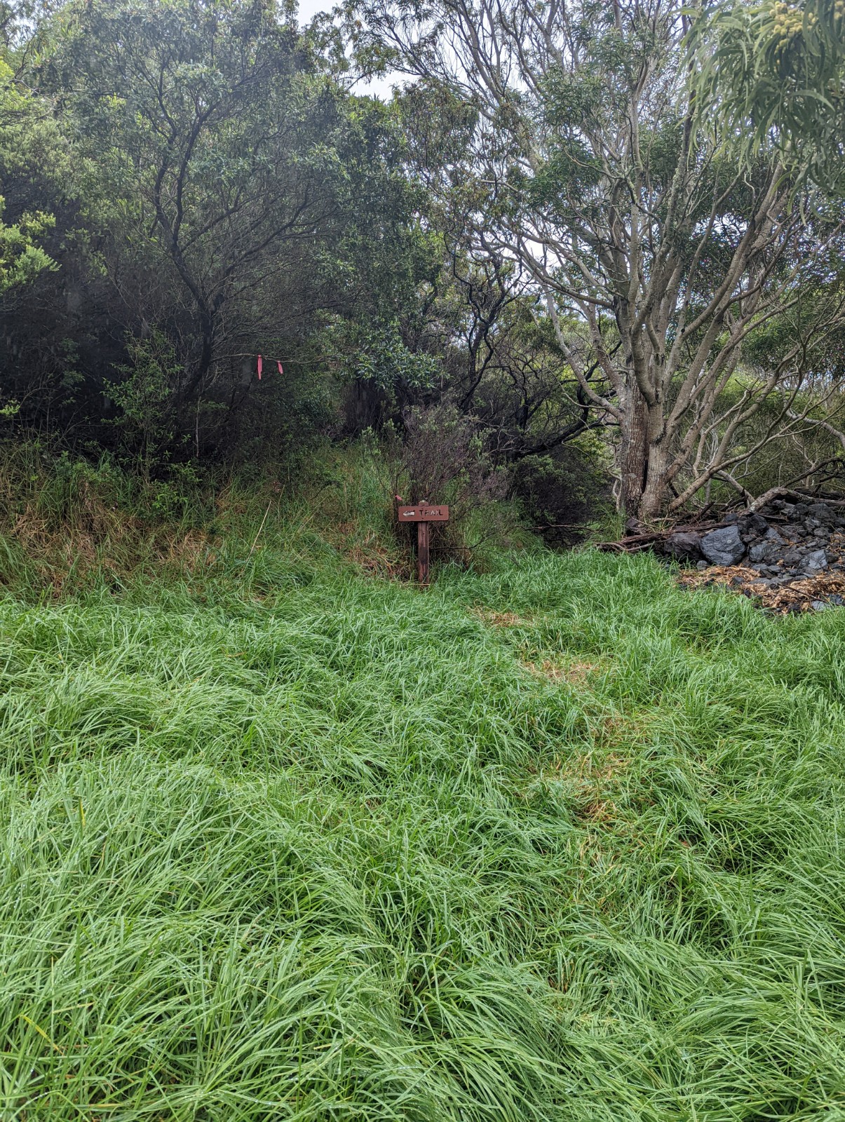
This was literally the first actual trail sign I'd seen in two hours.
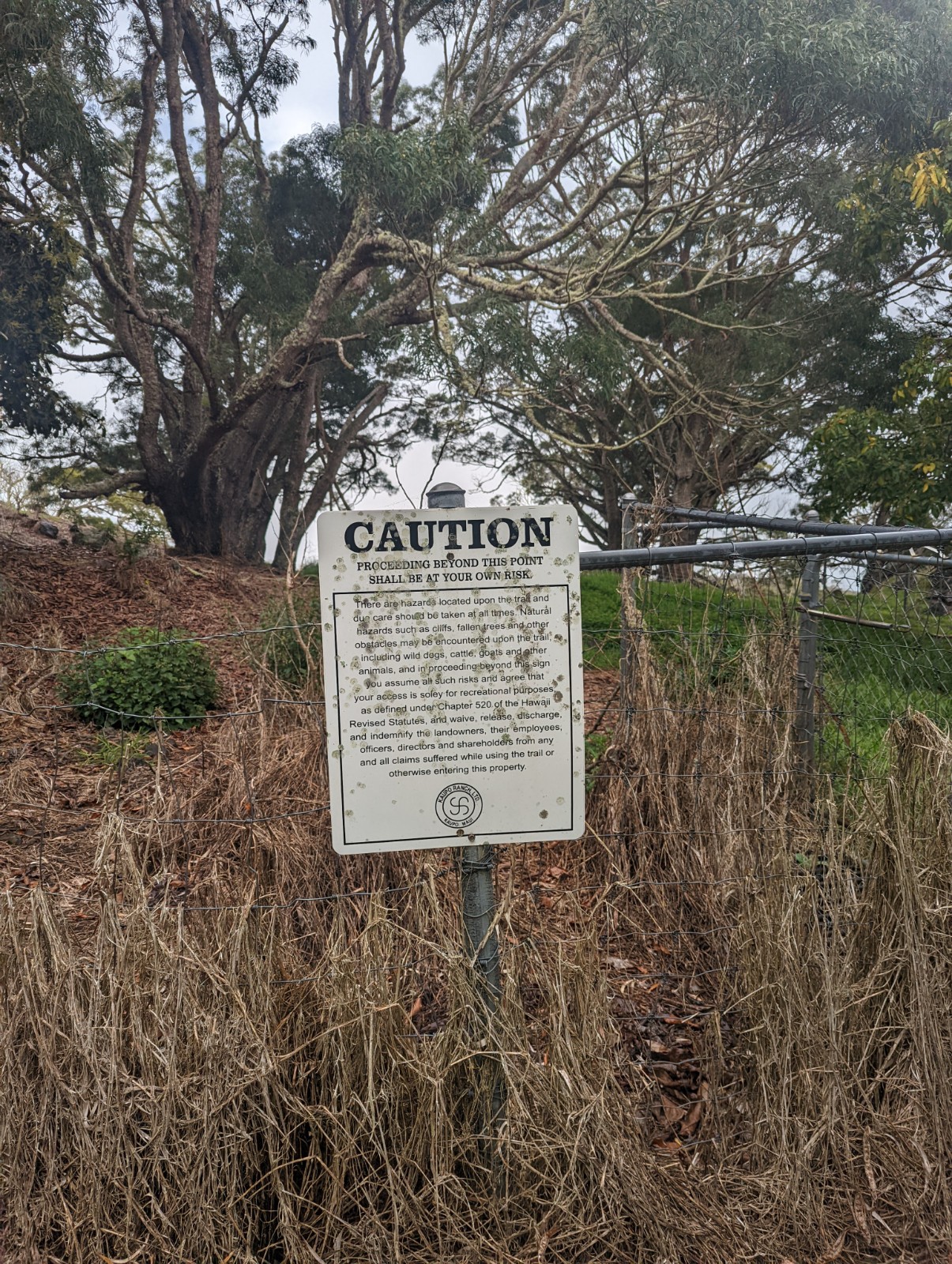
Yes that's really helpful, thanks fuckface
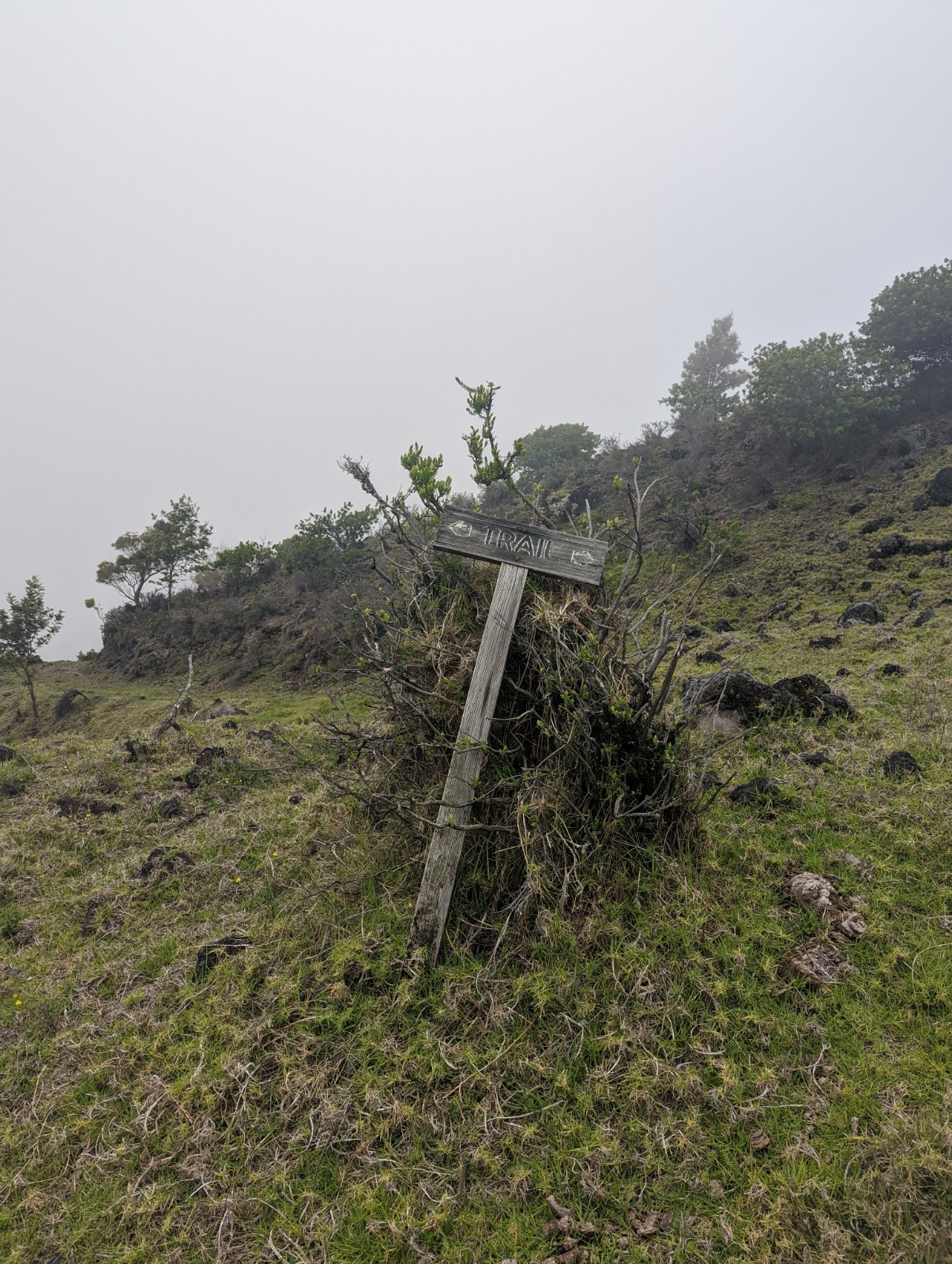
Gradually being swallowed by the forest. This sign has looked like this in online images for years. By this point I started thinking I'd somehow entered Bradbury's Venus and wished for a sun-dome, or maybe the far-future plant-choked Earth imagined by Aldiss in Hothouse.

Yeah great, that's super!
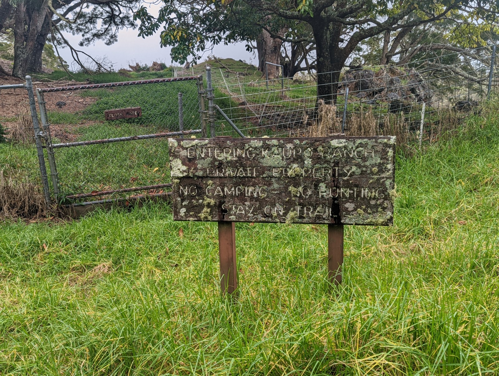
Helpful as always. This is I think the Park-ranch boundary. I saw a large pheasant right about here; I had heard many birds on trail but not seen a one at this point, since the nene posse at Paliku. I was thrilled to be entering open terrain but the lesson of Kaupo Gap is it always gets worse, and is worse than you thought it would be. If you're thinking I might have been having less fun by this point, you're not wrong.
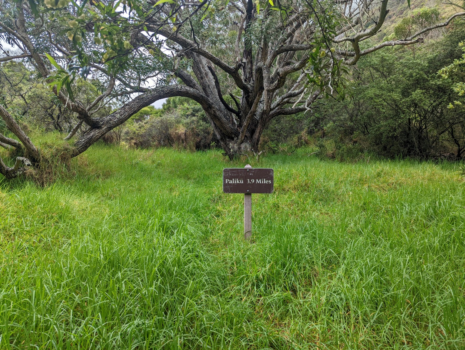
Mostly taking pictures so future Kaupo Gap hikers recognize the signs when they get to them, as I did (signs are in order as I was descending.) I saw no feral pigs, no feral dogs. I heard dogs barking at one point but not at me.
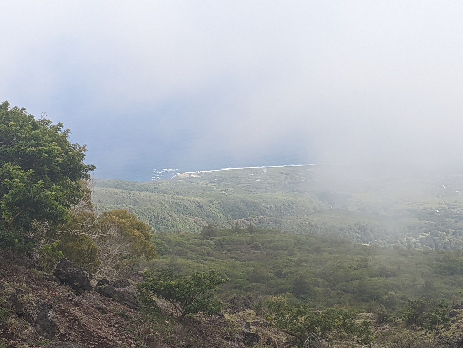
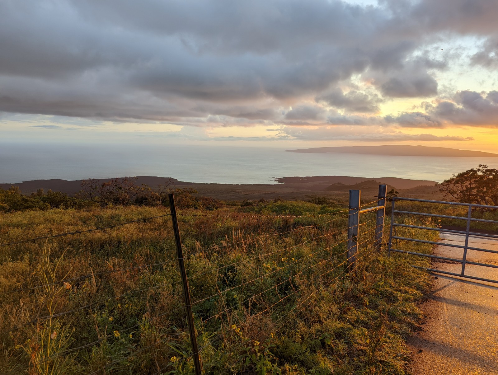
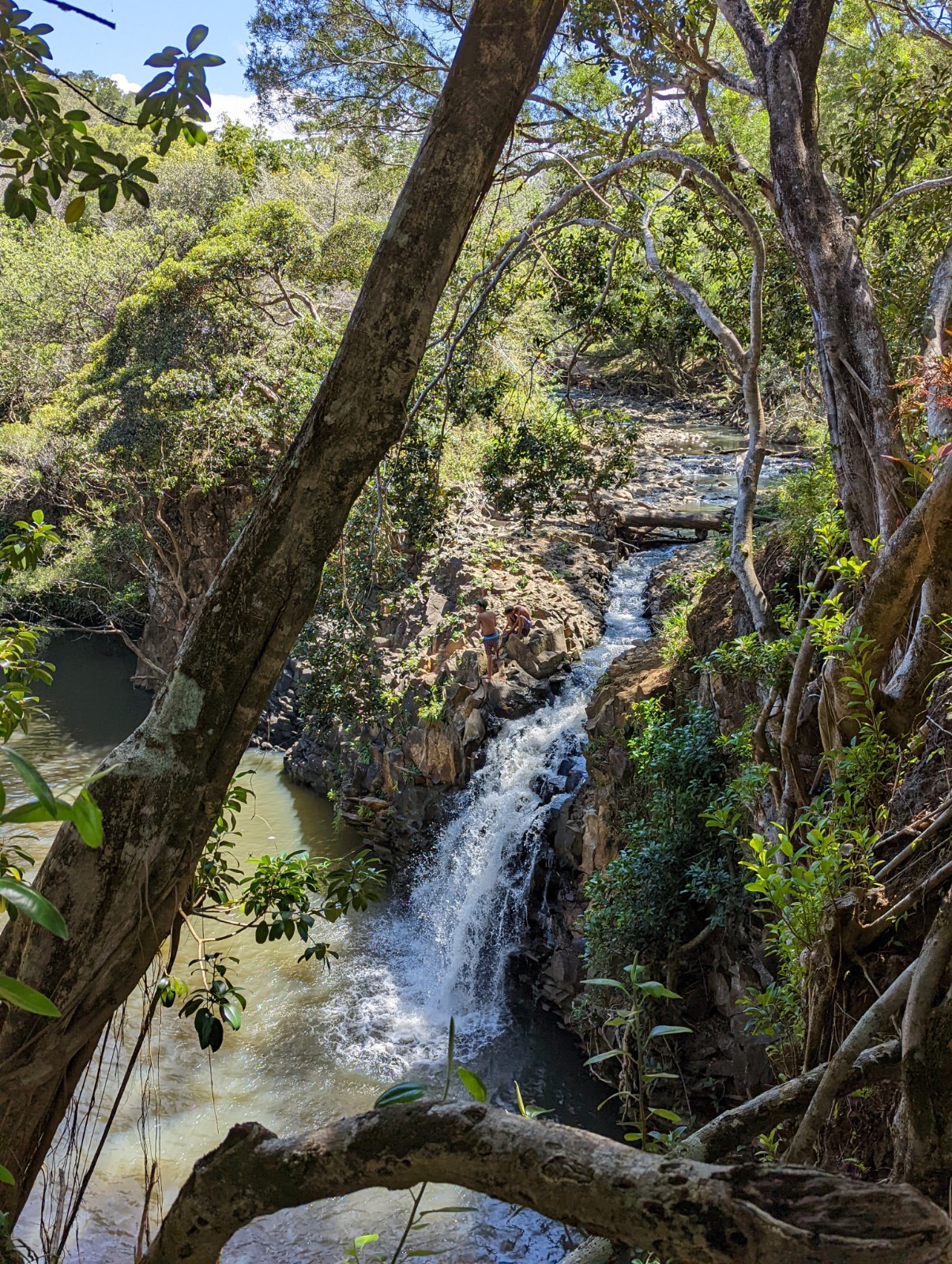
Above: this was the first time I saw the ocean since I left the summit building, about 3,000'.
At the end of the video above, as regards whiskey, I was inspired to quote British officer John St. Clair, who was in charge of building roads across the Pennsylvania Appalachians during the Seven Years War. And I stand behind that.
Typical of the upper ranch area (except for the sign) - actually the footing here was better than I expected. Imagine the worst coarse, rolly round gravel you can think of, on a steep grade, for miles. Much more annoying than I'd prepared myself for. Near the bottom of the trail, as far as I could tell, there was no trail, and that's where I got lost, in the last 0.3 miles. I think the park service actually should just tell people that there's no trail there, and be prepared to bush-whack - it's quite misleading to say there is a trail here.

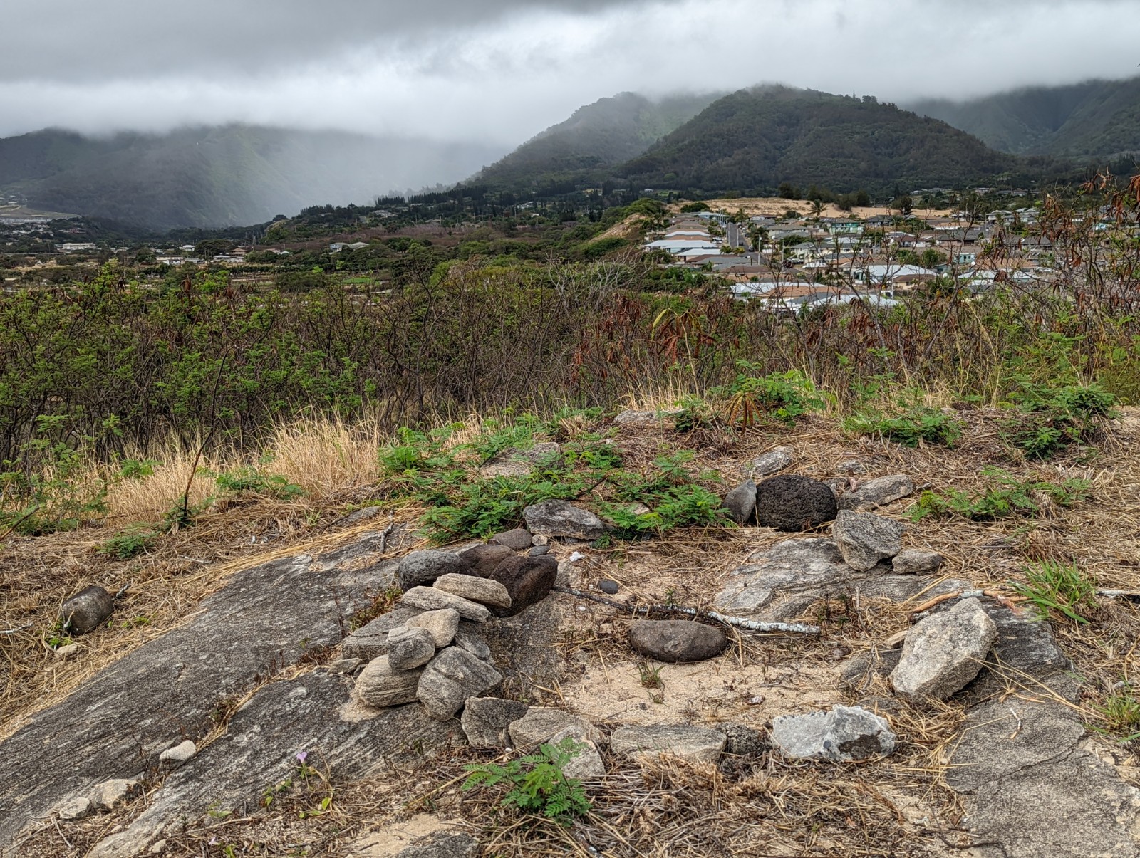
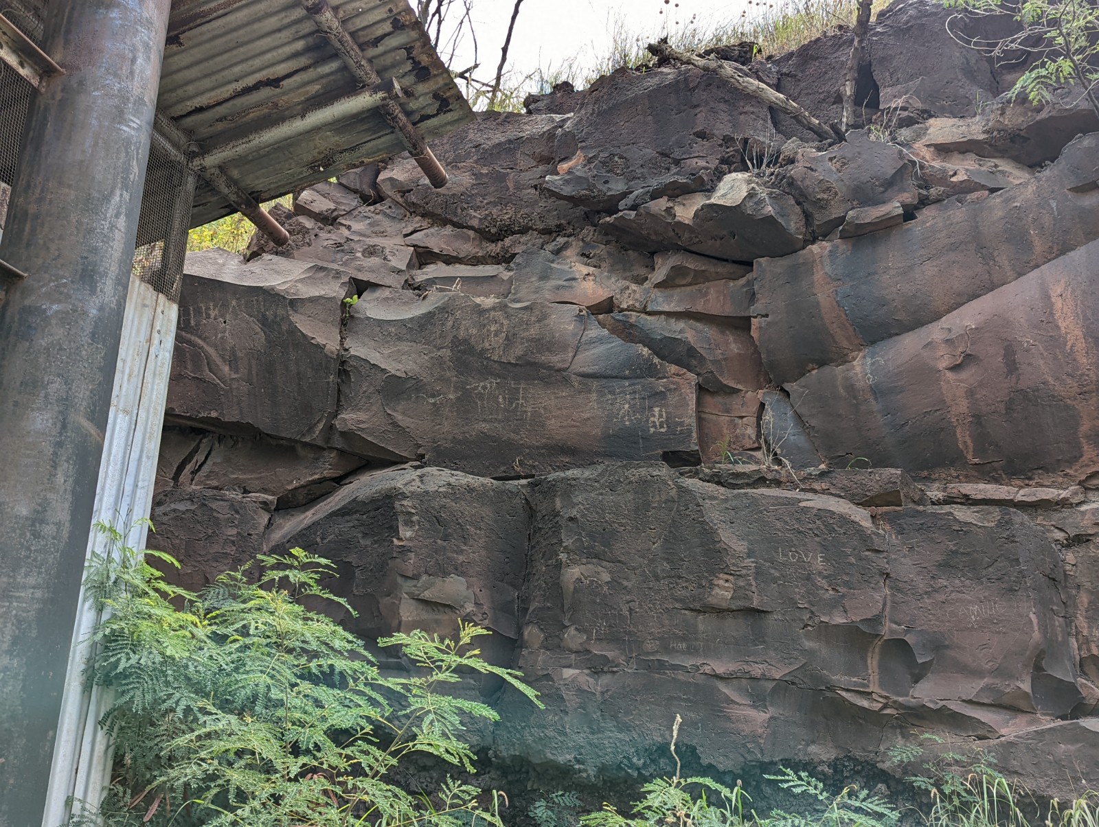
This is Popoiwi Heiau (temple), an old Hawaiian temple foundation on private land, just to the east of the road down to Piilani Highway. This area - the south slope of the volcano that Kaupo Ranch is on - was called "Kahiki Nui" (Great Tahiti), though Kahiki was used as the name for any foreign land, not just Tahiti. That said, this part of the island does face south toward Tahiti - the channel between Lanai and Kaho'olawe is called Kealaikahiki (the road to Tahiti) likely for this reason.
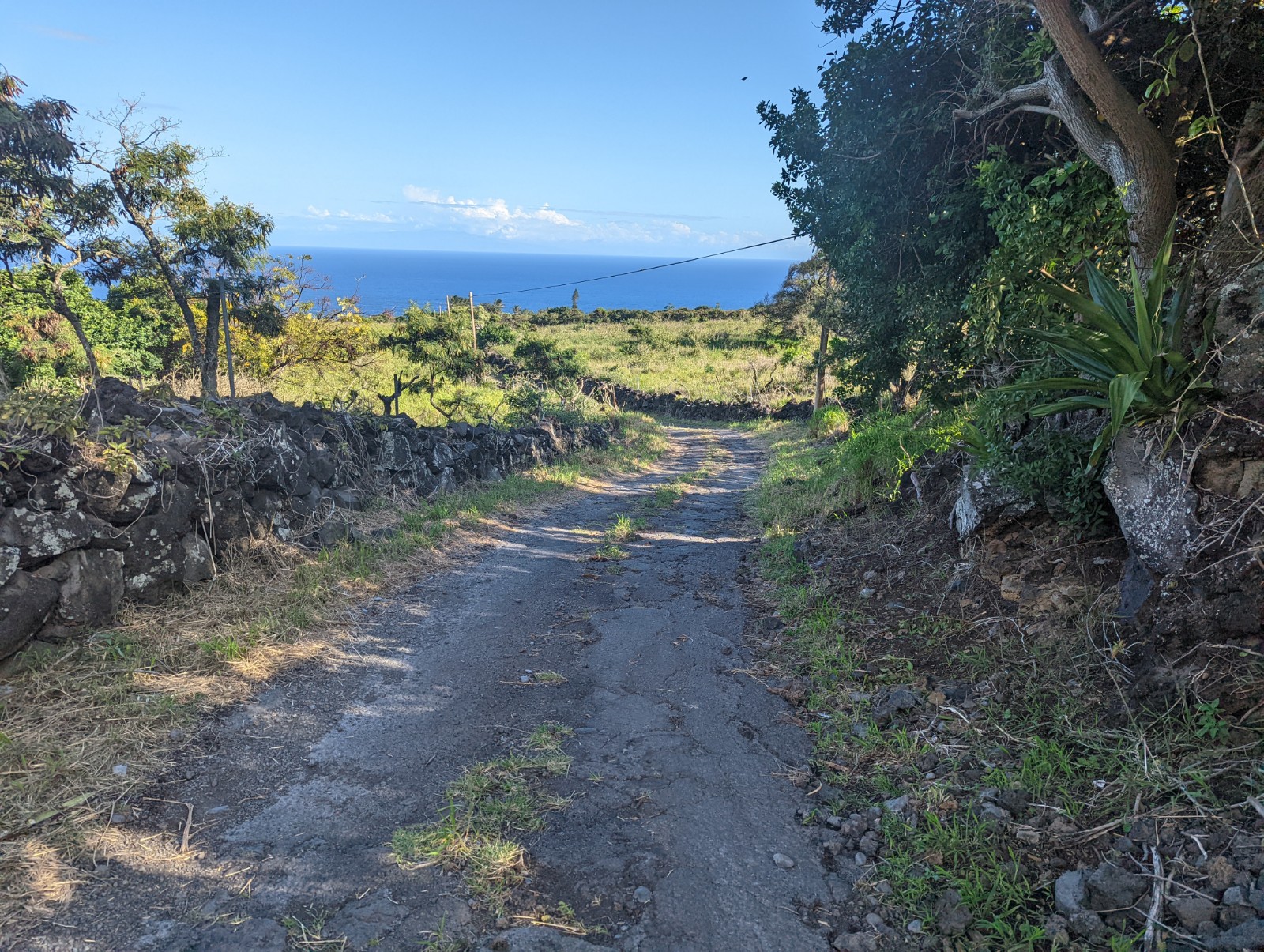
The road down from the ranch to Piilani Highway. NOTE, the Kaupo Store appears to be closed indefinitely. For the record, on a day where I hiked about half the time in cool misty clouds I got to the bottom on about 4 L of water, but I was still thirsty.
It is self-evident that Kaupo is the Leesport of Hawaii.
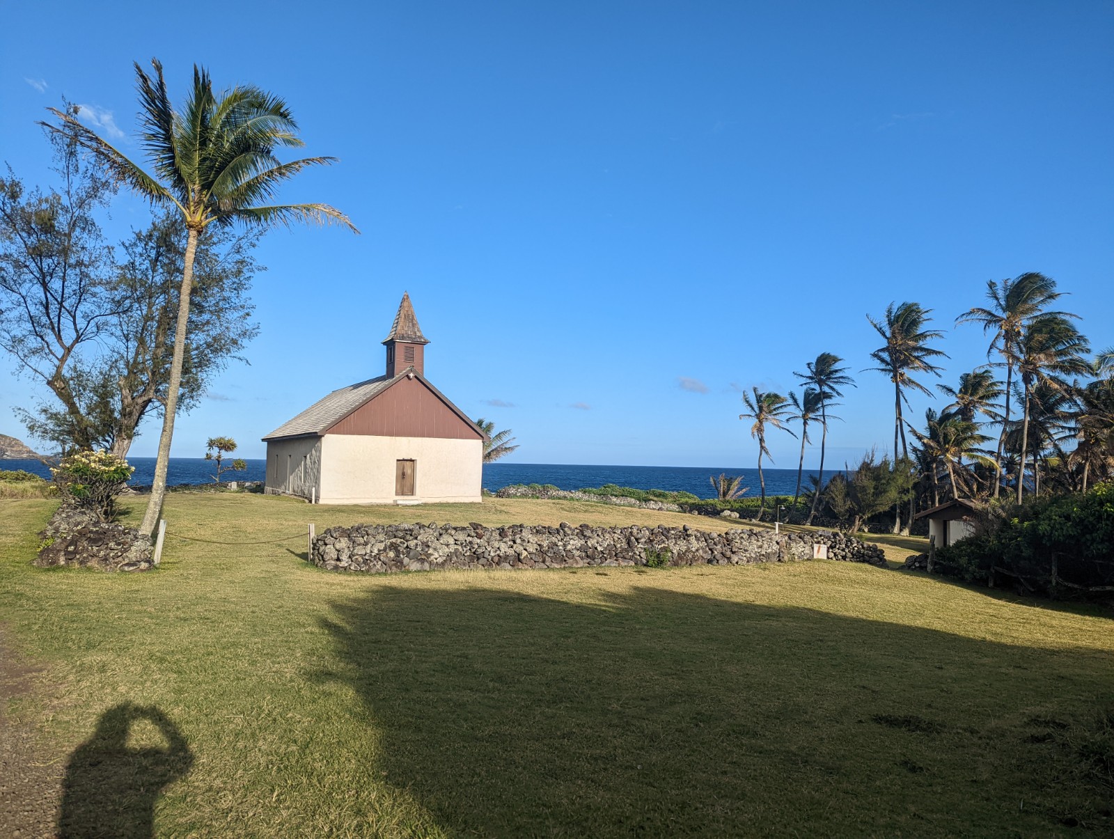
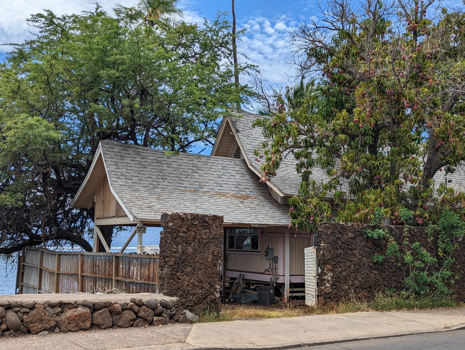
Hui Aloha Church, just before I touched the Pacific.
The proof. Hear the unalloyed joy in my voice.
Above and below: views toward Kaho'olawe from Piilani Highway on the way home.
NON-HALEAKALA STUFF
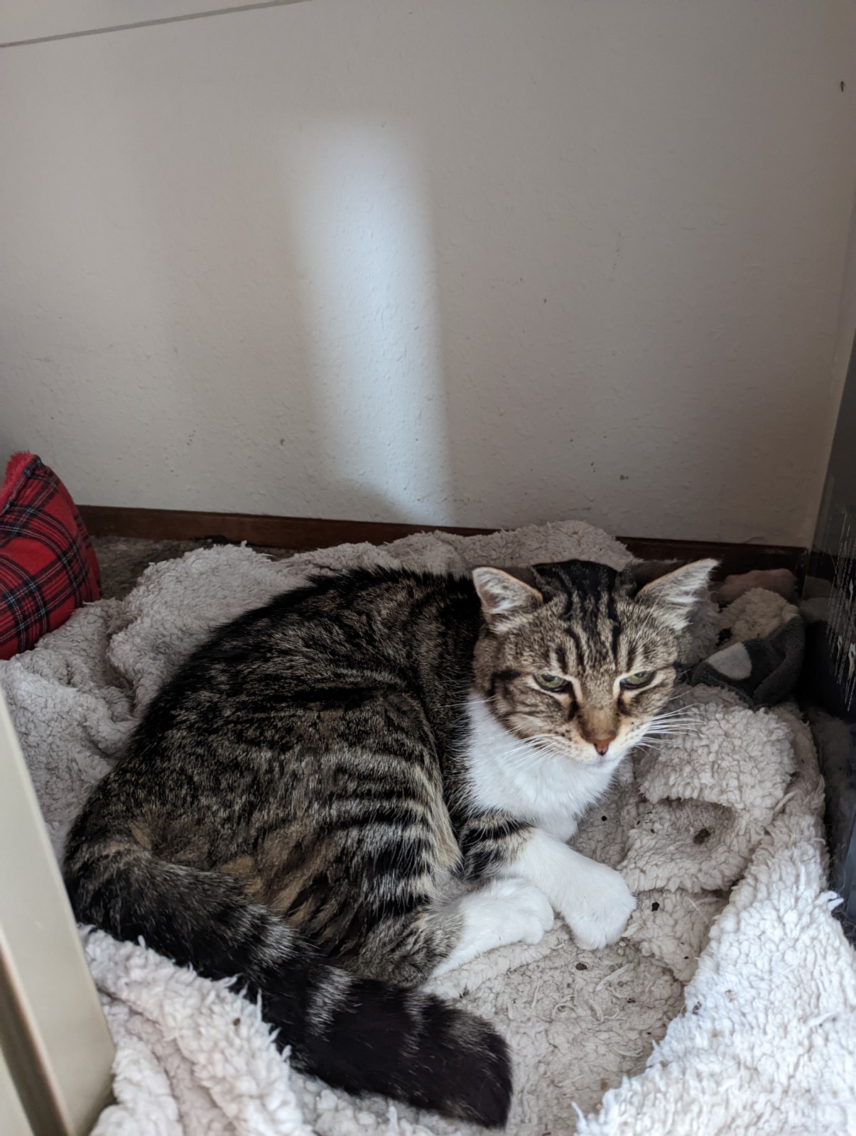
Above: before leaving home, an even dimmer-than-usual view from a clingy cat at the moment he realized he was about to be abandoned for a week. Well let's have a widdle pity party, 1-2-3-AWWWWWW
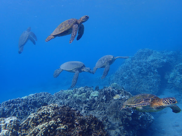
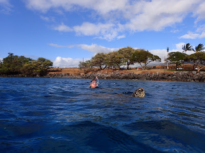
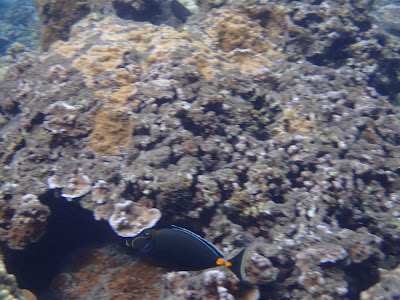
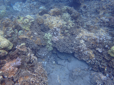
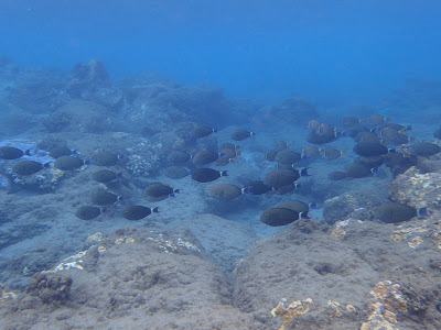
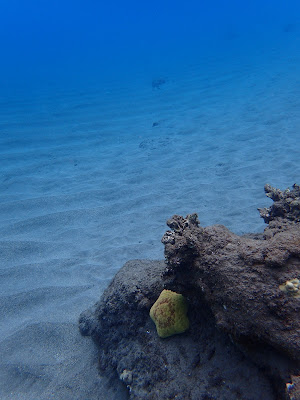
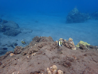
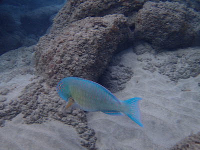
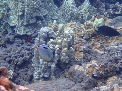
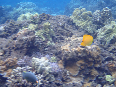
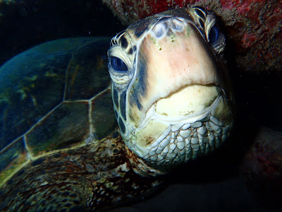
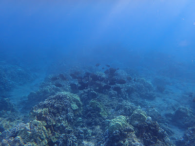
In the Ocean
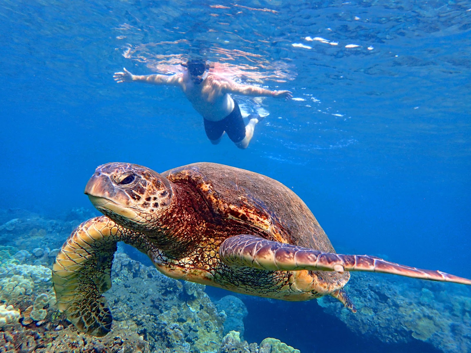

To quote Spinoza: there was turtles all up in this place.


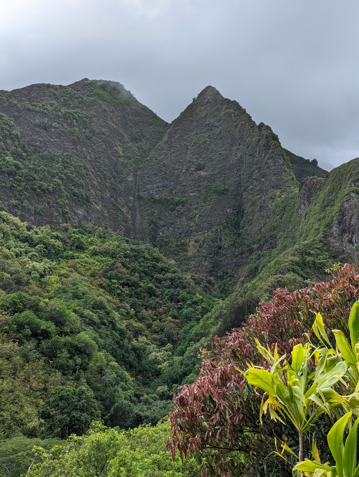
Iao Valley
Maui is really two volcanoes that were once separate islands, but grew together during the last ice age. The older, lower more broken-down one is in the northwest, exactly as you'd expect as the hotspot tracks southeast across the Pacific (now active at Kilauea and underwater at Lo'ihi.) The mountain is called Pu'u Kukui but I never heard people using this name. The windward side is green and beautiful but really such a small area, and it would be easy to destroy it with carelessness. THIS IS WHY YOU SHOULD NOT HIKE THE SECRET TRAIL IN THE IAO VALLEY, unless you want to let everyone know you're an asshole who doesn't care about nature. Seriously. Don't be a dick. (If that's not enough for you - they now patrol it, and they very often catch people, and the fine is steeper than the mountain.)
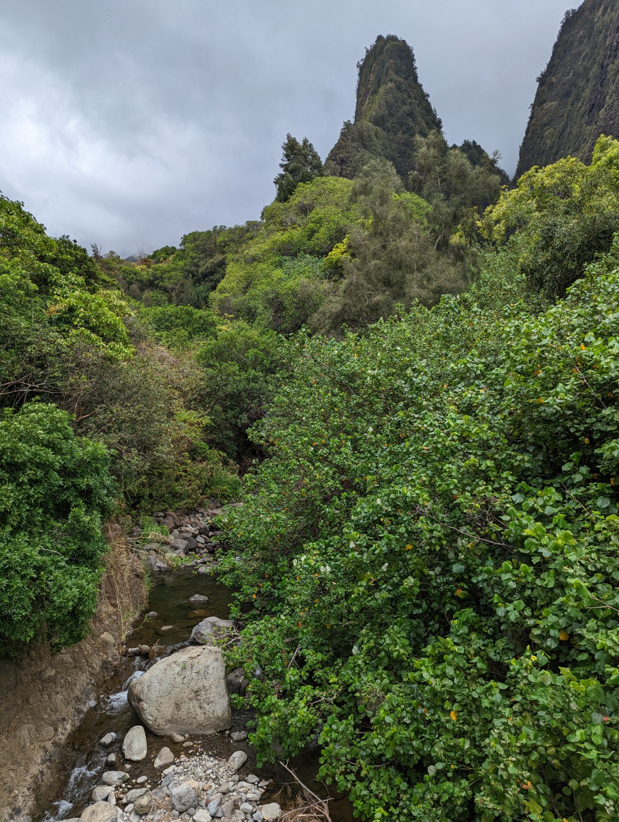
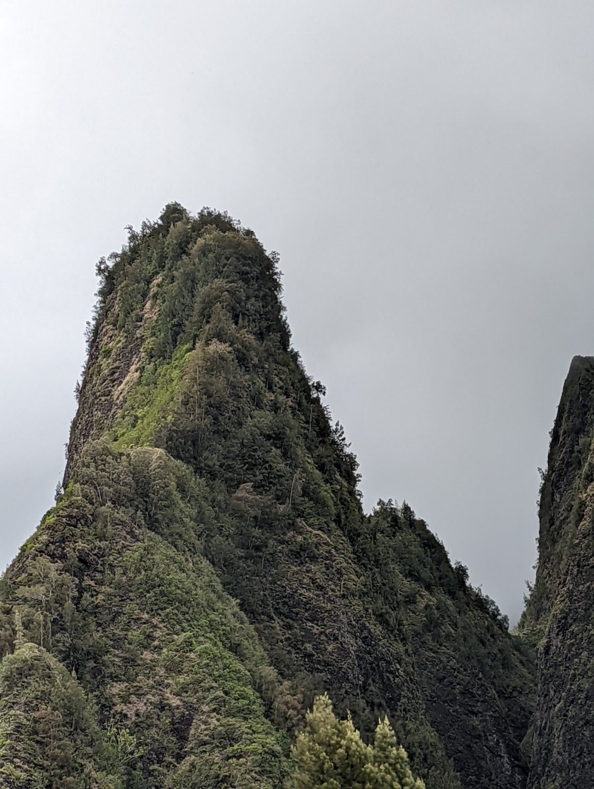
Above: the Iao Needle and Valley, inside the smaller (and older) Pu'u Kukui volcano. Green inside where the clouds hit it, dry on the Lahaina side, where you can see the fog and clouds lingering inside the peaks. Below, a closer view of the Needle. This formation and the forest below it were a place of Kanaloa, the ocean god.
Above: More inside Iao Valley. Below: looking back at the coast. When the warriors came from the Big Island in 1790 this must be where the Maui defenders watched them from, before encountering their first cannons.

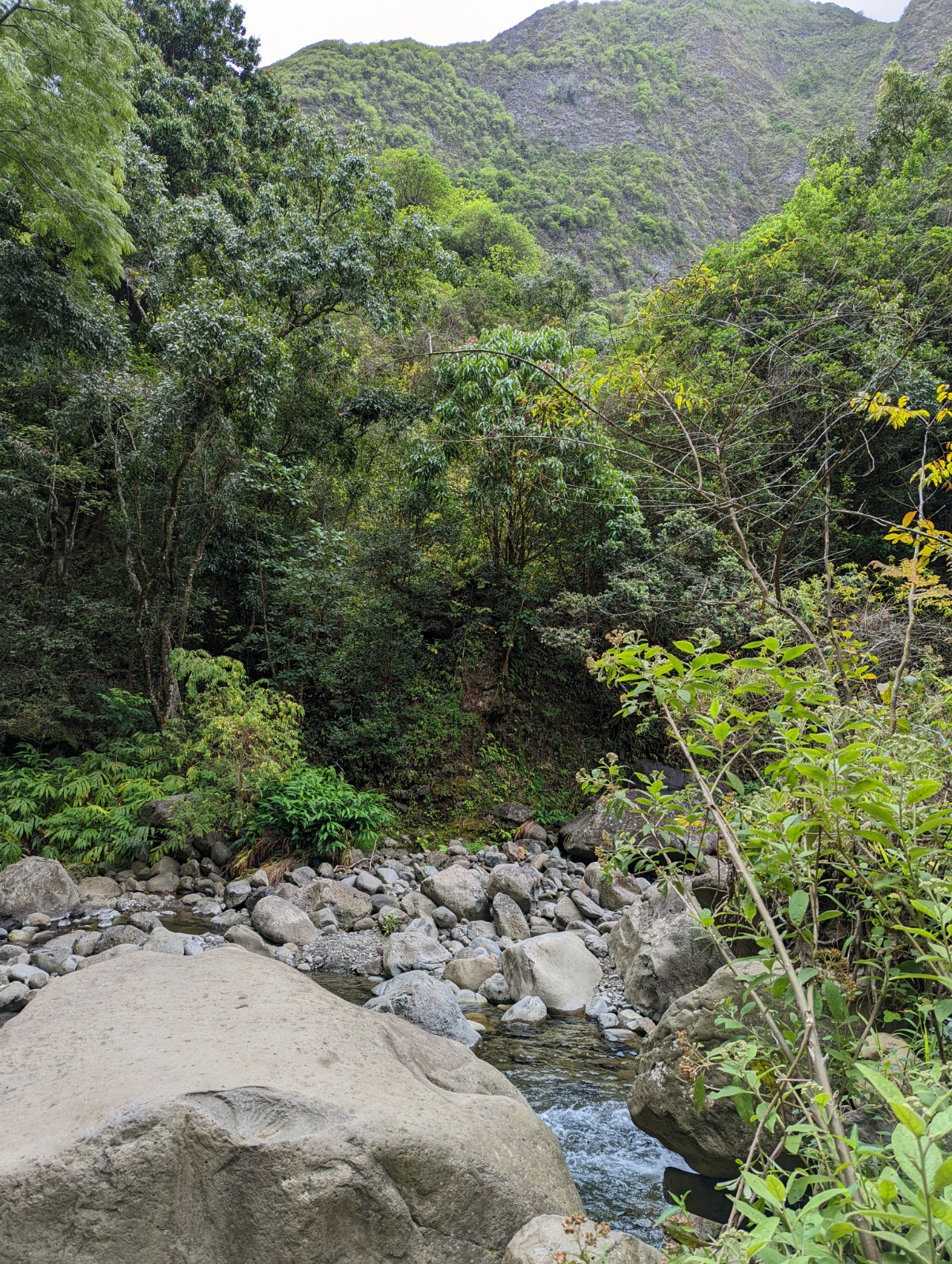
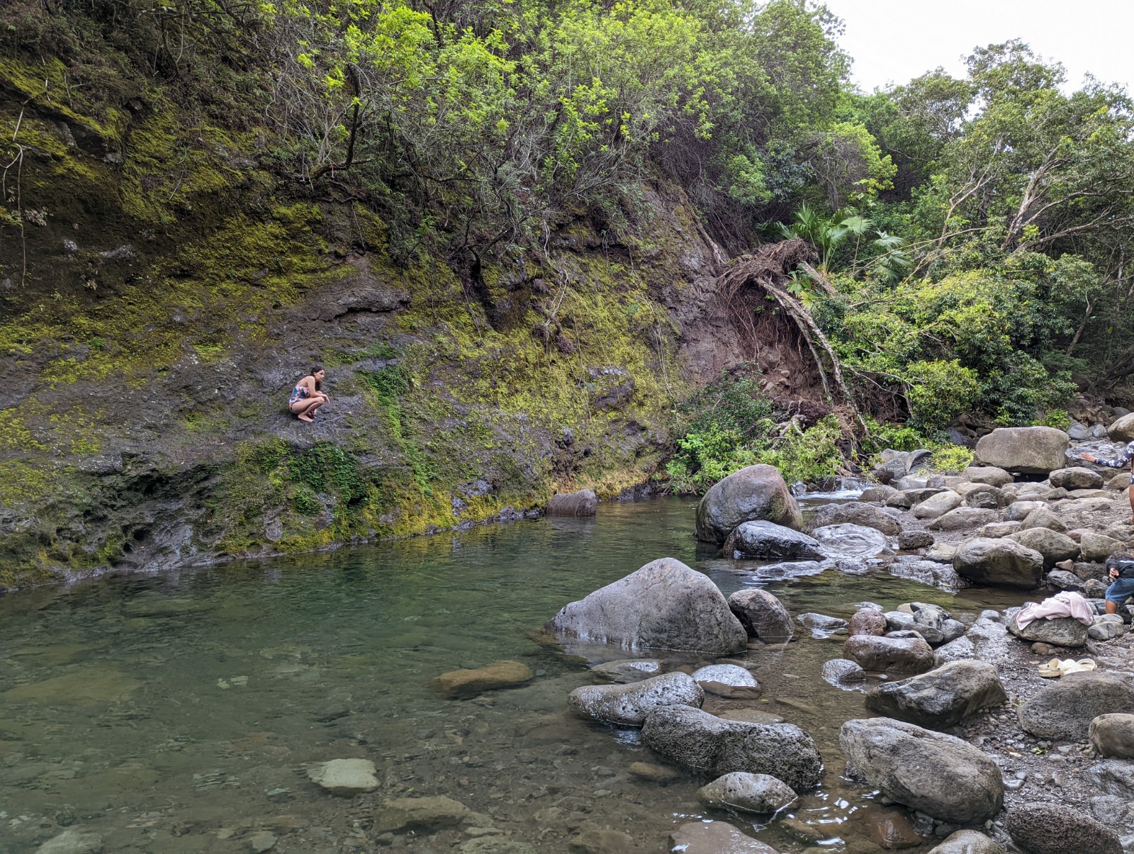
Above: Iao Stream in Kepaniwai Park, at the mouth of the Iao Valley. Dammed with rocks to make it swimmable, it was once dammed with bodies of hundreds of Maui warriors who fell to the Big Island's cannons.
Wailuku (and Food)
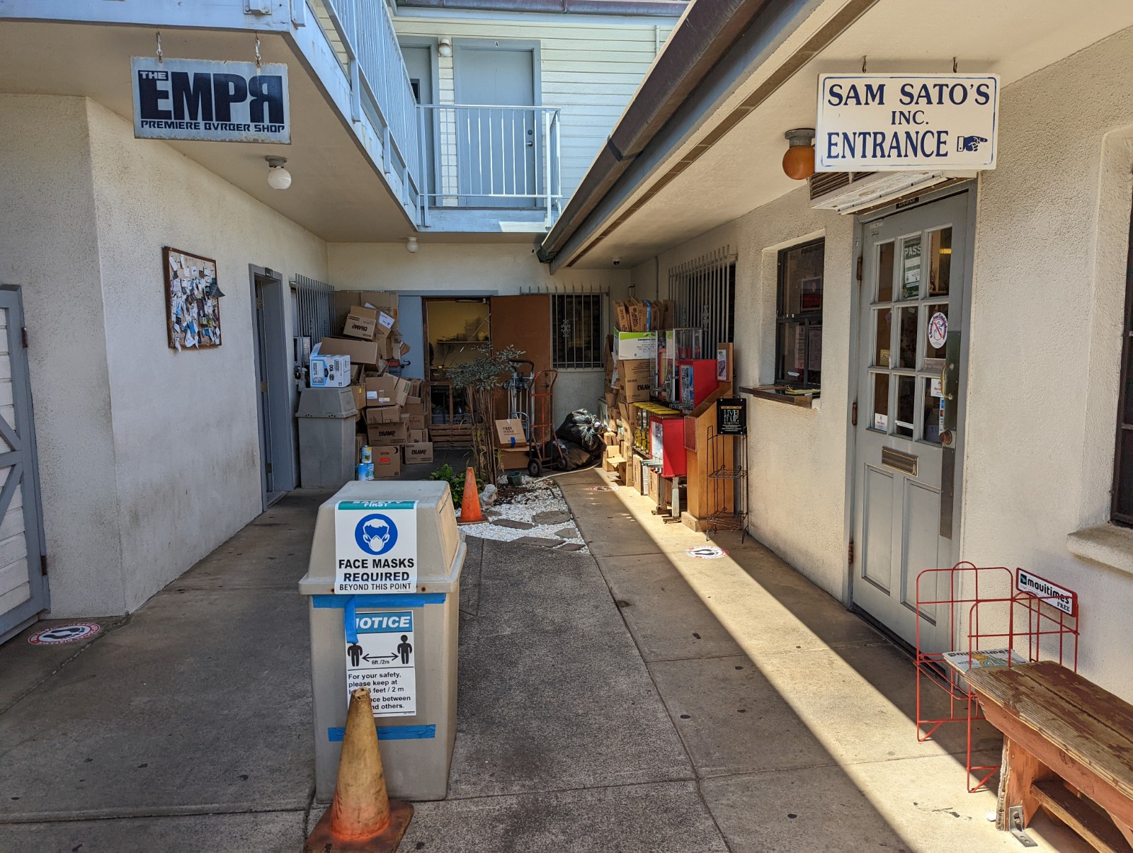
Sam Sato's is an old local joint famous for their dry mein (which it turns out is saimin without the broth.) Wailuku is culturally by far the most interesting place on the island and we went there repeatedly just for food. Below: the exclusive side dining room.

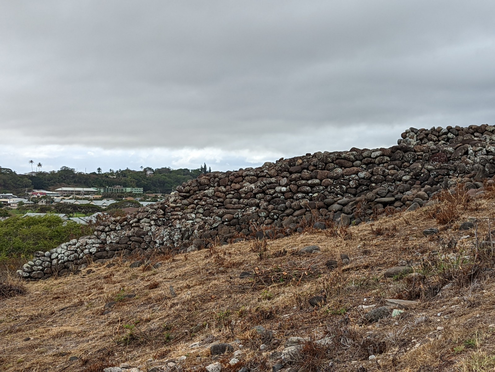
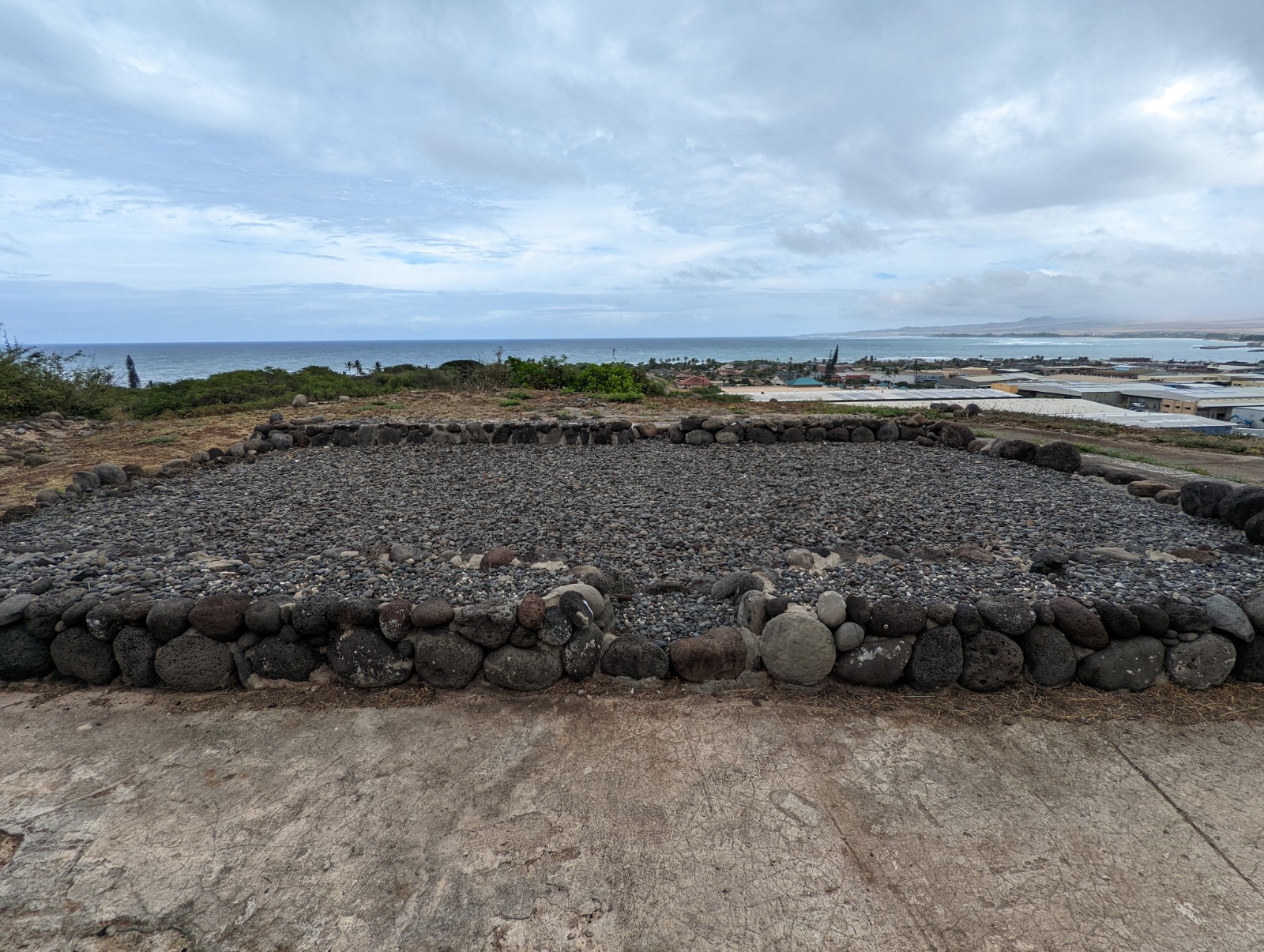
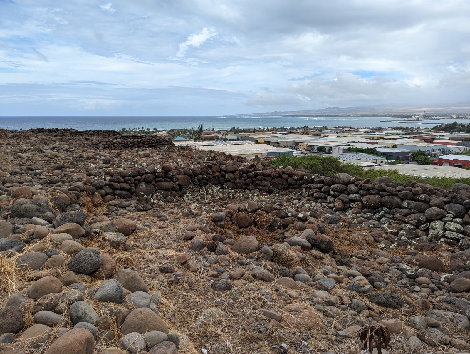
Above and next three: Haleki'i-Pihana Heiau: this temple was the seat of religious authority in Maui. All we can see now are basalt platforms, but when active these would have had grass and wood structures over them. In 1819 the Hawaiian religion was abandoned (just 30 years after contact) and in 1834 Christianity was mandated. It's funny how the rulers never just say "ah, that was all B.S., do what you want", it's always "that was all B.S., but THIS one is true this time, and you have to do it." Weird!

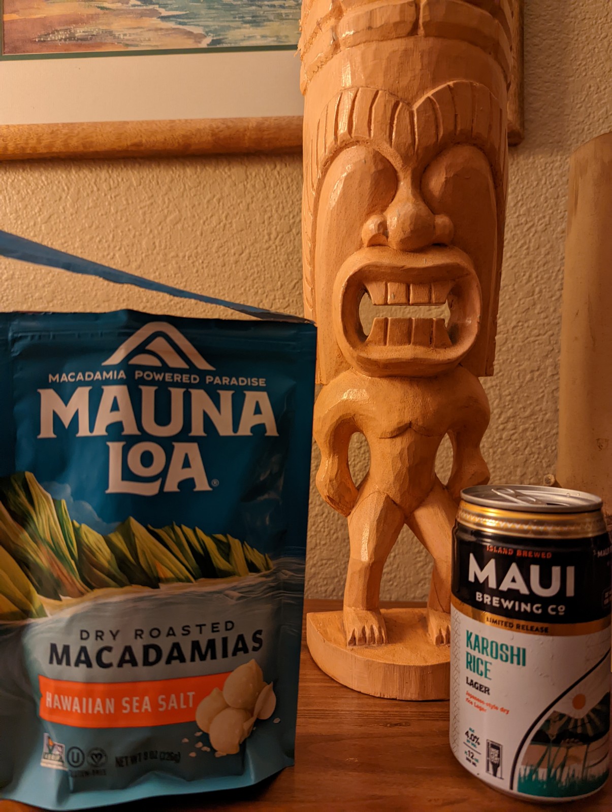
Listen. I'm in Hawai'i. I'm going to eat Hawaiian stuff. Although admittedly macademia nuts are originally Australian, one of the few useful-to-human things originated on that otherwise benighted and cursed continent. Not pictured: mass amounts of poke and spam musubi.
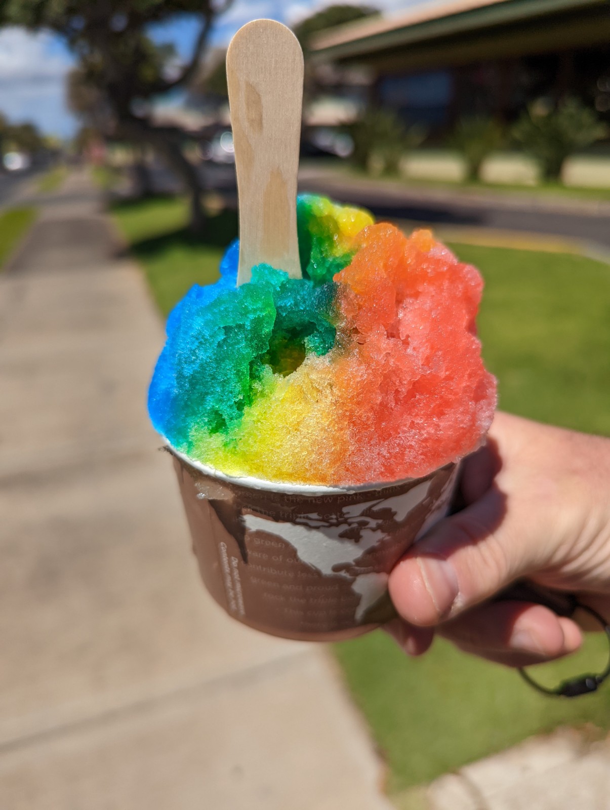
Yeah I got shave ice. It's good and the Hawaiians have done wonderful things with colors, but let's be honest, it's not Rita's. (PA represent.) Reasonable people can disagree about this, though keep in mind that people who think shave ice is better are wrong and bad.
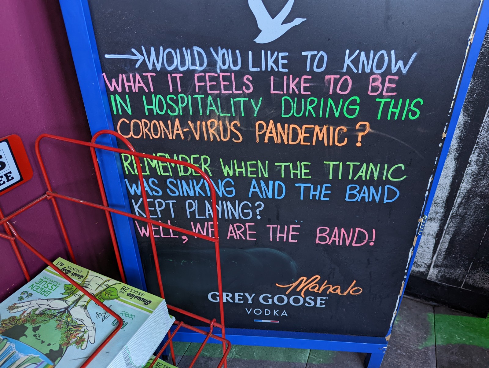
Seen in a restaurant. Useful for all of us to think of. We're living in strange times. Be kind to each other. Except people who think shave ice is better than Rita's, they suck.
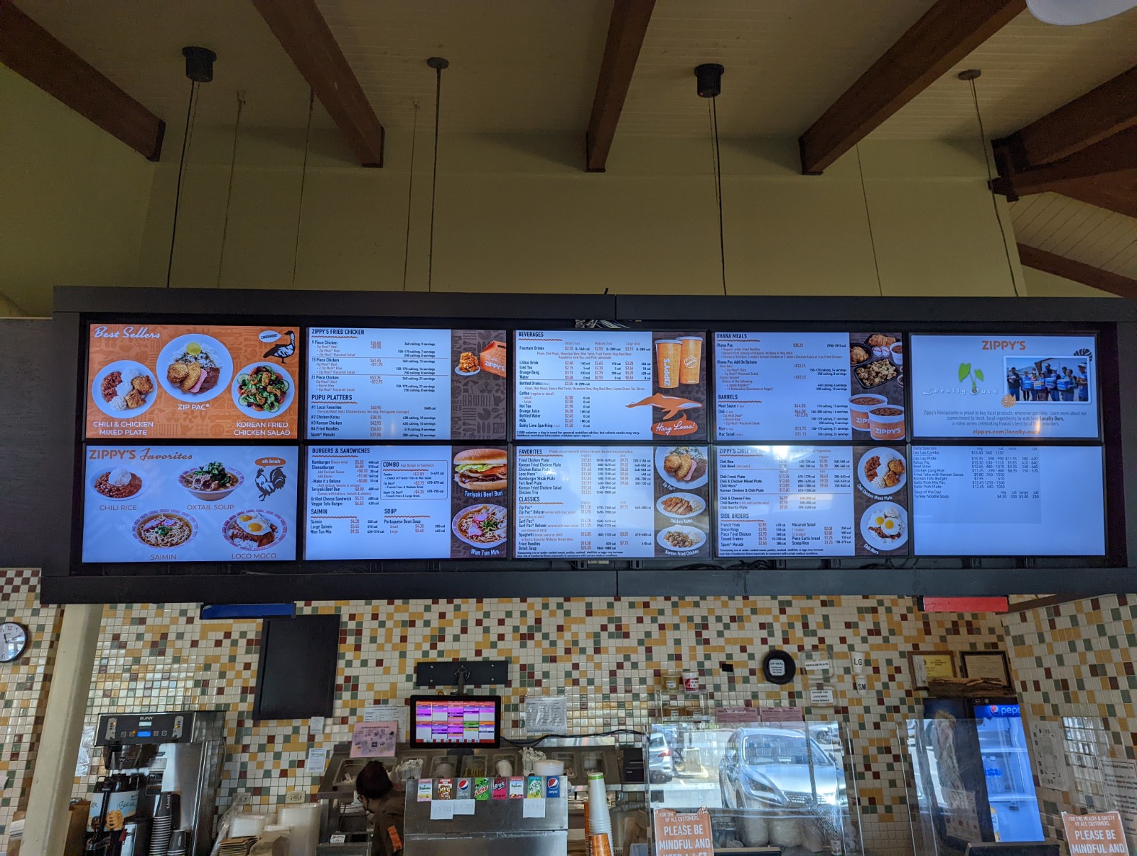
Also, go to Zippy's. If you don't eat at a Zippy's while you're in Hawai'i then what's wrong with you.
Paia and the Road to Hana

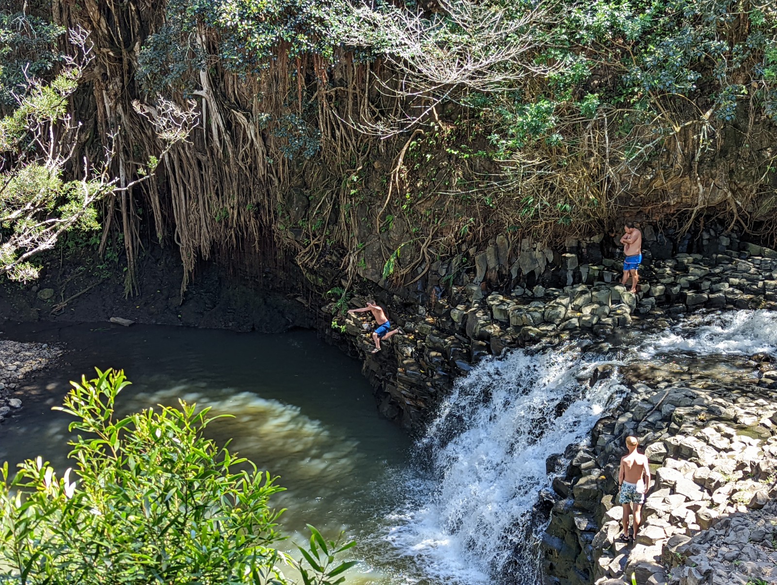
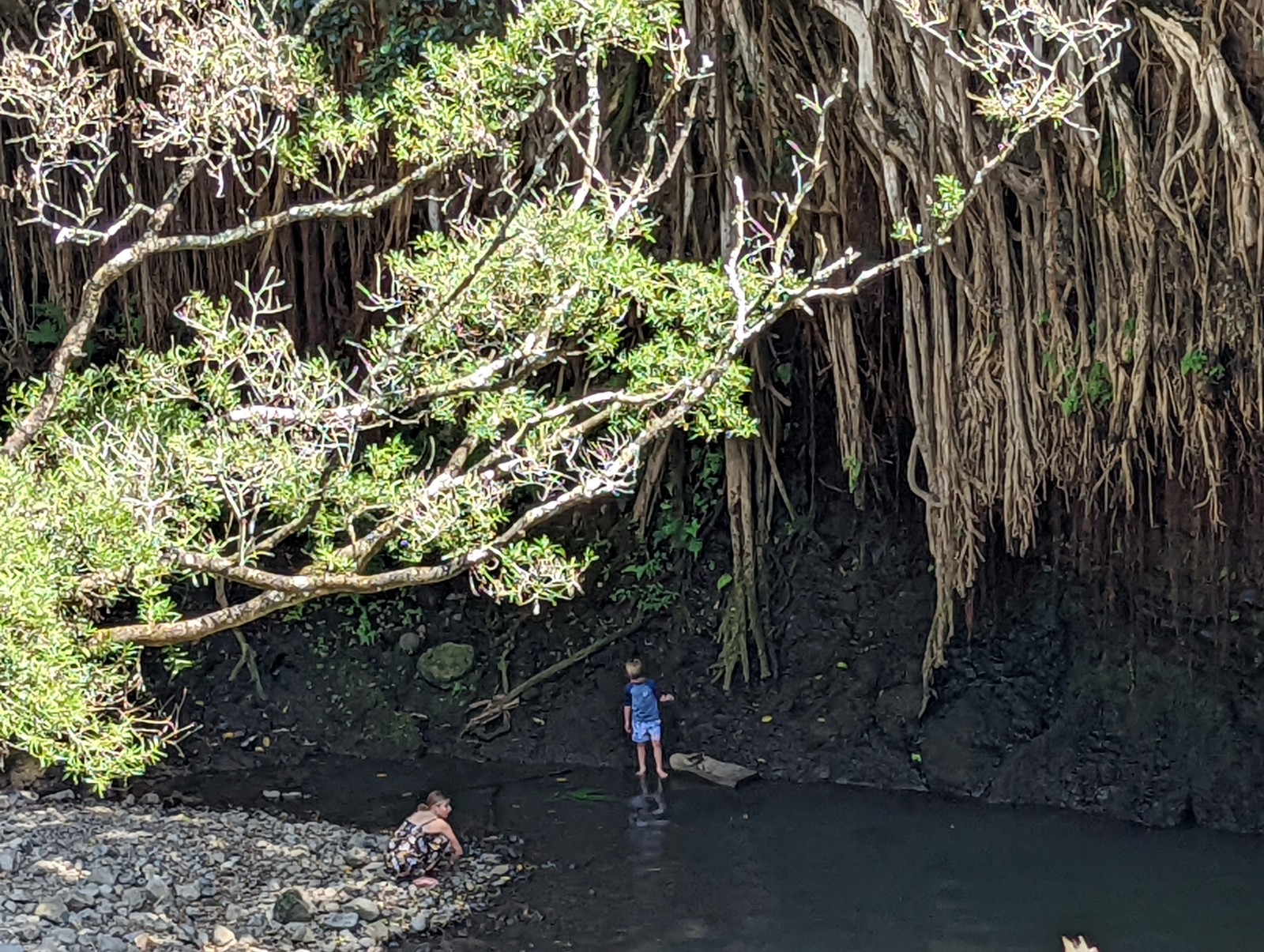
Above and many more: Twin Falls on the Road to Hana. We didn't go all the way to Hana because there's a tropical paradise with a swimmable waterfall pool in the rainforest already just east of Paia.


Above: that's what a growing pineapple looks like.
Above: someone in mid-air about halfway down.
Lahaina
Above, a house in Lahaina whose owner (I hope) likes mangoes.

Kihei
We found the poke at both Coconut's Fish Cafe and South Maui Fish Company quite tasty.
Lanai in the morning, from Kihei.

There were chickens everywhere in Maui. I didn't remember this from 1985, but they eat centipedes so they're alright in my book. Mauians seem affectionate toward them. The theory as to where they all suddenly came from is that a lot of chickens got out and went into the woods and bred with the wild fowl the native Hawaiians brought with them (and handsome fellows they are as you can see) but this doesn't explain why the Polynesian chickens wouldn't have done the same thing and similarly overrun the island long ago.

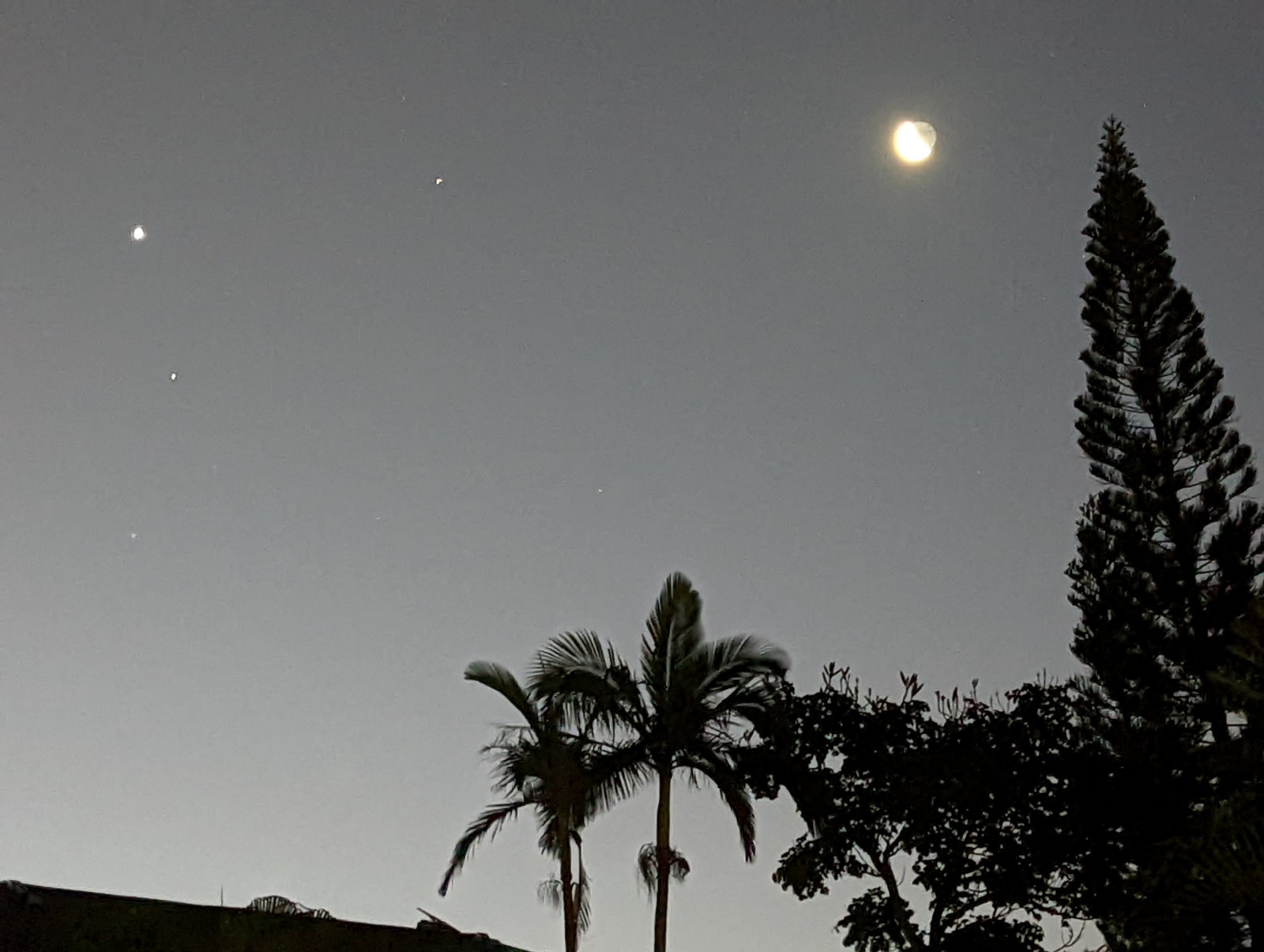
Venus and the Moon at dawn looking back toward the volcano, the last morning in Maui.
ADDENDUM: THE HAWAIIAN LANGUAGE AND SOME THEORETICAL ARCHAEOLOGY

No idea if this is a reproduction of Cook's actual map, but you can see the Tahitian spellings of the islands (modern L is R in the map, modern K is T.)
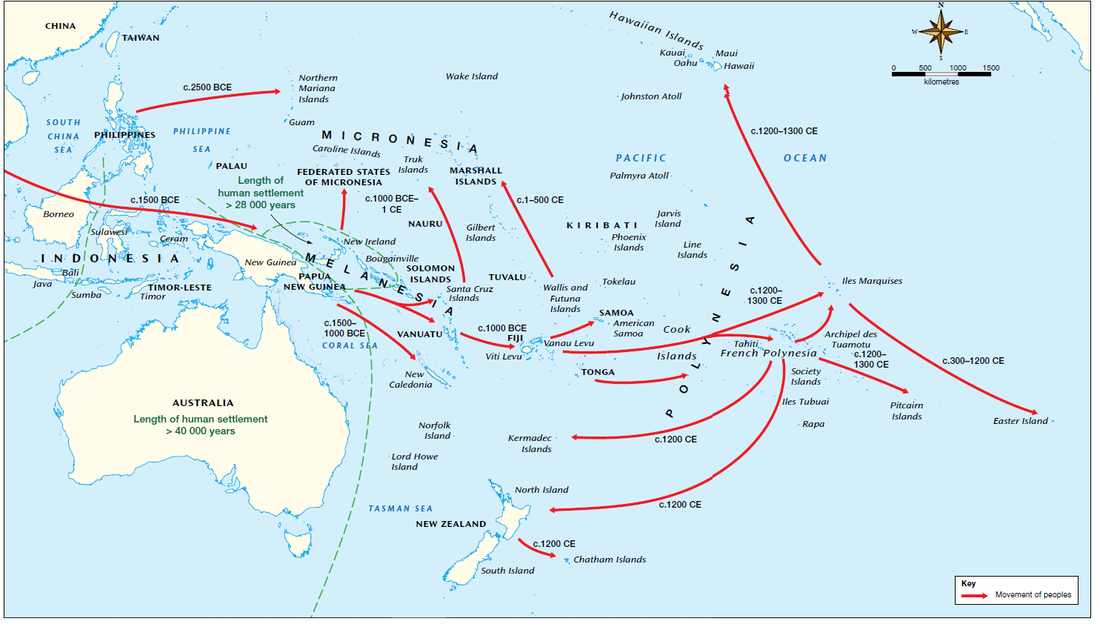
One of the things that interested me in language from an early age was encountering Hawaiian. 13 letters? And one of them is an apostrophe? And later I discovered it's verb initial ("I eat fish" is "eat I fish". Turns out that's not so rare though, Mayan and Celtic languages do the same thing.) There are made-up alien languages in science fiction that aren't this fascinating! And then when I was in New Zealand a few years ago where the signs are in both English and Maori, I noticed the obvious similarities to Hawaiian. We now think both groups of settlers left Tahiti around the thirteenth century CE, and Hawaiian is actually the language with more innovations (that is, Maori is more like the ancestor.) Still, Hawaiian and Tahitian remained similar enough that the Tahitian interpreter Captain Cook brought along (Tupaia) found Hawaiian intelligible (and Cook made a map of the archipelago reflecting this.)
Basically, from Tahitian, Hawaiian changed T's to K's, K's to glottal stops (okinas, written as apostrophes - like that little stop between the two i's in Hawai'i) and R's to L's. It produced fairly predictable shifts, so no wonder Tupaia figured it out. The R to L and K to ' transitions might have happened earlier, but the T to K transition didn't even run fully to completion by the time of contact - in Kauai, the northernmost island, local dialect still used the T (meaning they called their island Tauai.)
| English | Hawaiian | Maori or Tahitian |
| Pleiades | makali'i | matariki |
| Spirit/statue | ki'i | tiki |
| Ocean god | Kanaloa | Tangaroa |
| wood | la'au | rakau |
We think there were probably already people in Hawai'i when the modern Hawaiians came directly from Tahiti - probably the original settlers came from what are now the Marquesas, but the new arrivals from Tahiti overwhelmed them with better technology. Hawaiian mythology has a demi-human called the menehune, kind of like their leprechauns, who were said to be small and live in the forest and would build temples with superhuman speed. This has an unfortunate resonance with the actual histories of many places in the world where the first, less-advanced inhabitants are displaced into the less desirable mountain areas by new arrivals (Basques by Indo-Europeans in the Pyrenees, Algonaian-speakers by Iroqouis in the Appalachians and Adirondacks) and sometimes enslaved. (Added later: turns out in Tahitian manahune means "commoner", and in the decades after initial contact there were lower class Hawaiians that the upper class referred to as menehune.)
And this connects to another interesting speculation. People have long speculated about Polynesian contact with the Americas, most famously Thor Heyerdahl. There are lots of curiosities - one is that the sweet potato originated in South America, and to this day New Zealanders use the Maori word for them, kumara, which extremely concidentally is also the Inca word for it. We now have solid genetic evidence that the Polynesians did indeed make it to South America, around AD 1200 when everyone was leaving Tahiti for other faraway lands like Aotearoa and Hawai'i. (Perhaps also not coincidentally, Tahitians banned cannibalism around that time too - I wonder what was going on in 1200 in Tahiti, yikes!)
But did they make it to California? It's curious that the Chumash who lived on the Central Coast from about San Luis Obispo to Ventura a) are a language isolate (some include them in the Hokan language family) and b) were the only people on the coast who made ocean-worthy canoes, using tar to seal them. The Hawaiian word for "useful tree" is kumulaa'au. Before the T to K transition that wasn't even complete by Cook's time, that would have been tumulaa'au. The Chumash word for canoe is tomolo'o. The theory is seriously discussed but the jury is very much out on this and the contact would have been earlier than the Tahitian dispora discussed above.
Outstanding questions: what was going on that was so bad in Tahiti around 1200-1300 that people set out for distant lands like Rapa Nui, Hawaii and Aotearoa/New Zealand? Famine? Cvil war? Improvement in navigation technology? All of the above? Clearly they were motivated. Also, why is it that of all the places American settlers encountered native people, Hawaii was the place that they adapted local words and customs the most strongly? Because it happened later (than say, Virginia) and they were more enlightened? A larger native population? A more diverse set of colonists, also coming from Asia, with less of a dominant culture of origin for the new arrivals?
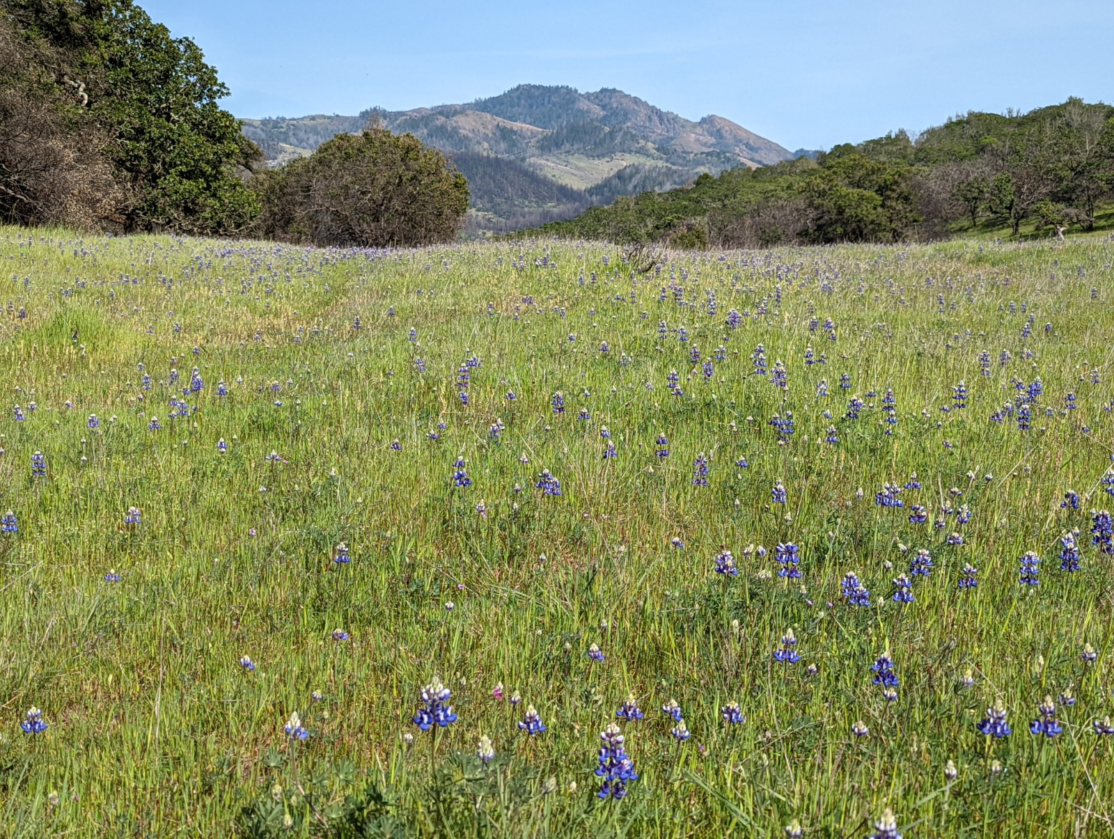
Above: back home in the possible Polynesian colony of Norcal.
Pros: volcanoes less than 10,000'.
Cons: have to worry about poison oak again.
FIN


No comments:
Post a Comment