Monday, December 28, 2009
San Dieguito Half Marathon, 14 February 2010
You should sign up; it benefits San Diego County parks. Never did an event like this before but want to support the parks? This should be a great one to try. Fast half-marathon time? Try a few rolling hills to see what you're made of. Should be a blast.
Wednesday, December 23, 2009
The Athletic Schism, and the Evolution of Endurance in Humans
A central controversy in current exercise science essentially boils down to endurance vs strength. What do you get out of (for example) sprinting vs. distance running? Is one or the other not only not as good, but actively bad for us? Perhaps even more importantly, why do each of us who sprint or lift weights or ride bikes a hundred miles do it - is it entirely for life extension? Or mostly for meditation?
I've waded into this a few times before, most recently here. Normally I don't care, except that a subset of the high-impact sprinter/lifter types have taken it on themselves to purge the exercise world of endurance-sport apostates. Evolutionary approaches have a great deal to offer this debate, and both sides have employed evolutionary arguments. And of course there are myriad other vitally important questions impacted by investigations into recent human evolution, in fields ranging from medicine to literature to philosophy.
One of the central questions in human evolution is whether human culture has "fed back" to impact our evolution. For the curious and/or scientifically-minded, U of Wisconsin Anthropologist John Hawks has hands-down the best blog focusing on recent human evolution and on feedback cycle of impact of our own culture. Actually, the question is becoming less central because the near inevitable consensus is yes.
Examples? 1) East Africans and Arabians have more efficient versions than the rest of us of a drug detoxification enzyme that operates best on alkaloids found in East African and Middle Eastern food. 2) Human skeletons have become more gracile (delicate) over the past hundred thousand years, paralleling the physical changes that follow domestication in other species of mammals. 3) Europeans and West Africans have much higher rates of lactose tolerance because they started using milk as a diet staple earliest. These are all genetic changes resulting from the impact of cultural behaviors transmitted down the generations. Almost seems like common sense, in retrospect. If you're still not convinced, you better check your doctors' credentials because they're teaching us this at UCSD medical school too.
So what does any of this have to do with the endurance/strength debate? Everything. While the vast majority of genes in humans are the same across the whole species, a few of them do differ. This is why we're not all clones of each other. Some of those differing genes have a geographic patterning (for example, skin and hair coloration); some don't. For some differences we've figured out an obvious adaptive value (anemias as malaria-resistance in tropical regions); for some we haven't.
One recently discovered difference is in alpha-actinin, a protein critical for muscle function. Muscles are fascinating molecular machines (actinin is in the Z-line in that animation), and as you might expect, changing the parts in machines usually isn't a good idea. There are different sub-types of alpha-actinin, and most mutations in most sub-types are just plain bad. That is, they cause a disease. There is one curious one, however: sub-type #3 is disappearing from humans, at least in some parts of the world. Some people are lacking it entirely. If you're African, there's about a 10% chance that you're missing it. But if you're European or Asian, odds are 50% (presumably similar odds for everybody else not African). Fortunately there's no disease if you're missing it because sub-type #2 takes over. The thing is, when you see a difference like that between different populations, that's a big red flag. It often means something is going on, in terms of natural selection.
Here's Where It Starts to Get Cool
Looking at where we find people missing this gene today, as well as taking information from surrounding DNA, it looks like about starting in Asia around 33,000 years ago, this gene was selected for. Why is that a big deal? Because it means that not only was it not harmful, but there was some reason that people missing this gene did better. (About this time is when people are starting to jump up and down and shout Well what does the goddamn thing do but don't worry, we're getting there.) Based on these same methods, it looks like the gene made its way into Europe about 16,000 years ago. The timing is interesting because humans began leaving Africa en masse about 40,000 years ago, right when the famous language gene FoxP2 started spreading - that's important because it correlated with a paleolithic industrial revolution, in the sense that suddenly tools became more specialized and refined. Because we also know a) the ancestors of modern Indo-European speakers dispersed from the Eurasian steppes starting no later than 6,000 years ago, and b) there was still a big ice sheet over much of Europe and the Eurasian steppes 33,000 years ago, preventing people from moving into Europe until it retreated. Consequently I would bet that what we're seeing is the selection of some muscle-related trait post-Africa FoxP2 positive ancestors of steppe-dwellers, including the ancestors of today's Indo-Europeans (and probably at least Altaic speakers).
It Gets Really Cool Here
So what does the alpha-actinin-3 deletion do? What has been found is that in competitive sprinters and weight-lifters, very few people are entirely deleted. In fact it seems that the higher up you go in the competitive world, the less likely it is you could carry the deletion. So there is some phenotypic effect, at least at the margins of human activity. But it's still hard to imagine why not being able to lift heavy weights or run fast would actually be selected for, unless...
This Is the Coolest Part
...unless there's another effect. It turns out that a) mice who have alpha-actinin-3 knocked out show a greater endurance capacity, judging by metabolic markers, and b) the effect is seen in female endurance athletes, who are more likely to have the deletion than the general population. It hasn't been seen in males, not yet anyway (one of many things I'd love to do my med school research project on). [Added later: I have now had my genome screened for a host of functional polymorphisms, by 23andMe. It turns out I am an alpha-actinin-3 knock-out homozygote. I don't have any functional copies. So it's no surprise I'm a much better endurance runner than sprinter.]
Long story short: deletion of this protein correlates with better aerobic performance at the cost of extreme feats of strength. Why would that have been selected for starting 33,000 years ago? Because suddenly our ancestors found ourselves on some enormous plains, with less fruit but better tools and herds of game. Ambush hunting (or running away from large African predators) would have been less useful than chasing down game over miles and miles, a practice that can only evolve in predators smart enough to develop persistence - like humans. What we're seeing in our genes is selection for high-endurance long-term physical activity. As I've pointed out before, there are groups of people in the world who still do this, or did until the recent past (Khoi-San, i.e. Bushmen, and Navajos being two examples).
So why am I happy? The core of the paleo diet and/or high impact sprint/lift people seems to be that greater health is to be had from those types of exercises because they more closely match the behavior of our pre-agricultural ancestors. This view seems increasingly wrong, unless they want to discount the evolution that's taken place since the spread of FoxP2 turned us into cognitively modern humans - and we started doing things that fed back to impact our own evolution. After all, there must be some reason that the deletion was selected for. And anyway, I'll trade in the ability to work up to an 800 lb. clean-and-jerk for being able to run 15 miles easily enough that it's meditative. Because the most important point in all this is that distance running is a hell of a lot more fun.
This post was inspired by an entry at PZ Myers's blog.
REFERENCES
[1] MacArthur et al. Loss of ACTN3 gene function alters mouse muscle metabolism and shows evidence of positive selection in humans. Nature Genetics 39, 1261 - 1265 (2007)
[2] Lek et al. The evolution of skeletal muscle performance: gene duplication and divergence of human sarcomeric alpha-actinins. Bioessays 32(1):17-25. (2009)
[3] Yang et al. ACTN3 genotype is associated with human elite athletic performance. American Journal of Human Genetics 73(3):627-31. (2003)
Sunday, December 20, 2009
Hey Paleo Dieters, Let's Go Out for Pasta
New find in Mozambique shows that some humans were already relying on grains 100,000 years ago, way the hell back in the paleolithic (if that's gated for you, here's the boiled down version). To see a longer rant against Devany'ite jihadists (and indirectly against paleolithic diet and other bad evolutionary arguments) go here.
Thursday, December 17, 2009
Random Update
1) If you live in SoCal you're already way ahead of me on this, but in case you're not: check out the wine selection at Henry's Markets. Imagine a local chain with the quality of a Whole Foods, the prices of a Trader Joes (or even better) and a wine selection with good picks from Argentina, Chile, Spain and California Central Coast, and you have Henry's. Here is my excuse for posting this on an outdoor blog.
2) Somebody cut a hole in the Susquehanna River by accident once. You can see the whirlpool around 5:10 here.
3) I have two more pieces to go before I've run the whole coast of San Diego County. Still trying to figure out if there's a way they'll let you run through Camp Pendleton, other than on I-5.
Saturday, December 5, 2009
Tijuana River Valley is Cooler Than You Think
As part of my little run-the-whole-coast project I was back there today - very green and woodsy, which I miss. Highlight: I saw three of the following gorgeous (and talkative) birds:
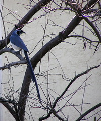
They were black-throated magpie jays, principally found in northwest Mexico. Since I was only about a mile from the border at the time and I couldn't make out the color at first, my first thought was that the U.S. was getting colonized by quetzales. But these guys are just as cool. Always neat when you see a critter that you've never seen before (even in photographs) and weren't expecting bio-novelty. Credit to LoveYourDog on Flickr not only for the picture but posting it with the species name so I could figure out what I'd seen.
They were black-throated magpie jays, principally found in northwest Mexico. Since I was only about a mile from the border at the time and I couldn't make out the color at first, my first thought was that the U.S. was getting colonized by quetzales. But these guys are just as cool. Always neat when you see a critter that you've never seen before (even in photographs) and weren't expecting bio-novelty. Credit to LoveYourDog on Flickr not only for the picture but posting it with the species name so I could figure out what I'd seen.
Monday, November 30, 2009
Obstructing Access to Horseshoe Trail Near French Creek
Yes, the Horseshoe Trail and French Creek in Berks County, Pennsylvania, where I was back for the holidays. I had read about the Horseshoe Trail and was all fired up to run a good section of it early afternoon on Thanksgiving. So I start in French Creek, come out the western side and cross Geigertown Road, where the yellow blazes clearly show that it continues up the driveway of the South Birdsboro Archery, Rod and Gun Club.
There were active shooters using the range, 2 men and a boy. Wanting to be safe and polite, I approached them between volleys to make sure that was the trail. "No, the trail goes into the park." "I know, I just came from the park. The trail is blazed and crosses Geigertown Road here." "No, those yellow blazes are for archery practice," he insisted (repeatedly). "Well then why are they exactly the same as the ones marking Horseshoe Trail in French Creek?" "I don't know what to tell you. We've had problems with people thinking they can hike here. Don't be one of them." Not one to argue with people with guns, I decided to cut my run short.
Needless to say, I was disappointed, not only for myself (I'd been looking forward to running this trail literally for months) but for the people who maintain and support the trail, which I know is a lot of work. I emailed the trail commission but it's difficult to give the benefit of the doubt to these guys when the trail is so clearly blazed, which means by extension that they were clearly lying to keep me from using the trail.
Fortunately, there were no such problems on the Appalachian Trail near Port Clinton, where the Schuylkill River emerges from the "front range" of the Appalachians:

It was interesting that even from one end of Berks County to the other (Port Clinton to Morgantown) there was a difference in small-vegetation greenery surviving this late in the season. The turnpike still has a fair number of green leafy bushes which were nowhere to be seen up in Hamburg.
Sunday, November 8, 2009
Friday, November 6, 2009
Good SoCal Hiking Guides
In doing my homework for my upcoming weekend hikes in San Bernardino Natl Forest and Mt. San Jacinto State Wilderness, I was fortunate to run across the extremely knowledgeable and helpful Allen Riedel, whose books 100 Classic Hikes in Southern California and Best Hikes with Dogs in Southern California are indispensable. Also check out this great hiking site.
With so many friendly people giving advice, I'm finding it hard to maintain my snobby Northern California stereotype of Southern Californians. Come on guys, start talking about your tan or something! Anyway, here's looking forward to hiking 'mongst actual trees.
With so many friendly people giving advice, I'm finding it hard to maintain my snobby Northern California stereotype of Southern Californians. Come on guys, start talking about your tan or something! Anyway, here's looking forward to hiking 'mongst actual trees.
Wednesday, November 4, 2009
Bears vs. Al Qaeda?
Yes. Bear 2, Al Qaeda 0.
For added fun: imagine reporting that one to your local Al Qaeda commander, or explaining how Allah let this creature triumph over his "warriors". NICE, and by that I mean TOTALLY NICE!
For added fun: imagine reporting that one to your local Al Qaeda commander, or explaining how Allah let this creature triumph over his "warriors". NICE, and by that I mean TOTALLY NICE!
Monday, October 12, 2009
Anza-Borrego, and Encroaching Power Lines

I made my first real trip out to Anza-Borrego today, saw me some rams and some oasis and some petroglyphs, but what I really noticed was the signs and bumper-stickers about the power line project. People's Power Link has information about a project to cut through the middle of Anza-Borrego with power lines.
It may not seem like there's a lack of open space when you travel east of the city, but what's not part of Anza-Borrego or Cleveland is ranchland, and when it becomes economical for the ranchers to sell it to developers, they will. That's why we have to protect what we do have. One thing I've noticed San Diegans pride themselves on is being Southern California, but not being LA. A good way to keep not being LA, in fact to get even more unlike LA, is to preserve that open space.
Open space erodes easily. It's nice to have Miriam Bear Canyon, but the 52 freeway forms the northern boundary, and frankly the Regents Road parking area is ridiculous - it has to take up a quarter of the canyon, and I've never seen it even a tenth full. It's almost as if city planners were nervous about letting there be too much contiguous land surface without some kind of road on it, and they couldn't help themselves. And current property owners - nature preserves will drive up the value of your property. Even wonder why the Bay Area is so expensive? Parks everywhere, and people want to live there, that's one reason.
Meanwhile, do we still need to keep our lights on? Yes - and what's not helping is our antiquated power grid. What do we need? More nuclear. Yes, I really said that in a pro-nature blog post. (Don't agree? The co-founder of Greenpeace does.) It's the greenest option we have at the moment.
Monday, October 5, 2009
Great Time in Marin Yesterday
Thanks to a certain unnamed physical therapist and her very lucky groom for a very fun time. Great to see everyone. It was a typical gorgeous Bay Area autumn day in China Camp, and just before the end of the trail there was a superb four-bridge view and I had to sit down on a log and look upon't well. I was trying to fill up on Bay Area experiences - you know, trails through redwoods and scrub oak, the smell of the autumn dust and chapparal in the sun, the cold wind coming off the North Pacific. Terrible! I'm thinking of the desert 2 miles from my house and crying on my keyboard. It seems that my visit had the opposite of its intended effect.
Looking forward to pictures.
Looking forward to pictures.
Wednesday, September 30, 2009
Preserve Rose Canyon
Tonight I was running through Rose Canyon when I had the good fortune to run into Debby Knight from Friends of Rose Canyon. Having just moved to the area, naturally I want to help preserve the open spaces that San Diego enjoys, and I would think everyone else does - not only is it nice to have somewhere quiet to get away, but nature preserves increase property values.
This makes it all the more astonishing that, per Debby, the City of San Diego has twice tried to build a major road right over top of the canyon, perpendicular to it. Never mind for the moment the huge number of people who enjoy the canyon - what did the people who live along the canyon have to say about this? Whatever it was, I bet it wasn't printable. Fortunately, the first time and the most recent time the city tried to do this, Friends of Rose Canyon prevailed.
So what can we do to ensure the canyon's future? For one thing, get involved with Friends of Rose Canyon by going here. Or just go down to the canyon one evening for a little walk along the south edge. Easiest access is from Genesee south of Decoro and north of Governor, or from the end of Regents Road north of Governor. It's already one of my favorite places in San Diego; helps that I live right next to it.
One idea I've been kicking around in the short time I've lived here: I've noticed a dearth of trail races in San Diego County relative to NorCal. Maybe it's because I'm just not integrated with the community yet, or maybe it's the dearth of online resources listing races. (By all means, point me to resources!) Or, maybe there just aren't any - which is all the more reason to start a new one. So maybe it's time to start, if only informally, the Tri-Canyon Challenge? Including the full lengths of Rose, San Clemente and Tecolote adds up very roughly to 14 miles. The bonus would be a whole new group of people interested in preserving these canyons. Other (very cool) races have been started specifically inspired by the need for preservation and ended becoming local favorites.
Sunday, September 27, 2009
Watch an Avalanche From Inside
This video is incredible, and scary as hell. Definitely a keeper if you've a) been on a 38 degree slope and wondered how set the layers were and/or b) in movies, you hold your breath while the protagonist is underwater. A back-country skier in Alaska triggers an avalanche seconds after starting his run, and fortunately his mates dig him out (all videoed from his helmet cam, complete with sounds of him gasping for air) less than 5 minutes after he goes in. Can you watch the whole thing until they get to him? I couldn't, and it wasn't out of boredom that I stopped it.
Sunday, September 13, 2009
What is the Greatest Gift of All?
In this holiday season,* it is important to remember the greatest gift we can give to our fellow humans. You may be tempted to say: "It's nothing that has monetary value; it's nothing tangible; in fact, it's love." But you would be wrong. Because it's Yuengling. I have been presented with not one, but two cases of this nectar of the gods by one Garron, a truly stand-up individual. I am eternally indebted. I'll try not to drink it all at once.
*The Feast of St. John Chrysostom, according to Wikipedia.
*The Feast of St. John Chrysostom, according to Wikipedia.
Saturday, September 12, 2009
Run and Swim
For all my kvetching about "I miss the Bay", I do have to admit it's nice going for a swim in reasonably warm ocean water at the end of the run. Today I lapped Mission Bay and took a little swim next to the PB pier after I was done.
Below is an image tracking where I've run in the last couple weeks (in red) and which will be updated as I explore more routes and trails.

Below is an image tracking where I've run in the last couple weeks (in red) and which will be updated as I explore more routes and trails.

Friday, September 11, 2009
Goddammit, Now I Have to Run This Trail Too
I refer to San Diego's Trans-County Sea to Sea (Salton to Pacific). Not finished yet, but neither was the Bay Rim Trail (or whatever it's called, I already forget).
In fact, I think for my next little projecty (in the spirit of my around-the-Bay run) I'm going to let my many thousands of readers vote. Should I:
a) Run around the seldom-referred-to San Diego Bay
b) Run some chunk of the Pacific Crest Trail
c) Run the bad boy referred to at the start of this post
d) Run the whole San Diego Coast (about 57 miles; IMHO, the most boring project mentioned here)
e) Some other program of devious intent to be suggested by readers
Thoughts?
Sunday, July 26, 2009
Northern California Summer

Spiderwebs sagging with fog
While moss and ferns drink.

Quick hilly run on Matt Davis Trail, Mt. Tam. Started in the heat about 1,000' and descended into one of the densest marine layers I'd ever been in. The contrast was rapid. I stopped at the fog boundary to look at the sunlight slanting down through the forest canopy. The mist droplets were big enough that I held out my hand to watch them trace the air currents around my hand and eddy at the back. I got cold - couldn't have been more than 60 F down there - then climbed back up above the marine layer and was soon dying from the heat as I slogged back up the mountain. At the pullout where I'd parked a German tourist family was enjoying the view of the white washed-out world below and the hidden rushing ocean, with no idea how cold it was just a mile beyond the trailhead.
Saturday, July 25, 2009
What's With the Trail Signage in CA State Parks
Disclaimer: I greatly enjoy California's state park system and I realize that it faces under-appreciated challenges, like for example that 50 parks will be closed as a result of the most recent state budget deal. That said - has anyone noticed that sometimes the signage and in particular the mileage is a little off? There are some markers at junctions around Castle Rock and the northern part of Big Basin that seem way off. If anyone has run back there with a GPS, I'd appreciate a yay or nay as to whether I'm right that the mileages are often way off.
Monday, July 13, 2009
China Wall Rock Formations at Mt. Diablo Foothills
Right on the border between the state park and the Mt. Diablo Foothills regional park is this awesome formation:

(credit to ParsecTraveller, whose photos are almost too good.)
I stumbled across it during the East Bay Hash's 30th anniversary, where I showed up two hours late (surprise) and running it all by my lonesome, got badly lost (surprise again). But I found this place, so it was worth it.
(credit to ParsecTraveller, whose photos are almost too good.)
I stumbled across it during the East Bay Hash's 30th anniversary, where I showed up two hours late (surprise) and running it all by my lonesome, got badly lost (surprise again). But I found this place, so it was worth it.
What's With The New Contra Costa Images on Google Maps
New Contra Costa County images. Go look. They appear 1) to have been taken during the winter, when the grass is green, thus decreasing contrast between grassland and forest, as well as decreasing visibility of topography, and 2) they appear somehow smoother or more artificial than the previous satellite photos.
I don't consider the new images an improvement. Go look - see what I mean? Am I alone in thinking these are worse?
I don't consider the new images an improvement. Go look - see what I mean? Am I alone in thinking these are worse?
What Do I Miss About Summer on the East Coast?
Real summer days at the beach. 89, humid, and you can't wait to jump into 78 degree water where there's surf (but no Maverick's waves), and no great whites.
Every other day: the pool. Laying on grass, listening to the same soft rock station play the same songs every day, and it's okay. Because a summer day where you don't swim is a day wasted.
Crab houses. Places where everybody is just fine with relaxing and being middle class and not worrying about the rest of the people in the restaurant, because frankly no one is even thinking about all that.
Yuengling.
Real food. Pizza, Italian sandwiches, and cheesesteaks. And funnel cakes. And Turkey Hill iced tea. And Tastykakes.
Real boardwalks, with well-behaved families and kids busting their asses selling french fries and pinball machines that look like they were there when your grandfather was chasing your grandmother (and guess what, they probably were).
Thunderstorms; the smell of the earth five minutes before the rain comes, and the sound of the first sheet of it approaching through woods so green they stain your retinas.
At night: frogs and katydids and lightning bugs.
And the strangely joyous urgency of having to get all this in within 14 short weeks, until the return of football and school and falling leaves.
Saturday, July 11, 2009
Websites for Trail Races in Southern California?
I'm looking for trail events this fall in San Diego and SoCal in general, and not finding any nice centralized lists - TheSchedule.com seems to focus on NorCal events. Is this just because there are more NorCal events? Anyone know of any trail event resources for SoCal?
Thursday, July 9, 2009
Fire Photos
I'm putting together my fall race schedule and I'm populating it for the first time with races in the southern half of CA, since I'll be moving to San Diego in a couple months. I had met the person that used to organize the 9 trails race in Santa Barbara and it seemed like a cool race, so I'd wanted to do it. Want to see a scary picture? Go here and you'll see why yhis year's run will be in Montana de Oro instead.
Needless to say, I'll be disappointed not to be running in the Santa Barbara coast range (as I'm sure many people will) but it's more important to let the vegetation recover.
Needless to say, I'll be disappointed not to be running in the Santa Barbara coast range (as I'm sure many people will) but it's more important to let the vegetation recover.
Sunday, July 5, 2009
The Bermuda Triangle? No, The San Leandro Square
What? This:
View Larger Map
A while ago I noticed this formation on satellite maps. Not only are they straight lines a mile on a side, they're oriented exactly with the cardinal directions. The lines are pretty clearly vegetation, but there's no mention of what it might be on the EBMUD trail map. So I ran back in there with the annotated trail map and a GPS. Those lines are rows eucalyptus trees - tall old ones - planted exactly aligned with the cardinal directions, which is not easy considering the rather robust relief of the land back there. Ramage Peak Trail goes right through it - from inside, if you weren't looking for it, you might not notice the straight lines of trees since it's pretty big. There is evidence of cattle terracing inside on both sides of the summer-dry creek bed running up the middle.
So what is this? It wouldn't keep cattle in because at their bases the trees aren't close enough together, and yes I know that often eucalyptus is planted as windbreaks, but then it would be one stand, right next to a house or field with fragile soil or crops. Any theories? Yes, I know I could just call EBMUD and they'd probably tell me but that would spoil the fun.
Saturday, July 4, 2009
My Half-Baked Ideas for Distance Races Part II - The Pony Express Challenge
A few years ago - I think about 2003 and 2004? - some very kind souls were good enough to join me on a lark. That lark was running the approximate last leg of the Pony Express. On this leg, they unloaded the mail on the docks in Martinez and loaded it onto horses that would ride from there to what is now Jack London Square in Oakland, and then loaded the San Francisco mail back onto a boat would take it across the Bay.
The route we took wasn't quite exactly the same as the real one (that would involve running on freeways, which didn't exist at the time the Express was operating). We started at the train station in Martinez, headed south on Alhambra Valley Road, then up into Briones, southwest on Old Briones Road to the Bear Creek Road entrance, down Bear Creek, crossing San Pablo Dam Road and up through the Orinda hills to meet Grizzly Peak Boulevard at the steam train in Tilden. From there it was south on Grizzly Peak, right on Claremont, and through Rockridge to Broadway, and then a straight shot to Jack London Square. Clocks at 26 to 27 miles, depending on which program you ask.
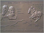
One of the runners (the notorious Mike Palmer) mentioned that he knew of a similar lark that was done in Utah - a group of ultras ran 80+ miles of the Express in UT. I thought: what a great half-baked idea - we should join up! So I got the organizer's email and said hey, we should have a series or something. First one to run the whole thing gets a Pony Express medal or something (design based on picture below:
As it turned out, the day of the second PE Run, I noticed this plaque on the side of the old Wells Fargo building in the SF Financial District, which is now the HSBC Building and which was the final terminus of the Express. Totally by coincidence I stumbled across it the same day.
Well, the other guy with the Utah version never wrote back. But of course I still think it's an awesome idea. Since it looks like I'll be away for four years, I just hope nobody else gets the same awesome half-baked idea and forgets all about little old me. So if anybody does organize or adjudicate (or whatever) a run of the whole thing, then goddammit I want the last leg named the Mike Caton Memorial Last Leg of the Pony Express or something. Or like proceeds go to a good charity (my tuition). But if such a thing does start up, then I want to be part of it. [Note: it has since been done by Karl Meltzer.]

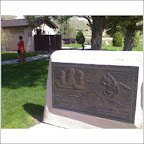
Last summer I took a picture of this marker in Scottsbluff, Nebraska. Look familiar?
The route we took wasn't quite exactly the same as the real one (that would involve running on freeways, which didn't exist at the time the Express was operating). We started at the train station in Martinez, headed south on Alhambra Valley Road, then up into Briones, southwest on Old Briones Road to the Bear Creek Road entrance, down Bear Creek, crossing San Pablo Dam Road and up through the Orinda hills to meet Grizzly Peak Boulevard at the steam train in Tilden. From there it was south on Grizzly Peak, right on Claremont, and through Rockridge to Broadway, and then a straight shot to Jack London Square. Clocks at 26 to 27 miles, depending on which program you ask.
One of the runners (the notorious Mike Palmer) mentioned that he knew of a similar lark that was done in Utah - a group of ultras ran 80+ miles of the Express in UT. I thought: what a great half-baked idea - we should join up! So I got the organizer's email and said hey, we should have a series or something. First one to run the whole thing gets a Pony Express medal or something (design based on picture below:
 |
| From Road Trip American West August 2008 |
As it turned out, the day of the second PE Run, I noticed this plaque on the side of the old Wells Fargo building in the SF Financial District, which is now the HSBC Building and which was the final terminus of the Express. Totally by coincidence I stumbled across it the same day.
Well, the other guy with the Utah version never wrote back. But of course I still think it's an awesome idea. Since it looks like I'll be away for four years, I just hope nobody else gets the same awesome half-baked idea and forgets all about little old me. So if anybody does organize or adjudicate (or whatever) a run of the whole thing, then goddammit I want the last leg named the Mike Caton Memorial Last Leg of the Pony Express or something. Or like proceeds go to a good charity (my tuition). But if such a thing does start up, then I want to be part of it. [Note: it has since been done by Karl Meltzer.]
Last summer I took a picture of this marker in Scottsbluff, Nebraska. Look familiar?
 |
| From Road Trip American West August 2008 |
Saturday, June 13, 2009
You Want Space and Silence? Try the Southern Part of Henry Coe
Just got back from a little jaunt in southern Henry Coe, entering from Bell Station. What an amazing park this is - rugged Mediterranean scrub forest in the Diablo Range, and huge. The tarantulas won't be out for another couple months. The Bell Station/Dowdy Ranch access only opened 2 years ago and there was still nobody there. Get in there before the CA State parks are closed on Labor Day.
It's worth pointing out that the state has tried to put a bullet train through Coe - specifically through Orestimba Wilderness, which is (so far as I know) only one of two wilderness areas on the coast, and certainly the closest to the Bay Area. I voted for the bullet train in the last election (Measure 1A in Nov '08) but it doesn't have to go through Coe. I don't know much about the status of this route and would love for readers to comment and let me know where it is, since I know there was already a good bit of resistance to previous plans.
It's worth pointing out that the state has tried to put a bullet train through Coe - specifically through Orestimba Wilderness, which is (so far as I know) only one of two wilderness areas on the coast, and certainly the closest to the Bay Area. I voted for the bullet train in the last election (Measure 1A in Nov '08) but it doesn't have to go through Coe. I don't know much about the status of this route and would love for readers to comment and let me know where it is, since I know there was already a good bit of resistance to previous plans.
Baby Burrowing Owls is Some Cute Little Bastids
I learned this upon meeting some of them yesterday. I had never seen burrowing owls in the wild, but I ran across mom and dad here, standing guard above the burrow while the three younguns jostled each other to get their impatient curious glimpses of me. The picture below gives you an idea how cute these little dummies are (credit mountaineers.org). There was someone else there who got much better shots, so I hope I get to see those. Notice how I haven't told you where this was: I wish I could, but they're so easy to get to that I worry that any extra attention won't be good for them, even what might come about from this humble blog. If you do happen to hear about where they are or run across them yourself, take care not to disturb them.

![]()
The same day, in the space of an hour in the same park, I also saw (without even trying to) a Western scrub jay, a Bullock's Oriole (harrassing crows three times its size and making its squeak-toy call), three Cooper's hawks and a white breasted nuthatch. I'm not a bird-nut but I was pretty excited to figure out what species these were since I'd never seen any of them before. This was in the same park where, during the winter, I found a flowering eucalyptus tree - the only flowering plant for miles - with the result that it was overrun with dozens of hummingbirds, which made a sound like a living high-tension wire. I've been using the East Bay Parks for over a decade and they never cease to amaze me.
 |
| What dummy ever said there's no such thing as pure line in nature? |
The same day, in the space of an hour in the same park, I also saw (without even trying to) a Western scrub jay, a Bullock's Oriole (harrassing crows three times its size and making its squeak-toy call), three Cooper's hawks and a white breasted nuthatch. I'm not a bird-nut but I was pretty excited to figure out what species these were since I'd never seen any of them before. This was in the same park where, during the winter, I found a flowering eucalyptus tree - the only flowering plant for miles - with the result that it was overrun with dozens of hummingbirds, which made a sound like a living high-tension wire. I've been using the East Bay Parks for over a decade and they never cease to amaze me.
Monday, June 8, 2009
Save the Salmon - Salmon Aid June 20-21 Jack London Square, Oakland
Free music and food! Plus you'll support the dwindling salmon populations along California's coasts, which need your help. Hope to see you there.
EBMUD Checking Permits at Briones Reservoir
To test my ankle I did a loop around Briones Reservoir yesterday. Saw some neat stuff - the goats are out, big gopher snake, woke up a deer sleeping in high grass - but the point of the post is that right as I finished, an EBMUD officer pulled into the Bear Creek staging area and asked to see my permit. In 10 years of running EBMUD trails, that's the first time I'd been asked. When I got mine it was $20 for 3years - I laminated it at the office and carry it with me on trail.
Saturday, May 30, 2009
Where I've Driven
These are my "where I've driven" logs for various parts of the world. Don't ask me why, but I like to keep track of it. Click on the images to see any real detail. I started doing this before you could save tracks on Google Maps, which is why they're static JPGs. In the unlikely event that you care, I'll be updating this specific blog post by adding little specks of green to the map as I drive new routes. Note that just being on a ground transport doesn't count - I have to do the driving. So there's no track from El Salvador to Guatemala, because I took a bus.


Thursday, May 28, 2009
What Does It Mean to "Close" a Park?
The great State of California, due to its budget problems, may have to cut funding to its park system and close 80% of them. For the Bay Area, this includes Mt. Diablo, Mt. Tamalpais, Henry Coe, Portola Redwoods, and a bunch of beaches.
I'm told by the politically savvy that sometimes in times of budget crisis, public officials make moves as if to cut beloved programs, but in reality they're deliberately trying to provoke an outcry - either to mobilize the electorate to protect said programs (so public officials are then able to say "it's not my pet project, the public made me do it") or to free up funding, as in one recent case.
Given the deep hole California is now in, I have trouble believing that's what's going on, and that we're not seeing an earnest attempt to cut park funding.
My question is. What does it mean to close a park? In the case of state beaches, is the broke state going to put a fence up to keep people out? Or will the local cities now patrol them and cite people for trespassing? Wouldn't a "use at your own risk" policy make more sense?
About two years ago I spoke to someone at Henry Coe State Park and asked what would happen if Coe were closed (as was then being threatened). Coe is huge. What the staff member told me: "We currently have two paid staff members. If the park is closed, the state still has to patrol the land. Patrolling the land would require two paid staff members. Plus a closed park doesn't generate any revenue to offset costs. So closing it would actually be more expensive than leaving it open."
Not every park is as big as Henry Coe, but certainly the same arguments apply to many parks - plus, how do you keep somebody out of large, remote, un-fence-offable chunks of land?
Tuesday, May 26, 2009
32 Down, 24 to Go
National Parks, that is. Because the best way to measure life experience is by collecting points. If I have more than you, I'm a better person. Hey, I kid, I kid!
This weekend I hit the Redwood National and State Parks in the NW corner of the state (pictures to come). Now that I have points for Redwood, I started looking at the list. Rather than post a list bragging about the ones I've been to, here's a list of the ones I haven't been to. I started ranking them but thought I'd leave it up to any readers to weigh in if they've been there. Note that the list neglects all the monuments and scenic rivers and historic sites I haven't yet been to, which would be enormous. In no particular order:
Theodore Roosevelt National Park, North Dakota
Virgin Islands National Park, U.S. Virgin Islands
Voyageurs National Park, Minnesota
Wrangell-St. Elias National Park and Preserve, Alaska
Acadia National Park, Maine
National Park of American Samoa, American Samoa
Big Bend National Park, Texas
Black Canyon of the Gunnison National Park, Colorado
Carlsbad Caverns National Park, New Mexico
Channel Islands National Park, California
Congaree National Park, South Carolina
Cuyahoga Valley National Park, Ohio
Dry Tortugas National Park, Florida
Glacier Bay National Park and Preserve, Alaska
Great Basin National Park, Nevada
Great Sand Dunes National Park and Preserve, Colorado
Guadalupe Mountains National Park, Texas
Hawaii Volcanoes National Park, New Hampshire
Hot Springs National Park, Arkansas
Isle Royale National Park, Michigan
Katmai National Park and Preserve, Alaska
Kobuk Valley National Park, Alaska
Lake Clark National Park and Preserve, Alaska
Mammoth Cave National Park, Kentucky
Any comments on these?
Thursday, May 21, 2009
The Reverse Taper: Training Regimen of Champions
I will be doing a little runny-run from Las Trampas to my house in Rockridge via EBMUD land, Redwood Preserve, and the Oakland Hills with a few people, one of whom occasionally reads this blog. It clocks in around 18 very hilly miles. I cannot understate how out of condition I am right now. I'm getting maybe 10 low impact miles a week, and this has been going on for maybe a month.
You might say that biting off such a big, long run in such poor shape is foolish. You are correct sir! Therefore, for no good reason other than to punish myself (because this can't possibly have a good outcome) I plan to put in 75 miles the week leading into the long run, starting this coming Tuesday, with no recovery break before the run. Sound good? I'll post from the hospital to let you know how it turns out. Or my running pal Johnson will summarize in my eulogy.
You might say that biting off such a big, long run in such poor shape is foolish. You are correct sir! Therefore, for no good reason other than to punish myself (because this can't possibly have a good outcome) I plan to put in 75 miles the week leading into the long run, starting this coming Tuesday, with no recovery break before the run. Sound good? I'll post from the hospital to let you know how it turns out. Or my running pal Johnson will summarize in my eulogy.
Wednesday, May 20, 2009
The Canadian Rockies and Points Further North
I'm thinking of taking a summer trip to the Canadian Rockies and beyond. Canadians will laugh at me for saying this, but it's humbling how much North America there is above the 49th parallel (put simply, most of it). You can't see the Arctic Ocean from North Dakota.
From the MT-AB border to Yellowknife (territorial capital of NT), it's the same distance as Oakland to Vancouver, BC. Of course, getting to Vancouver is already about 1,240 miles. Overall, driving to Yellowknife from here is the same as driving to Indianapolis from here. And how many people are up there? In NT, about 45,000 total. More natives than Euro-Canadians. And of course, since it's Canada, even these tiny frontier-towns will be safe and well-run. (I admire our northern neighbors greatly. Somehow, even the crazies in the hills in Canada are reasonable.)
Anyway, I've often looked north and east into the mountains from Vancouver, but not had the time to get into the interior, the part of North America where the Rockies, the Cascades and the Coast Range meet. Now we will. I can't wait. It's going to rock.
Monday, May 18, 2009
Geological Anomalies of Northern California: Central Valley Volcanism
(Note: the experts have spoken - the Sutter Buttes are not a Cascade. See here for more. The rest of the article remains as originally posted.)
Geologists/geology buffs: your input on this discussion is most welcome.
Several years ago I was on a Cascade-climbing kick, and part of my motivation was to collect a piece of basalt at the top of each one to try to show a relationship in lava composition between volcanoes. I was fascinated with the Sutter Buttes, a tiny circular volcanic mountain range jutting up in the middle of the Central Valley, and I wanted to support my pet theory that they were in fact the southernmost Cascade: here we had a mini-stratovolcano due east of the Mendocino triple junction, and therefore a result of Juan de Fuca plate subduction. How could it not be a Cascade?
To satisfy my curiosity I visited the privately-owned area with the Middle Mountain Foundation I took a tour with geologist and Buttes expert Brian Hausback, who explained two things: a) basalt composition is a function of the overlying crust; you don't necessarily see chemical similarity in basalts from stratovolcanoes in the same chain just because they're drawing from the same magma reservoir - so my sample collection wouldn't show anything; and b) the Buttes were way-off trend relative to the other Cascades (in terms of geography and age) and it turned out that my error was one of definition: not all volcanism associated with the JDF plate is a Cascade. I objected to the age argument because I put together a graph showing that the supposed relationship between northerliness and most recent eruption in the Cascades just didn't exist - what about Lassen and Thielsen? But I couldn't dispute the geography. What about Konocti at Clear Lake? What about all the flows that produce Oregon's black sand beaches? Eventually I relented, although now the USGS link about the Sutter Buttes that I provided above does say that the Sutter Buttes are in fact the southernmost Cascade.
So far so good? Not so fast. While the Cascades beginning with Shasta seem basically a textbook case of plate tectonics, as does California starting at the Bay and moving south, I saw a few things yesterday that confused the hell out of me. I saw a few igneous rocks here and there in Mendocino National Forest, but no other evidence of volcanism. Add to that what seemed to me obvious hummock formations on Route 32 between Newville and Black Butte Lake. Hummocks are small but steep hills occurring in sets around areas of volcanism, resulting from lava flows or debris accumulations - in violent eruptions they're actually pieces of the volcano that were thrown out by the explosion. The first time I saw them and knew what I was looking at was at Mt. St. Helens. Needless to say my phone battery was dead so I couldn't get any pictures of the ones near Black Butte Lake, but here's a great shot of some northwest of Mt. Shasta:

Of course, the Orland Buttes are just east of there, and no one is arguing that they're not volcanic. Here's a nice picture of one of the major ones next to Black Butte Lake in the winter, credit to shastacascade.com:

The Orland Buttes have clear bands of basalt which reveal their volcanic origin. There are also one or two formations like these just east of highway 29 in southern Napa county, likely a result of Mt. St. Helena when it was still active and preserving redwoods in ash for us to look at 3 million years later, not to mention giving us a valley full of good soil for grapes.
Though I found no mention of the Newville hummocks, there are multiple papers explaining at least the Orland Buttes' origin as part of the Lovejoy basalts, which originated 15-16 MYA near Susanville, which today sits in a gap between the northern end of the Sierras and Mt. Lassen, the first unambiguous Cascade stratovolcano. (Interestingly enough, Maidu people from around the Susanville area considered one of the mountains near Susanville to be the place from which the creator god made the world and under which he is now sleeping, but don't get too nervous, it's a Penutian-language-family creation myth motif - the Modoc thought the same thing about the petroglyph-ringed sandstone mountain in the southeast of Lava Beds National Park and the Nez Perce believed it about a boulder in central Idaho. The Nez Perce one especially isn't anything to write home about.)
The problem remains that Susanville is about 120 air miles from these hummocks near Newville. Even if the basalt all the way over by Orland can be explained by an eruption in Susanville - and some geologists, suspicious at the size of the flow and its age, similar to the Columbia basalts - haved posited a Yellowstone-style eruption as the mechanism.
This would still have to be one hell of an eruption to put hummocks (if that's what they are) all the way over at Newville. My amateur vote is for volcanism somewhere nearby in the part of the Coast Range in Mendocino National Forest. Unlike in much of the rest of geology-textbook California, the picture is anything but clear (which makes it more interesting). The Trinity Alps to the north have been investigated in a series of papers attempting to describe the complex plate motion that continues to build these mountains. While I can't see a reason to rule out an association with the Yellowstone mantle plume, for my money, I also see no reason to think the same plate motion operating in the Trinity Alps wouldn't apply 70 air miles south in the northern Coast Range.
Sunday, May 17, 2009
Mendocino National Forest
I finally decided to cross Mendocino National Forest off my list. It's amazing that it's so close (3.5 hrs) and yet so few people have been there, or even heard of it. I went to Snow Mountain Wilderness and headed up to the summit. With the Central Valley roasting at about 103 F, it felt about 85 F at the top. There were still some very small patches of snow.
The environment seemed kind of like the Sierra foothills, but even drier, with a lot of the coastal scrub you'll see on the east side of slopes in coastal Marin. Highlight: Summit Spring, which had the highest flow of any spring I've ever seen. Not much wildlife, except the bumblebees were curiously interested in me, more like horseflies, and there were lizards everywhere - which makes me wonder how they survive 5-6 months covered in snow up there. There was an odd crow conference going on over the summit - I saw very few but there were making a big, gregarious circuit over the top. In the heat it was too hazy to see the ocean.
On the way back I went out of my way to check out Black Butte Lake. I've always wanted to see this lake. Ever notice that weird sloping mesa to the west as you drive up I-5, around the exit for Orland? That's Black Butte. The lake was surprisingly warm (lots of people swimming) but not that clear.
Overall, Mendocino it seemed more popular with the offroad vehicle crowd than hikers, but still only saw 4 of either. If you want isolation you can get it there, and I'm glad I checked out this N.F. but wouldn't go out of my way to visit it again.
Thursday, May 7, 2009
My Half-Baked Ideas for Distance Races - Back Home in PA
We all show our homesickness in different ways. For that pretentious hack John Updike it was walking the sidewalks of our native Shillington, trying to piece together some pattern in our lives. For me, it's looking at maps of Berks County, Pennsylvania and coming up with cockamamey ideas for races. I've had such ideas for races in the Bay Area - like the Pony Express run, where we more-or-less retraced the last leg of the old route - and come to think of it, people actually showed up for that one. Twice.
In particular, I think the East Coast is ripe for a Hood-to-Coast or Calistoga-style relay. While the change in landforms from interior to coast is not quite as dramatic on the right edge of the country, there is nonetheless a really interesting transition in Pennsylvania from Appalachian ridges to coastal plains, along with all the cultural vectors that go along with that. Of course, since I've been gone from the area for over a decade, some of these races may actually exist. So without further ado, here are my half-baked ideas for races in Berks County, Pennsylvania:
1) Penn State to Reading - 162 miles
A team of 10 at 3 legs each could easily do this. The race could begin at either the exact geographic center of Pennsylvania (on the HUB Lawn) or alternatively at Beaver Stadium or Mt. Nittany. I selfishly end it in my home development. Highlights of the race would be Rothrock State Forest, the climb up Route 74 south of Port Royal, and running parallel to and over the Blue Mountains east of Harrisburg.
View Larger Map
2) The Berks County Town-and-Trail Ultra - ~100k
I'm always impressed with Berks County's trail scene when I'm visiting and wish I would've paid more attention while I lived there. This trail would start in the gorgeous French Creek, exit west on the Horseshoe Trail, head northwest past the late Mr. Updike's home, make its way through Cumru Township into and through the hemlocks of Nolde Forest, up the newly budgeted trail along 625 into Reading, join the Tulpehocken trail, follow that up to Blue Marsh and take the west side of the lake. From there it would circle the Marsh (more closely than this map allows), come back down through Reading, pick up the Thun Trail, jump off at Birdsboro and head back down into French Creek. The actual route would be less than the slightly > 100k seen here, and could by done as an ultra or a relay like the Tussey Mountainback.
View Larger Map
3.) The Reading to Ocean City Relay - 172 miles
Just as it sounds - the race ends exactly at the DE-MD border, and follows the coast as much as is possible along DE's marshy shoreline. Perfect for a 10 or 12 person relay. A similar race could happen with OCNJ, and a George-Washington kayak leg for the Delaware crossing.
View Larger Map
4. Race Down the Schuylkill - 140 miles
Follow what Unami-speakers called the Ganshowehanne from its source in the Appalachian Coal Regions, through the Blue Ridge Gap at Hamburg, all the way through Montgomery County to the shipyards at its confluence with the Delaware. This would be a great way to publicize the Schuylkill River Trail, large contiguous parts of which are already complete.
View Larger Map
5. Mt. Nittany to the Chesapeake
- 181 miles
Another relay. This would go down the Juniata and Susquehanna to the northern tip of Chesapeake Bay.
View Larger Map
Tuesday, May 5, 2009
Purty Pitchers from Lost Coast
I took a little trip up to the North Coast this weekend and got some nice pics of coastline, sorrel, and everything in between:
Oddly, I'd never realized that sorrel wasn't just regular old clover. Underneath the leaves, it's purple. A plant example of convergent evolution! I'm also mystified by why it doesn't appear in the closer-in Bay Area redwood preserves (like Redwood Park or Muir Woods; it does appear in Samuel Taylor).
Oddly, I'd never realized that sorrel wasn't just regular old clover. Underneath the leaves, it's purple. A plant example of convergent evolution! I'm also mystified by why it doesn't appear in the closer-in Bay Area redwood preserves (like Redwood Park or Muir Woods; it does appear in Samuel Taylor).
Wednesday, April 29, 2009
Another Open Spot on a Relay Team - For FREE!
If you're interested in The Relay, email scott, then dot, then susie, and of course that's at gene with another dot then com.
Friday, April 24, 2009
Want to Run the Relay? Join Tramps Like Us
Elyse Stratton and Keith Watson need a runner for their Relay Team. If you're thinking of running The Relay, you probably have a lot of options right about now. You should run with Keith and Elyse's team because a) it's a Genentech team, meaning it's awesome, and b) you get a cool T-shirt for free:

If you're interested, email them at watson_keith@yahoo.com and Elyse_Stratton@yahoo.com.

If you're interested, email them at watson_keith@yahoo.com and Elyse_Stratton@yahoo.com.
Tuesday, April 21, 2009
You Should Get Your Running Gear at TranSports
TranSports continues to prove itself the most awesome running store, ever. The service and expertise are beyond fantastic. I just bought a pair of shoes there and after they filmed my stride in several pairs, I settled on some Asics. Because of their consistent excellence I plug them whenever I can.
Monday, April 20, 2009
Pictures from the Trail in Briones
My pal Tom, guitarist of the one and only god-king of metal Crysknife, kindly helped me with the beer stop on my easy, flat, seasonably mild trail yesterday in Briones and took lots of damn good photos too. You really should see them. Some of my favorites:


Thursday, April 16, 2009
New Information: What To Do If You See A Mountain Lion
A study reported in the Sacramento Bee suggests that running is appropriate in some circumstances. 'Oze guys, 'ey bitem.
Saturday, April 11, 2009
CrossFit: Get Ready to Get Served
If Tom C wasn't my friend I would be concerned for my health and well-being. Witness as those who dare enter the CrossFit competition are about to be crushed and extruded like so much goose waste by the Tom C. Hyperbole, you say? Just watch. Warning: video contains metal.
Wednesday, April 8, 2009
Drink Hoptimus Prime Beer
This is why I'm posting this here:
a) I probably drink the majority of my beer outside, during outdoor activities.
b) This blog is dedicated to things I enjoy for their own sake, in and of themselves.
c) Even though this is a West Coast outdoors blog I am from Pennsylvania.
d) Transformers are cool.
Therefore, drink Hoptimus Prime Beer.
Monday, April 6, 2009
Someone is Shooting Condors in Ventana
Why would someone do this? Really makes me angry. If you're hiking in the open sections of Ventana, keep your eyes open.
Sunday, April 5, 2009
Marin Watershed Lands
I went out in Mt. Tam watershed lands yesterday and don't know why I never did before. Fantastic. Was time-constrained but didn't have a watch so I took my phone, and decided that if I was going to carry the damn thing the whole time, I might as well get some nice pitchers. I think I did. Enjoy.
Original album here.
Original album here.
 |
| From Wildflowers, Mt. Tam Watershed |
 |
| From Wildflowers, Mt. Tam Watershed |
 |
| From Wildflowers, Mt. Tam Watershed |
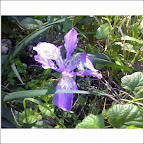 |
| From Wildflowers, Mt. Tam Watershed |
 |
| From Wildflowers, Mt. Tam Watershed |
 |
| From Wildflowers, Mt. Tam Watershed |
 |
| From Wildflowers, Mt. Tam Watershed |
 |
| From Wildflowers, Mt. Tam Watershed |
 |
| From Wildflowers, Mt. Tam Watershed |
 |
| From Wildflowers, Mt. Tam Watershed |
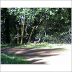 |
| From Wildflowers, Mt. Tam Watershed |
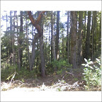 |
| From Wildflowers, Mt. Tam Watershed |
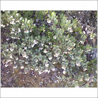 |
| From Wildflowers, Mt. Tam Watershed |
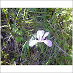 |
| From Wildflowers, Mt. Tam Watershed |
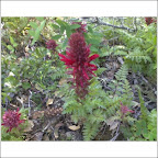 |
| From Wildflowers, Mt. Tam Watershed |
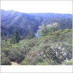 |
| From Wildflowers, Mt. Tam Watershed |
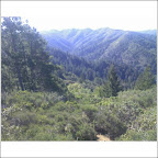 |
| From Wildflowers, Mt. Tam Watershed |
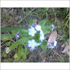 |
| From Wildflowers, Mt. Tam Watershed |
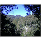 |
| From Wildflowers, Mt. Tam Watershed |
 |
| From Wildflowers, Mt. Tam Watershed |
 |
| From Wildflowers, Mt. Tam Watershed |
Tuesday, March 24, 2009
Great Pics from Save Mt. Diablo, Thanks Chihping!
Chihping Fu took some great pictures that Mike Palmer sent around - highly recommended. Visit Chihping's blog at Ultrafamilyman. The pictures were every bit as gorgeous as I remember the trail from the day before, except drier (lucky racers!)
Sunday, March 22, 2009
Set Trail for the Save Mt. Diablo 50k Yesterday
Mike "Little Johnson" (don't ask) Lijewski and I marked out the portion of the Save Mt. Diablo 50k course from the start to the aid station at Mile 9.8. The rain yesterday probably washed out any flour we layed down, and I hope the wind didn't blow away any ribbons. Unfortunately, even though Mike Palmer gave us signs to put at trailheads telling people there was an official event and not to remove the ribbons, some self-appointed trail authorities took some down anyway - fortunately this would have been on Hardy Canyon trail just for the first 3 miles or so of the course, where it's hard to get lost. This was my first time in Los Vaqueros and also the biggest chunk of the Mt. Diablo Trail that I've done to date. My favorite part was Hardy Canyon Trail - fantastic.
Mike L. and I met up with the very nice Joe and Beth at Morgan Territory Road - thanks for the water and the offer of the jacket - I should've taken you guys up on it, given how it rained on the way back! Between the cold and the rain on one hand and that horrible East Bay clay turning the trail into a miles-long downhill oil slick, I don't know which was worse. One bonus: very well fed coyote trotted out in front of us at the intersection with Hardy and Miwok. S/he was a little more nervous about us than the bobcat I saw down at Pescadero Creek last weekend.
So that's my first volunteer commitment for the running community this year. Here's hoping everyone's race went well. If I'm still in the area I hope to be participating in the race next year.
Thursday, March 19, 2009
March Madness Picks: UNC Takes it if Gonzaga Doesn't Upset Them
Update 6 April: I correctly called the final winner (UNC), along with most of the rest of the country. But my overall success rate of predicting winners was 60.3%. Maybe this is my last year doing this.
I know nothing about basketball. But like an unemotional, disciplined investor, I developed a quantitative approach and I stick with it. Last year I got into my office pool at the Sweet Sixteen stage and picked 14 out of 15, including the winner, despite the disbelieving howls at some of my picks when I made them. The method is simple - best scoring margin wins, period.
This year I was inspired by masseyratings.com to try to figure out the relative skill of teams; that is, if you have a good scoring margin but you're in a crappy conference, when you line up against somebody from the Big 12 or Big East, you might be in trouble. Masseyratings does some giant networking thing (A beat B, who beat C but was beaten by D, who beat A...etc.) Whereas I have an Excel sheet and a day job. But to take skill level into account, I looked at the tournament last year and tried to assess skill level by looking at how many teams each conference sent to the tournament. If you're in the Pac-10 or the Big East (which had 6 and 8 teams in the 2008 tournament respectively) chances are you're a seasoned team, because you have to play all the other good teams from your conference. On the other hand, if you're the only representative of East Bumblef**k Valley Conference at the tournament, maybe not.
Well it didn't work. To scoring margin, I added the difference between each pair of team's representation at the tournament, multiplied by an adjustable fudge factor. But I could never make it come out more accurately in terms of number of correct win/loss predictions than plain old scoring margin, which in any event is the best correlation I could find between tournament progress and any commonly tracked team statistic (R=0.694). Number of entrants in tournament doesn't give as much information as stats for each of the conferences, but if you're interested in that, you can play with spreadsheets because I'm officially done.
Here are the picks. I only pick win-lose, not spreads. For each game I only care about the winner - so say I predicted that in Round 1, A beats B and C beats D; in Round 2 I predict A beats C. Say that what really happens is that in Round 1 A beats B as I predicted but D beats C. As long as A beats D and wins the Round 2 game, that counts as a correct prediction. Consequently if I predicted a team would win a game in Round 2, but they got knocked out already in Round 1, then I know I'm wrong before Round 2 even begins. They can't win a game they're not in.
Bottom line, I agree with Obama that UNC will take it, although Gonzaga has a real chance to squeak by them in the third round.
FIRST ROUND PICKS - 22 W/L out of 32. 68.75% correct. Terrible. Lower than 75% I got last year at this stage.
I was right:
Connecticut over Chattanooga
Purdue over Northern Iowa
Washington over Mississippi St
Memphis over Cal State Northridge
Villanova over American
Texas over Minnesota
North Carolina over Radford
LSU over Butler
Gonzaga over Akron
Oklahoma over Morgan State
Duke over Binghamton
UCLA over VCU
Oklahoma St over Tennessee
Louisville over Morehead State
Pittsburgh over East Tennessee St
Michigan State over Robert Morris
Missouri over Cornell
Arizona State over Temple
Xavier over Portland State
USC over Boston College
Wisconsin over Florida State
Siena over Ohio State
I was wrong:
BYU over Texas A&M
Cal over Maryland
Clemson over Michigan
Illinois over Western Kentucky
Stephen F. Austin over Syracuse
North Dakota State over Kansas
Utah St over Marquette
Wake Forest over Cleveland State
West Virginia over Dayton
Utah over Arizona
SECOND ROUND PICKS - 75% correct.
I was right:
Louisville over Siena
Mich State over USC
Connecticut over BYU (really Texas A&M)
Purdue over Washington
Missouri over Utah St (Really Marquette)
Memphis over Cal (really Maryland)
Pittsburgh over Oklahoma St
Xavier over Wisconsin
Duke over Texas
North Carolina over Butler (really LSU)
Gonzaga over Illinois (really Western Kentucky)
Oklahoma over Clemson (really Michigan)
I was wrong:
Stephen F. Austin over Arizona State
North Dakota State over West Virginia
Wake Forest over Utah
UCLA over Villanova (a little paranoid about this one) (turns out I should have been more than a little paranoid)
THIRD ROUND PICKS - 62.5% correct.
I was right:
Pittsburgh over Xavier
Connecticut over Purdue
Louisville over Wake Forest (really Arizona)
North Carolina over Gonzaga (thought it would be very close)
Oklahoma over Stephen F. Austin (really Syracuse)
I was wrong:
Memphis over Missouri
UCLA over Duke (very close) (was really Villanova over Duke)
North Dakota State over Michigan State (iffy about this one but I'll stay with it; turned out to be Kansas vs. Michigan State, Michigan State won)
FOURTH ROUND PICKS - 25% correct.
I was right:
North Carolina over Oklahoma
I was wrong:
Louisville over North Dakota State (turned out to be Michigan State over Louisville)
Pittsburgh over UCLA (will be Villanova, and they won)
Memphis over Connecticut (actual game was Connecticut vs. Missouri, Connecticut won)
FIFTH ROUND - 50% correct.
I was right:
North Carolina over Pittsburgh (will be Villanova)
I was wrong:
Memphis over Louisville
CHAMPIONSHIP: - 100% correct.
North Carolina over Memphis (will be Michigan State)
Monday, March 9, 2009
Sugarloaf Ridge State Park = Way Cool
I went up there on Saturday. Great time of year to be there too - the waterfall is in full glory, and the wildflowers are just starting to come out. I didn't even know there was an observatory there too. On the drive up you pass by some more rural smaller wineries with a lot more character than the ones along the main drag in Napa, or even along Silverado.
Yesterday I finally got in about 18 miles in the Marin Headlands. Felt good to get in some real mileage and terrain. Lot of people on trails. Many trails were effectively rivers giving back a lot of the runoff from our recent rain. Lots of crows involved in their upside-down-flying courtship ritual but no mammals except for some bun-buns on the way back.
Yesterday I finally got in about 18 miles in the Marin Headlands. Felt good to get in some real mileage and terrain. Lot of people on trails. Many trails were effectively rivers giving back a lot of the runoff from our recent rain. Lots of crows involved in their upside-down-flying courtship ritual but no mammals except for some bun-buns on the way back.
Subscribe to:
Posts (Atom)
