Saturday, May 30, 2009

Where I've Driven

These are my "where I've driven" logs for various parts of the world. Don't ask me why, but I like to keep track of it. Click on the images to see any real detail. I started doing this before you could save tracks on Google Maps, which is why they're static JPGs. In the unlikely event that you care, I'll be updating this specific blog post by adding little specks of green to the map as I drive new routes. Note that just being on a ground transport doesn't count - I have to do the driving. So there's no track from El Salvador to Guatemala, because I took a bus.


Thursday, May 28, 2009

What Does It Mean to "Close" a Park?

The great State of California, due to its budget problems, may have to cut funding to its park system and close 80% of them. For the Bay Area, this includes Mt. Diablo, Mt. Tamalpais, Henry Coe, Portola Redwoods, and a bunch of beaches.

I'm told by the politically savvy that sometimes in times of budget crisis, public officials make moves as if to cut beloved programs, but in reality they're deliberately trying to provoke an outcry - either to mobilize the electorate to protect said programs (so public officials are then able to say "it's not my pet project, the public made me do it") or to free up funding, as in one recent case.

Given the deep hole California is now in, I have trouble believing that's what's going on, and that we're not seeing an earnest attempt to cut park funding.

My question is. What does it mean to close a park? In the case of state beaches, is the broke state going to put a fence up to keep people out? Or will the local cities now patrol them and cite people for trespassing? Wouldn't a "use at your own risk" policy make more sense?

About two years ago I spoke to someone at Henry Coe State Park and asked what would happen if Coe were closed (as was then being threatened). Coe is huge. What the staff member told me: "We currently have two paid staff members. If the park is closed, the state still has to patrol the land. Patrolling the land would require two paid staff members. Plus a closed park doesn't generate any revenue to offset costs. So closing it would actually be more expensive than leaving it open."

Not every park is as big as Henry Coe, but certainly the same arguments apply to many parks - plus, how do you keep somebody out of large, remote, un-fence-offable chunks of land?

Tuesday, May 26, 2009

32 Down, 24 to Go

National Parks, that is. Because the best way to measure life experience is by collecting points. If I have more than you, I'm a better person. Hey, I kid, I kid!

This weekend I hit the Redwood National and State Parks in the NW corner of the state (pictures to come). Now that I have points for Redwood, I started looking at the list. Rather than post a list bragging about the ones I've been to, here's a list of the ones I haven't been to. I started ranking them but thought I'd leave it up to any readers to weigh in if they've been there. Note that the list neglects all the monuments and scenic rivers and historic sites I haven't yet been to, which would be enormous. In no particular order:


Theodore Roosevelt National Park, North Dakota

Virgin Islands National Park, U.S. Virgin Islands

Voyageurs National Park, Minnesota

Wrangell-St. Elias National Park and Preserve, Alaska

Acadia National Park, Maine

National Park of American Samoa, American Samoa

Big Bend National Park, Texas

Black Canyon of the Gunnison National Park, Colorado

Carlsbad Caverns National Park, New Mexico

Channel Islands National Park, California

Congaree National Park, South Carolina

Cuyahoga Valley National Park, Ohio

Dry Tortugas National Park, Florida

Glacier Bay National Park and Preserve, Alaska

Great Basin National Park, Nevada

Great Sand Dunes National Park and Preserve, Colorado

Guadalupe Mountains National Park, Texas

Hawaii Volcanoes National Park, New Hampshire

Hot Springs National Park, Arkansas

Isle Royale National Park, Michigan

Katmai National Park and Preserve, Alaska

Kobuk Valley National Park, Alaska

Lake Clark National Park and Preserve, Alaska

Mammoth Cave National Park, Kentucky


Any comments on these?

Thursday, May 21, 2009

The Reverse Taper: Training Regimen of Champions

I will be doing a little runny-run from Las Trampas to my house in Rockridge via EBMUD land, Redwood Preserve, and the Oakland Hills with a few people, one of whom occasionally reads this blog. It clocks in around 18 very hilly miles. I cannot understate how out of condition I am right now. I'm getting maybe 10 low impact miles a week, and this has been going on for maybe a month.

You might say that biting off such a big, long run in such poor shape is foolish. You are correct sir! Therefore, for no good reason other than to punish myself (because this can't possibly have a good outcome) I plan to put in 75 miles the week leading into the long run, starting this coming Tuesday, with no recovery break before the run. Sound good? I'll post from the hospital to let you know how it turns out. Or my running pal Johnson will summarize in my eulogy.

Wednesday, May 20, 2009

The Canadian Rockies and Points Further North

I'm thinking of taking a summer trip to the Canadian Rockies and beyond. Canadians will laugh at me for saying this, but it's humbling how much North America there is above the 49th parallel (put simply, most of it). You can't see the Arctic Ocean from North Dakota.

From the MT-AB border to Yellowknife (territorial capital of NT), it's the same distance as Oakland to Vancouver, BC. Of course, getting to Vancouver is already about 1,240 miles. Overall, driving to Yellowknife from here is the same as driving to Indianapolis from here. And how many people are up there? In NT, about 45,000 total. More natives than Euro-Canadians. And of course, since it's Canada, even these tiny frontier-towns will be safe and well-run. (I admire our northern neighbors greatly. Somehow, even the crazies in the hills in Canada are reasonable.)

Anyway, I've often looked north and east into the mountains from Vancouver, but not had the time to get into the interior, the part of North America where the Rockies, the Cascades and the Coast Range meet. Now we will. I can't wait. It's going to rock.

Monday, May 18, 2009

Geological Anomalies of Northern California: Central Valley Volcanism

(Note: the experts have spoken - the Sutter Buttes are not a Cascade. See here for more. The rest of the article remains as originally posted.)

Geologists/geology buffs: your input on this discussion is most welcome.

Several years ago I was on a Cascade-climbing kick, and part of my motivation was to collect a piece of basalt at the top of each one to try to show a relationship in lava composition between volcanoes. I was fascinated with the Sutter Buttes, a tiny circular volcanic mountain range jutting up in the middle of the Central Valley, and I wanted to support my pet theory that they were in fact the southernmost Cascade: here we had a mini-stratovolcano due east of the Mendocino triple junction, and therefore a result of Juan de Fuca plate subduction. How could it not be a Cascade?

To satisfy my curiosity I visited the privately-owned area with the Middle Mountain Foundation I took a tour with geologist and Buttes expert Brian Hausback, who explained two things: a) basalt composition is a function of the overlying crust; you don't necessarily see chemical similarity in basalts from stratovolcanoes in the same chain just because they're drawing from the same magma reservoir - so my sample collection wouldn't show anything; and b) the Buttes were way-off trend relative to the other Cascades (in terms of geography and age) and it turned out that my error was one of definition: not all volcanism associated with the JDF plate is a Cascade. I objected to the age argument because I put together a graph showing that the supposed relationship between northerliness and most recent eruption in the Cascades just didn't exist - what about Lassen and Thielsen? But I couldn't dispute the geography. What about Konocti at Clear Lake? What about all the flows that produce Oregon's black sand beaches? Eventually I relented, although now the USGS link about the Sutter Buttes that I provided above does say that the Sutter Buttes are in fact the southernmost Cascade.

So far so good? Not so fast. While the Cascades beginning with Shasta seem basically a textbook case of plate tectonics, as does California starting at the Bay and moving south, I saw a few things yesterday that confused the hell out of me. I saw a few igneous rocks here and there in Mendocino National Forest, but no other evidence of volcanism. Add to that what seemed to me obvious hummock formations on Route 32 between Newville and Black Butte Lake. Hummocks are small but steep hills occurring in sets around areas of volcanism, resulting from lava flows or debris accumulations - in violent eruptions they're actually pieces of the volcano that were thrown out by the explosion. The first time I saw them and knew what I was looking at was at Mt. St. Helens. Needless to say my phone battery was dead so I couldn't get any pictures of the ones near Black Butte Lake, but here's a great shot of some northwest of Mt. Shasta:

Of course, the Orland Buttes are just east of there, and no one is arguing that they're not volcanic. Here's a nice picture of one of the major ones next to Black Butte Lake in the winter, credit to shastacascade.com:

The Orland Buttes have clear bands of basalt which reveal their volcanic origin. There are also one or two formations like these just east of highway 29 in southern Napa county, likely a result of Mt. St. Helena when it was still active and preserving redwoods in ash for us to look at 3 million years later, not to mention giving us a valley full of good soil for grapes.

Though I found no mention of the Newville hummocks, there are multiple papers explaining at least the Orland Buttes' origin as part of the Lovejoy basalts, which originated 15-16 MYA near Susanville, which today sits in a gap between the northern end of the Sierras and Mt. Lassen, the first unambiguous Cascade stratovolcano. (Interestingly enough, Maidu people from around the Susanville area considered one of the mountains near Susanville to be the place from which the creator god made the world and under which he is now sleeping, but don't get too nervous, it's a Penutian-language-family creation myth motif - the Modoc thought the same thing about the petroglyph-ringed sandstone mountain in the southeast of Lava Beds National Park and the Nez Perce believed it about a boulder in central Idaho. The Nez Perce one especially isn't anything to write home about.)

The problem remains that Susanville is about 120 air miles from these hummocks near Newville. Even if the basalt all the way over by Orland can be explained by an eruption in Susanville - and some geologists, suspicious at the size of the flow and its age, similar to the Columbia basalts - haved posited a Yellowstone-style eruption as the mechanism.

This would still have to be one hell of an eruption to put hummocks (if that's what they are) all the way over at Newville. My amateur vote is for volcanism somewhere nearby in the part of the Coast Range in Mendocino National Forest. Unlike in much of the rest of geology-textbook California, the picture is anything but clear (which makes it more interesting). The Trinity Alps to the north have been investigated in a series of papers attempting to describe the complex plate motion that continues to build these mountains. While I can't see a reason to rule out an association with the Yellowstone mantle plume, for my money, I also see no reason to think the same plate motion operating in the Trinity Alps wouldn't apply 70 air miles south in the northern Coast Range.

Sunday, May 17, 2009

Mendocino National Forest

I finally decided to cross Mendocino National Forest off my list. It's amazing that it's so close (3.5 hrs) and yet so few people have been there, or even heard of it. I went to Snow Mountain Wilderness and headed up to the summit. With the Central Valley roasting at about 103 F, it felt about 85 F at the top. There were still some very small patches of snow.

The environment seemed kind of like the Sierra foothills, but even drier, with a lot of the coastal scrub you'll see on the east side of slopes in coastal Marin. Highlight: Summit Spring, which had the highest flow of any spring I've ever seen. Not much wildlife, except the bumblebees were curiously interested in me, more like horseflies, and there were lizards everywhere - which makes me wonder how they survive 5-6 months covered in snow up there. There was an odd crow conference going on over the summit - I saw very few but there were making a big, gregarious circuit over the top. In the heat it was too hazy to see the ocean.

On the way back I went out of my way to check out Black Butte Lake. I've always wanted to see this lake. Ever notice that weird sloping mesa to the west as you drive up I-5, around the exit for Orland? That's Black Butte. The lake was surprisingly warm (lots of people swimming) but not that clear.

Overall, Mendocino it seemed more popular with the offroad vehicle crowd than hikers, but still only saw 4 of either. If you want isolation you can get it there, and I'm glad I checked out this N.F. but wouldn't go out of my way to visit it again.

Thursday, May 7, 2009

My Half-Baked Ideas for Distance Races - Back Home in PA

We all show our homesickness in different ways. For that pretentious hack John Updike it was walking the sidewalks of our native Shillington, trying to piece together some pattern in our lives. For me, it's looking at maps of Berks County, Pennsylvania and coming up with cockamamey ideas for races. I've had such ideas for races in the Bay Area - like the Pony Express run, where we more-or-less retraced the last leg of the old route - and come to think of it, people actually showed up for that one. Twice.

In particular, I think the East Coast is ripe for a Hood-to-Coast or Calistoga-style relay. While the change in landforms from interior to coast is not quite as dramatic on the right edge of the country, there is nonetheless a really interesting transition in Pennsylvania from Appalachian ridges to coastal plains, along with all the cultural vectors that go along with that. Of course, since I've been gone from the area for over a decade, some of these races may actually exist. So without further ado, here are my half-baked ideas for races in Berks County, Pennsylvania:


1) Penn State to Reading - 162 miles

A team of 10 at 3 legs each could easily do this. The race could begin at either the exact geographic center of Pennsylvania (on the HUB Lawn) or alternatively at Beaver Stadium or Mt. Nittany. I selfishly end it in my home development. Highlights of the race would be Rothrock State Forest, the climb up Route 74 south of Port Royal, and running parallel to and over the Blue Mountains east of Harrisburg.


View Larger Map

2) The Berks County Town-and-Trail Ultra - ~100k

I'm always impressed with Berks County's trail scene when I'm visiting and wish I would've paid more attention while I lived there. This trail would start in the gorgeous French Creek, exit west on the Horseshoe Trail, head northwest past the late Mr. Updike's home, make its way through Cumru Township into and through the hemlocks of Nolde Forest, up the newly budgeted trail along 625 into Reading, join the Tulpehocken trail, follow that up to Blue Marsh and take the west side of the lake. From there it would circle the Marsh (more closely than this map allows), come back down through Reading, pick up the Thun Trail, jump off at Birdsboro and head back down into French Creek. The actual route would be less than the slightly > 100k seen here, and could by done as an ultra or a relay like the Tussey Mountainback.


View Larger Map


3.) The Reading to Ocean City Relay - 172 miles

Just as it sounds - the race ends exactly at the DE-MD border, and follows the coast as much as is possible along DE's marshy shoreline. Perfect for a 10 or 12 person relay. A similar race could happen with OCNJ, and a George-Washington kayak leg for the Delaware crossing.


View Larger Map

4. Race Down the Schuylkill - 140 miles

Follow what Unami-speakers called the Ganshowehanne from its source in the Appalachian Coal Regions, through the Blue Ridge Gap at Hamburg, all the way through Montgomery County to the shipyards at its confluence with the Delaware. This would be a great way to publicize the Schuylkill River Trail, large contiguous parts of which are already complete.


View Larger Map

5. Mt. Nittany to the Chesapeake
- 181 miles

Another relay. This would go down the Juniata and Susquehanna to the northern tip of Chesapeake Bay.


View Larger Map

Tuesday, May 5, 2009

Purty Pitchers from Lost Coast

I took a little trip up to the North Coast this weekend and got some nice pics of coastline, sorrel, and everything in between:


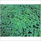
Oddly, I'd never realized that sorrel wasn't just regular old clover. Underneath the leaves, it's purple. A plant example of convergent evolution! I'm also mystified by why it doesn't appear in the closer-in Bay Area redwood preserves (like Redwood Park or Muir Woods; it does appear in Samuel Taylor).