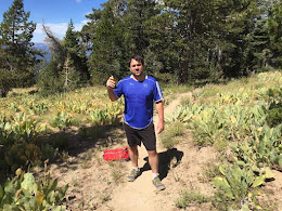
My first thought was: "Wow, every mountain in California has the same incline!" (About 10-12%.) And then I thought, "No dummy. This is most likely because that is the maximum slope we build trails on, and/or we use switchbacks to keep the incline from being too silly. Remember Pyramid Peak?" (An unofficial trail which does not restrict itself to 12%; I bet the unofficial Cactus to Clouds doesn't either.) There are also non-trail ways to get up mountains, e.g. with an ice-axe. Not 12%.
Oddly enough, dramatically different geological processes operating on different time scales have produced a crop of very-similar-in-height 14ers in the Rockies and a few on the West Coast.
The reason I posted this is that it seems to me (anecdotally, without having the same kind of data as above) that back in the smaller Appalachians, paradoxically, trails and even roads have nasty little steep runs worse than this, because (I bet) the hills are smaller, and they don't go on that steep for long enough for people to think of putting in switchbacks.

