Friday, February 26, 2010

Missing Runner in San Diego Area, Spread the Word

http://findchelsea.com/


TEEN GIRL GOES MISSING WHILE JOGGING IN RANCHO BERNARDO: Massive search launched

February 26, 2010 (4:15 a.m.) - Sheriff Bill Gore has activated more than 100 Search and Rescue volunteers and deputies to locate missing Poway teen Chelsea King. King was reported missing by her family late Thursday after she did not return home from a run in the north Rancho Bernardo area.


She is an avid long-distance runner and routinely takes long runs in rural areas. She parked her car after school at the Rancho Bernardo Community Center on West Bernardo Drive and did not return to her locked car

Chelsea is a white female, Height: 5' 5", 115 pounds
with blond hair and blue eyes.


Anyone with information is requested to contact:
San Diego Sheriff's Department: 565-5200
Crime Stoppers: (619) 531-1500 or (619)531-1547

Wednesday, February 24, 2010

Saturday, February 20, 2010

Pacific Crest Trail Southern Terminus


Image credit: Paul Magnanti's PCT Thru-Hike


[Added later: Endurance Guy Toby Guillette ran this section the day after I did, but the border guys apparently didn't try to scare him. I posted at the article to ask Toby what was different; maybe the one I talked to hates runners?]


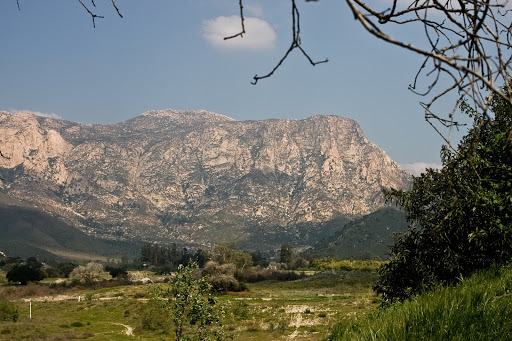
Today I ran, ih, 14 miles sorta kinda on the PCT, at the southern terminus right south of Campo. Note #1: don't just roll into Campo without looking up how to get to the official start of the trail. While people in Campo were certainly nice enough, they had no idea how to get to the trailhead (with the exception of the nice docent at the museum - thanks for your help!)

Note #2: when planning a run here, do your homework and take into account illegal border activity. As I plugged up the wet-sand road from Route 94 to the border where the official marker is, a Border Patrol officer in a truck stopped me. (I've never seen so much border activity in my life as I did today in Campo). He strongly advised me not to run on the PCT near the border because of drug and gun smugglers. It was raining off and on, and he said that activity increased during rain because the visibility is worse and some the trails and roads become impassable. Apparently he didn't think I was suitably spooked because he rolled down the back window to show me the M-16 he was carrying. "Don't run this section of the trail. Especially not today."

So I decided to stay on 94 and Buckman Springs Road for most of it, hence the sorta-kinda. It rained fairly hard while I was out but I tried to enjoy the un-San Diego-ness of cold rain at 3,000' since I know I'll be complaining about the heat inside two months. I also did a stretch on the actual trail just north of I-8 from Boulder Oaks campground up toward Laguna Mountain. That'll be the part I do next time I'm up there. On coming home, I did a search for any bad news happening on the trail and couldn't find much; maybe I should've done that ahead of time to avoid being put off by the Border guy.

(Image credit Craig Stanton.)

Two political thoughts (skip to last paragraph to avoid). First, it's extremely unfortunate that at the PCT's southern terminus access to open space meets safety considerations as a result of criminal activity; public safety is a core service of functional government and this problem is usually associated with the developing world. I found Central America frustrating for exactly this reason; lots of awesome volcanoes and forests and trails criss-crossing between villages, and lots of people in the woods who will rob and hurt you if you use those trails. In San Salvador, there are trails all over the volcano immediately next to town, and I was strenuously warned off running any of them - although you can pay guides who used those trails as guerillas in the recently-ended Salvadorean Civil War to take you up. (And here I used to think American Civil War re-enactments were a little strange. At least none of the guys on the field are the ones who were really killing each other during the war. By the way, here's a picture of my extremely handsome great great grandfather Jacob Caton prior to his capture at Moorefield West Virginia in 1864 in the Civil War's only sword fight.*)


The second thought is that the economic equation driving the smuggling part of the illegal activity up there is: drugs go north, guns go south. If we decriminalize, guess who goes out of business? And civilization doesn't end when countries do this - in 2001, Portugal decriminalized everything, and by all sorts of measures, they're better off than before. (Seriously, click on the link. Why this isn't discussed more in the U.S. is a mystery to me. Decriminalization is the worst nightmare of those smugglers sneaking across the border in Campo because it would put them out of business overnight.)

Am I planning to run the whole thing in pieces? Probably not, but who knows; that's one of the projects I'll do if we reach actuarial escape velocity while I can still run. (Prediction: will not happen.) Might as well knock off as many SoCal chunks as I can now because come 2013 I'll be heading back up north.

*My great great grandfather Jacob really was captured by the Confederates during a sword battle in West Virginia but he wasn't nearly this good-looking, or humble for that matter.

Mitochondria-Related Gene Variant Associated with Endurance Running

The gene is associated with producing new mitochondria as well as reducing oxidation damage and inflammation. Original article here, digests here and here.

Next, I'd be interested to see what the tissue expression profile is, particularly with respect to slow- and fast-twitch muscle fibers; a glance at the mouse transcriptome shows high expression in cardiac myocytes and smooth muscle, and a peak in thyroid, but not so much in skeletal muscle. It would also be interested to look into the geographic patterning among humans (if any); this is likely to be a fairly homogeneous sample in the context of overall human genetic diversity since it's an Israeli study that used Ashkenazi and non-Ashkenazi Jews. In particular, if such a pattern emerges, does it show any overlap with the pattern of alpha-actinin-3 deletion, another gene I wrote about before, a muscle component that is more likely than even odds to be deleted in female distance runners (and non-Africans) but less likely than even odds to be deleted in sprinters and weight-lifters.

Preserving Open Space the Right Way

I'm all for more preserved wilderness and open space; I'm also all for resepecting private property. These two priorities do not conflict. In fact, preserved open space increases property values and makes cities and states more enjoyable places to live. It's invariably suburban property developers who try to imply that there's some kind of political conflict between private property owners and preserving open space. Of course, it's in their interest to free up as much land as possible and sub-divide it as finely as possible. But is it in your interest? To put a fine point on it, are you a property developer? I'm not.

That's exactly why it's unfortunate when this growing but still-fragile public understanding of the relationship between private property and open space is damaged when government bungles an open space expansion, as they seem to be doing now in several places in the intermontane West. (One of these places is the San Rafael Swell. Q. How awesome would it be if this opened up to the public? A: very awesome. Think of the trails back there.) Unfortunately Utah residents are still feeling blindsided by the way that Grand Staircase National Monument was created, and anecdotally, I know that southwest Coloradans are none too thrilled with the way that Hovenweep National Monument was brought into being. They don't seem to mind that literally hundreds of Puebloan ruins are now open to public exploration - it was the ham-handed way the Monument was created that was the problem.

This is no screed against eminent domain. It's a reminder that there is a whole spectrum of private-property-respecting open space solutions, and they all begin with involving the stake-holders non-adversarially. In Ireland you can hike across farms and ranches as long as you're sure to close gates behind you (I've taken advantage of this system to explore the megaliths that are part of Ireland's prehistoric heritage and which would be off-limits behind ranch boundaries if they were in the U.S. In the Bay Area's East Bay Park System, in my wholly unbiased opinion the best urban park system in the United States, ranchers share space with the parks. These solutions work if they're handled well, and I think for the most part, ranchers and farmers selling their land would rather, all things being equal, see it preserved as is for future generations. In this case, as Utah Representative Rob Bishop says, "If [various agencies] do things in an open and transparent way and involve everyone, then there's no need for yelling and screaming...Do it the right way, and we can work it out."

Monday, February 15, 2010

Return of the Pony Express Route

That Pony Express route just won't leave me alone. I ran across a set of outstanding photos by some offroad folks who did a piece of the Pony Express in Utah. I posted on the thread to let them know that people have been inspired to similar feats (at least on foot and I would wager on bikes as well) and it might be good fun to join up for a cross-country offroading/biking/running triathlon to do the whole Pony Express route, maybe for a good cause. It would be a blast. Hood-to-Coast would seem passé!

El Cap and San Jacinto Down

I'm glad to be getting some time on trails around SoCal. El Capitan was a fun little slog Saturday; from the top of you can look back and see the San Diego skyline but yesterday you could also see three separate snow-capped sets of mountains and all the hills and knobs and ridges in between. El Cap is inexplicably little-known among San Diegans so I include a picture below - it's at one side of El Monte Valley (now endangered by power lines), and you may know it as that big red mother you see as you're heading out I-8 eastbound before you start climbing in earnest:


(Credit to the nice person at Picasaweb who took this)

Yesterday San Jacinto was too snowy to get to the summit (or even to Suicide Rock) but it was real purty-like and I'll be back. Once they all melt out, I might spend a long weekend summit-running. San Jacinto, San Gorgonio, and whatever the highest is in San Gabriel Natl Forest. Immediately after I post this I'm off to knock out Iron Mountain.

It's funny how much it bugs me to look out over the mountains and knobs and ridges inland, and not know all their names or how to get to them. But that makes it interesting too. A whole new territory to consume - not like the mountains care for the infinitesimal moment in their lives that we're scrambling along their flanks. But for that nanosecond, we're there, and I can't explain why, but it counts.

Oakland Cleverly Re-Starts Its Marathon

I lived in the East Bay for 11 years, and less than a year after I leave, Oakland cleverly re-starts its marathon. Hey Oakland Marathon, did you think I wouldn't notice the timing? But hey. I'm a trooper. I can take the rejection.

Oakland marathon runners, when you're running from Rockridge BART up to Route 13, there's one thing you should keep in mind: you poor bastards have twenty miles left.

This is what's called "sending out positive energy". It's what's great about America.

Friday, February 12, 2010

Saturday, February 6, 2010

Paleo Running

A distance runner and evolutionary biologist decided to look at barefoot runners. Only question: do you go to the physical environment that our earliest modern-human ancestors lived in, or do you go to a part of the world known for great distance runners who also run without shoes? Turns out it's the same answer for both: the Rift Valley in Kenya. And it turns out that biomechanically, barefoot runners land on the balls of their feet, which lessens the strike impact. It makes sense that this would mean less abuse to the joints and a longer running career - which you need if you're going to be chasing after game herds until you're old - but the real test would be to look at these folks when they're older and compare to a control group. Finding that control group would be tough.

As for me, I would love to "paleo run" and switch over to barefoot, but unfortunately our ancestors (and apparently the people of the Rift Valley) didn't have nails and glass. Next question: the Tarahumara usually run in home-made sandals, but what is their form like?

Friday, February 5, 2010

So Much for the Bay Area's Well-Behaved Mountain Lions

Here's a scary encounter between two families: two human brothers and a mountain lion mom and her adolescent son. Given how many outdoor-oriented people there are in the Bay Area, and how many pusses there probably are out there, it's amazing that there aren't more problems. There has only ever been one (unconfirmed) attack. Compare that to San Diego County (Cuyamaca Ranch in the 90s - yikes) or Orange County, or Vancouver Island up north. The lions in the Bay Area are so well-behaved I sometimes joke that even the mountain lions are polite in NorCal.

Pescadero Creek
is huge and empty heavily wooded, and amazingly close to Palo Alto. It adjoins to Big Basin too, so it's no surprise there are lions in there. Who knows, maybe it's the economy and lions are out of work.